photo free
Home Images Vectors Videos

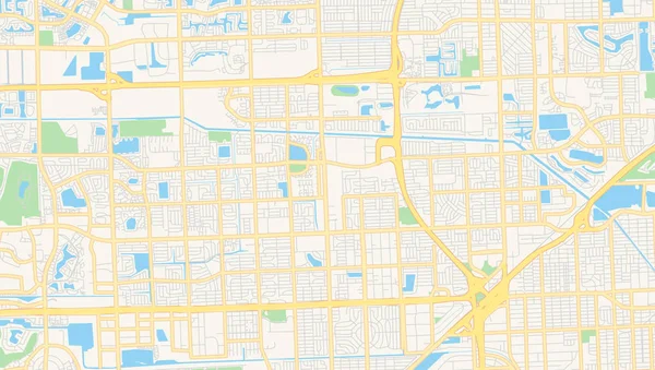
Stock image Miami Map

stock vector Black and white vector city map of Miami with well organized separated layers.

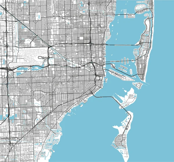
Black And White Vector City Map Of Miami With Well Organized Separated Layers.

Vector, 10.75MB, 4688 × 4369 eps
stock vector Florida isolated map

Florida Isolated Map

Vector, 8.29MB, 5000 × 4500 eps
stock image Map of USA with major cities

Map Of USA With Major Cities

Image, 1.6MB, 4502 × 2127 jpg
stock vector vector city map of Miami on a vintage grunge paper with well organized separated layers

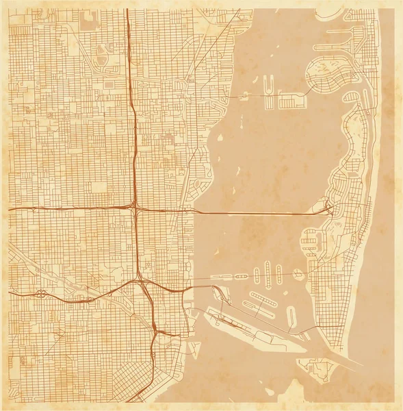
Vector City Map Of Miami On A Vintage Grunge Paper With Well Organized Separated Layers

Vector, 12.82MB, 7197 × 7329 eps
stock vector map of the city of Miami, USA

Map Of The City Of Miami, USA

Vector, 5.3MB, 5038 × 4885 eps
stock vector Grunge rubber stamp or label with name of Miami, Florida

Grunge Rubber Stamp Or Label With Name Of Miami, Florida

Vector, 1.41MB, 5669 × 5669 eps
stock vector Map of Miami in Florida in grayscale. Contains layered vector with roads water, parks, etc.

Map Of Miami In Florida In Grayscale. Contains Layered Vector With Roads Water, Parks, Etc.

Vector, 10.76MB, 2400 × 2400 eps
stock image Map of Miami County in Ohio state on white background. single County map highlighted by black colour on Ohio map. UNITED STATES, US

Map Of Miami County In Ohio State On White Background. Single County Map Highlighted By Black Colour On Ohio Map. UNITED STATES, US

Image, 5.59MB, 8000 × 8000 jpg
stock vector Road map of Miami in Florida. Contains layered vector with roads water, parks, etc.

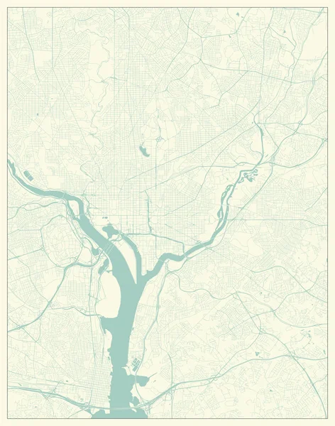
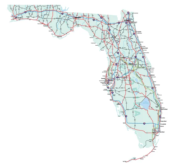
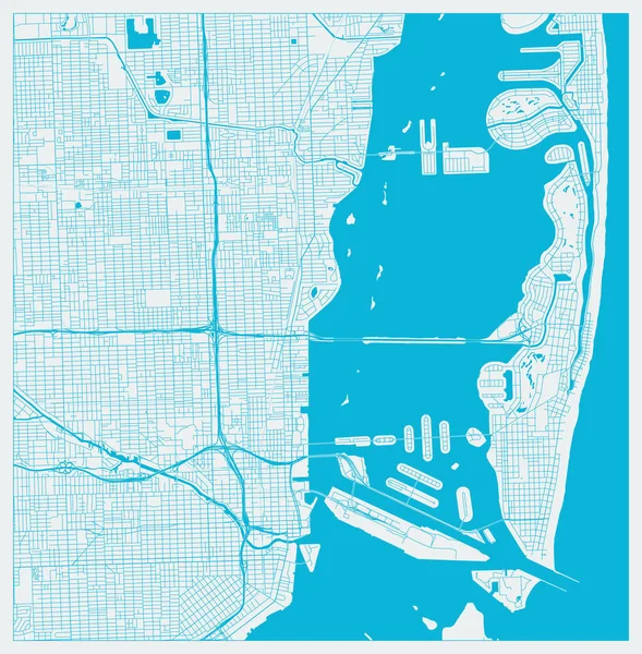
Road Map Of Miami In Florida. Contains Layered Vector With Roads Water, Parks, Etc.

Vector, 10.78MB, 2400 × 2400 eps
stock vector Map of Miami in Florida in blue. Contains layered vector with roads water, parks, etc.

Map Of Miami In Florida In Blue. Contains Layered Vector With Roads Water, Parks, Etc.

Vector, 10.18MB, 2400 × 2400 eps
stock image Map of Miami County in Florida state on white background. single County map highlighted by black colour on Florida map. UNITED STATES, US

Map Of Miami County In Florida State On White Background. Single County Map Highlighted By Black Colour On Florida Map. UNITED STATES, US

Image, 5.82MB, 8000 × 8000 jpg
stock vector Vector map of the world with set of the most famous landmarks.

Vector Map Of The World With Set Of The Most Famous Landmarks.

Vector, 4.38MB, 5999 × 4242 ai
stock vector Map of Florida

Map Of Florida

Vector, 7.16MB, 5906 × 5906 eps
stock vector United States (USA) - map, flag and navigation labels - illustration.

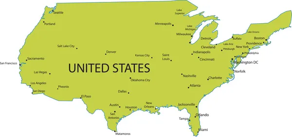
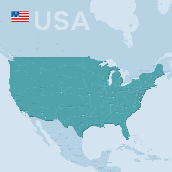
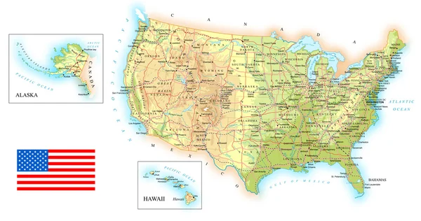
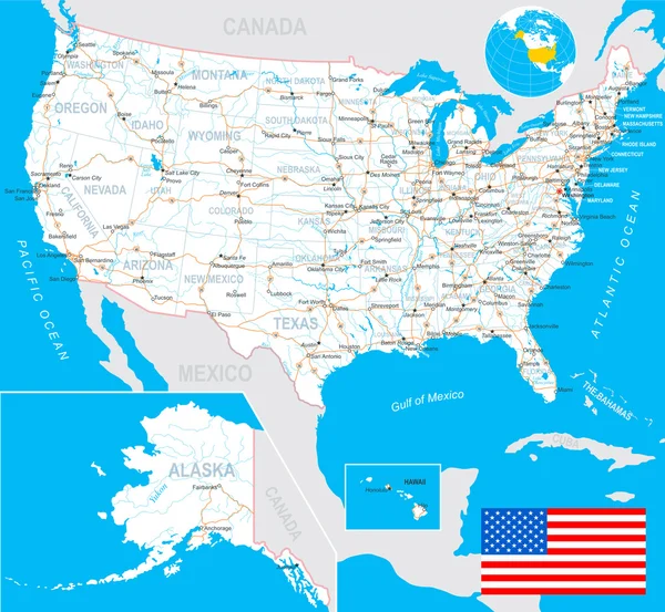
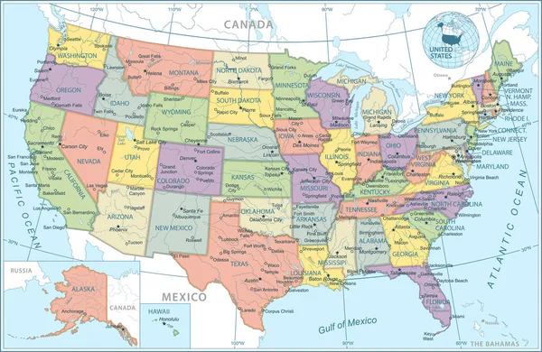
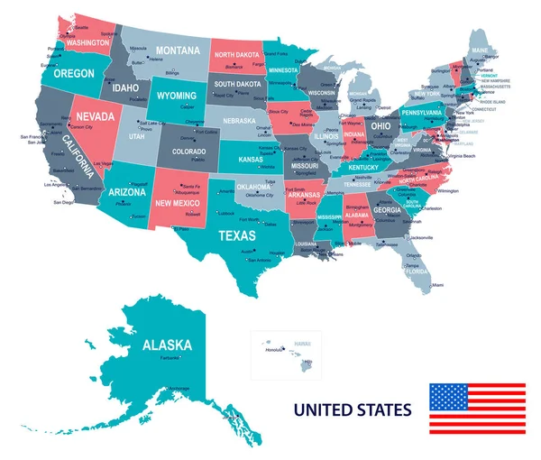
United States (USA) - Map, Flag And Navigation Labels - Illustration.

Vector, 3.12MB, 5400 × 4938 eps
stock vector Washington DC, District of Columbia, US City Map in Retro Style.

Washington DC, District Of Columbia, US City Map In Retro Style.

Vector, 15.21MB, 5507 × 7000 eps
stock vector Empty vector map of Miami Gardens, Florida, USA

Empty Vector Map Of Miami Gardens, Florida, USA

Vector, 5.01MB, 7168 × 4060 eps
stock vector Verctor Map of cities and roads in USA.

Verctor Map Of Cities And Roads In USA.

Vector, 9.73MB, 7087 × 7087 eps
stock image stylized map of Miami, Rio de Janeiro and Hong Kongs colors of blue red yellow to decorate a room or hotel

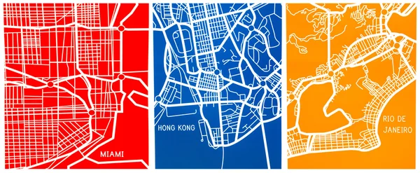
Stylized Map Of Miami, Rio De Janeiro And Hong Kongs Colors Of Blue Red Yellow To Decorate A Room Or Hotel

Image, 20.47MB, 10159 × 4193 jpg
stock vector Florida Flag Collection

Florida Flag Collection

Vector, 7.52MB, 5000 × 5294 eps
stock image Miami, Florida/USA, 07/17/2020 - Buildings in Brickell next to the Miami South Channel, Wide shot of Brickell's skyline near the Miami South Channel, Architecture of Brickell Ave during the daytime, Condos, and offices in Brickell, Boat in channel

Miami, Florida/USA, 07/17/2020 - Buildings In Brickell Next To The Miami South Channel, Wide Shot Of Brickell's Skyline Near The Miami South Channel, Architecture Of Brickell Ave During The Daytime, Condos, And Offices In Brickell, Boat In Channel

Image, 15.66MB, 5380 × 3942 jpg
stock image Port of miami

Port Of Miami

Image, 4.48MB, 3429 × 2333 jpg
stock vector Florida State Interstate Map

Florida State Interstate Map

Vector, 4.56MB, 2975 × 2671 eps
stock vector road map of the US American State of florida

Road Map Of The US American State Of Florida

Vector, 2MB, 4396 × 4053 eps
stock vector USA - detailed map - illustration.

USA - Detailed Map - Illustration.

Vector, 7.84MB, 6400 × 3485 eps
stock vector USA - detailed topographic map - illustration.

USA - Detailed Topographic Map - Illustration.

Vector, 8.05MB, 6400 × 3375 eps
stock image Map of the Bermuda Triangle in the Caribbean Sea

Map Of The Bermuda Triangle In The Caribbean Sea

Image, 1.27MB, 3200 × 2000 jpg
stock vector United States of America isolated map and Florida state territory. vector USA political map. geographic banner design

United States Of America Isolated Map And Florida State Territory. Vector USA Political Map. Geographic Banner Design

Vector, 0.71MB, 6000 × 4000 eps
stock vector Florida state USA map glowing silhouette made of stars lines dots triangles, low polygonal shapes.

Florida State USA Map Glowing Silhouette Made Of Stars Lines Dots Triangles, Low Polygonal Shapes.

Vector, 6.41MB, 4167 × 4167 eps
stock vector Gray vector map of the Federal State of Florida, USA with white borders of its counties

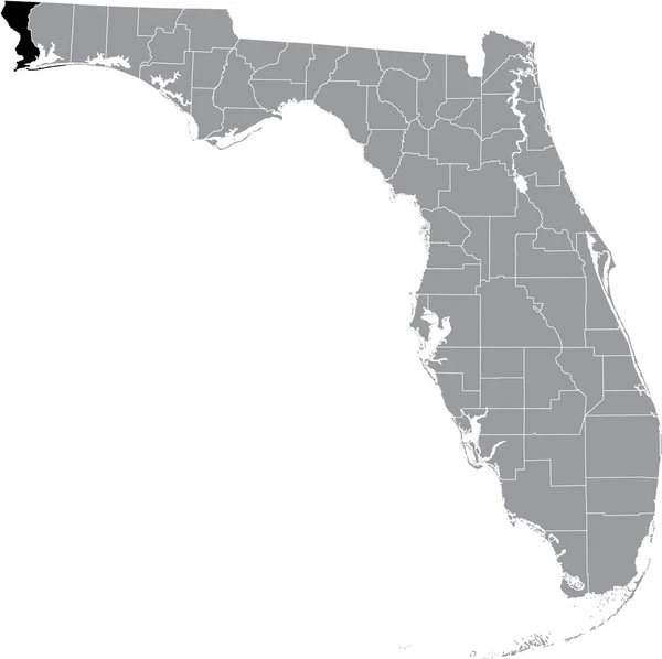
Gray Vector Map Of The Federal State Of Florida, USA With White Borders Of Its Counties

Vector, 1.96MB, 5005 × 4988 eps
stock vector Map of Florida state

Map Of Florida State

Vector, 1.86MB, 8059 × 5854 eps
stock vector Black highlighted location map of the US Escambia county inside gray map of the Federal State of Florida, USA

Black Highlighted Location Map Of The US Escambia County Inside Gray Map Of The Federal State Of Florida, USA

Vector, 1.97MB, 5005 × 4988 eps
stock image Night Earth. Gulf of Mexico and Florida

Night Earth. Gulf Of Mexico And Florida

Image, 9.53MB, 5000 × 5000 jpg
stock vector Streets of Miami, city map, Florida, United States. Street map

Streets Of Miami, City Map, Florida, United States. Street Map

Vector, 2.24MB, 6659 × 4634 eps
stock vector Unite States (USA) - 3D illustration

Unite States (USA) - 3D Illustration

Vector, 2.92MB, 5400 × 4674 eps
stock image Close-up Detailed View on North America from Space. Elements of this image furnished by NASA. 3D Rendering

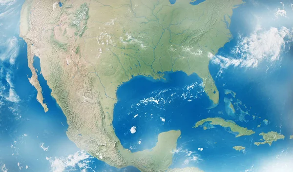
Close-up Detailed View On North America From Space. Elements Of This Image Furnished By NASA. 3D Rendering

Image, 9.97MB, 5100 × 3000 jpg
stock vector United States (USA) - map, flag, navigation labels, roads - illustration.

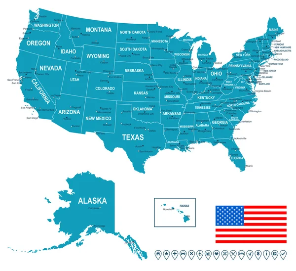
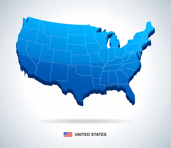
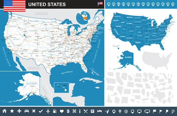
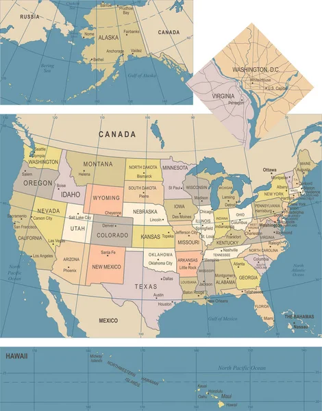
United States (USA) - Map, Flag, Navigation Labels, Roads - Illustration.

Vector, 7.27MB, 5400 × 4982 eps
stock vector Animals world map, South America

Animals World Map, South America

Vector, 6.95MB, 6663 × 6663 eps
stock vector United States map - vector illustration

United States Map - Vector Illustration

Vector, 3.49MB, 8398 × 5378 eps
stock vector Miami, Florida, US City Map in Blue Colors. Outline Map

Miami, Florida, US City Map In Blue Colors. Outline Map

Vector, 15.99MB, 7197 × 7329 eps
stock vector United States map - vector illustration

United States Map - Vector Illustration

Vector, 11.33MB, 5510 × 3590 eps
stock vector Black highlighted location map of the US Volusia county inside gray map of the Federal State of Florida, USA

Black Highlighted Location Map Of The US Volusia County Inside Gray Map Of The Federal State Of Florida, USA

Vector, 1.97MB, 5005 × 4988 eps
stock vector vector map of United States with indication of Florida

Vector Map Of United States With Indication Of Florida

Vector, 2.22MB, 4600 × 3450 eps
stock vector Cartoon vector map of USA. Travel illustration with american main cities.

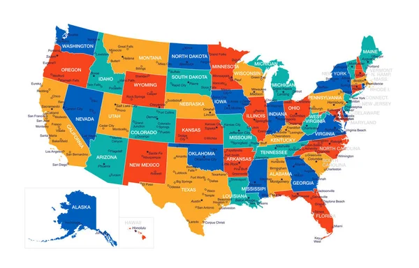
Cartoon Vector Map Of USA. Travel Illustration With American Main Cities.

Vector, 6.99MB, 5760 × 3218 eps
stock vector United States (USA) - infographic map - illustration.

United States (USA) - Infographic Map - Illustration.

Vector, 10.75MB, 5400 × 3535 eps
stock vector Florida's congressional disctricts vector map with cityscapes of capital and major cities of Florida

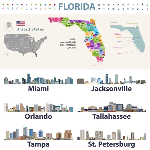
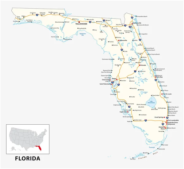
Florida's Congressional Disctricts Vector Map With Cityscapes Of Capital And Major Cities Of Florida

Vector, 11.72MB, 8333 × 8333 eps
stock vector Hand Drawn map of the state of Florida with main cities and points of interest. Colorful sketch style

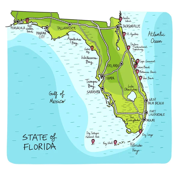
Hand Drawn Map Of The State Of Florida With Main Cities And Points Of Interest. Colorful Sketch Style

Vector, 5.43MB, 6001 × 5757 eps
stock vector United States - map and flag illustration

United States - Map And Flag Illustration

Vector, 2.85MB, 6468 × 5500 eps
stock vector United States Map - Vintage Vector Illustration

United States Map - Vintage Vector Illustration

Vector, 3.58MB, 5500 × 7011 eps
stock vector City map Miami, color detailed plan, vector illustration

City Map Miami, Color Detailed Plan, Vector Illustration

Vector, 3.27MB, 4219 × 5906 eps
stock vector Highly detailed vector silhouettes of US state maps, Division United States into counties, political and geographic subdivisions of a states, South Atlantic and East South Central - Alabama, Georgia, Florida - set 10 of 17

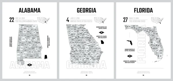
Highly Detailed Vector Silhouettes Of US State Maps, Division United States Into Counties, Political And Geographic Subdivisions Of A States, South Atlantic And East South Central - Alabama, Georgia, Florida - Set 10 Of 17

Vector, 12.93MB, 9608 × 4501 eps
Page 1 >> Next