photo free
Home Images Vectors Videos

Stock image Midwestern State page 2

stock vector Illinois map

Illinois Map

Vector, 8.17MB, 7002 × 7002 eps
stock image Illinois  State Map

Illinois State Map

Image, 9.71MB, 5000 × 2888 jpg
stock vector Minnesota map

Minnesota Map

Vector, 8.31MB, 7002 × 7002 eps
stock vector Iowa map

Iowa Map

Vector, 7.91MB, 7002 × 7002 eps
stock image Kansas (USA State) button flag round shape

Kansas (USA State) Button Flag Round Shape

Image, 2.17MB, 5000 × 5000 jpg
stock vector Nebraska map

Nebraska Map

Vector, 7.44MB, 7002 × 7002 eps
stock image Indiana Red Abstract 3D State Map United States America

Indiana Red Abstract 3D State Map United States America

Image, 4.17MB, 4096 × 4096 jpg
stock vector North Dakota map

North Dakota Map

Vector, 7.33MB, 7002 × 7002 eps
stock vector Missouri map

Missouri Map

Vector, 9.23MB, 7002 × 7002 eps
stock image Minnesota  State Map

Minnesota State Map

Image, 10.18MB, 5000 × 3000 jpg
stock vector 34 of 50 states of the United States with a name, nickname, and

34 Of 50 States Of The United States With A Name, Nickname, And

Vector, 0.82MB, 7311 × 4112 eps
stock vector Flag of Illinois  state, vector illustration. Coat of arms of Illinois state on white background,, high-quality hand-drawn illustration.

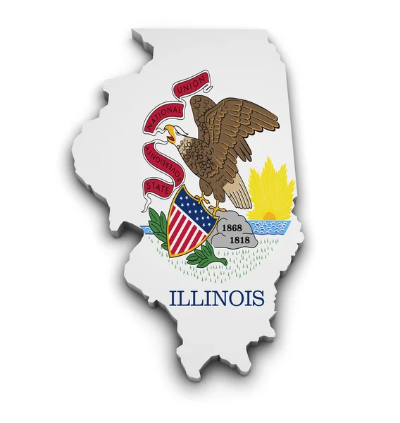
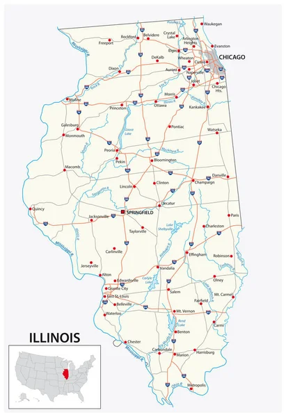
Flag Of Illinois State, Vector Illustration. Coat Of Arms Of Illinois State On White Background,, High-quality Hand-drawn Illustration.

Vector, 0.99MB, 6000 × 3600 eps
stock image Illinois IL State USA

Illinois IL State USA

Image, 3.91MB, 4444 × 2666 jpg
stock image Missouri Flag Map Shape

Missouri Flag Map Shape

Image, 5.85MB, 5600 × 4200 jpg
stock image Iowa  State Map

Iowa State Map

Image, 10.12MB, 5000 × 3000 jpg
stock image Flag of the state of Iowa

Flag Of The State Of Iowa

Image, 5.76MB, 6400 × 4800 jpg
stock vector South Dakota map

South Dakota Map

Vector, 7.79MB, 7002 × 7002 eps
stock image Flag of Nebraska state, USA

Flag Of Nebraska State, USA

Image, 5.28MB, 4000 × 2387 jpg
stock vector Map of the Midwest United States of America

Map Of The Midwest United States Of America

Vector, 0.7MB, 3988 × 3100 eps
stock vector road map of the US American State of South Dakota

Road Map Of The US American State Of South Dakota

Vector, 1.35MB, 5771 × 3100 eps
stock vector Michigan map

Michigan Map

Vector, 8.12MB, 7002 × 7002 eps
stock image Michigan  State Map

Michigan State Map

Image, 10.12MB, 5000 × 2888 jpg
stock image Minnesota MN State USA

Minnesota MN State USA

Image, 4.38MB, 4444 × 2666 jpg
stock vector Flag of Chicago in Illinois, United States

Flag Of Chicago In Illinois, United States

Vector, 5.17MB, 8334 × 5534 eps
stock image Illinois Flag Map Shape

Illinois Flag Map Shape

Image, 3.97MB, 4174 × 4400 jpg
stock vector Ohio state flag of America, isolated on white background.

Ohio State Flag Of America, Isolated On White Background.

Vector, 0.23MB, 4000 × 4000 eps
stock image Wisconsin USA Flag

Wisconsin USA Flag

Image, 5.6MB, 5000 × 3333 jpg
stock vector 29 of 50 states of the United States with a name, nickname, and

29 Of 50 States Of The United States With A Name, Nickname, And

Vector, 0.75MB, 7311 × 4112 eps
stock vector Flag of Illinois, United States

Flag Of Illinois, United States

Vector, 7.95MB, 8334 × 5534 eps
stock image Kansas  State Map

Kansas State Map

Image, 10.35MB, 5000 × 3000 jpg
stock vector Coat of arms of Illinois, United States

Coat Of Arms Of Illinois, United States

Vector, 7.29MB, 5433 × 6085 eps
stock image Wisconsin WI State USA

Wisconsin WI State USA

Image, 4.35MB, 4444 × 2666 jpg
stock image Ohio Red Abstract 3D State Map United States America

Ohio Red Abstract 3D State Map United States America

Image, 5.44MB, 4096 × 4096 jpg
stock image Map Of Illinois 3d Shape

Map Of Illinois 3d Shape

Image, 3.11MB, 3882 × 4368 jpg
stock image Ohio  State Map

Ohio State Map

Image, 9.63MB, 5000 × 2888 jpg
stock image Illinois IL USA Flag

Illinois IL USA Flag

Image, 4.76MB, 5000 × 3333 jpg
stock image Illinois

Illinois

Image, 1.41MB, 4300 × 2800 jpg
stock vector road map of the US American State of north dakota

Road Map Of The US American State Of North Dakota

Vector, 1.39MB, 5597 × 3100 eps
stock image Indiana  State Map

Indiana State Map

Image, 10.17MB, 5000 × 3000 jpg
stock vector road map of the US American State of illinois

Road Map Of The US American State Of Illinois

Vector, 1.81MB, 3100 × 4513 eps
stock vector Kansas map

Kansas Map

Vector, 7.58MB, 7002 × 7002 eps
stock vector Michigan Isometric map and flag. Vector Illustration.

Michigan Isometric Map And Flag. Vector Illustration.

Vector, 1.57MB, 5000 × 5000 eps
stock vector 37 of 50 states of the United States with a name, nickname, and

37 Of 50 States Of The United States With A Name, Nickname, And

Vector, 0.74MB, 7311 × 4112 eps
stock vector Minnesota, MN, political map, with capital Saint Paul and metropolitan area Minneapolis. State in the upper Midwestern United States. Nicknamed Land of 10,000 Lakes, North Star State and Gopher State.

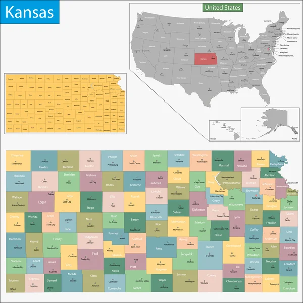
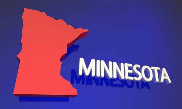
Minnesota, MN, Political Map, With Capital Saint Paul And Metropolitan Area Minneapolis. State In The Upper Midwestern United States. Nicknamed Land Of 10,000 Lakes, North Star State And Gopher State.

Vector, 6.13MB, 6000 × 6000 eps
stock vector 19 of 50 states of the United States with a name, nickname, and

19 Of 50 States Of The United States With A Name, Nickname, And

Vector, 0.75MB, 7311 × 4112 eps
stock image Fabric texture of the North Dakota Flag - Flags from the USA

Fabric Texture Of The North Dakota Flag - Flags From The USA

Image, 5.52MB, 5357 × 1949 jpg
stock vector Michigan, MI, political map, with capital Lansing and metropolitan area Detroit. State in Great Lakes region of upper Midwestern United States, nicknamed The Great Lake State, and The Wolverine State.

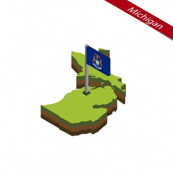
Michigan, MI, Political Map, With Capital Lansing And Metropolitan Area Detroit. State In Great Lakes Region Of Upper Midwestern United States, Nicknamed The Great Lake State, And The Wolverine State.

Vector, 6.65MB, 6000 × 6000 eps
stock image Countryside scenery at Fall season. Autumn colors. Harvest, harvesting time. Rural landscape. Aerial, view from above of the Farm

Countryside Scenery At Fall Season. Autumn Colors. Harvest, Harvesting Time. Rural Landscape. Aerial, View From Above Of The Farm

Image, 3.78MB, 3000 × 1688 jpg
stock image Ohio Map Clouds USA

Ohio Map Clouds USA

Image, 5.93MB, 5000 × 2888 jpg
stock vector Nebraska Isometric map and flag. Vector Illustration.

Nebraska Isometric Map And Flag. Vector Illustration.

Vector, 1.62MB, 5000 × 5000 eps
Previous << Page 2 >> Next