photo free
Home Images Vectors Videos

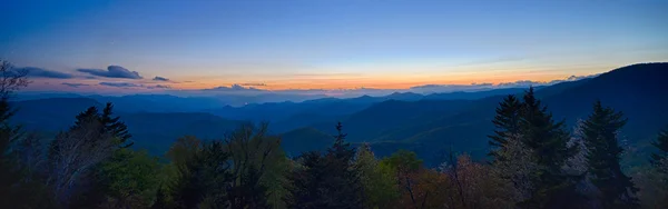
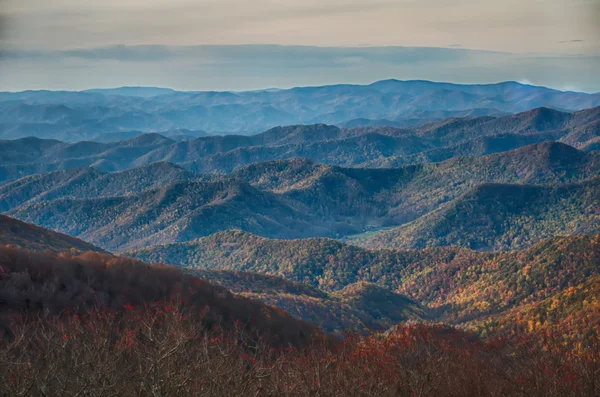
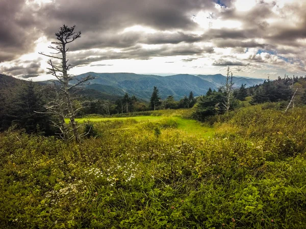
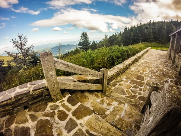
Stock image Mount Mitchell

stock image top of mount mitchell before sunset

Top Of Mount Mitchell Before Sunset

Image, 6.8MB, 4908 × 3256 jpg
stock image Rhodedendron in a Mountain Forest in Mount Mitchell State Park in North Carolina

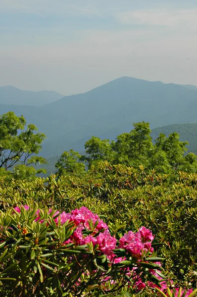
Rhodedendron In A Mountain Forest In Mount Mitchell State Park In North Carolina

Image, 8.23MB, 4500 × 3000 jpg
stock image mount mimtchell sunset landscape in summer

Mount Mimtchell Sunset Landscape In Summer

Image, 9.97MB, 5472 × 3648 jpg
stock image scenic views at sunset on top of mount mitchell

Scenic Views At Sunset On Top Of Mount Mitchell

Image, 6.57MB, 3680 × 2415 jpg
stock image The Enviromental Education Center and benches at Mount Mitchell

The Enviromental Education Center And Benches At Mount Mitchell

Image, 7.43MB, 3800 × 2533 jpg
stock image Appalachian Mountains from Mount Mitchell, the highest point in the eastern United States

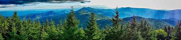
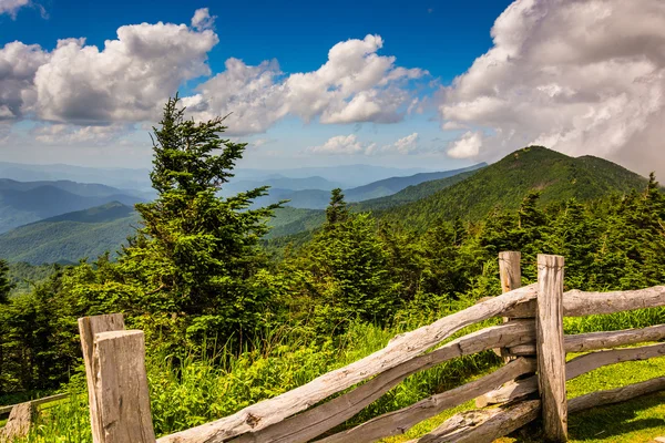
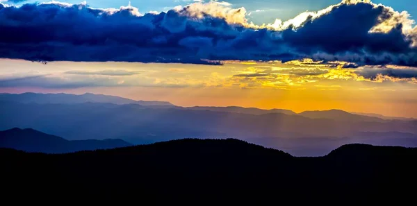
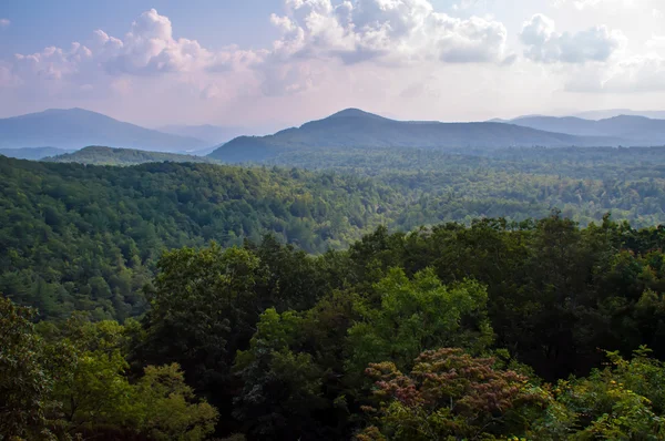
Appalachian Mountains From Mount Mitchell, The Highest Point In The Eastern United States

Image, 7.24MB, 3872 × 2119 jpg
stock image scenic views at sunset on top of mount mitchell

Scenic Views At Sunset On Top Of Mount Mitchell

Image, 12.56MB, 3456 × 4608 jpg
stock image Mount Mitchell State Park

Mount Mitchell State Park

Image, 5.19MB, 2727 × 4159 jpg
stock image Fence along a trail and view of the Appalachians from Mount Mitc

Fence Along A Trail And View Of The Appalachians From Mount Mitc

Image, 9.31MB, 3800 × 2533 jpg
stock image Fence and view of the Appalachians from Mount Mitchell, North Ca

Fence And View Of The Appalachians From Mount Mitchell, North Ca

Image, 9.34MB, 2533 × 3800 jpg
stock image sunset view over blue ridge mountains

Sunset View Over Blue Ridge Mountains

Image, 3.51MB, 4151 × 2752 jpg
stock image Mitchell Mountain Range Kootenay National Park

Mitchell Mountain Range Kootenay National Park

Image, 7.95MB, 3264 × 3264 jpg
stock image Springtime at Scenic Blue Ridge Parkway Appalachians Smoky Mount

Springtime At Scenic Blue Ridge Parkway Appalachians Smoky Mount

Image, 15.78MB, 5337 × 3560 jpg
stock image Springtime at Scenic Blue Ridge Parkway Appalachians Smoky Mount

Springtime At Scenic Blue Ridge Parkway Appalachians Smoky Mount

Image, 11.53MB, 5335 × 3561 jpg
stock image Mount Mitchell View

Mount Mitchell View

Image, 13.22MB, 5616 × 3744 jpg
stock image landscape scenic views at isgah national forest

Landscape Scenic Views At Isgah National Forest

Image, 15.01MB, 8192 × 1856 jpg
stock image Springtime at Scenic Blue Ridge Parkway Appalachians Smoky Mount

Springtime At Scenic Blue Ridge Parkway Appalachians Smoky Mount

Image, 7.3MB, 7770 × 2445 jpg
stock image sunset view over blue ridge mountains

Sunset View Over Blue Ridge Mountains

Image, 5.07MB, 4102 × 2722 jpg
stock image Springtime at Scenic Blue Ridge Parkway Appalachians Smoky Mount

Springtime At Scenic Blue Ridge Parkway Appalachians Smoky Mount

Image, 17.99MB, 5997 × 3986 jpg
stock image sunset view over blue ridge mountains

Sunset View Over Blue Ridge Mountains

Image, 4.64MB, 4282 × 2836 jpg
stock image top of mount mitchell before sunset

Top Of Mount Mitchell Before Sunset

Image, 7.4MB, 4927 × 2816 jpg
stock image landscape scenic views at isgah national forest

Landscape Scenic Views At Isgah National Forest

Image, 12.25MB, 5472 × 3648 jpg
stock image top of mount mitchell after sunset

Top Of Mount Mitchell After Sunset

Image, 7.68MB, 4914 × 3244 jpg
stock image Fence and view of the Appalachians from Mount Mitchell, North Ca

Fence And View Of The Appalachians From Mount Mitchell, North Ca

Image, 9.25MB, 3800 × 2533 jpg
stock image scenic views at sunset on top of mount mitchell

Scenic Views At Sunset On Top Of Mount Mitchell

Image, 8.38MB, 3571 × 2678 jpg
stock image scenic views at sunset on top of mount mitchell

Scenic Views At Sunset On Top Of Mount Mitchell

Image, 6.13MB, 3680 × 2760 jpg
stock image Sign showing altitude on top of mount Mitchell, NC

Sign Showing Altitude On Top Of Mount Mitchell, NC

Image, 6.74MB, 2000 × 3041 jpg
stock image Mount mitchell

Mount Mitchell

Image, 13.95MB, 2848 × 4288 jpg
stock image scenic views at sunset on top of mount mitchell

Scenic Views At Sunset On Top Of Mount Mitchell

Image, 7.2MB, 3680 × 2760 jpg
stock image top of mount mitchell before sunset

Top Of Mount Mitchell Before Sunset

Image, 8.45MB, 4926 × 3262 jpg
stock image scenic views at sunset on top of mount mitchell

Scenic Views At Sunset On Top Of Mount Mitchell

Image, 10.91MB, 4608 × 3456 jpg
stock image mount mimtchell sunset landscape in summer

Mount Mimtchell Sunset Landscape In Summer

Image, 5.94MB, 5472 × 2712 jpg
stock image Mountains around mount mitchell

Mountains Around Mount Mitchell

Image, 5.14MB, 4288 × 2848 jpg
stock image Rhododendron in the NC Mountains

Rhododendron In The NC Mountains

Image, 1.94MB, 2000 × 3008 jpg
stock image Thick forest

Thick Forest

Image, 8.91MB, 4288 × 2848 jpg
stock image Waterfall in Appalachian mountains

Waterfall In Appalachian Mountains

Image, 12.97MB, 4892 × 3261 jpg
stock image taking sunset photo with a camera in the mountains

Taking Sunset Photo With A Camera In The Mountains

Image, 6.84MB, 5248 × 2952 jpg
stock image twin tunnel

Twin Tunnel

Image, 11.24MB, 5360 × 3560 jpg
stock image Blue ridge mountains tunnels

Blue Ridge Mountains Tunnels

Image, 4.64MB, 3684 × 2456 jpg
stock image Top of mount mitchell

Top Of Mount Mitchell

Image, 5.38MB, 2424 × 3650 jpg
stock image moss in the alpine forest climbing on a fir tree

Moss In The Alpine Forest Climbing On A Fir Tree

Image, 10.89MB, 4256 × 2832 jpg
stock image Corn Palace

Corn Palace

Image, 11.7MB, 5152 × 3438 jpg
stock vector South Dakota, SD, political map, with capital Pierre, and largest city Sioux Falls. State in the upper Midwestern subregion of the United States of America, nicknamed The Mount Rushmore State. Vector.

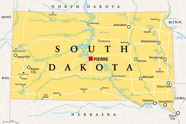
South Dakota, SD, Political Map, With Capital Pierre, And Largest City Sioux Falls. State In The Upper Midwestern Subregion Of The United States Of America, Nicknamed The Mount Rushmore State. Vector.

Vector, 3.62MB, 9000 × 5999 eps
stock image Abattoir Swamp near Mount Molloy offers a 75m boardwalk to a bird hide. Managed by MRWMG, it's a biodiversity hotspot with plans to improve habitat and facilities for better birdwatching experiences

Abattoir Swamp Near Mount Molloy Offers A 75m Boardwalk To A Bird Hide. Managed By MRWMG, It's A Biodiversity Hotspot With Plans To Improve Habitat And Facilities For Better Birdwatching Experiences

Image, 17.94MB, 5510 × 3673 jpg
stock image Abattoir Swamp near Mount Molloy offers a 75m boardwalk to a bird hide. Managed by MRWMG, it's a biodiversity hotspot with plans to improve habitat and facilities for better birdwatching experiences

Abattoir Swamp Near Mount Molloy Offers A 75m Boardwalk To A Bird Hide. Managed By MRWMG, It's A Biodiversity Hotspot With Plans To Improve Habitat And Facilities For Better Birdwatching Experiences

Image, 21.14MB, 6000 × 4000 jpg
stock image Abattoir Swamp near Mount Molloy offers a 75m boardwalk to a bird hide. Managed by MRWMG, it's a biodiversity hotspot with plans to improve habitat and facilities for better birdwatching experiences

Abattoir Swamp Near Mount Molloy Offers A 75m Boardwalk To A Bird Hide. Managed By MRWMG, It's A Biodiversity Hotspot With Plans To Improve Habitat And Facilities For Better Birdwatching Experiences

Image, 15.75MB, 5620 × 3747 jpg
stock image Abattoir Swamp near Mount Molloy offers a 75m boardwalk to a bird hide. Managed by MRWMG, it's a biodiversity hotspot with plans to improve habitat and facilities for better birdwatching experiences

Abattoir Swamp Near Mount Molloy Offers A 75m Boardwalk To A Bird Hide. Managed By MRWMG, It's A Biodiversity Hotspot With Plans To Improve Habitat And Facilities For Better Birdwatching Experiences

Image, 20.04MB, 3966 × 5950 jpg
stock image Abattoir Swamp near Mount Molloy offers a 75m boardwalk to a bird hide. Managed by MRWMG, it's a biodiversity hotspot with plans to improve habitat and facilities for better birdwatching experiences

Abattoir Swamp Near Mount Molloy Offers A 75m Boardwalk To A Bird Hide. Managed By MRWMG, It's A Biodiversity Hotspot With Plans To Improve Habitat And Facilities For Better Birdwatching Experiences

Image, 18.03MB, 5650 × 3767 jpg
stock image Abattoir Swamp near Mount Molloy offers a 75m boardwalk to a bird hide. Managed by MRWMG, it's a biodiversity hotspot with plans to improve habitat and facilities for better birdwatching experiences

Abattoir Swamp Near Mount Molloy Offers A 75m Boardwalk To A Bird Hide. Managed By MRWMG, It's A Biodiversity Hotspot With Plans To Improve Habitat And Facilities For Better Birdwatching Experiences

Image, 17.17MB, 5390 × 3593 jpg
stock image top of mount mitchell after sunset

Top Of Mount Mitchell After Sunset

Image, 6MB, 4912 × 2610 jpg
Page 1 >> Next