photo free
Home Images Vectors Videos

Stock image Nay Pyi Taw page 2

stock image Myanmar extruded on the physical orthographic map. Capital, administrative borders and graticule

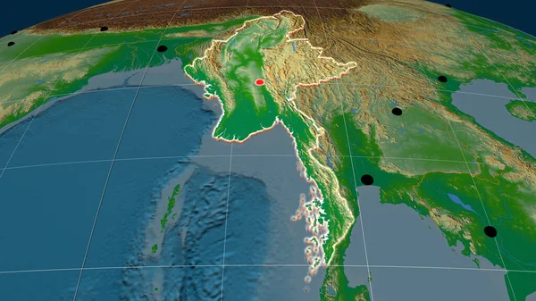
Myanmar Extruded On The Physical Orthographic Map. Capital, Administrative Borders And Graticule

Image, 6.67MB, 3840 × 2160 jpg
stock image Myanmar flag depicted on folded wavy fabric of old cloth close up

Myanmar Flag Depicted On Folded Wavy Fabric Of Old Cloth Close Up

Image, 7.31MB, 4928 × 3264 jpg
stock image Myanmar flag depicted on side wall of white delivery van close up. Shipping and local delivery concept

Myanmar Flag Depicted On Side Wall Of White Delivery Van Close Up. Shipping And Local Delivery Concept

Image, 2.14MB, 4928 × 3264 jpg
stock image Myanmar flag and big stack of shipping cargo containers in docks with sky background close up

Myanmar Flag And Big Stack Of Shipping Cargo Containers In Docks With Sky Background Close Up

Image, 5.52MB, 4928 × 3264 jpg
stock image Toll Gate, 115 miles away from Yangon, on Yangon-Mandalay express way, Myanmar, Feb-2018

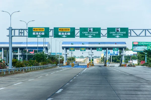
Toll Gate, 115 Miles Away From Yangon, On Yangon-Mandalay Express Way, Myanmar, Feb-2018

Image, 11.39MB, 6000 × 4000 jpg
stock image Uppatasanti Pagoda - Nay Pyi Taw

Uppatasanti Pagoda - Nay Pyi Taw

Image, 6.36MB, 4288 × 2848 jpg
stock image Physical map within the Myanmar area in the stereographic projection with legend - raw composition of raster layers with light glowing outline

Physical Map Within The Myanmar Area In The Stereographic Projection With Legend - Raw Composition Of Raster Layers With Light Glowing Outline

Image, 6.43MB, 2880 × 1620 jpg
stock image Myanmar flag and big stack of shipping cargo containers in docks with sky background close up

Myanmar Flag And Big Stack Of Shipping Cargo Containers In Docks With Sky Background Close Up

Image, 5.58MB, 4928 × 3264 jpg
stock image Uppatasanti Pagoda Complex - Nay Pyi Taw

Uppatasanti Pagoda Complex - Nay Pyi Taw

Image, 6.51MB, 4288 × 2848 jpg
stock image Myanmar extruded on the satellite orthographic map. Capital, administrative borders and graticule

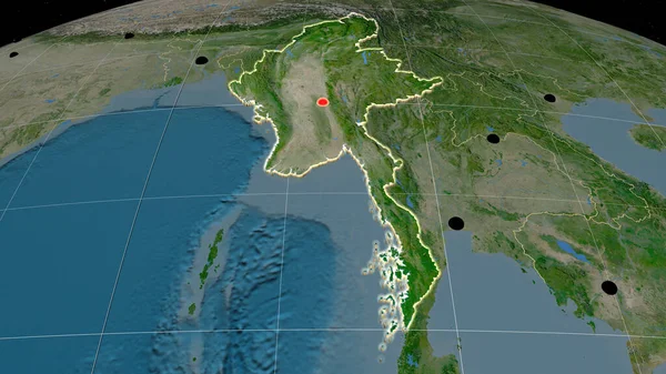
Myanmar Extruded On The Satellite Orthographic Map. Capital, Administrative Borders And Graticule

Image, 6.67MB, 3840 × 2160 jpg
stock image Myanmar flag depicted on folded wavy fabric of old cloth close up

Myanmar Flag Depicted On Folded Wavy Fabric Of Old Cloth Close Up

Image, 7.17MB, 4928 × 3264 jpg
stock image Flag of Australia and Myanmar. Two Flags Together Australian and Burma national flags. State flags. Australian-Myanmar relations. Sports competitions between countries. Two flags

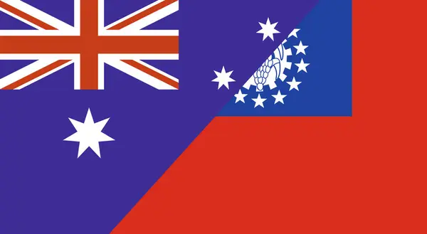
Flag Of Australia And Myanmar. Two Flags Together Australian And Burma National Flags. State Flags. Australian-Myanmar Relations. Sports Competitions Between Countries. Two Flags

Image, 3.25MB, 6673 × 3661 jpg
stock image Myanmar flag depicted on folded wavy fabric of old cloth close up

Myanmar Flag Depicted On Folded Wavy Fabric Of Old Cloth Close Up

Image, 5.65MB, 4928 × 3264 jpg
Previous << Page 2 >> Next