photo free
Home Images Vectors Videos

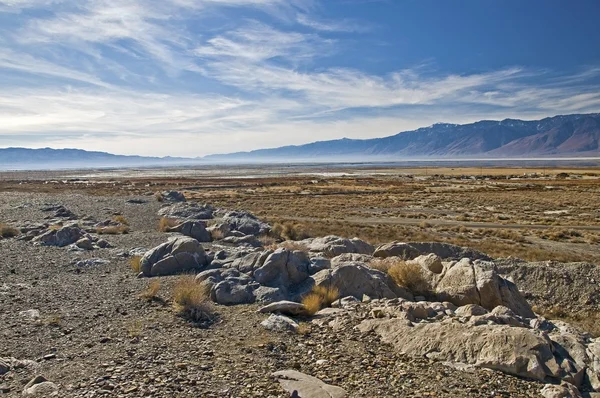
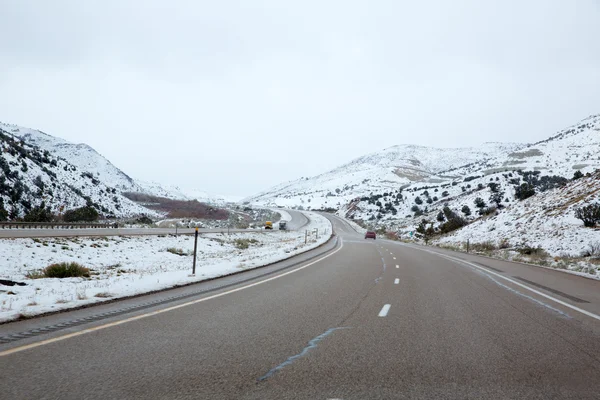
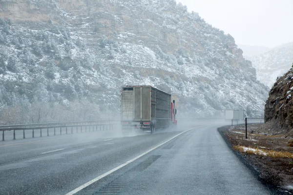
Stock image Nevada Ca

stock image Long interstate road at summer sunset with countryside landscape

Long Interstate Road At Summer Sunset With Countryside Landscape

Image, 6.37MB, 2560 × 2925 jpg
stock image Deserted Route 190 highway in Death Valley California

Deserted Route 190 Highway In Death Valley California

Image, 15.38MB, 5760 × 5760 jpg
stock image Las Vegas Highway Sign

Las Vegas Highway Sign

Image, 11.79MB, 5616 × 3744 jpg
stock image Zabriskie Point sunset with sky in Death Valley National Park Ca

Zabriskie Point Sunset With Sky In Death Valley National Park Ca

Image, 45.2MB, 14785 × 5067 jpg
stock image Deserted Route 190 highway in Death Valley California

Deserted Route 190 Highway In Death Valley California

Image, 12.83MB, 5760 × 3840 jpg
stock image Never ending road to Death Valley California

Never Ending Road To Death Valley California

Image, 13.13MB, 5760 × 5760 jpg
stock image Sunset

Sunset

Image, 18.38MB, 7000 × 3973 jpg
stock image Mojave Desert Interstate 15 Freeway near Baker California

Mojave Desert Interstate 15 Freeway Near Baker California

Image, 8.46MB, 4500 × 3000 jpg
stock image Interstate 15 On Ramp Sign in the Mojave Desert

Interstate 15 On Ramp Sign In The Mojave Desert

Image, 12.65MB, 5553 × 3702 jpg
stock image Owens Lake, California, Usa

Owens Lake, California, Usa

Image, 9.86MB, 5620 × 3733 jpg
stock image Never ending road to Death Valley California

Never Ending Road To Death Valley California

Image, 13.14MB, 3840 × 5760 jpg
stock image Alabama Hills at Sunset Mt Whitney in the Background

Alabama Hills At Sunset Mt Whitney In The Background

Image, 5.09MB, 3238 × 2161 jpg
stock image Four layers landscape Sierra Nevada

Four Layers Landscape Sierra Nevada

Image, 7.96MB, 4288 × 2848 jpg
stock image Interstate 15 Desert Freeway Entrance in the Mojave National Preserve

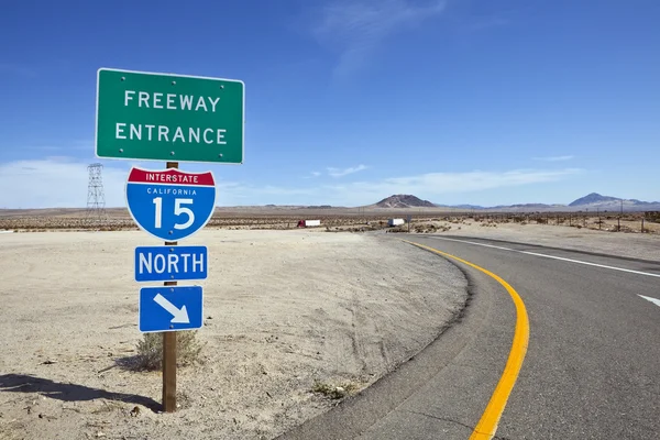
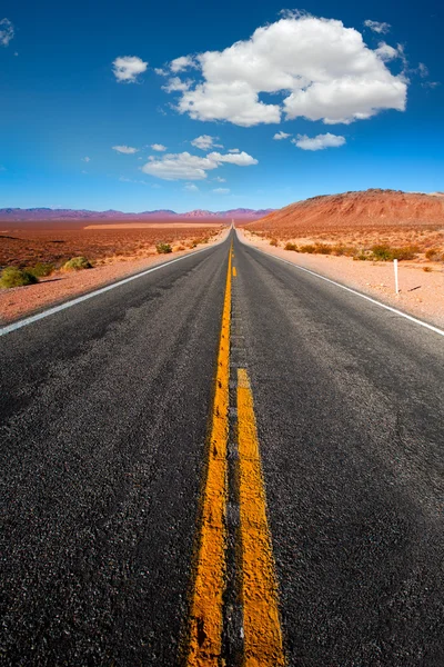
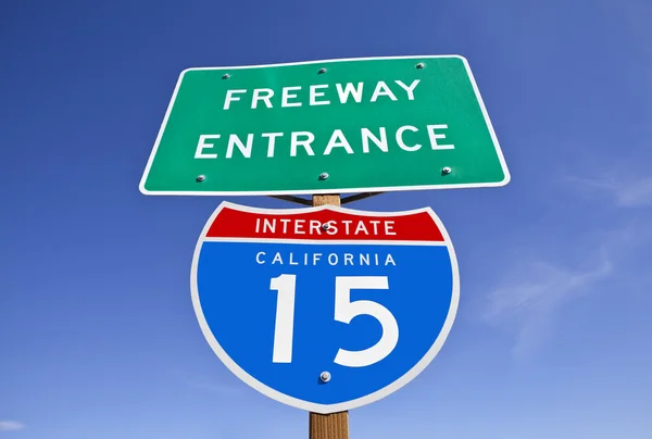
Interstate 15 Desert Freeway Entrance In The Mojave National Preserve

Image, 12.41MB, 5545 × 3697 jpg
stock image Yosemite National Park Trails

Yosemite National Park Trails

Image, 8.69MB, 5336 × 3557 jpg
stock vector USA map with abbreviated state names. United States of America cartography with colored states. Vector illustration.

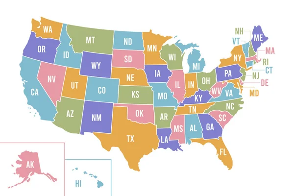
USA Map With Abbreviated State Names. United States Of America Cartography With Colored States. Vector Illustration.

Vector, 0.68MB, 6250 × 4167 eps
stock image Nevada USA spring snow in the mountains

Nevada USA Spring Snow In The Mountains

Image, 9.65MB, 5760 × 3840 jpg
stock image Mesquite Dunes desert in Death Valley National Park

Mesquite Dunes Desert In Death Valley National Park

Image, 11.11MB, 5760 × 5760 jpg
stock image Lake Tahoe - Emerald Bay

Lake Tahoe - Emerald Bay

Image, 16.54MB, 6000 × 4000 jpg
stock image Foothills of the Sierra-Nevada mountains

Foothills Of The Sierra-Nevada Mountains

Image, 5.92MB, 5620 × 3733 jpg
stock image Foothills of the Sierra-Nevada mountains

Foothills Of The Sierra-Nevada Mountains

Image, 6.83MB, 5620 × 3733 jpg
stock image Scenic winter path along June Lake Loop in California

Scenic Winter Path Along June Lake Loop In California

Image, 0MB, 4190 × 2783 jpg
stock image The pavement ends and the dirt road begins on California State Highway 270 near Bodie Ghost Town in the Eastern Sierra Nevada Mountains.

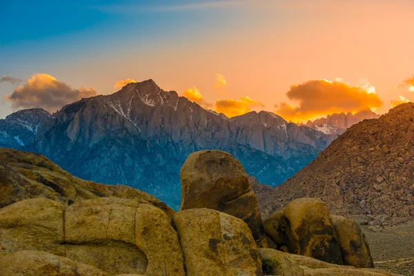
The Pavement Ends And The Dirt Road Begins On California State Highway 270 Near Bodie Ghost Town In The Eastern Sierra Nevada Mountains.

Image, 13.01MB, 5338 × 3559 jpg
stock image Famous Tea Kettle Junction in Death Valley National Park, California

Famous Tea Kettle Junction In Death Valley National Park, California

Image, 4.28MB, 4003 × 2767 jpg
stock image Lundy Canyon in Autumn with fall leaves on the trees reflecting in a beautiful pond. Part of the Sierra Nevada mountains near Lee Vining and Mono Lake, CA

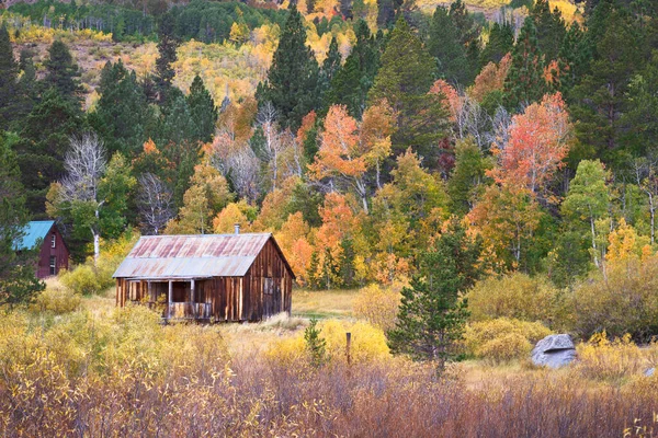
Lundy Canyon In Autumn With Fall Leaves On The Trees Reflecting In A Beautiful Pond. Part Of The Sierra Nevada Mountains Near Lee Vining And Mono Lake, CA

Image, 7.95MB, 4000 × 2667 jpg
stock image A high angle shot of a forest in the mountains near the Big Pine Lakes, CA

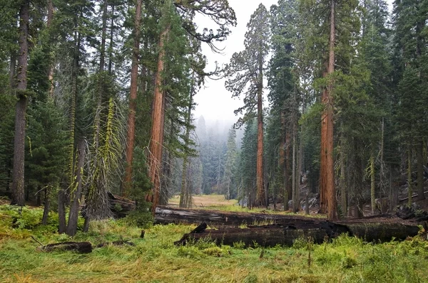
A High Angle Shot Of A Forest In The Mountains Near The Big Pine Lakes, CA

Image, 17.53MB, 5644 × 3763 jpg
stock image Mesquite Dunes desert in Death Valley National Park

Mesquite Dunes Desert In Death Valley National Park

Image, 9.82MB, 3840 × 5288 jpg
stock image US snowing I 15 interstate snowed road in Nevada

US Snowing I 15 Interstate Snowed Road In Nevada

Image, 7.29MB, 5760 × 3840 jpg
stock image Mono Lake

Mono Lake

Image, 1.77MB, 2994 × 1981 jpg
stock image US snowing I 15 interstate snowed road in Nevada

US Snowing I 15 Interstate Snowed Road In Nevada

Image, 7.63MB, 5760 × 3840 jpg
stock image General Grant tree (Sequoiadendron giganteum) - is the largest sequoia in General Grant Grove section of Kings Canyon National Park, CA

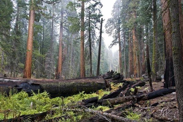
General Grant Tree (Sequoiadendron Giganteum) - Is The Largest Sequoia In General Grant Grove Section Of Kings Canyon National Park, CA

Image, 64.27MB, 6920 × 10209 jpg
stock image California state on the map

California State On The Map

Image, 11.97MB, 6000 × 4000 jpg
stock image Twin Lakes near Bridgeport, CA. Mountain lake with reflections and clear water showing the rocks beneath.

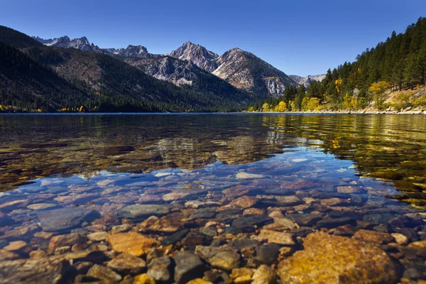
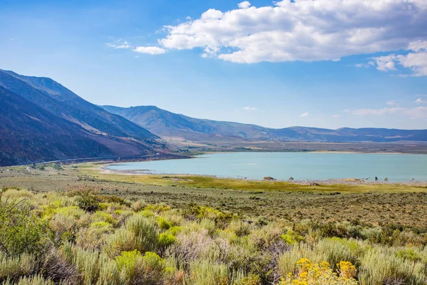
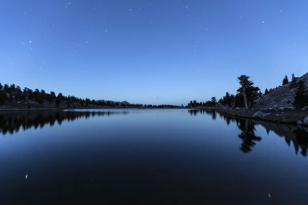
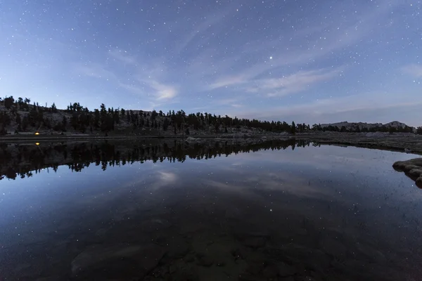
Twin Lakes Near Bridgeport, CA. Mountain Lake With Reflections And Clear Water Showing The Rocks Beneath.

Image, 6.34MB, 4000 × 2666 jpg
stock image Cereal fields with irrigation wheels with snow in Nevada

Cereal Fields With Irrigation Wheels With Snow In Nevada

Image, 7.17MB, 5760 × 5760 jpg
stock image Forest floor, Kings Canyon national park

Forest Floor, Kings Canyon National Park

Image, 11.39MB, 5620 × 3733 jpg
stock image San Bernardino 15 Freeway

San Bernardino 15 Freeway

Image, 4.66MB, 4000 × 3000 jpg
stock image Ferris Wheel and Lights with Twilight Colorful Clouds at Country Fair

Ferris Wheel And Lights With Twilight Colorful Clouds At Country Fair

Image, 16.23MB, 5760 × 3840 jpg
stock image Nevada USA spring snow in the mountains

Nevada USA Spring Snow In The Mountains

Image, 9.86MB, 5760 × 5760 jpg
stock image Mobius Arch Alabama Hills

Mobius Arch Alabama Hills

Image, 4.84MB, 3400 × 2269 jpg
stock image Sequoia national park

Sequoia National Park

Image, 9.6MB, 5620 × 3733 jpg
stock image Cirque Lake Dawn

Cirque Lake Dawn

Image, 5.54MB, 5301 × 3534 jpg
stock image Rustic barn with fall colors in Hope Valley, California

Rustic Barn With Fall Colors In Hope Valley, California

Image, 7.72MB, 2999 × 1999 jpg
stock image Cirque Lake Starscape

Cirque Lake Starscape

Image, 7.15MB, 5279 × 3519 jpg
stock image Star Reflections Sierra Lake Wilderness

Star Reflections Sierra Lake Wilderness

Image, 7.19MB, 4500 × 3000 jpg
stock image Mono Lake is a saline soda lake in Mono County, California. Many columns of limestone, called tufa, rise above the surface of Mono Lake. The Sierra Nevada Mountain Range is in the background.

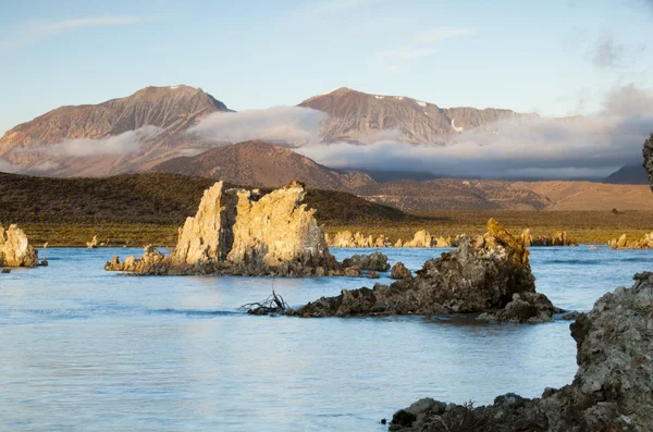
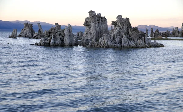
Mono Lake Is A Saline Soda Lake In Mono County, California. Many Columns Of Limestone, Called Tufa, Rise Above The Surface Of Mono Lake. The Sierra Nevada Mountain Range Is In The Background.

Image, 3.31MB, 3872 × 2592 jpg
stock image Ripple

Ripple

Image, 10.1MB, 5184 × 3168 jpg
stock image Sequoia national park

Sequoia National Park

Image, 10.27MB, 5620 × 3733 jpg
stock image Grass Valley, California, USA: Main Street with a clock tower, Clock Tower Records, Sierra Star Winery, and Pete's Pizza. Grass Valley is a Gold Rush town in the Sierra Nevada foothills.

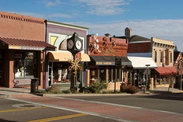
Grass Valley, California, USA: Main Street With A Clock Tower, Clock Tower Records, Sierra Star Winery, And Pete's Pizza. Grass Valley Is A Gold Rush Town In The Sierra Nevada Foothills.

Image, 2.07MB, 3872 × 2592 jpg
stock image Sequoia national park

Sequoia National Park

Image, 8.5MB, 3733 × 5620 jpg
stock image California Interstate 15 Freeway Entrance Sign

California Interstate 15 Freeway Entrance Sign

Image, 6.24MB, 5461 × 3680 jpg
Page 1 >> Next