photo free
Home Images Vectors Videos

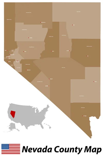
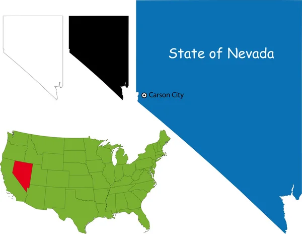
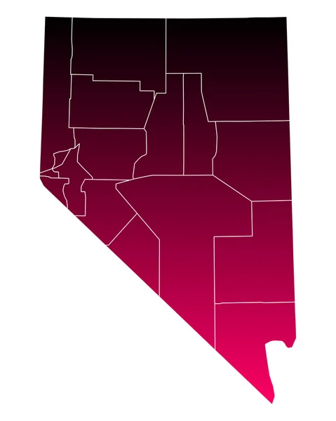
Stock image Nevada County Map

stock vector Nevada County Map

Nevada County Map

Vector, 0.49MB, 3333 × 5000 ai
stock vector Accurate map of Nevada

Accurate Map Of Nevada

Vector, 0.61MB, 4000 × 5000 eps
stock vector Map of the United States of America

Map Of The United States Of America

Vector, 2.33MB, 5000 × 3123 ai
stock vector Highly detailed vector silhouettes of US state maps, Division United States into counties, political and geographic subdivisions of a states, Mountain - Nevada, Utah, Arizona - set 14 of 17

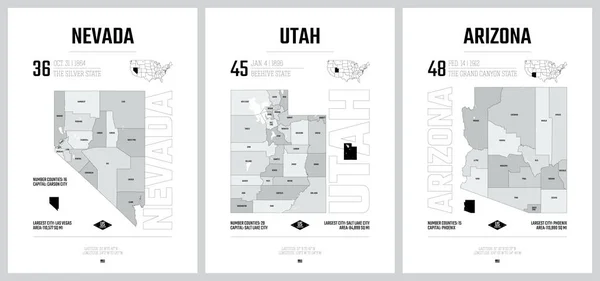
Highly Detailed Vector Silhouettes Of US State Maps, Division United States Into Counties, Political And Geographic Subdivisions Of A States, Mountain - Nevada, Utah, Arizona - Set 14 Of 17

Vector, 5.36MB, 9608 × 4501 eps
stock image US State Maps Set II

US State Maps Set II

Image, 22MB, 7500 × 7500 jpg
stock vector Map of the United States of America

Map Of The United States Of America

Vector, 2.58MB, 5000 × 3125 ai
stock vector Green map of Nevada with indication of Las Vegas

Green Map Of Nevada With Indication Of Las Vegas

Vector, 1.48MB, 3780 × 4200 eps
stock vector Nevada

Nevada

Vector, 0.82MB, 2814 × 3626 eps
stock vector Orange map of Nevada

Orange Map Of Nevada

Vector, 1.47MB, 3780 × 4200 eps
stock vector Accurate map of Nevada

Accurate Map Of Nevada

Vector, 0.61MB, 4000 × 5000 eps
stock vector Nevada map

Nevada Map

Vector, 6.03MB, 7002 × 7002 eps
stock vector blue vector map of United States with indication of Nevada

Blue Vector Map Of United States With Indication Of Nevada

Vector, 1.73MB, 4600 × 3450 eps
stock vector Doodle freehand drawing USA political map with major cities. Vector illustration.

Doodle Freehand Drawing USA Political Map With Major Cities. Vector Illustration.

Vector, 10.16MB, 8344 × 6282 eps
stock vector USA map with abbreviated state names. United States of America cartography with colored states. Vector illustration.

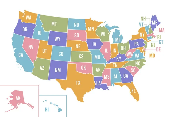
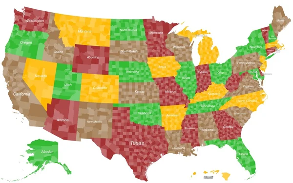
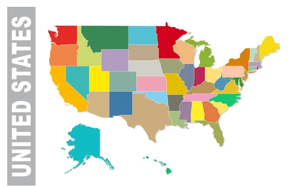
USA Map With Abbreviated State Names. United States Of America Cartography With Colored States. Vector Illustration.

Vector, 0.68MB, 6250 × 4167 eps
stock vector Utah vector accurate high detailed State Map with Community Assistance and Activates Icons Original pastel Illustratio

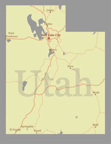
Utah Vector Accurate High Detailed State Map With Community Assistance And Activates Icons Original Pastel Illustratio

Vector, 0.55MB, 4244 × 5501 eps
stock vector Pennsylvania vector accurate high detailed State Map with Commun

Pennsylvania Vector Accurate High Detailed State Map With Commun

Vector, 0.51MB, 5001 × 3018 eps
stock vector New Mexico detailed exact detailed vector State Map with Community Assistance and Activates Icons Original pastel yellow Illustration with main roads. United States of Americ

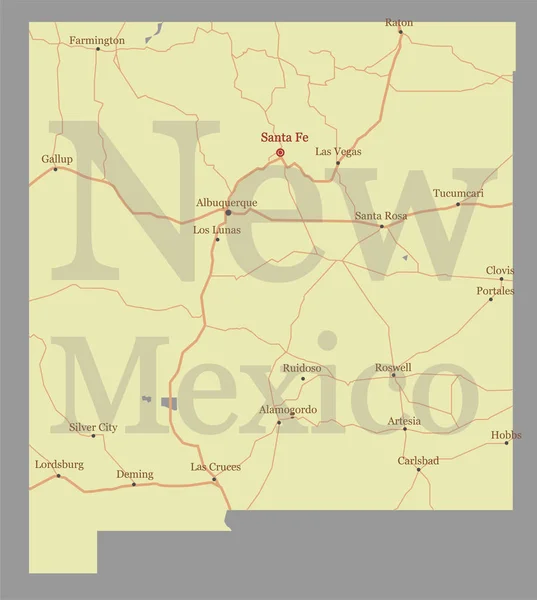
New Mexico Detailed Exact Detailed Vector State Map With Community Assistance And Activates Icons Original Pastel Yellow Illustration With Main Roads. United States Of Americ

Vector, 0.64MB, 5501 × 6134 eps
stock vector Vector hand drawn stylized map of The United States of America. Travel illustration of USA states. Hand drawn lettering illustration. North America map element

Vector Hand Drawn Stylized Map Of The United States Of America. Travel Illustration Of USA States. Hand Drawn Lettering Illustration. North America Map Element

Vector, 0.64MB, 6000 × 4000 eps
stock vector Colorful united staes administrative and political vector map.

Colorful United Staes Administrative And Political Vector Map.

Vector, 0.6MB, 5104 × 3262 eps
stock vector USA map silhouette isolated on white. United States of America country. Vector illustration.

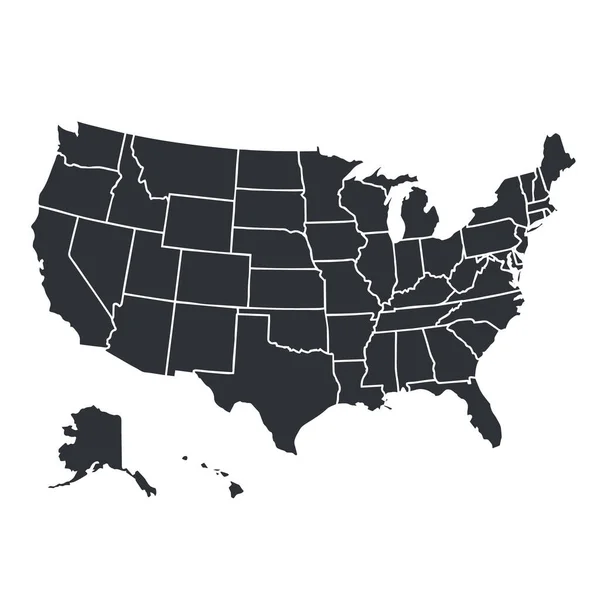
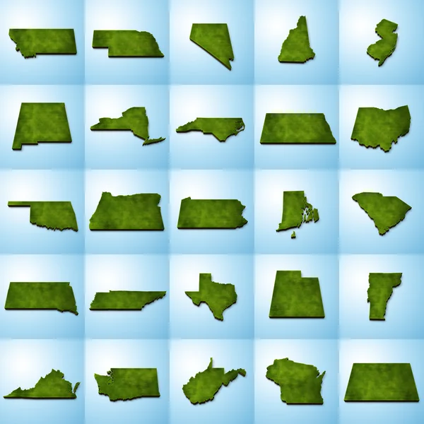
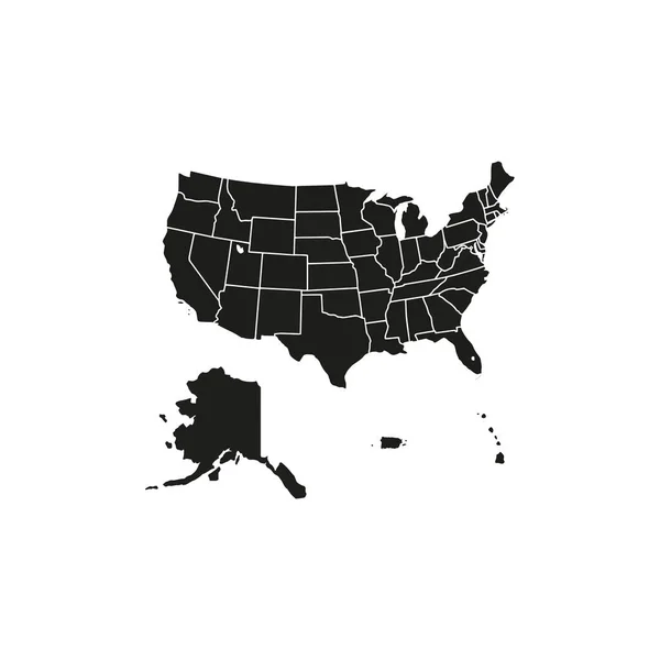
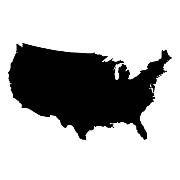
USA Map Silhouette Isolated On White. United States Of America Country. Vector Illustration.

Vector, 0.64MB, 4000 × 4000 eps
stock vector California and its counties

California And Its Counties

Vector, 9.34MB, 5000 × 5000 eps
stock vector Nevada map

Nevada Map

Vector, 4.01MB, 5503 × 4257 eps
stock vector United States Map, states border map. Vector illustration.

United States Map, States Border Map. Vector Illustration.

Vector, 1.29MB, 4167 × 4167 eps
stock vector USA map. United States of America poster with state names. Geographic american maps including Alaska and Hawaii vector illustration

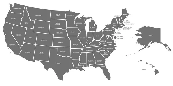
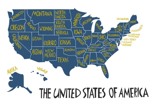
USA Map. United States Of America Poster With State Names. Geographic American Maps Including Alaska And Hawaii Vector Illustration

Vector, 1.63MB, 9000 × 4500 eps
stock vector USA State counties emblem map

USA State Counties Emblem Map

Vector, 0MB, 5136 × 5168 zip
stock vector Arizona state detailed editable map

Arizona State Detailed Editable Map

Vector, 0.97MB, 4901 × 5521 eps
stock vector Nevada state detailed editable map

Nevada State Detailed Editable Map

Vector, 0.82MB, 5050 × 6500 eps
stock vector usa map on white background. flat style. United States of America map. usa vector map.

Usa Map On White Background. Flat Style. United States Of America Map. Usa Vector Map.

Vector, 5.57MB, 5000 × 5000 eps
stock vector Nevada road and administrative map with interstate US highways and main roads

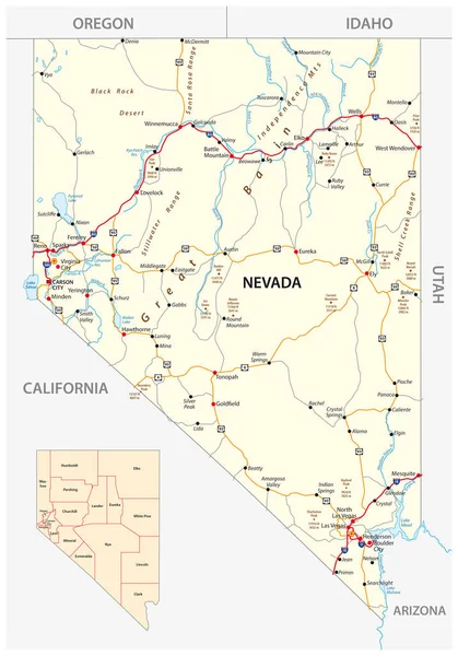
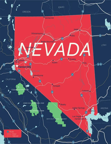
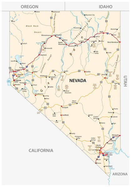
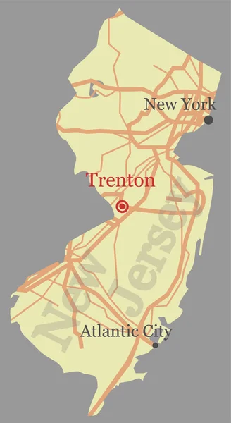
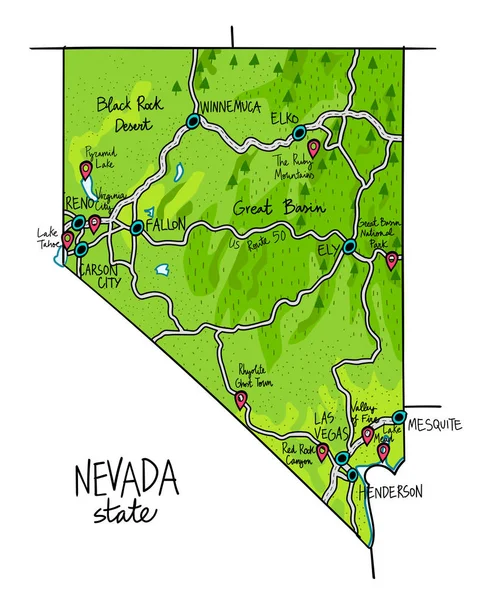
Nevada Road And Administrative Map With Interstate US Highways And Main Roads

Vector, 1.8MB, 3100 × 4432 eps
stock vector Nevada road map with interstate US highways and federal highways

Nevada Road Map With Interstate US Highways And Federal Highways

Vector, 1.71MB, 3100 × 4432 eps
stock vector Accurate map of Nevada

Accurate Map Of Nevada

Vector, 0.61MB, 4000 × 5000 eps
stock vector Las Vegas Vector Map

Las Vegas Vector Map

Vector, 7.15MB, 8000 × 8000 eps
stock vector California - Nevada - Utah - Arizona Map labelled black

California - Nevada - Utah - Arizona Map Labelled Black

Vector, 3.22MB, 5856 × 5000 eps
stock vector Accurate map of Nevada

Accurate Map Of Nevada

Vector, 0.62MB, 4000 × 5000 eps
stock vector Map of Lake Tahoe, located between the US states of California a

Map Of Lake Tahoe, Located Between The US States Of California A

Vector, 0.98MB, 3100 × 4497 eps
stock vector California state map silhouette in the United States

California State Map Silhouette In The United States

Vector, 0.03MB, 5000 × 3000 eps
stock vector vector high detailed map of California's Congressional districts since 2013

Vector High Detailed Map Of California's Congressional Districts Since 2013

Vector, 6.44MB, 8333 × 7456 eps
stock vector Nevada USA Map grey

Nevada USA Map Grey

Vector, 4.67MB, 5000 × 7107 eps
stock vector New Jersey vector accurate high detailed State Map with Communit

New Jersey Vector Accurate High Detailed State Map With Communit

Vector, 0.41MB, 2739 × 5001 eps
stock vector Las Vegas Nevada city map USA labelled black illustration

Las Vegas Nevada City Map USA Labelled Black Illustration

Vector, 7.99MB, 6641 × 5000 eps
stock vector Modern City Map - Las Vegas Nevada city of the USA with neighborhoods and titles outline map

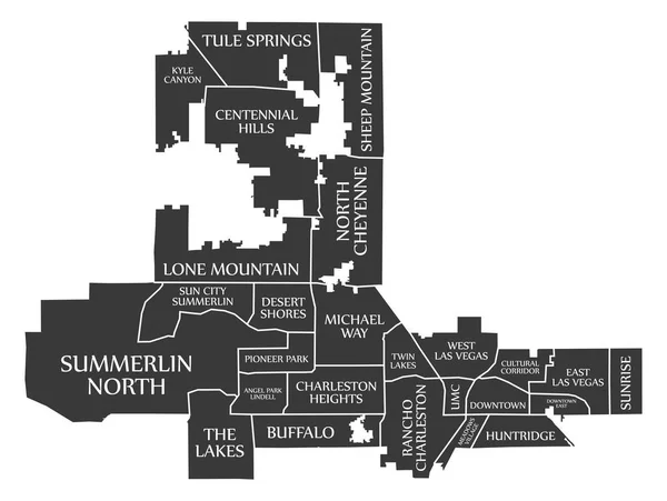
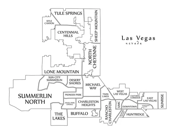
Modern City Map - Las Vegas Nevada City Of The USA With Neighborhoods And Titles Outline Map

Vector, 8.43MB, 6541 × 5000 eps
stock vector Henderson Nevada city map USA labelled black illustration

Henderson Nevada City Map USA Labelled Black Illustration

Vector, 7.95MB, 5422 × 5000 eps
stock vector Accurate map of Nevada

Accurate Map Of Nevada

Vector, 0.63MB, 4000 × 5000 eps
stock vector Map of Nevada state of the USA, with landmarks

Map Of Nevada State Of The USA, With Landmarks

Vector, 7.7MB, 6000 × 7526 eps
stock vector USA - Nevada state infographic template

USA - Nevada State Infographic Template

Vector, 9.51MB, 8222 × 6334 eps
stock vector Grey map of Nevada

Grey Map Of Nevada

Vector, 1.46MB, 3780 × 4200 eps
stock vector Nevada map flag and Map pointer with American flag. vector illustration

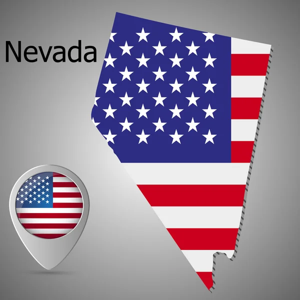
Nevada Map Flag And Map Pointer With American Flag. Vector Illustration

Vector, 1.32MB, 4005 × 4005 eps
stock vector Shape of Nevada state map with American flag. vector illustration. can use for united states of America indepenence day, nationalism, and patriotism illustration. USA flag design

Shape Of Nevada State Map With American Flag. Vector Illustration. Can Use For United States Of America Indepenence Day, Nationalism, And Patriotism Illustration. USA Flag Design

Vector, 8.12MB, 4000 × 4000 eps
stock vector oregon administrative and political map with flag

Oregon Administrative And Political Map With Flag

Vector, 3MB, 4482 × 3100 eps
stock vector blue outline of Nevada map

Blue Outline Of Nevada Map

Vector, 1.46MB, 3780 × 4200 eps
Page 1 >> Next