photo free
Home Images Vectors Videos

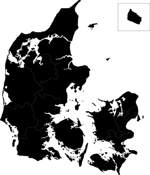
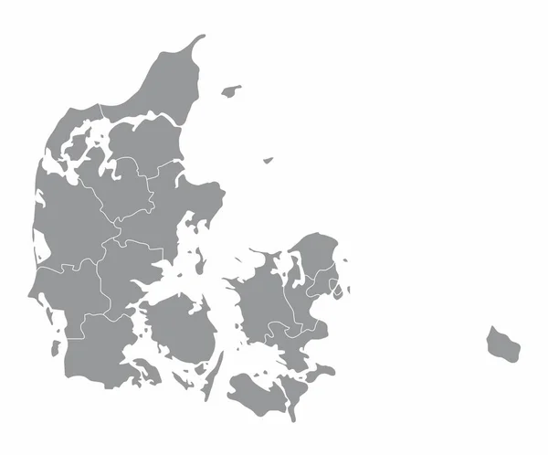
Stock image Nordjylland Outline

stock vector North Denmark Region (Kingdom of Denmark) map vector illustration, scribble sketch North Jutland Region (Nordjylland) map

North Denmark Region (Kingdom Of Denmark) Map Vector Illustration, Scribble Sketch North Jutland Region (Nordjylland) Map

Vector, 0.73MB, 7087 × 4726 eps
stock vector country Denmark and regions

Country Denmark And Regions

Vector, 0.51MB, 5079 × 5079 eps
stock image Denmark map on a white background

Denmark Map On A White Background

Image, 1.78MB, 8001 × 7001 jpg
stock vector Denmark - highly detailed map

Denmark - Highly Detailed Map

Vector, 2.61MB, 5001 × 3019 eps
stock vector vector map of Denmark with ensign on white background

Vector Map Of Denmark With Ensign On White Background

Vector, 2MB, 6000 × 6000 eps
stock vector map of Denmark

Map Of Denmark

Vector, 1MB, 8334 × 8334 eps
stock vector Denmark

Denmark

Vector, 2.98MB, 6011 × 7002 eps
stock vector Denmark map

Denmark Map

Vector, 2.98MB, 4295 × 5002 eps
stock vector Map of Denmark in gray on a white background

Map Of Denmark In Gray On A White Background

Vector, 0.85MB, 4167 × 4167 eps
stock vector Denmark

Denmark

Vector, 4.21MB, 6003 × 5340 eps
stock image Denmark map on a white background

Denmark Map On A White Background

Image, 1.32MB, 8001 × 7001 jpg
stock vector Denmark map line, linear thin vector simple and flag. Black on white background

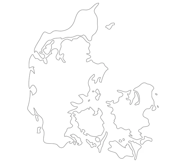
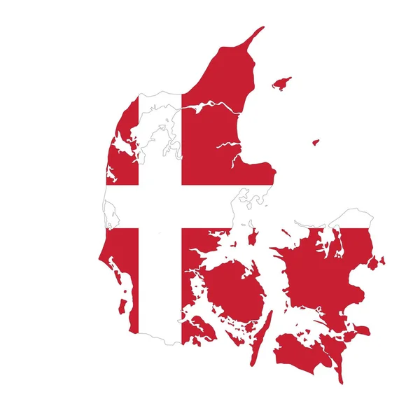
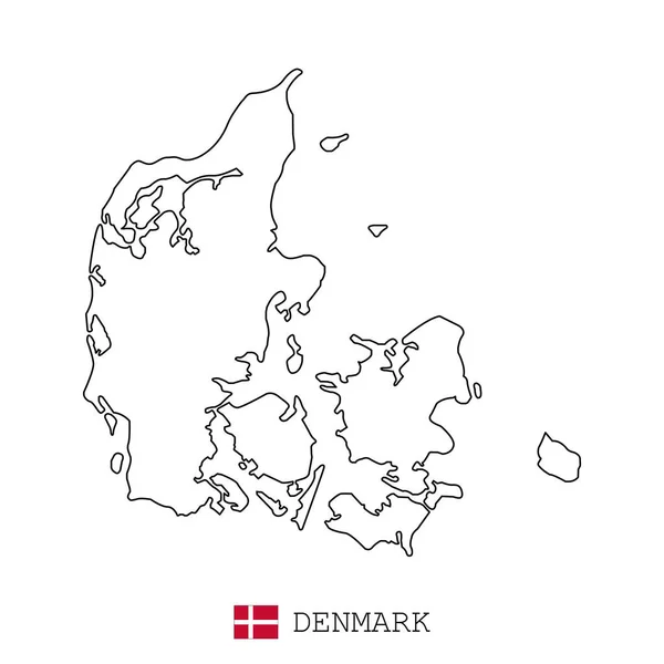
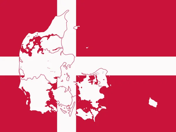
Denmark Map Line, Linear Thin Vector Simple And Flag. Black On White Background

Vector, 2.3MB, 3543 × 3543 eps
stock vector Denmark map

Denmark Map

Vector, 3.13MB, 6194 × 7004 eps
stock vector Map of Denmark

Map Of Denmark

Vector, 0.51MB, 5000 × 5000 eps
stock vector map and flag of Denmark

Map And Flag Of Denmark

Vector, 1.48MB, 7709 × 5834 eps
stock vector map of Denmark

Map Of Denmark

Vector, 1.17MB, 10417 × 8334 eps
stock vector Map of denmark

Map Of Denmark

Vector, 1.43MB, 4800 × 3691 eps
stock vector Denmark provinces map

Denmark Provinces Map

Vector, 8.15MB, 5000 × 4151 eps
stock vector Map of Denmark

Map Of Denmark

Vector, 8.34MB, 6421 × 7021 eps
stock vector Denmark map

Denmark Map

Vector, 3.17MB, 5318 × 6004 eps
stock vector Administrative and political vector outline map of the Kingdom of Denmark

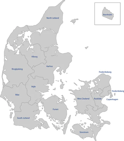
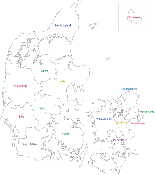
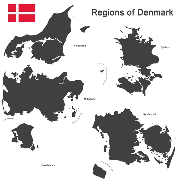
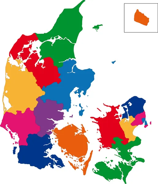
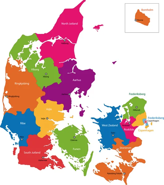
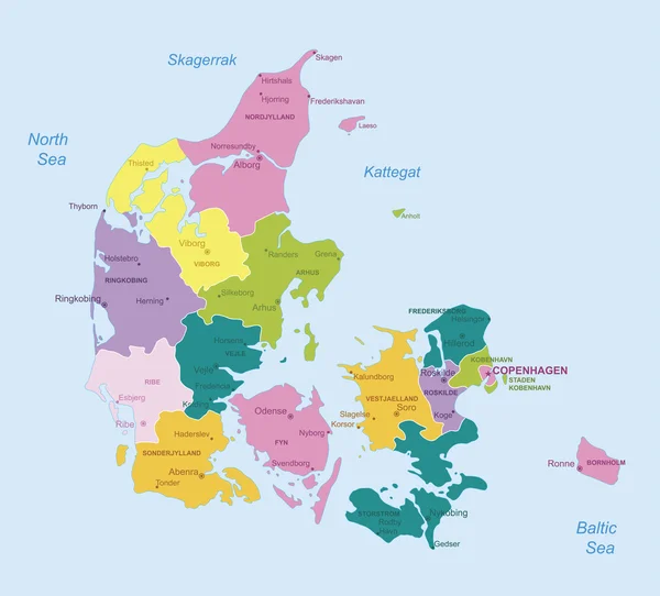
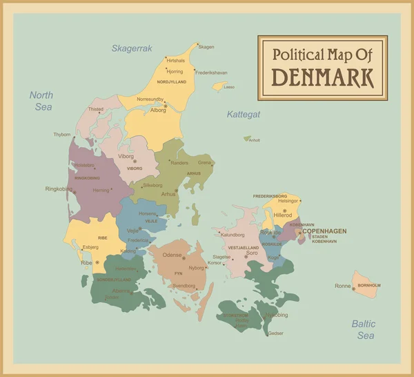
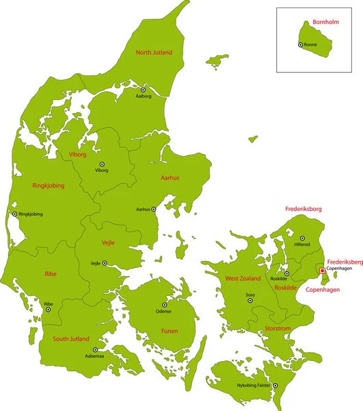
Administrative And Political Vector Outline Map Of The Kingdom Of Denmark

Vector, 1.8MB, 3100 × 3300 eps
stock vector Vector map of Denmark isolated on white background.

Vector Map Of Denmark Isolated On White Background.

Vector, 0.4MB, 5000 × 5000 eps
stock vector map of Denmark

Map Of Denmark

Vector, 1.27MB, 10417 × 8334 eps
stock vector Denmark map

Denmark Map

Vector, 3.22MB, 6203 × 7002 eps
stock vector Denmark - highly detailed map.

Denmark - Highly Detailed Map.

Vector, 1.66MB, 5001 × 4521 eps
stock vector Denmark-highly detailed map.

Denmark-highly Detailed Map.

Vector, 1.82MB, 5001 × 4551 eps
stock vector Denmark

Denmark

Vector, 3.22MB, 6204 × 7004 eps
stock image North Jutlandic Island in the Kattegat on a colored elevation map

North Jutlandic Island In The Kattegat On A Colored Elevation Map

Image, 2.38MB, 2880 × 1620 jpg
stock vector Vector map of the northern European country of Denmark

Vector Map Of The Northern European Country Of Denmark

Vector, 4.69MB, 4182 × 4632 eps
stock image North Jutlandic Island in the Kattegat on a topographic, OSM Humanitarian style map

North Jutlandic Island In The Kattegat On A Topographic, OSM Humanitarian Style Map

Image, 2.91MB, 2880 × 1620 jpg
stock image North Jutlandic Island in the Kattegat - belonging to Denmark. Described location diagram with yellow shape of the island and sample maps of its surroundings

North Jutlandic Island In The Kattegat - Belonging To Denmark. Described Location Diagram With Yellow Shape Of The Island And Sample Maps Of Its Surroundings

Image, 2.89MB, 3840 × 2160 jpg
stock vector map of Denmark

Map Of Denmark

Vector, 1.25MB, 8334 × 8334 eps
stock image North Jutlandic Island in the Kattegat on a satellite image taken in April 16, 2020

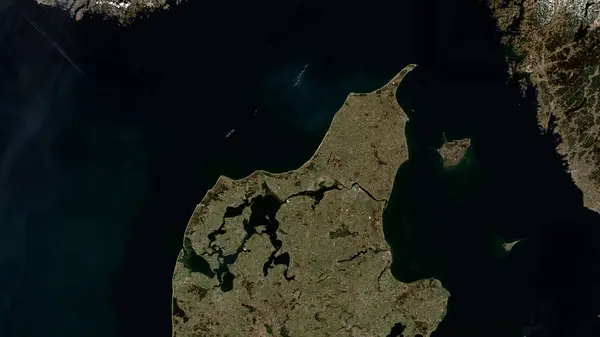
North Jutlandic Island In The Kattegat On A Satellite Image Taken In April 16, 2020

Image, 3.73MB, 2880 × 1620 jpg
stock vector Nordjylland region outline map set

Nordjylland Region Outline Map Set

Vector, 5.03MB, 6000 × 3000 eps
stock image North Jutlandic Island in the Kattegat, belonging to Denmark, isolated on a topographic, OSM Humanitarian style map, with distance scale

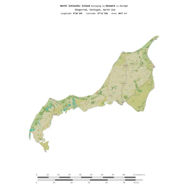
North Jutlandic Island In The Kattegat, Belonging To Denmark, Isolated On A Topographic, OSM Humanitarian Style Map, With Distance Scale

Image, 1MB, 2160 × 2160 jpg
stock image North Jutlandic Island in the Kattegat, belonging to Denmark, isolated on a satellite image taken in July 15, 2021, with distance scale

North Jutlandic Island In The Kattegat, Belonging To Denmark, Isolated On A Satellite Image Taken In July 15, 2021, With Distance Scale

Image, 1.11MB, 2160 × 2160 jpg
stock image North Jutlandic Island in the Kattegat, belonging to Denmark, isolated on a bilevel elevation map, with distance scale

North Jutlandic Island In The Kattegat, Belonging To Denmark, Isolated On A Bilevel Elevation Map, With Distance Scale

Image, 0.46MB, 2160 × 2160 jpg
Page 1 >> Next