photo free
Home Images Vectors Videos

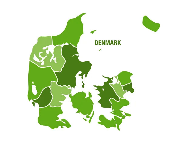
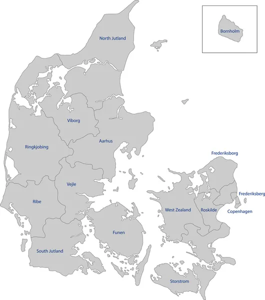
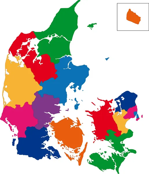
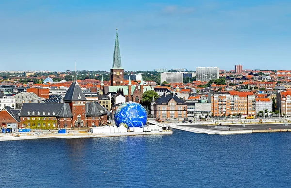
Stock image Nordjylland Region

stock vector North Denmark Region (Kingdom of Denmark) map vector illustration, scribble sketch North Jutland Region (Nordjylland) map

North Denmark Region (Kingdom Of Denmark) Map Vector Illustration, Scribble Sketch North Jutland Region (Nordjylland) Map

Vector, 0.73MB, 7087 × 4726 eps
stock image Zoom in on Nordjylland (region of Denmark) extruded. Oblique perspective. Colored and bumped map of the administrative division with surface waters. 3D rendering

Zoom In On Nordjylland (region Of Denmark) Extruded. Oblique Perspective. Colored And Bumped Map Of The Administrative Division With Surface Waters. 3D Rendering

Image, 1.36MB, 3840 × 2160 jpg
stock vector Denmark map with regions

Denmark Map With Regions

Vector, 2.04MB, 6000 × 4800 eps
stock vector country Denmark and regions

Country Denmark And Regions

Vector, 0.51MB, 5079 × 5079 eps
stock vector Denmark - highly detailed map

Denmark - Highly Detailed Map

Vector, 2.61MB, 5001 × 3019 eps
stock image Walking in the Wadden Sea

Walking In The Wadden Sea

Image, 5.53MB, 3860 × 2588 jpg
stock image Passport stamps from Iceland, Greenland and Denmark

Passport Stamps From Iceland, Greenland And Denmark

Image, 1.06MB, 3508 × 2480 jpg
stock vector Denmark

Denmark

Vector, 2.98MB, 6011 × 7002 eps
stock image Wadden Sea Hiking

Wadden Sea Hiking

Image, 4.8MB, 3848 × 2567 jpg
stock vector Administrative and political vector outline map of the Kingdom of Denmark

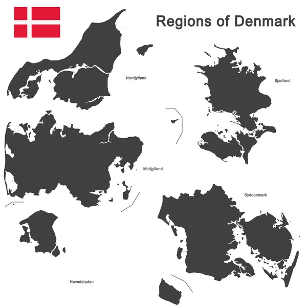
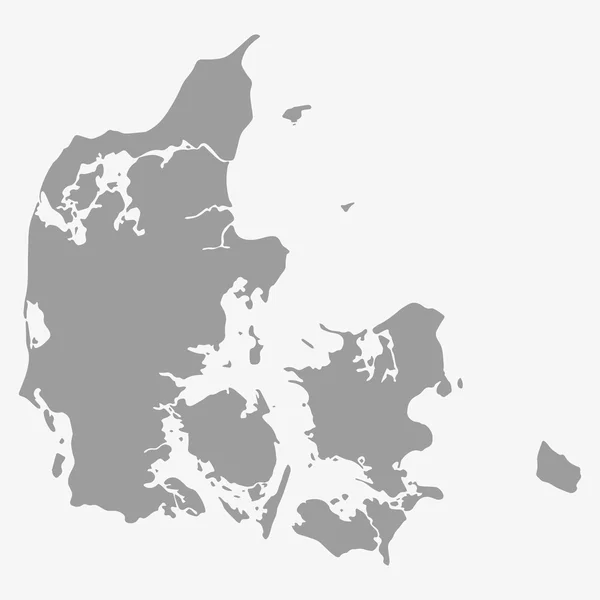
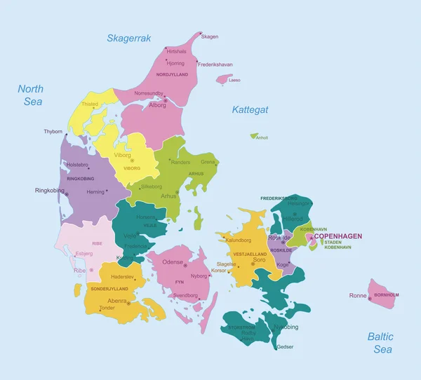
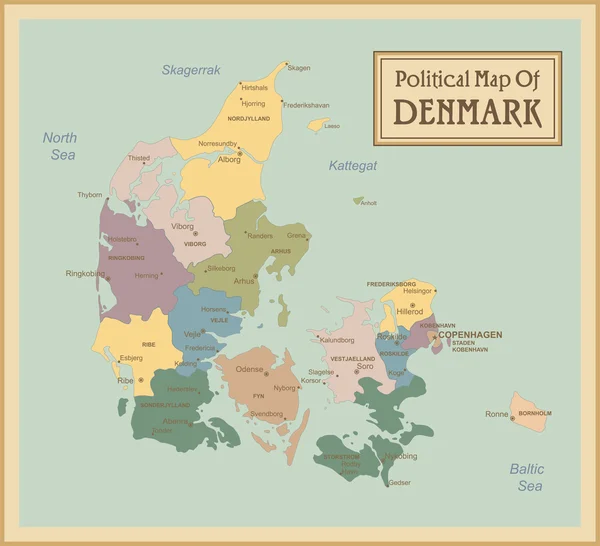
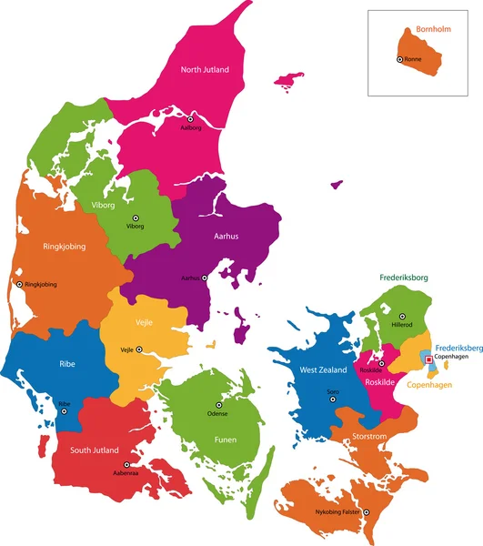
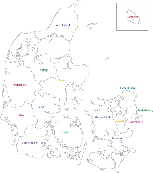
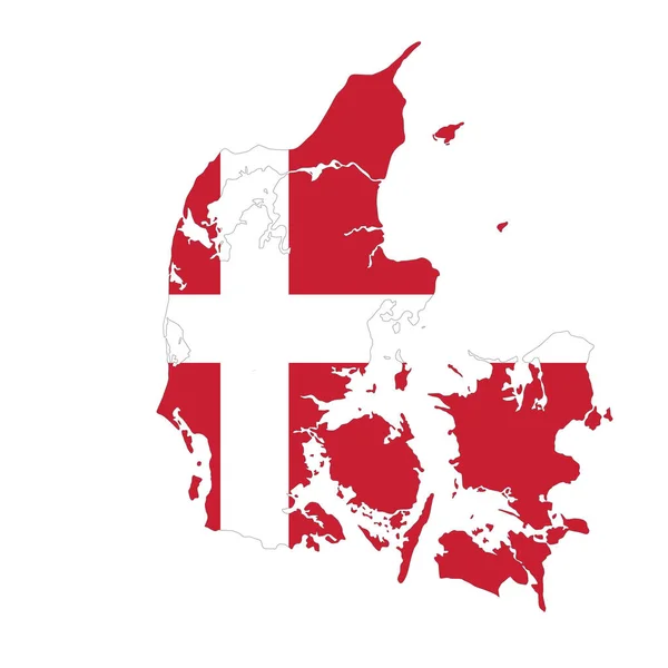
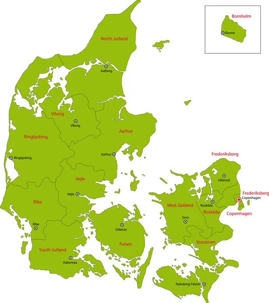
Administrative And Political Vector Outline Map Of The Kingdom Of Denmark

Vector, 1.8MB, 3100 × 3300 eps
stock vector Map of Denmark in gray on a white background

Map Of Denmark In Gray On A White Background

Vector, 0.85MB, 4167 × 4167 eps
stock image Sunset at the danish coast at Saltum Strand. High quality photo

Sunset At The Danish Coast At Saltum Strand. High Quality Photo

Image, 19.5MB, 6168 × 4112 jpg
stock vector Map of Denmark

Map Of Denmark

Vector, 0.51MB, 5000 × 5000 eps
stock vector Map of Denmark

Map Of Denmark

Vector, 8.34MB, 6421 × 7021 eps
stock image Wide Dunes at the danish north sea shore. High quality photo

Wide Dunes At The Danish North Sea Shore. High Quality Photo

Image, 23.95MB, 6079 × 4053 jpg
stock vector Denmark map line, linear thin vector simple and flag. Black on white background

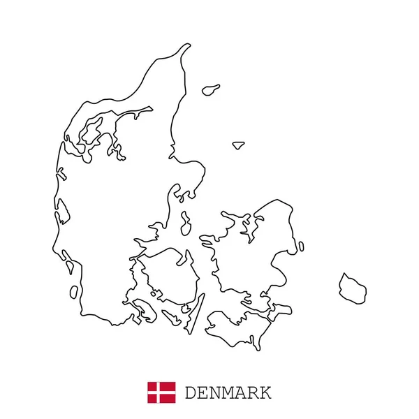
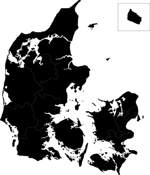
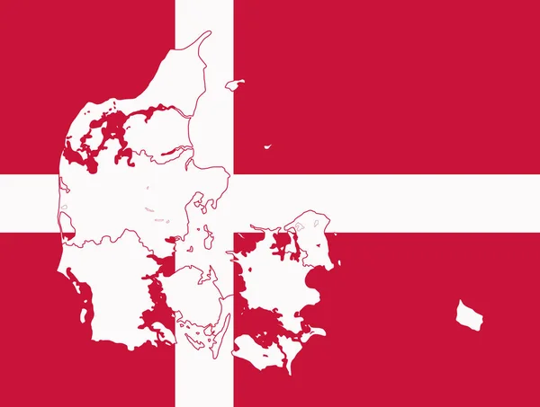
Denmark Map Line, Linear Thin Vector Simple And Flag. Black On White Background

Vector, 2.3MB, 3543 × 3543 eps
stock image Danish Coast in northern Jutland. High quality photo

Danish Coast In Northern Jutland. High Quality Photo

Image, 25.29MB, 4160 × 6240 jpg
stock vector Denmark map

Denmark Map

Vector, 3.13MB, 6194 × 7004 eps
stock vector Denmark - highly detailed map.

Denmark - Highly Detailed Map.

Vector, 1.66MB, 5001 × 4521 eps
stock vector Northern Europe, political map. British Isles, Fennoscandia, Jutland peninsula, Baltic plain lying to the east, and the islands offshore from mainland Northern Europe and the main European continent.

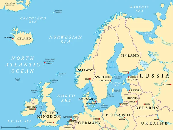
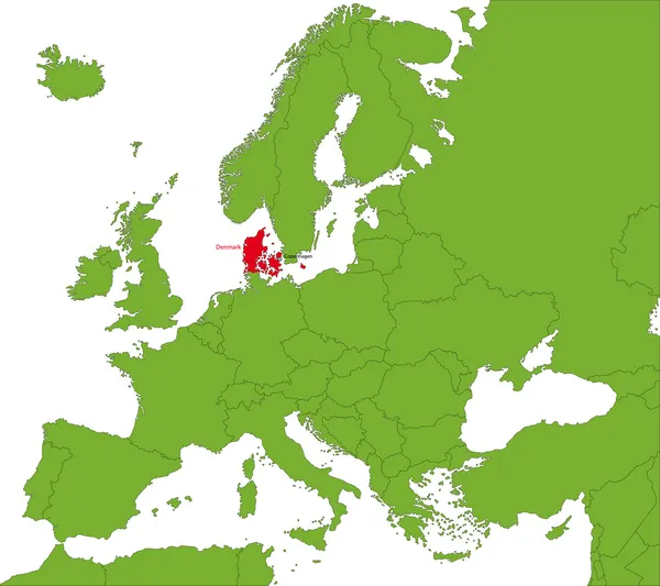
Northern Europe, Political Map. British Isles, Fennoscandia, Jutland Peninsula, Baltic Plain Lying To The East, And The Islands Offshore From Mainland Northern Europe And The Main European Continent.

Vector, 5.81MB, 7972 × 6000 eps
stock vector Denmark map

Denmark Map

Vector, 2.98MB, 4295 × 5002 eps
stock image Beach Gras and Dunes at the north sea in Denmark. High quality photo

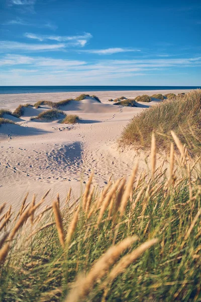
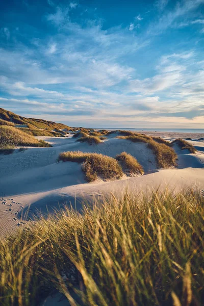
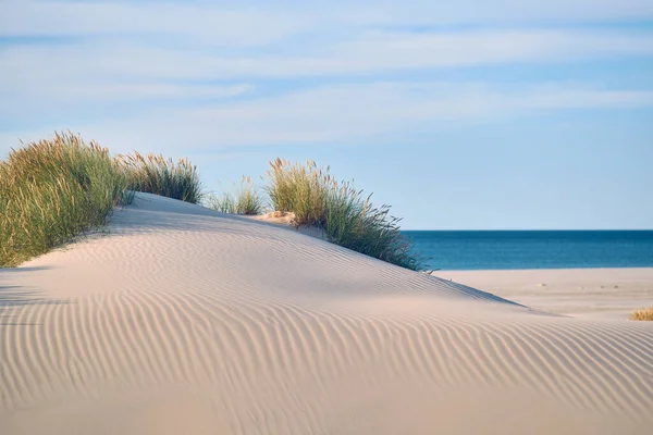
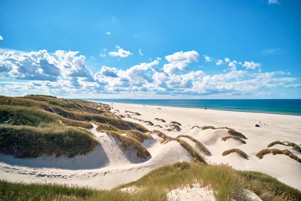
Beach Gras And Dunes At The North Sea In Denmark. High Quality Photo

Image, 25.68MB, 4097 × 6146 jpg
stock image Cityscape of Aarhus in Denmark

Cityscape Of Aarhus In Denmark

Image, 9.9MB, 5837 × 3125 jpg
stock vector map of Denmark

Map Of Denmark

Vector, 1.27MB, 10417 × 8334 eps
stock vector Denmark-highly detailed map.

Denmark-highly Detailed Map.

Vector, 1.82MB, 5001 × 4551 eps
stock image Cars at the beach at Saltum Strand in Denmark. High quality photo

Cars At The Beach At Saltum Strand In Denmark. High Quality Photo

Image, 23.83MB, 6217 × 4145 jpg
stock image Beach Gras and Dunes at the Jammerbugt in Denmark. High quality photo

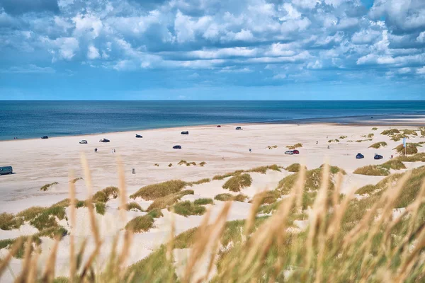
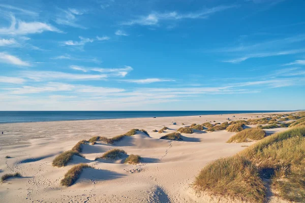
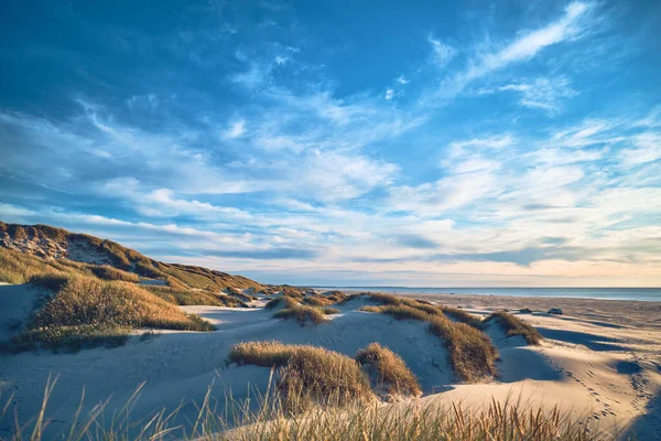
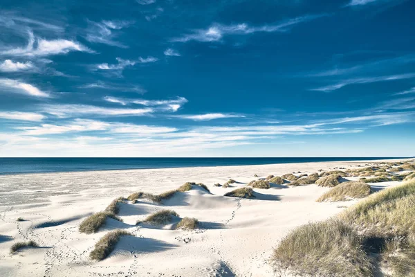
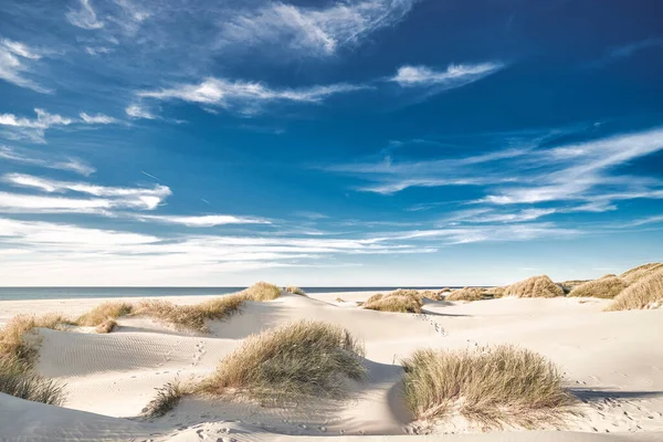
Beach Gras And Dunes At The Jammerbugt In Denmark. High Quality Photo

Image, 21.71MB, 6009 × 4006 jpg
stock vector Denmark

Denmark

Vector, 4.21MB, 6003 × 5340 eps
stock vector Denmark map

Denmark Map

Vector, 3.22MB, 6203 × 7002 eps
stock vector Denmark map

Denmark Map

Vector, 3.17MB, 5318 × 6004 eps
stock image wide White sand dunes in northern Denmark. High quality photo

Wide White Sand Dunes In Northern Denmark. High Quality Photo

Image, 17.33MB, 6022 × 4015 jpg
stock image Sand dune on danish beach. High quality photo

Sand Dune On Danish Beach. High Quality Photo

Image, 21.45MB, 6011 × 4008 jpg
stock image interesting architecture, selective focus

Interesting Architecture, Selective Focus

Image, 0MB, 3072 × 2048 jpg
stock image Cityscape of Aarhus in Denmark

Cityscape Of Aarhus In Denmark

Image, 18.48MB, 5762 × 3716 jpg
stock vector Sapmi, Lapland, political map. A cultural region in Northern and Eastern Europe, including the northern parts of Fennoscandia, stretching over the four countries Norway, Sweden, Finland and Russia.

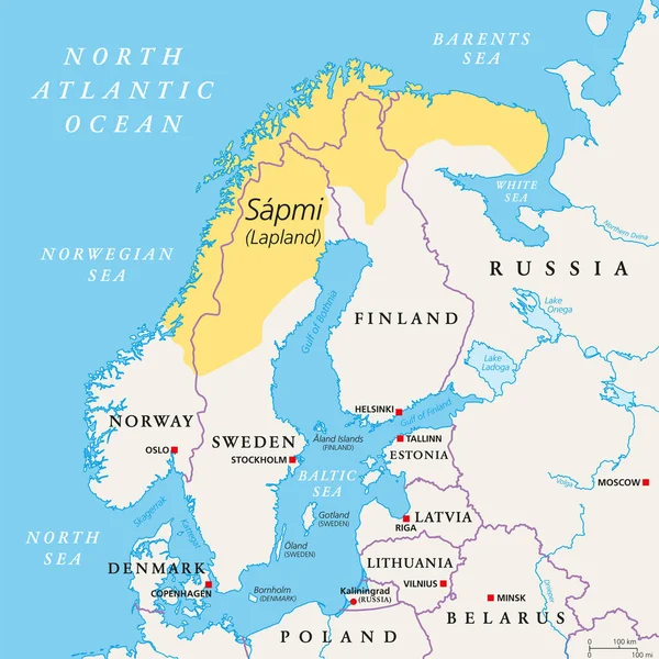
Sapmi, Lapland, Political Map. A Cultural Region In Northern And Eastern Europe, Including The Northern Parts Of Fennoscandia, Stretching Over The Four Countries Norway, Sweden, Finland And Russia.

Vector, 3.84MB, 6000 × 6000 eps
stock image White sands of northern Denmark. High quality photo

White Sands Of Northern Denmark. High Quality Photo

Image, 19.88MB, 6099 × 4066 jpg
stock image Cityscape of Aarhus in Denmark

Cityscape Of Aarhus In Denmark

Image, 14.49MB, 6000 × 3694 jpg
stock image Bright white beach in northern Denmark. High quality photo

Bright White Beach In Northern Denmark. High Quality Photo

Image, 26.14MB, 6076 × 4050 jpg
stock vector map of Denmark

Map Of Denmark

Vector, 1MB, 8334 × 8334 eps
stock vector map of Denmark

Map Of Denmark

Vector, 1.17MB, 10417 × 8334 eps
stock vector vector map of Denmark with ensign on white background

Vector Map Of Denmark With Ensign On White Background

Vector, 2MB, 6000 × 6000 eps
stock vector Northern Europe, gray political map. British Isles, Fennoscandia, Jutland Peninsula, Baltic plain lying to the east, and islands offshore from mainland Northern Europe and the main European continent.

Northern Europe, Gray Political Map. British Isles, Fennoscandia, Jutland Peninsula, Baltic Plain Lying To The East, And Islands Offshore From Mainland Northern Europe And The Main European Continent.

Vector, 3.18MB, 7972 × 6000 eps
stock vector Denmark

Denmark

Vector, 3.22MB, 6204 × 7004 eps
stock vector Denmark provinces map

Denmark Provinces Map

Vector, 8.15MB, 5000 × 4151 eps
stock vector map and flag of Denmark

Map And Flag Of Denmark

Vector, 1.48MB, 7709 × 5834 eps
stock image garden,bicycle with support wheels

Garden,bicycle With Support Wheels

Image, 0MB, 3072 × 2048 jpg
stock image North Jutlandic Island in the Kattegat on a colored elevation map

North Jutlandic Island In The Kattegat On A Colored Elevation Map

Image, 2.38MB, 2880 × 1620 jpg
stock vector Vector map of the northern European country of Denmark

Vector Map Of The Northern European Country Of Denmark

Vector, 4.69MB, 4182 × 4632 eps
stock image North Jutlandic Island in the Kattegat on a topographic, OSM Humanitarian style map

North Jutlandic Island In The Kattegat On A Topographic, OSM Humanitarian Style Map

Image, 2.91MB, 2880 × 1620 jpg
stock image North Jutlandic Island in the Kattegat - belonging to Denmark. Described location diagram with yellow shape of the island and sample maps of its surroundings

North Jutlandic Island In The Kattegat - Belonging To Denmark. Described Location Diagram With Yellow Shape Of The Island And Sample Maps Of Its Surroundings

Image, 2.89MB, 3840 × 2160 jpg
Page 1 >> Next