photo free
Home Images Vectors Videos

Stock image Northern Karoo page 2

stock image Early morning street scene in Colesberg, South Africa

Early Morning Street Scene In Colesberg, South Africa

Image, 4.94MB, 3162 × 2100 jpg
stock image Hall of the Dutch Reformed Church in Prieska

Hall Of The Dutch Reformed Church In Prieska

Image, 4.15MB, 3595 × 2400 jpg
stock image  Dutch Reformed Church in Britstown

Dutch Reformed Church In Britstown

Image, 10.48MB, 5644 × 4016 jpg
stock image Arid karoo landscape showing characteristic hills

Arid Karoo Landscape Showing Characteristic Hills

Image, 17.62MB, 9465 × 2433 jpg
stock image Ruin of the Dutch Reformed Mission Church in Prieska

Ruin Of The Dutch Reformed Mission Church In Prieska

Image, 7.4MB, 4045 × 2700 jpg
stock image Mesquite tree (Prosopis pubescens)

Mesquite Tree (Prosopis Pubescens)

Image, 8.32MB, 3872 × 2592 jpg
stock image Kanonaalwyn or Kraalaalwyn

Kanonaalwyn Or Kraalaalwyn

Image, 5.63MB, 3011 × 2000 jpg
stock image An old windmill next to road R63 near Loxton, used as solar panel platform. Solar power is used to pump water into a water tank

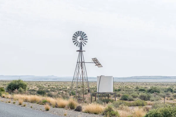
An Old Windmill Next To Road R63 Near Loxton, Used As Solar Panel Platform. Solar Power Is Used To Pump Water Into A Water Tank

Image, 4.39MB, 3595 × 2400 jpg
stock image Sunrise over Tankwa Karoo

Sunrise Over Tankwa Karoo

Image, 15.92MB, 5472 × 3648 jpg
stock image View of the Ouberg Pass near Sutherland in the Northern Cape Karoo

View Of The Ouberg Pass Near Sutherland In The Northern Cape Karoo

Image, 6.3MB, 3595 × 2400 jpg
stock image Camp site in the Karoo National Park

Camp Site In The Karoo National Park

Image, 6.37MB, 3613 × 2400 jpg
stock image HOPETOWN, SOUTH AFRICA, SEPTEMBER 1, 2018: Grain silos and a mill at Hopetown in the Northern Cape Province

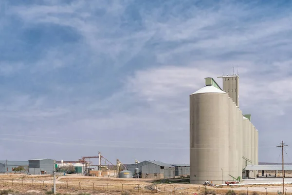
HOPETOWN, SOUTH AFRICA, SEPTEMBER 1, 2018: Grain Silos And A Mill At Hopetown In The Northern Cape Province

Image, 3.49MB, 3595 × 2400 jpg
stock image Panoramic aerial view over the small karoo town of nieuwoudtville in the Northern Cape of South Africa

Panoramic Aerial View Over The Small Karoo Town Of Nieuwoudtville In The Northern Cape Of South Africa

Image, 15.4MB, 9479 × 2868 jpg
stock image Windpump or water pumping windmill

Windpump Or Water Pumping Windmill

Image, 6.89MB, 6000 × 4000 jpg
stock image Windmills and a concrete dam

Windmills And A Concrete Dam

Image, 13.09MB, 5393 × 3600 jpg
stock image Sign at the turn-off to Noupoort

Sign At The Turn-off To Noupoort

Image, 4.85MB, 3595 × 2400 jpg
stock image Wide angle view of roadsigns on a dirtroad, in the karoo region of south africa, showing the direction to the towns of Sutherland and Laingsburg

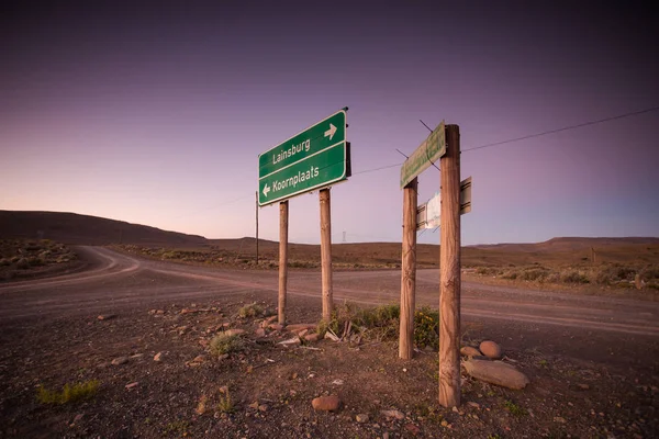
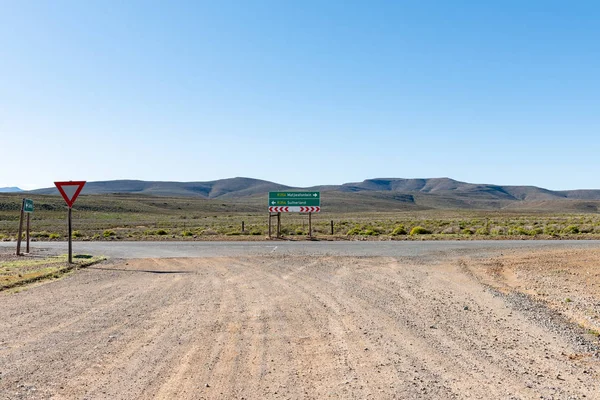
Wide Angle View Of Roadsigns On A Dirtroad, In The Karoo Region Of South Africa, Showing The Direction To The Towns Of Sutherland And Laingsburg

Image, 13MB, 5472 × 3648 jpg
stock image A water-pumping windmill and water tank on a farm near Hanover in the Northern Cape Karoo

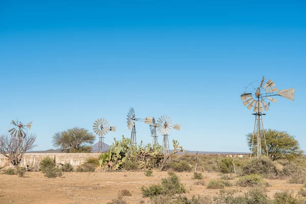
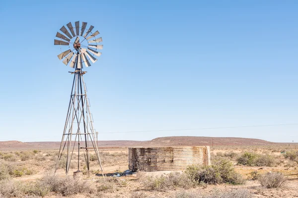
A Water-pumping Windmill And Water Tank On A Farm Near Hanover In The Northern Cape Karoo

Image, 4.52MB, 3595 × 2400 jpg
stock image Sunrise panorama of Prieska

Sunrise Panorama Of Prieska

Image, 18.02MB, 9591 × 3000 jpg
stock image Grain silos at Prieska

Grain Silos At Prieska

Image, 4.4MB, 3595 × 2400 jpg
stock image Rural monochrome Karoo scene

Rural Monochrome Karoo Scene

Image, 11.44MB, 6016 × 4016 jpg
stock image Sunrise at the Prieska blockhouse

Sunrise At The Prieska Blockhouse

Image, 9.12MB, 4045 × 2700 jpg
stock image Historic St Andrews Presbyterian Church in Noupoort, now a museu

Historic St Andrews Presbyterian Church In Noupoort, Now A Museu

Image, 5.3MB, 3146 × 2100 jpg
stock image Six water-pumping windmills beteen Vosburg and Britstown. Monoch

Six Water-pumping Windmills Beteen Vosburg And Britstown. Monoch

Image, 4.2MB, 3595 × 2400 jpg
stock image Reaching for the sky

Reaching For The Sky

Image, 14.16MB, 4032 × 6048 jpg
stock image Traffic control point at roadworks on the N9 road

Traffic Control Point At Roadworks On The N9 Road

Image, 5.3MB, 3595 × 2400 jpg
stock image Junctiion between road R356 from Ceres and road R354 in the Northern Cape Province. Directional signs are visible

Junctiion Between Road R356 From Ceres And Road R354 In The Northern Cape Province. Directional Signs Are Visible

Image, 6.63MB, 3595 × 2400 jpg
stock image Huge postbox in Calvinia

Huge Postbox In Calvinia

Image, 11.23MB, 2700 × 4393 jpg
stock image FRASERBURG, SOUTH AFRICA - SEP 3, 2022: Road landscape at Eselfontein Guest Farm on the historic Postal Route between Fraserburg and Sutherland in the Northern Cape Karoo

FRASERBURG, SOUTH AFRICA - SEP 3, 2022: Road Landscape At Eselfontein Guest Farm On The Historic Postal Route Between Fraserburg And Sutherland In The Northern Cape Karoo

Image, 4.91MB, 3150 × 2100 jpg
stock image View from the Quiver Tree Forest at Gannabos

View From The Quiver Tree Forest At Gannabos

Image, 8.98MB, 3595 × 2400 jpg
stock image Tree in desert

Tree In Desert

Image, 8.26MB, 3758 × 2506 jpg
stock image Rural Karoo scene

Rural Karoo Scene

Image, 13.68MB, 6016 × 4016 jpg
stock image Southern White Rhino

Southern White Rhino

Image, 5.02MB, 3008 × 2000 jpg
stock image A windmill, dam and sheep near Middelpos in the Northern Cape Province of South Africa. Monochrome

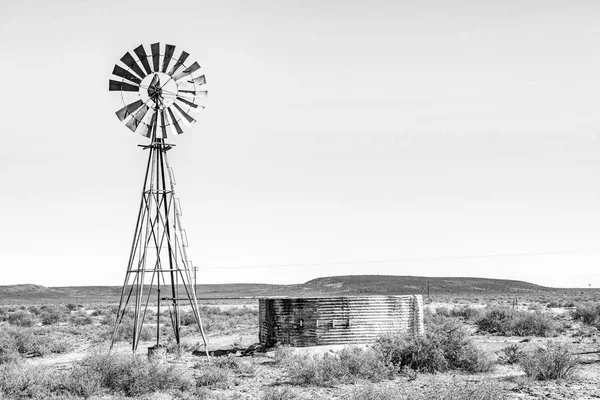
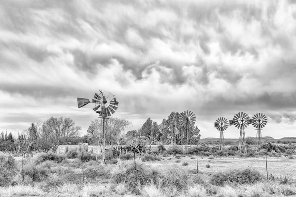
A Windmill, Dam And Sheep Near Middelpos In The Northern Cape Province Of South Africa. Monochrome

Image, 3.74MB, 3595 × 2400 jpg
stock image Grain silos and a mill at Hopetown. Monochrome

Grain Silos And A Mill At Hopetown. Monochrome

Image, 3.6MB, 3595 × 2400 jpg
stock image Dutch Reformed Church in Colesberg

Dutch Reformed Church In Colesberg

Image, 4.17MB, 3162 × 2100 jpg
stock image WILLISTON, SOUTH AFRICA, AUGUST 31, 2018: An historic cemetery on the direct route between Middelpos and Williston in the Northern Cape Province of South Africa

WILLISTON, SOUTH AFRICA, AUGUST 31, 2018: An Historic Cemetery On The Direct Route Between Middelpos And Williston In The Northern Cape Province Of South Africa

Image, 7.87MB, 3595 × 2400 jpg
stock image Wall of the Vanderkloof Dam in the Orange River on the border of the Free State and Northern Cape Provinces

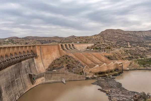
Wall Of The Vanderkloof Dam In The Orange River On The Border Of The Free State And Northern Cape Provinces

Image, 5.53MB, 3591 × 2400 jpg
stock image A field of white wildflowers near Williston in the Northern Cape Province of South Africa

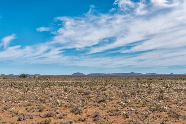
A Field Of White Wildflowers Near Williston In The Northern Cape Province Of South Africa

Image, 6.83MB, 3595 × 2400 jpg
Previous << Page 2 >> Next