photo free
Home Images Vectors Videos

Stock image Oita Map

stock vector Oita prefecture outline map set

Oita Prefecture Outline Map Set

Vector, 2.46MB, 6000 × 3000 eps
stock image Area of Oita, prefecture of Japan, isolated on a solid background in a georeferenced bounding box. Labels. Bilevel elevation map. 3D rendering

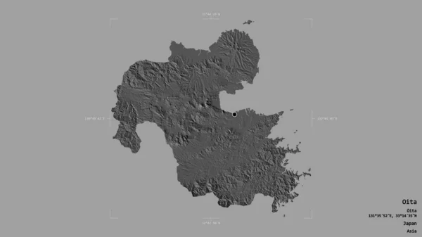
Area Of Oita, Prefecture Of Japan, Isolated On A Solid Background In A Georeferenced Bounding Box. Labels. Bilevel Elevation Map. 3D Rendering

Image, 0.68MB, 2880 × 1620 jpg
stock vector Map Japan prefectures green

Map Japan Prefectures Green

Vector, 0.78MB, 4520 × 4533 ai
stock vector Kyushu map green icon

Kyushu Map Green Icon

Vector, 0.3MB, 4520 × 4520 ai
stock vector Kyushu map.

Kyushu Map.

Vector, 2.54MB, 8268 × 7992 eps
stock image flag of oita prefecture on map with administrative divisions and borders of japan

Flag Of Oita Prefecture On Map With Administrative Divisions And Borders Of Japan

Image, 0.74MB, 4576 × 4531 jpg
stock image KYUSYU travel map with landmarks and symbols. Hand drawn vector illustration.

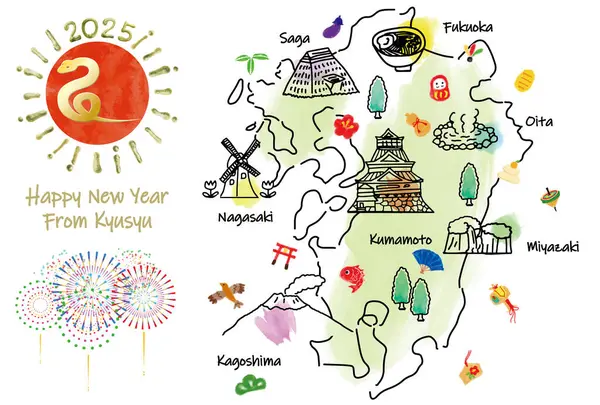
KYUSYU Travel Map With Landmarks And Symbols. Hand Drawn Vector Illustration.

Image, 3.64MB, 5000 × 3378 jpg
stock image OITA Japan travel map with landmarks and attractions. Hand drawn vector illustration.

OITA Japan Travel Map With Landmarks And Attractions. Hand Drawn Vector Illustration.

Image, 3.79MB, 5000 × 3378 jpg
stock image OITA Japan travel map with landmarks and symbols. Hand drawn vector illustration.

OITA Japan Travel Map With Landmarks And Symbols. Hand Drawn Vector Illustration.

Image, 3.82MB, 5000 × 3378 jpg
Page 1 >> Next