photo free
Home Images Vectors Videos

Stock image Oita Region

stock image Area of Oita, prefecture of Japan, isolated on a solid background in a georeferenced bounding box. Labels. Bilevel elevation map. 3D rendering

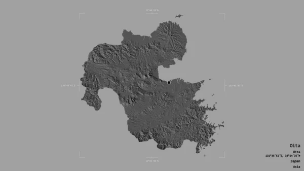
Area Of Oita, Prefecture Of Japan, Isolated On A Solid Background In A Georeferenced Bounding Box. Labels. Bilevel Elevation Map. 3D Rendering

Image, 0.68MB, 2880 × 1620 jpg
stock vector Symbol Map of the Voivodeship/Province Swietokrzyskie (Poland) showing the state/province with a pattern of black circles

Symbol Map Of The Voivodeship/Province Swietokrzyskie (Poland) Showing The State/province With A Pattern Of Black Circles

Vector, 1.23MB, 6000 × 5474 eps
stock vector Symbol Map of the Prefecture Oita (Japan) showing the state/province with a pattern of black squares like a chessboard

Symbol Map Of The Prefecture Oita (Japan) Showing The State/province With A Pattern Of Black Squares Like A Chessboard

Vector, 0.59MB, 6000 × 5474 eps
stock vector Kyushu map.

Kyushu Map.

Vector, 2.54MB, 8268 × 7992 eps
stock vector Symbol Map of the Prefecture Oita (Japan) showing the contour of the state/province buffered inside in rainbow colors

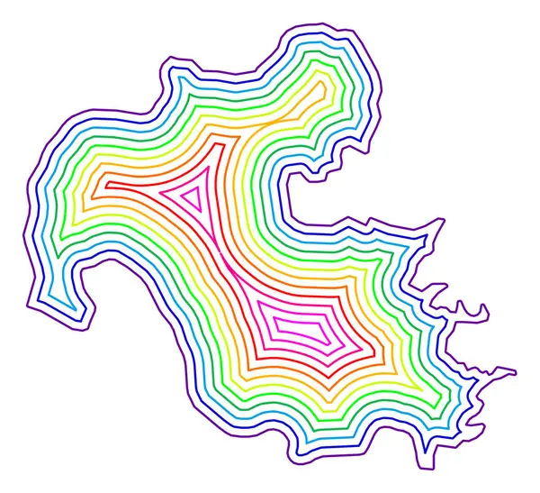
Symbol Map Of The Prefecture Oita (Japan) Showing The Contour Of The State/province Buffered Inside In Rainbow Colors

Vector, 0.82MB, 6000 × 5474 eps
stock image Coat of arms of the village of Kokonoe. Oita Prefecture. Japan

Coat Of Arms Of The Village Of Kokonoe. Oita Prefecture. Japan

Image, 1.37MB, 4000 × 4000 jpg
stock vector Symbol Map of the Prefecture Oita (Japan) showing the territory with concentric circles in rainbow colors like a shooting target

Symbol Map Of The Prefecture Oita (Japan) Showing The Territory With Concentric Circles In Rainbow Colors Like A Shooting Target

Vector, 0.65MB, 6000 × 5474 eps
stock vector Kyushu island and northern part of the Kyushu region in Japan, political map with prefectures. One of the four major islands of Japan, southwest of Honshu and Shikoku, separated by Seto Inland Sea.

Kyushu Island And Northern Part Of The Kyushu Region In Japan, Political Map With Prefectures. One Of The Four Major Islands Of Japan, Southwest Of Honshu And Shikoku, Separated By Seto Inland Sea.

Vector, 8.66MB, 6000 × 6857 eps
stock image flag of oita prefecture on map with administrative divisions and borders of japan

Flag Of Oita Prefecture On Map With Administrative Divisions And Borders Of Japan

Image, 0.74MB, 4576 × 4531 jpg
Page 1 >> Next