photo free
Home Images Vectors Videos

Stock image Palawan Map

stock vector Gray silhouette map of the Philippine island of Palawan with flag

Gray Silhouette Map Of The Philippine Island Of Palawan With Flag

Vector, 2.62MB, 3512 × 3561 eps
stock vector Palawan high detailed map Island silhouette icon Isolated Palawan black map outline Vector

Palawan High Detailed Map Island Silhouette Icon Isolated Palawan Black Map Outline Vector

Vector, 0.74MB, 8805 × 9418 eps
stock vector Palawan map Blank vector map of the Island Borders of Palawan for your infographic Vector

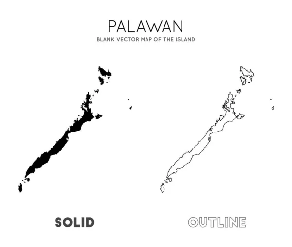
Palawan Map Blank Vector Map Of The Island Borders Of Palawan For Your Infographic Vector

Vector, 0.75MB, 5949 × 5047 eps
stock vector Palawan province outline map set

Palawan Province Outline Map Set

Vector, 12.16MB, 6000 × 3000 eps
stock vector Map of the Malaysia, Philippines, Taiwan, Vietnam, People's Republic of China and Brunei controversial Spratly Islands in the South China Sea

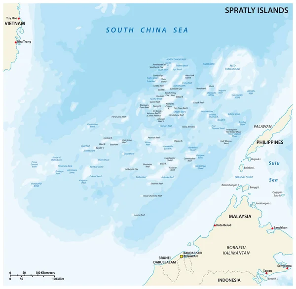
Map Of The Malaysia, Philippines, Taiwan, Vietnam, People's Republic Of China And Brunei Controversial Spratly Islands In The South China Sea

Vector, 1.85MB, 3164 × 3100 eps
stock vector Philippines Political Map

Philippines Political Map

Vector, 4.53MB, 6000 × 7748 eps
stock vector Palawan polygonal map mosaic style island Extra low poly style modern design Palawan polygonal

Palawan Polygonal Map Mosaic Style Island Extra Low Poly Style Modern Design Palawan Polygonal

Vector, 0.17MB, 5072 × 5917 eps
stock vector Country map of the East Asian island nation of the Philippines

Country Map Of The East Asian Island Nation Of The Philippines

Vector, 3.4MB, 3100 × 3966 eps
stock vector Philippines highly detailed physical map,in vector format,with all the relief forms,regions and big cities.

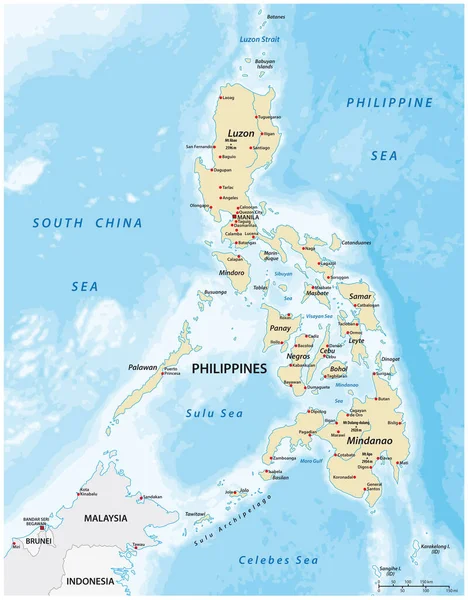
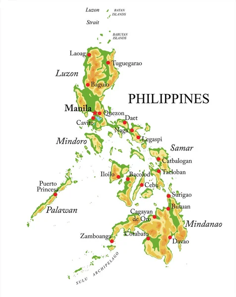
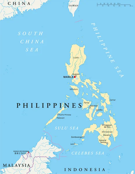
Philippines Highly Detailed Physical Map,in Vector Format,with All The Relief Forms,regions And Big Cities.

Vector, 1.18MB, 3975 × 5000 eps
stock image Palawan Island in the Sulu Sea on a colored elevation map

Palawan Island In The Sulu Sea On A Colored Elevation Map

Image, 2.56MB, 2880 × 1620 jpg
stock image Palawan Island in the Sulu Sea, belonging to Philippines, isolated on a topographic, OSM Humanitarian style map, with distance scale

Palawan Island In The Sulu Sea, Belonging To Philippines, Isolated On A Topographic, OSM Humanitarian Style Map, With Distance Scale

Image, 0.5MB, 2160 × 2160 jpg
stock vector Stamp Postal of Coron Island. Map Silhouette rubber Seal.  Design Retro Travel. Seal of  Coron Island grunge  for your design. Philippines. EPS10

Stamp Postal Of Coron Island. Map Silhouette Rubber Seal. Design Retro Travel. Seal Of Coron Island Grunge For Your Design. Philippines. EPS10

Vector, 3.7MB, 5000 × 5000 eps
stock image Palawan Island in the Sulu Sea on a satellite image taken in March 1, 2022

Palawan Island In The Sulu Sea On A Satellite Image Taken In March 1, 2022

Image, 1.98MB, 2880 × 1620 jpg
stock image Palawan Island in the Sulu Sea - belonging to Philippines. Described location diagram with yellow shape of the island and sample maps of its surroundings

Palawan Island In The Sulu Sea - Belonging To Philippines. Described Location Diagram With Yellow Shape Of The Island And Sample Maps Of Its Surroundings

Image, 2.27MB, 3840 × 2160 jpg
stock image Palawan Island in the Sulu Sea on a topographic, OSM Humanitarian style map

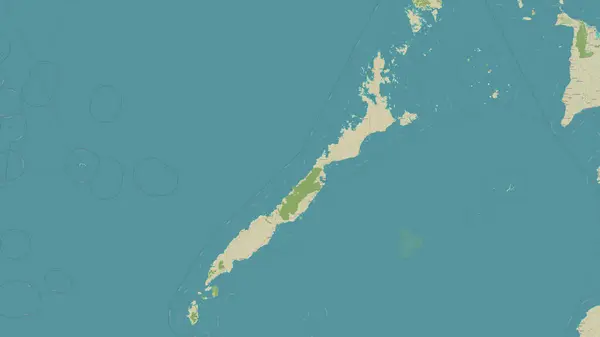
Palawan Island In The Sulu Sea On A Topographic, OSM Humanitarian Style Map

Image, 1.05MB, 2880 × 1620 jpg
stock image Palawan Island in the Sulu Sea, belonging to Philippines, isolated on a satellite image taken in November 19, 2020, with distance scale

Palawan Island In The Sulu Sea, Belonging To Philippines, Isolated On A Satellite Image Taken In November 19, 2020, With Distance Scale

Image, 0.61MB, 2160 × 2160 jpg
stock image Palawan Island in the Sulu Sea, belonging to Philippines, isolated on a bilevel elevation map, with distance scale

Palawan Island In The Sulu Sea, Belonging To Philippines, Isolated On A Bilevel Elevation Map, With Distance Scale

Image, 0.36MB, 2160 × 2160 jpg
Page 1 >> Next