photo free
Home Images Vectors Videos

Stock image Pasman

stock image View from the top od the mountain, Pasman island, Croatia

View From The Top Od The Mountain, Pasman Island, Croatia

Image, 8.67MB, 3443 × 2295 jpg
stock image Turanj village and Pasman island archipelago panoramic view, Dalmatia region of Croatia

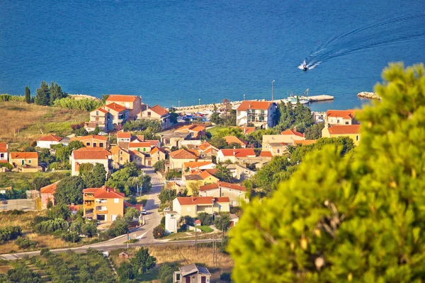
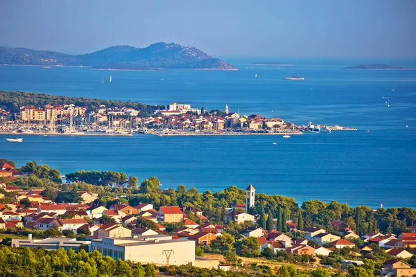
Turanj Village And Pasman Island Archipelago Panoramic View, Dalmatia Region Of Croatia

Image, 8.81MB, 4300 × 2866 jpg
stock image blooming flowers in the garden

Blooming Flowers In The Garden

Image, 0MB, 3872 × 2592 jpg
stock image Coastal village on Island of Pasman

Coastal Village On Island Of Pasman

Image, 4.47MB, 4300 × 2867 jpg
stock image Islands of Ugljan and Pasman bridge

Islands Of Ugljan And Pasman Bridge

Image, 3.46MB, 6800 × 1787 jpg
stock image Island of Pasman coas yachting

Island Of Pasman Coas Yachting

Image, 4.36MB, 4300 × 2867 jpg
stock image Beach in Turanj, small village in Dalmatia, Croatia, island of Pasman in background

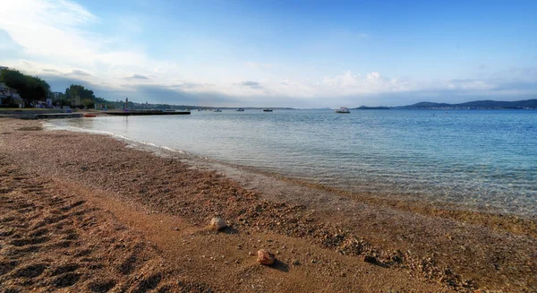
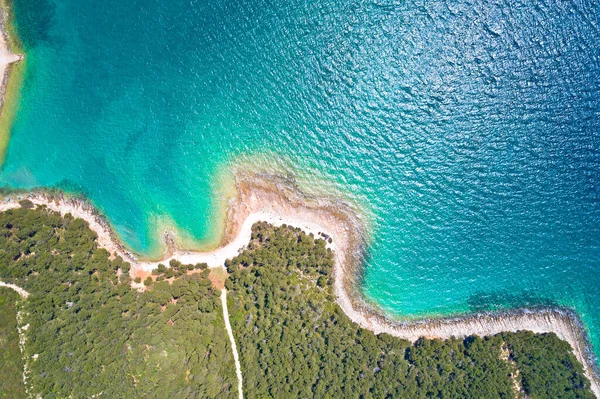
Beach In Turanj, Small Village In Dalmatia, Croatia, Island Of Pasman In Background

Image, 18.2MB, 8209 × 4476 jpg
stock image Pata Island in the Celebes Sea, belonging to Philippines, isolated on a topographic, OSM Humanitarian style map, with distance scale

Pata Island In The Celebes Sea, Belonging To Philippines, Isolated On A Topographic, OSM Humanitarian Style Map, With Distance Scale

Image, 0.33MB, 2160 × 2160 jpg
stock image Paxos Island in the Ionian Sea, belonging to Greece, isolated on a topographic, OSM Humanitarian style map, with distance scale

Paxos Island In The Ionian Sea, Belonging To Greece, Isolated On A Topographic, OSM Humanitarian Style Map, With Distance Scale

Image, 0.88MB, 2160 × 2160 jpg
stock image Biograd na Moru historic coastal town and archipelago aerial view, Dalmatia region of Croatia

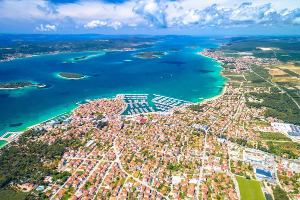
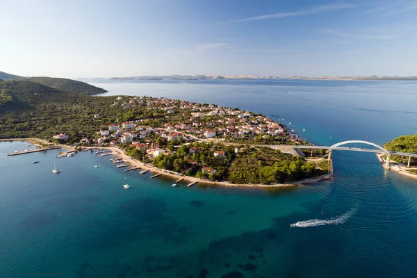
Biograd Na Moru Historic Coastal Town And Archipelago Aerial View, Dalmatia Region Of Croatia

Image, 9.17MB, 4750 × 3164 jpg
stock image Pavuvu Island in the Solomon Sea, belonging to Solomon Islands, isolated on a topographic, OSM Humanitarian style map, with distance scale

Pavuvu Island In The Solomon Sea, Belonging To Solomon Islands, Isolated On A Topographic, OSM Humanitarian Style Map, With Distance Scale

Image, 0.45MB, 2160 × 2160 jpg
stock image Amazing colorful sunset panorama of Pakostane archipelago

Amazing Colorful Sunset Panorama Of Pakostane Archipelago

Image, 3.58MB, 5472 × 2311 jpg
stock image Nevidane village bay on Pasman island

Nevidane Village Bay On Pasman Island

Image, 4.43MB, 4300 × 2867 jpg
stock image Aerial view of a pier.

Aerial View Of A Pier.

Image, 5.87MB, 3456 × 2304 jpg
stock image Kornati islands national park archipelago at dramatic sundown vi

Kornati Islands National Park Archipelago At Dramatic Sundown Vi

Image, 9.16MB, 4750 × 3167 jpg
stock image Pasmano Island in the Adriatic Sea on a topographic, OSM Humanitarian style map

Pasmano Island In The Adriatic Sea On A Topographic, OSM Humanitarian Style Map

Image, 3.04MB, 2880 × 1620 jpg
stock image Paul Island in the Gulf of Alaska - belonging to United States. Described location diagram with yellow shape of the island and sample maps of its surroundings

Paul Island In The Gulf Of Alaska - Belonging To United States. Described Location Diagram With Yellow Shape Of The Island And Sample Maps Of Its Surroundings

Image, 2.01MB, 3840 × 2160 jpg
stock image Patmos Island in the Aegean Sea - belonging to Greece. Described location diagram with yellow shape of the island and sample maps of its surroundings

Patmos Island In The Aegean Sea - Belonging To Greece. Described Location Diagram With Yellow Shape Of The Island And Sample Maps Of Its Surroundings

Image, 2.15MB, 3840 × 2160 jpg
stock image Patnanongan Island in the Philippine Sea, belonging to Philippines, isolated on a bilevel elevation map, with distance scale

Patnanongan Island In The Philippine Sea, Belonging To Philippines, Isolated On A Bilevel Elevation Map, With Distance Scale

Image, 0.35MB, 2160 × 2160 jpg
stock image Patmos Island in the Aegean Sea, belonging to Greece, isolated on a bilevel elevation map, with distance scale

Patmos Island In The Aegean Sea, Belonging To Greece, Isolated On A Bilevel Elevation Map, With Distance Scale

Image, 0.29MB, 2160 × 2160 jpg
stock image Pate Island in the Indian Ocean, belonging to Kenya, isolated on a bilevel elevation map, with distance scale

Pate Island In The Indian Ocean, Belonging To Kenya, Isolated On A Bilevel Elevation Map, With Distance Scale

Image, 0.31MB, 2160 × 2160 jpg
stock image Zdrelac bridge connecting Ugljan and Pasman

Zdrelac Bridge Connecting Ugljan And Pasman

Image, 3.52MB, 4300 × 2867 jpg
stock image Biograd na Moru historic town and marina aerial view

Biograd Na Moru Historic Town And Marina Aerial View

Image, 8.51MB, 4750 × 3164 jpg
stock image Aerial overhead view of Mala Bisaga Island in Dalmatia Adriatic sea near Galesnjak Islan in Croatia summer

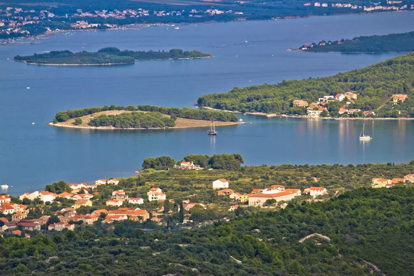
Aerial Overhead View Of Mala Bisaga Island In Dalmatia Adriatic Sea Near Galesnjak Islan In Croatia Summer

Image, 1.66MB, 4244 × 2827 jpg
stock image Flock of seagull near the Pasman island in the Adriatic sea.Croatia.

Flock Of Seagull Near The Pasman Island In The Adriatic Sea.Croatia.

Image, 9.57MB, 4606 × 5000 jpg
stock image Pata Island in the Celebes Sea, belonging to Philippines, isolated on a bilevel elevation map, with distance scale

Pata Island In The Celebes Sea, Belonging To Philippines, Isolated On A Bilevel Elevation Map, With Distance Scale

Image, 0.34MB, 2160 × 2160 jpg
stock image Pasmano Island in the Adriatic Sea, belonging to Croatia, isolated on a bilevel elevation map, with distance scale

Pasmano Island In The Adriatic Sea, Belonging To Croatia, Isolated On A Bilevel Elevation Map, With Distance Scale

Image, 0.27MB, 2160 × 2160 jpg
stock image Paxos Island in the Ionian Sea - belonging to Greece. Described location diagram with yellow shape of the island and sample maps of its surroundings

Paxos Island In The Ionian Sea - Belonging To Greece. Described Location Diagram With Yellow Shape Of The Island And Sample Maps Of Its Surroundings

Image, 2.15MB, 3840 × 2160 jpg
stock image Amazing colorful sunset panorama of Pakostane archipelago

Amazing Colorful Sunset Panorama Of Pakostane Archipelago

Image, 9.06MB, 4750 × 3168 jpg
stock image Biograd Na Moru and Sveti Filip i Jakov waterfront panoramic view, towns in Dalmatia region of Croatia

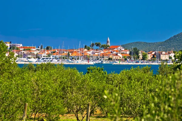
Biograd Na Moru And Sveti Filip I Jakov Waterfront Panoramic View, Towns In Dalmatia Region Of Croatia

Image, 7.29MB, 4300 × 2867 jpg
stock image Lookout tower above Pakostane archipelago at golden sunset view

Lookout Tower Above Pakostane Archipelago At Golden Sunset View

Image, 7.17MB, 4750 × 3167 jpg
stock image Pasmano Island in the Adriatic Sea - belonging to Croatia. Described location diagram with yellow shape of the island and sample maps of its surroundings

Pasmano Island In The Adriatic Sea - Belonging To Croatia. Described Location Diagram With Yellow Shape Of The Island And Sample Maps Of Its Surroundings

Image, 3.26MB, 3840 × 2160 jpg
stock image Pata Island in the Celebes Sea - belonging to Philippines. Described location diagram with yellow shape of the island and sample maps of its surroundings

Pata Island In The Celebes Sea - Belonging To Philippines. Described Location Diagram With Yellow Shape Of The Island And Sample Maps Of Its Surroundings

Image, 2.15MB, 3840 × 2160 jpg
stock image Amazing sunset above Pasman island

Amazing Sunset Above Pasman Island

Image, 2.72MB, 4750 × 3167 jpg
stock image Amazing colorful sunset panorama of Pakostane archipelago

Amazing Colorful Sunset Panorama Of Pakostane Archipelago

Image, 6.84MB, 7500 × 2306 jpg
stock image Pakostane idyllic turquoise rocky beach aerial view, Dalmatia region of Croatia

Pakostane Idyllic Turquoise Rocky Beach Aerial View, Dalmatia Region Of Croatia

Image, 12.73MB, 4300 × 2865 jpg
stock image Biograd na Moru idyllic turquoise beach aerial view

Biograd Na Moru Idyllic Turquoise Beach Aerial View

Image, 11.27MB, 4750 × 3164 jpg
stock image Paxos Island in the Ionian Sea, belonging to Greece, isolated on a bilevel elevation map, with distance scale

Paxos Island In The Ionian Sea, Belonging To Greece, Isolated On A Bilevel Elevation Map, With Distance Scale

Image, 0.32MB, 2160 × 2160 jpg
stock image Patnanongan Island in the Philippine Sea - belonging to Philippines. Described location diagram with yellow shape of the island and sample maps of its surroundings

Patnanongan Island In The Philippine Sea - Belonging To Philippines. Described Location Diagram With Yellow Shape Of The Island And Sample Maps Of Its Surroundings

Image, 2.24MB, 3840 × 2160 jpg
stock image Pasmano Island in the Adriatic Sea on a satellite image taken in October 9, 2023

Pasmano Island In The Adriatic Sea On A Satellite Image Taken In October 9, 2023

Image, 6.23MB, 2880 × 1620 jpg
stock image Patmos Island in the Aegean Sea, belonging to Greece, isolated on a topographic, OSM Humanitarian style map, with distance scale

Patmos Island In The Aegean Sea, Belonging To Greece, Isolated On A Topographic, OSM Humanitarian Style Map, With Distance Scale

Image, 0.61MB, 2160 × 2160 jpg
stock image Zdrelac bridge connecting Ugljan and Pasman islands, Croatia

Zdrelac Bridge Connecting Ugljan And Pasman Islands, Croatia

Image, 8.87MB, 4000 × 2665 jpg
stock image Zdrelac bridge connecting Ugljan and Pasman islands, Croatia

Zdrelac Bridge Connecting Ugljan And Pasman Islands, Croatia

Image, 7.99MB, 4000 × 2667 jpg
stock image Pavuvu Island in the Solomon Sea, belonging to Solomon Islands, isolated on a bilevel elevation map, with distance scale

Pavuvu Island In The Solomon Sea, Belonging To Solomon Islands, Isolated On A Bilevel Elevation Map, With Distance Scale

Image, 0.42MB, 2160 × 2160 jpg
stock image Pate Island in the Indian Ocean - belonging to Kenya. Described location diagram with yellow shape of the island and sample maps of its surroundings

Pate Island In The Indian Ocean - Belonging To Kenya. Described Location Diagram With Yellow Shape Of The Island And Sample Maps Of Its Surroundings

Image, 2.5MB, 3840 × 2160 jpg
stock image Paul Island in the Gulf of Alaska, belonging to United States, isolated on a topographic, OSM Humanitarian style map, with distance scale

Paul Island In The Gulf Of Alaska, Belonging To United States, Isolated On A Topographic, OSM Humanitarian Style Map, With Distance Scale

Image, 0.26MB, 2160 × 2160 jpg
stock image Town of Biogead naMoru and olive grove

Town Of Biogead NaMoru And Olive Grove

Image, 5.35MB, 4750 × 3166 jpg
stock image Paul Island in the Gulf of Alaska, belonging to United States, isolated on a bilevel elevation map, with distance scale

Paul Island In The Gulf Of Alaska, Belonging To United States, Isolated On A Bilevel Elevation Map, With Distance Scale

Image, 0.3MB, 2160 × 2160 jpg
stock image Pasmano Island in the Adriatic Sea, belonging to Croatia, isolated on a satellite image taken in January 22, 2024, with distance scale

Pasmano Island In The Adriatic Sea, Belonging To Croatia, Isolated On A Satellite Image Taken In January 22, 2024, With Distance Scale

Image, 1.08MB, 2160 × 2160 jpg
stock image Zadar, Croatia - July 23, 2018: Dusk over the island of Ugljan seen from Zadar

Zadar, Croatia - July 23, 2018: Dusk Over The Island Of Ugljan Seen From Zadar

Image, 10.27MB, 5184 × 3456 jpg
Page 1 >> Next