photo free
Home Images Vectors Videos

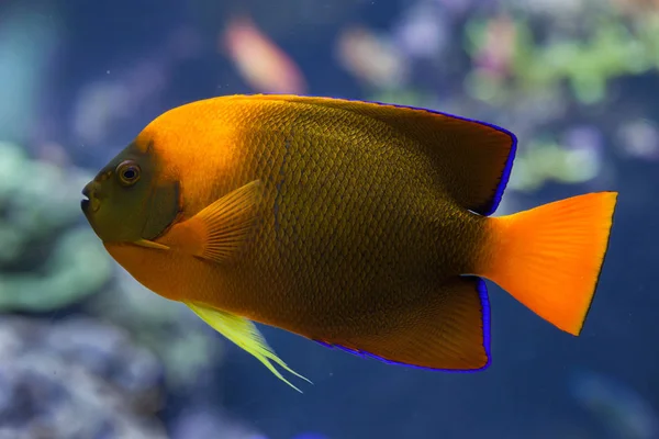
Stock image Revillagigedo Island

stock image Ketchikan, Alaska, USA - July 17, 2011: Large free standing colorful Welcome sign to the Salmon Capital of the World under blue cloudscape and snow covered mountain on horizon. Green foliage.

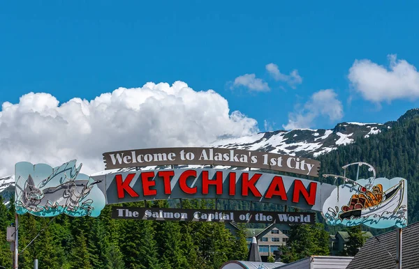
Ketchikan, Alaska, USA - July 17, 2011: Large Free Standing Colorful Welcome Sign To The Salmon Capital Of The World Under Blue Cloudscape And Snow Covered Mountain On Horizon. Green Foliage.

Image, 34.89MB, 11000 × 7086 jpg
stock image Ketchikan, Alaska, USA - July 17, 2011: Retail businesses built on wharf along Water Street featuring coffee shop, fishing charters, snacks, laundry services, and more. Green forest in back.

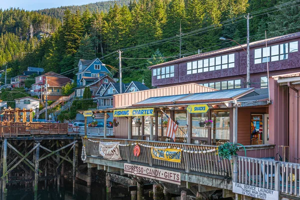
Ketchikan, Alaska, USA - July 17, 2011: Retail Businesses Built On Wharf Along Water Street Featuring Coffee Shop, Fishing Charters, Snacks, Laundry Services, And More. Green Forest In Back.

Image, 24.22MB, 6792 × 4552 jpg
stock image Close portrait of a scalloped shark (sphyrna lewini)

Close Portrait Of A Scalloped Shark (sphyrna Lewini)

Image, 0.56MB, 3654 × 2392 jpg
stock image School of hammerhead in the blue with one shark in the foreground

School Of Hammerhead In The Blue With One Shark In The Foreground

Image, 3.51MB, 5405 × 3542 jpg
stock image Revillagigedo Island in the The Coastal Waters of Southeast Alaska and British Columbia, belonging to United States, isolated on a bilevel elevation map, with distance scale

Revillagigedo Island In The The Coastal Waters Of Southeast Alaska And British Columbia, Belonging To United States, Isolated On A Bilevel Elevation Map, With Distance Scale

Image, 0.86MB, 2160 × 2160 jpg
stock image Beach, sea, and mountains at Herring Cove near Ketchikan, Alaska, seen past a cluster of intentionally out of focus daisies

Beach, Sea, And Mountains At Herring Cove Near Ketchikan, Alaska, Seen Past A Cluster Of Intentionally Out Of Focus Daisies

Image, 12.65MB, 5842 × 3900 jpg
stock image Revillagigedo Island in the The Coastal Waters of Southeast Alaska and British Columbia on a satellite image taken in July 30, 2018

Revillagigedo Island In The The Coastal Waters Of Southeast Alaska And British Columbia On A Satellite Image Taken In July 30, 2018

Image, 7.07MB, 2880 × 1620 jpg
stock image Beach, sea, and mountains under atmospheric light at Herring Cove near Ketchikan, Alaska

Beach, Sea, And Mountains Under Atmospheric Light At Herring Cove Near Ketchikan, Alaska

Image, 14.57MB, 6016 × 4016 jpg
stock image Revillagigedo Island in the The Coastal Waters of Southeast Alaska and British Columbia - belonging to United States. Described location diagram with yellow shape of the island and sample maps of its surroundings

Revillagigedo Island In The The Coastal Waters Of Southeast Alaska And British Columbia - Belonging To United States. Described Location Diagram With Yellow Shape Of The Island And Sample Maps Of Its Surroundings

Image, 4.31MB, 3840 × 2160 jpg
stock image Revillagigedo Island in the The Coastal Waters of Southeast Alaska and British Columbia, belonging to United States, isolated on a satellite image taken in August 19, 2018, with distance scale

Revillagigedo Island In The The Coastal Waters Of Southeast Alaska And British Columbia, Belonging To United States, Isolated On A Satellite Image Taken In August 19, 2018, With Distance Scale

Image, 1.73MB, 2160 × 2160 jpg
stock image Rainbow Falls waterfall about ten miles from Ketchikan, Alaska, plunges into a clear shallow pool amid large boulders

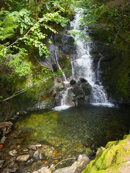
Rainbow Falls Waterfall About Ten Miles From Ketchikan, Alaska, Plunges Into A Clear Shallow Pool Amid Large Boulders

Image, 20.37MB, 4512 × 6016 jpg
stock image Revillagigedo Island in the The Coastal Waters of Southeast Alaska and British Columbia on a topographic, OSM Humanitarian style map

Revillagigedo Island In The The Coastal Waters Of Southeast Alaska And British Columbia On A Topographic, OSM Humanitarian Style Map

Image, 2.75MB, 2880 × 1620 jpg
stock image A nature reserve at Herring Cove near Ketchikan, Alaska, is a favored spot for bald eagles hunting for herring and salmon in the stream

A Nature Reserve At Herring Cove Near Ketchikan, Alaska, Is A Favored Spot For Bald Eagles Hunting For Herring And Salmon In The Stream

Image, 19.71MB, 5954 × 3974 jpg
stock image A small beach at Herring Cove near Ketchikan, Alaska, is framed by forests, the sea, and distant mountains.

A Small Beach At Herring Cove Near Ketchikan, Alaska, Is Framed By Forests, The Sea, And Distant Mountains.

Image, 13.2MB, 5784 × 3860 jpg
stock image Revillagigedo Island in the The Coastal Waters of Southeast Alaska and British Columbia on a colored elevation map

Revillagigedo Island In The The Coastal Waters Of Southeast Alaska And British Columbia On A Colored Elevation Map

Image, 6.73MB, 2880 × 1620 jpg
stock image Revillagigedo Island in the The Coastal Waters of Southeast Alaska and British Columbia, belonging to United States, isolated on a topographic, OSM Humanitarian style map, with distance scale

Revillagigedo Island In The The Coastal Waters Of Southeast Alaska And British Columbia, Belonging To United States, Isolated On A Topographic, OSM Humanitarian Style Map, With Distance Scale

Image, 0.74MB, 2160 × 2160 jpg
stock image Roca Partida or Split Rock smallest of the four Revillagigedo Islands, part of the Free and Sovereign State of Colima in Mexico

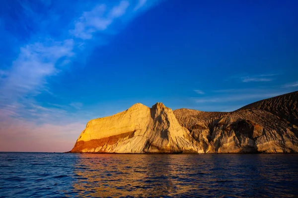
Roca Partida Or Split Rock Smallest Of The Four Revillagigedo Islands, Part Of The Free And Sovereign State Of Colima In Mexico

Image, 14.99MB, 5616 × 3744 jpg
stock image Roca Partida or Split Rock smallest of Socorro islands in Pacific Ocean

Roca Partida Or Split Rock Smallest Of Socorro Islands In Pacific Ocean

Image, 9.72MB, 5616 × 3744 jpg
stock image Socorro San Benedicto Island and volcano formerly Isla de los Innocentes third largest of the Revillagigedo Islands, located in the Pacific Ocean.

Socorro San Benedicto Island And Volcano Formerly Isla De Los Innocentes Third Largest Of The Revillagigedo Islands, Located In The Pacific Ocean.

Image, 14.51MB, 5616 × 3744 jpg
stock image School of small white tip baby sharks rest in the rocks

School Of Small White Tip Baby Sharks Rest In The Rocks

Image, 12.41MB, 5616 × 3744 jpg
stock image Clarion angelfish in aquarium

Clarion Angelfish In Aquarium

Image, 3.4MB, 5591 × 3727 jpg
stock image Clarion angelfish (Holacanthus clarionensis).

Clarion Angelfish (Holacanthus Clarionensis).

Image, 3.3MB, 5616 × 3744 jpg
stock image Clarion angelfish (Holacanthus clarionensis).

Clarion Angelfish (Holacanthus Clarionensis).

Image, 3.33MB, 5531 × 3687 jpg
stock image Silver tip shark (Carcharhinus albimarginatus) swimming in the blue

Silver Tip Shark (Carcharhinus Albimarginatus) Swimming In The Blue

Image, 2.08MB, 6000 × 4000 jpg
stock image Basalt monolith, San Benedicto island, Revillagigedo archipelagos, Colima, Mexico

Basalt Monolith, San Benedicto Island, Revillagigedo Archipelagos, Colima, Mexico

Image, 11.31MB, 2835 × 4252 jpg
stock image Socorro Island in the North Pacific Ocean on a topographic, OSM Humanitarian style map

Socorro Island In The North Pacific Ocean On A Topographic, OSM Humanitarian Style Map

Image, 0.43MB, 2880 × 1620 jpg
stock image Socorro Island in the North Pacific Ocean on a colored elevation map

Socorro Island In The North Pacific Ocean On A Colored Elevation Map

Image, 1.02MB, 2880 × 1620 jpg
stock image Socorro Island in the North Pacific Ocean - belonging to Mexico. Described location diagram with yellow shape of the island and sample maps of its surroundings

Socorro Island In The North Pacific Ocean - Belonging To Mexico. Described Location Diagram With Yellow Shape Of The Island And Sample Maps Of Its Surroundings

Image, 2.17MB, 3840 × 2160 jpg
stock image Socorro Island in the North Pacific Ocean, belonging to Mexico, isolated on a bilevel elevation map, with distance scale

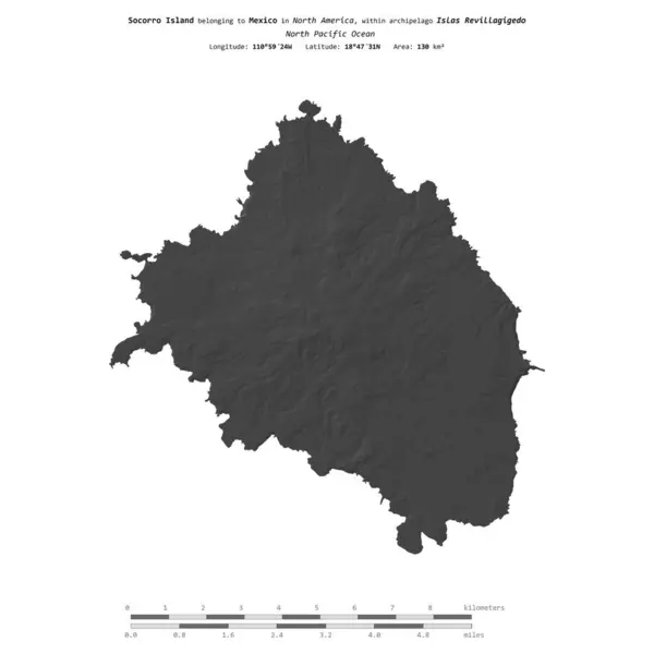
Socorro Island In The North Pacific Ocean, Belonging To Mexico, Isolated On A Bilevel Elevation Map, With Distance Scale

Image, 0.41MB, 2160 × 2160 jpg
stock image Socorro Island in the North Pacific Ocean, belonging to Mexico, isolated on a satellite image taken in December 27, 2023, with distance scale

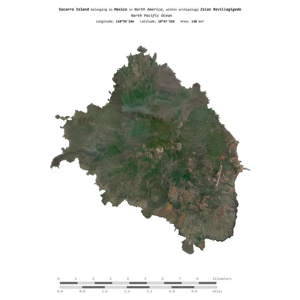
Socorro Island In The North Pacific Ocean, Belonging To Mexico, Isolated On A Satellite Image Taken In December 27, 2023, With Distance Scale

Image, 1.82MB, 2160 × 2160 jpg
stock image Socorro Island in the North Pacific Ocean on a satellite image taken in March 17, 2023

Socorro Island In The North Pacific Ocean On A Satellite Image Taken In March 17, 2023

Image, 6.05MB, 2880 × 1620 jpg
stock image Socorro Island in the North Pacific Ocean, belonging to Mexico, isolated on a topographic, OSM Humanitarian style map, with distance scale

Socorro Island In The North Pacific Ocean, Belonging To Mexico, Isolated On A Topographic, OSM Humanitarian Style Map, With Distance Scale

Image, 0.66MB, 2160 × 2160 jpg
Page 1 >> Next