photo free
Home Images Vectors Videos

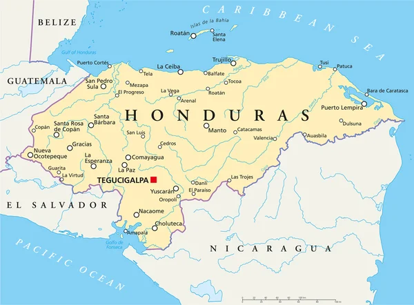
Stock image Roatan Map

stock vector Roatan map Island silhouette icon Isolated Roatan black map outline Vector illustration

Roatan Map Island Silhouette Icon Isolated Roatan Black Map Outline Vector Illustration

Vector, 0.2MB, 8333 × 8333 eps
stock vector roatan island road vector map, honduras

Roatan Island Road Vector Map, Honduras

Vector, 0.9MB, 6196 × 3100 eps
stock vector Roatan vector map Grunge rubber stamp with the name and map of island vector illustration Can be

Roatan Vector Map Grunge Rubber Stamp With The Name And Map Of Island Vector Illustration Can Be

Vector, 4.53MB, 8350 × 8350 eps
stock vector Roatan vector map Distressed travel stamp with text wrapped around a circle and stars Island

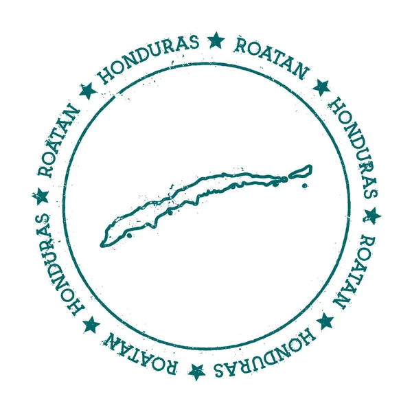
Roatan Vector Map Distressed Travel Stamp With Text Wrapped Around A Circle And Stars Island

Vector, 3.18MB, 8333 × 8333 eps
stock vector Roatan map sticker Hipster and retro style badge Minimalistic insignia with round dots border

Roatan Map Sticker Hipster And Retro Style Badge Minimalistic Insignia With Round Dots Border

Vector, 3.66MB, 8333 × 8333 eps
stock vector Roatan sticker Hipster round rubber stamp with island map Vintage passport sign with circular text

Roatan Sticker Hipster Round Rubber Stamp With Island Map Vintage Passport Sign With Circular Text

Vector, 4.05MB, 8333 × 8333 eps
stock vector roatan island road vector map, honduras

Roatan Island Road Vector Map, Honduras

Vector, 1.1MB, 6111 × 3100 eps
stock vector Abstract blue world map with magnified Honduras.

Abstract Blue World Map With Magnified Honduras.

Vector, 13MB, 8000 × 5000 eps
stock vector Honduras Political Map

Honduras Political Map

Vector, 3.79MB, 8131 × 6000 eps
stock image Isla de Roatan in the Caribbean Sea, belonging to Honduras, isolated on a satellite image taken in January 6, 2024, with distance scale

Isla De Roatan In The Caribbean Sea, Belonging To Honduras, Isolated On A Satellite Image Taken In January 6, 2024, With Distance Scale

Image, 0.47MB, 2160 × 2160 jpg
stock image Isla de Roatan in the Caribbean Sea, belonging to Honduras, isolated on a bilevel elevation map, with distance scale

Isla De Roatan In The Caribbean Sea, Belonging To Honduras, Isolated On A Bilevel Elevation Map, With Distance Scale

Image, 0.26MB, 2160 × 2160 jpg
stock image Isla de Roatan in the Caribbean Sea on a colored elevation map

Isla De Roatan In The Caribbean Sea On A Colored Elevation Map

Image, 1.27MB, 2880 × 1620 jpg
stock image Isla de Roatan in the Caribbean Sea on a topographic, OSM Humanitarian style map

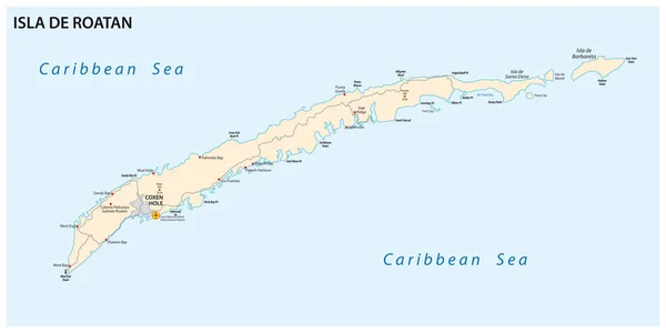
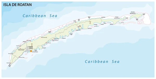
Isla De Roatan In The Caribbean Sea On A Topographic, OSM Humanitarian Style Map

Image, 0.38MB, 2880 × 1620 jpg
stock image Isla de Roatan in the Caribbean Sea on a satellite image taken in April 22, 2018

Isla De Roatan In The Caribbean Sea On A Satellite Image Taken In April 22, 2018

Image, 3.82MB, 2880 × 1620 jpg
stock image Isla de Roatan in the Caribbean Sea, belonging to Honduras, isolated on a topographic, OSM Humanitarian style map, with distance scale

Isla De Roatan In The Caribbean Sea, Belonging To Honduras, Isolated On A Topographic, OSM Humanitarian Style Map, With Distance Scale

Image, 0.4MB, 2160 × 2160 jpg
stock image Isla de Roatan in the Caribbean Sea - belonging to Honduras. Described location diagram with yellow shape of the island and sample maps of its surroundings

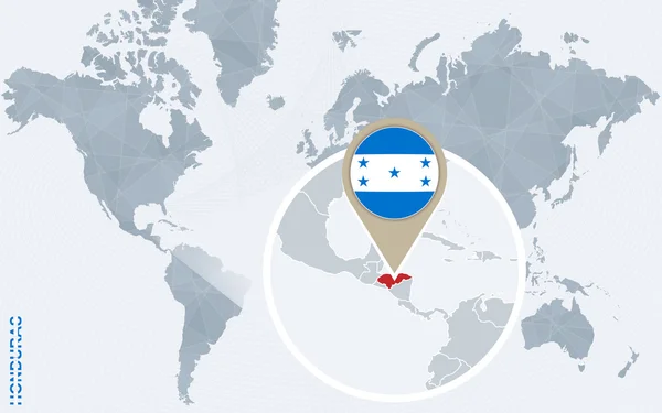
Isla De Roatan In The Caribbean Sea - Belonging To Honduras. Described Location Diagram With Yellow Shape Of The Island And Sample Maps Of Its Surroundings

Image, 1.81MB, 3840 × 2160 jpg
Page 1 >> Next