photo free
Home Images Vectors Videos

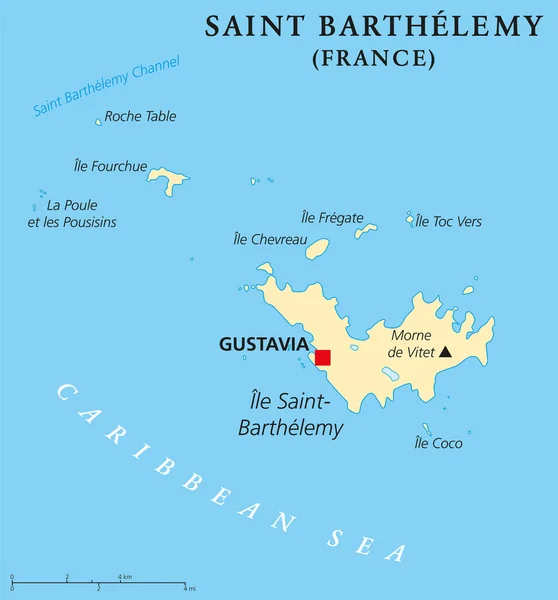
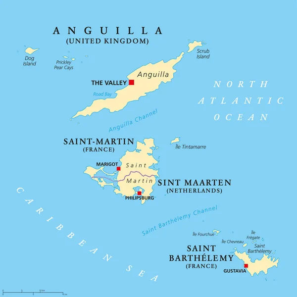
Stock image Saint Barthelemy Political Map

stock vector Saint Barthelemy Political Map

Saint Barthelemy Political Map

Vector, 0.51MB, 6000 × 6438 eps
stock vector Anguilla, Saint-Martin, Sint Maarten and Saint Barthelemy map

Anguilla, Saint-Martin, Sint Maarten And Saint Barthelemy Map

Vector, 3.44MB, 8033 × 8033 eps
stock vector 3d isometric map of Saint Barthelemy, isolated with shadow vector illustration

3d Isometric Map Of Saint Barthelemy, Isolated With Shadow Vector Illustration

Vector, 3.07MB, 4000 × 4000 eps
stock image Close-up of Saint Barthelemy and its location in the region and in the center of a large-scale world map. Satellite imagery

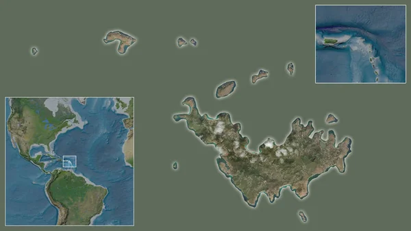
Close-up Of Saint Barthelemy And Its Location In The Region And In The Center Of A Large-scale World Map. Satellite Imagery

Image, 1.7MB, 2880 × 1620 jpg
stock vector Locator map showing the location of the country Saint Barthelemy in North America. The country is highlighted with a red polygon. No labels at all. Made with Natural Earth.

Locator Map Showing The Location Of The Country Saint Barthelemy In North America. The Country Is Highlighted With A Red Polygon. No Labels At All. Made With Natural Earth.

Vector, 1.36MB, 4223 × 4474 eps
Page 1 >> Next