
Stock image Santa Cruz Contour

Map Of Argentina Administrative Regions Departments, Icons. Map Location Pin, Arrow, Man, Bicycle, Car, Airplane.
Vector, 21.83MB, 12168 × 5620 eps


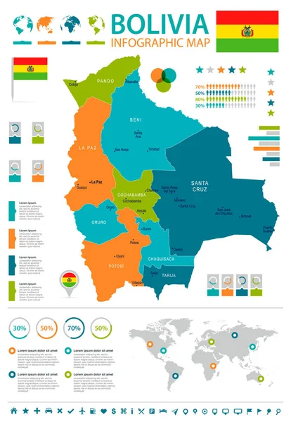
Santa Cruz Department (Plurinational State Of Bolivia, Departments Of Bolivia) Map Vector Illustration, Scribble Sketch Santa Cruz Ma
Vector, 1.24MB, 7087 × 4726 eps
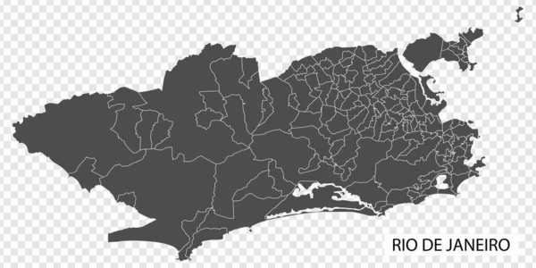
High Quality Map Of Rio De Janeiro Is A City Brazil, With Borders Of The Regions. Map Of Rio De Janeiro For Your Web Site Design, App, UI. EPS10.
Vector, 0.32MB, 7500 × 3752 eps
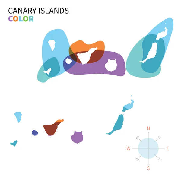
Abstract Vector Color Map Of Canary Islands With Transparent Paint Effect.
Vector, 3.38MB, 5867 × 5867 eps


Blank Map Santa Cruz Department Of Bolivia. High Quality Map Department Of Santa Cruz With Districts On Transparent Background For Your Design, Logo, App, UI. Plurinational State Of Bolivia. EPS10.
Vector, 4.7MB, 5000 × 5000 eps


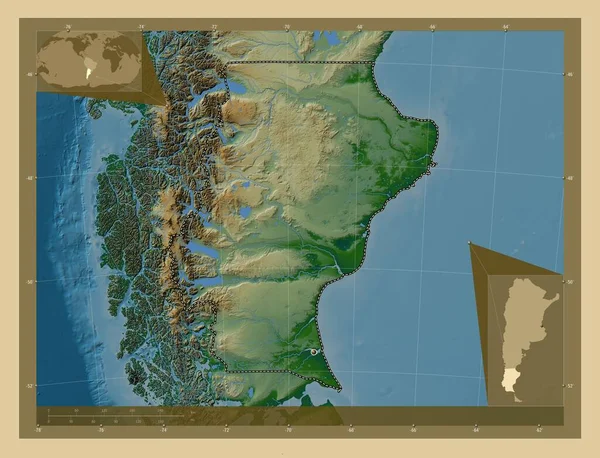
Santa Cruz, Province Of Argentina. Colored Elevation Map With Lakes And Rivers. Corner Auxiliary Location Maps
Image, 7.8MB, 4930 × 3770 jpg

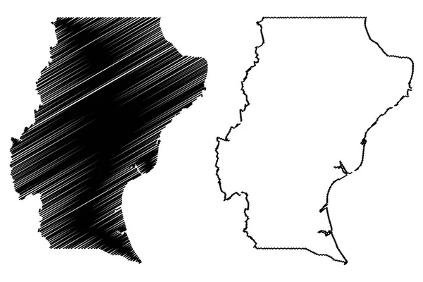
Santa Cruz (Region Of Argentina, Argentine Republic, Provinces Of Argentina) Map Vector Illustration, Scribble Sketch Santa Cruz Province Map
Vector, 0.7MB, 7087 × 4726 eps

I Love Santa Cruz, City Of United States. Hand Drawn Letters With Red Heart. Vector Illustration Lettering, Modern Design
Vector, 0.24MB, 4400 × 3500 eps

Blank Map Santa Cruz Province Of Argentina. High Quality Map Province Of Santa Cruz With Districts On Transparent Background For Your Web Site Design, Logo, App, UI. Argentine Republic. EPS10.
Vector, 4.17MB, 5000 × 6668 eps

Santa Cruz Department (Plurinational State Of Bolivia, Departments Of Bolivia) Map Vector Illustration, Scribble Sketch Santa Cruz Ma
Vector, 0.71MB, 7087 × 4726 eps
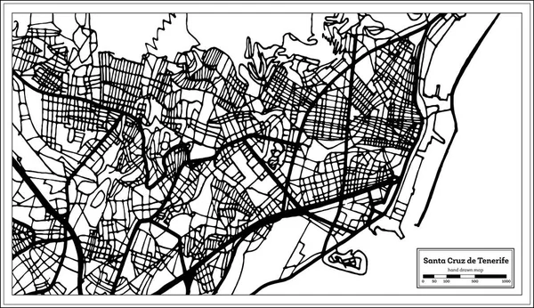
Santa Cruz De Tenerife Spain City Map In Retro Style. Outline Map. Vector Illustration.
Vector, 2.04MB, 8150 × 4702 eps
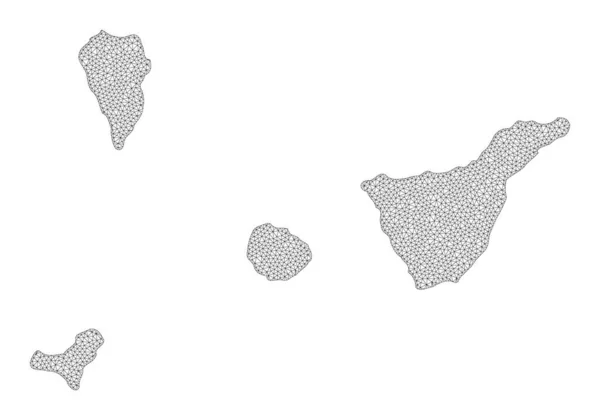
Polygonal Carcass Mesh High Detail Raster Map Of Santa Cruz De Tenerife Province Abstractions
Image, 1.67MB, 5969 × 4188 jpg

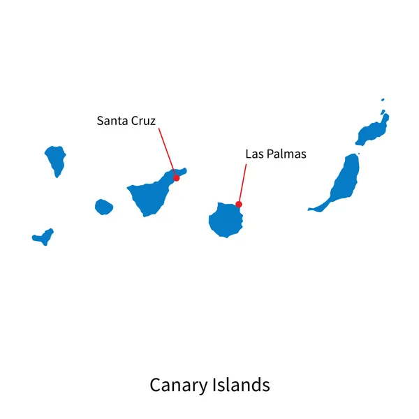
Location Of Canary Islands On Map Spain. 3d Autonomous Community Canary Islands Location Sign Similar To The Flag Of Canary Islands. Quality Map With Regions Kingdom Of Spain. Stock Vector. EPS10.
Vector, 6.19MB, 5000 × 5000 eps

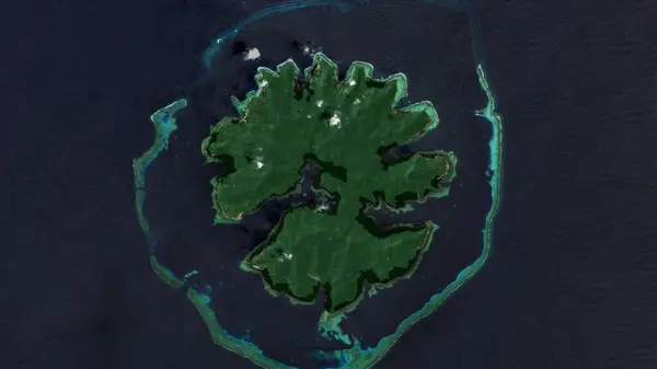
Nendo Island In The Coral Sea, Belonging To Solomon Islands, Isolated On A Satellite Image Taken In March 8, 2019, With Distance Scale
Image, 1.18MB, 2160 × 2160 jpg

Nendo Island In The Coral Sea On A Topographic, OSM Humanitarian Style Map
Image, 0.35MB, 2880 × 1620 jpg

Santa Cruz Island In The North Pacific Ocean - Belonging To United States. Described Location Diagram With Yellow Shape Of The Island And Sample Maps Of Its Surroundings
Image, 2.13MB, 3840 × 2160 jpg

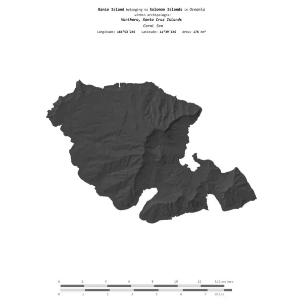
Banie Island In The Coral Sea On A Satellite Image Taken In November 8, 2019
Image, 6.99MB, 2880 × 1620 jpg
Banie Island In The Coral Sea, Belonging To Solomon Islands, Isolated On A Bilevel Elevation Map, With Distance Scale
Image, 0.45MB, 2160 × 2160 jpg

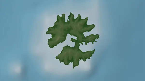
Santa Isabel Island In The Solomon Sea, Belonging To Solomon Islands, Isolated On A Bilevel Elevation Map, With Distance Scale
Image, 0.43MB, 2160 × 2160 jpg

Santa Cruz Island In The South Pacific Ocean, Belonging To Ecuador, Isolated On A Bilevel Elevation Map, With Distance Scale
Image, 0.66MB, 2160 × 2160 jpg

Isla Santa Margarita In The North Pacific Ocean, Belonging To Mexico, Isolated On A Bilevel Elevation Map, With Distance Scale
Image, 0.37MB, 2160 × 2160 jpg

Banie Island In The Coral Sea, Belonging To Solomon Islands, Isolated On A Topographic, OSM Humanitarian Style Map, With Distance Scale
Image, 0.5MB, 2160 × 2160 jpg

Isla Santa Margarita In The North Pacific Ocean, Belonging To Mexico, Isolated On A Topographic, OSM Humanitarian Style Map, With Distance Scale
Image, 0.27MB, 2160 × 2160 jpg

Banie Island In The Coral Sea On A Topographic, OSM Humanitarian Style Map
Image, 0.34MB, 2880 × 1620 jpg

Banie Island In The Coral Sea - Belonging To Solomon Islands. Described Location Diagram With Yellow Shape Of The Island And Sample Maps Of Its Surroundings
Image, 2MB, 3840 × 2160 jpg
Utupua Island In The Coral Sea On A Satellite Image Taken In January 2, 2020
Image, 5.7MB, 2880 × 1620 jpg

Utupua Island In The Coral Sea, Belonging To Solomon Islands, Isolated On A Satellite Image Taken In April 20, 2024, With Distance Scale
Image, 1.58MB, 2160 × 2160 jpg


Santa Isabel Island In The Solomon Sea - Belonging To Solomon Islands. Described Location Diagram With Yellow Shape Of The Island And Sample Maps Of Its Surroundings
Image, 2.17MB, 3840 × 2160 jpg


Isla Santa Margarita In The North Pacific Ocean - Belonging To Mexico. Described Location Diagram With Yellow Shape Of The Island And Sample Maps Of Its Surroundings
Image, 1.85MB, 3840 × 2160 jpg
Page 1 >> Next