
Stock image Santo Antao page 3

Delgadinho Mountain Ridge Road On Santo Antao, Cape Verde, Post Processed In HDR
Image, 12.79MB, 7354 × 4909 jpg

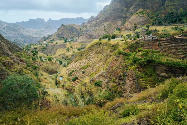
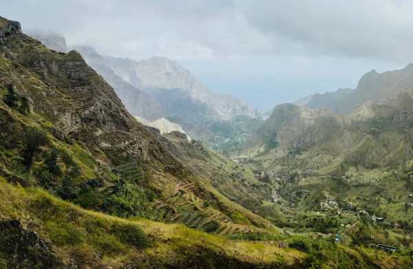
Mountain Silhouette Of Picturesque Canyon Ribeira Da Torre Covered With Sand Dust Brought From Sahara. Sugarcane, Coffee And Other Cultivation Grow On Steep Terraced Hills. Santo Antao Cape Verde
Image, 20.38MB, 6000 × 4000 jpg
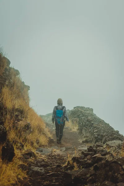
Woman Hiker On The Cobbled Misty Path On The Mountain Crest On Santo Antao Island, Cape Verde
Image, 9.44MB, 4000 × 6000 jpg
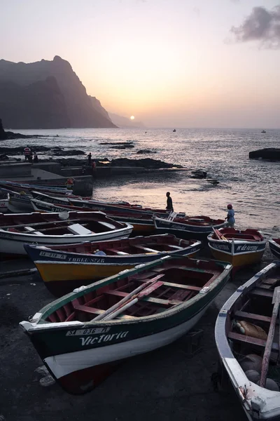
Fishing Boats At The Rocky Beach Of Santo Antao Island. Romantic Dusty Sunset Light. PONTA DO SOL, CAPE VERDE - DECEMBER 08, 2015
Image, 3.62MB, 2241 × 3361 jpg

Areal View Of Xo-Xo Valley Of Santa Antao Island, Cape Verde. Buildings In The Lowland Between High Rocks.
Image, 27.46MB, 4000 × 6000 jpg

Panorama Of Dried-up Stream Surrounded By Fertile Green Valley And Rugged Cliffs. Lonely White Dwelling On The Hill. Santo Antao, Cabo Verde
Image, 38.95MB, 8491 × 5883 jpg

Girl Walking Down Along The Trekking Route To Verdant Xo-Xo Valley. Warm Sunlight Seable On Horizont. Santo Antao Island Cape Verde
Image, 20.23MB, 5585 × 3723 jpg
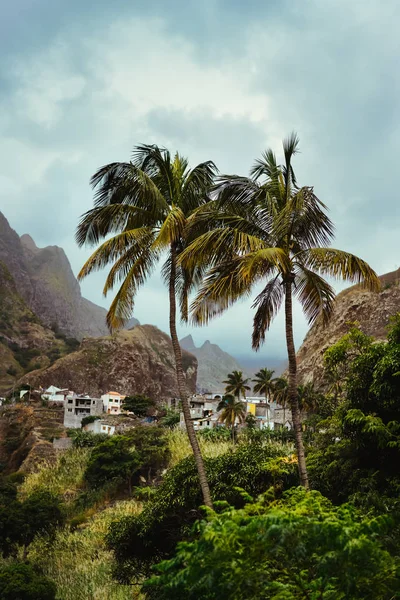
Santo Antao, Cape Verde. Landscape With Palm Trees And Houses Of Self-construction, In The Coastal Village Of Paul, In The North Of The Island
Image, 13.9MB, 4000 × 6000 jpg
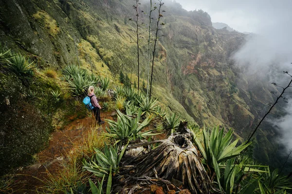
Female Traveler Staying On The Cove Volcano Edge Above The Foggy Green Valley Overgrown With Agaves Santo Antao Island In Cabo Verde
Image, 21.54MB, 6000 × 4000 jpg

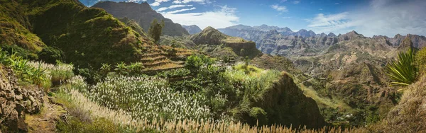
Gorgeous Panorama View Of A Fertile Paul Valley. Agriculture Terraces Of Sugarcane In Vertical Valley Sides, Dwellings, Rugged Peaks And Motion Clouds On Horizon
Image, 25.67MB, 6000 × 4000 jpg
Great Panorama View Of Terraces And Farms Fields Near To Ribeira Grande. Santo Antao Island, Cape Verde
Image, 31.04MB, 6000 × 4000 jpg
Gorgeous Panorama View Of Huge Barren Mountain Peaks, Cliff And Canyons Of Dry Arid Desert Landscape. Ribeira Grande. Santo Antao Island, Cape Verde
Image, 54.85MB, 12000 × 3777 jpg
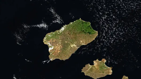
Santo Antao Island In The North Atlantic Ocean On A Satellite Image Taken In October 18, 2020
Image, 2.85MB, 2880 × 1620 jpg
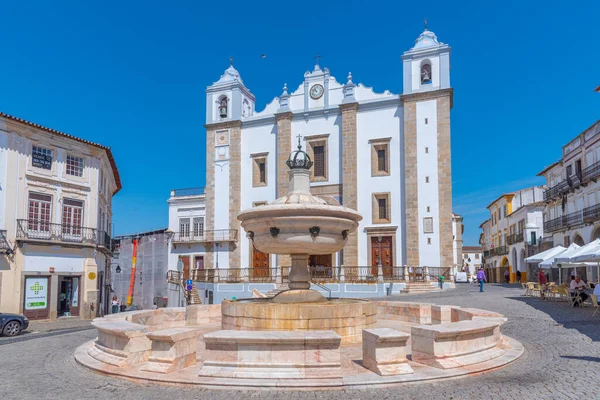
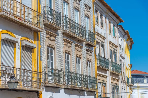
Evora, Portugal, June 15, 2021: People Are Enjoying A Suny Day At Praca Do Giraldo Square In Evora, Portugal.
Image, 11.83MB, 5867 × 3917 jpg

Santo Antao Island In The North Atlantic Ocean - Belonging To Cape Verde. Described Location Diagram With Yellow Shape Of The Island And Sample Maps Of Its Surroundings
Image, 2.26MB, 3840 × 2160 jpg

Mountainous Green Santiago Island Landscape In Rain Season - Cape Verde
Image, 23.4MB, 6720 × 4480 jpg

EVORA, Portugal - March 2, 2019. St. Anthony Church At The End Of Giraldo Square, Evora, Alentejo, Portugal
Image, 11.56MB, 4265 × 6397 jpg
Gorgeous Panorama View Of A Fertile Paul Valley. Agriculture Terraces In Vertical Valley Sides, Rugged Peaks And Motion Clouds On Horizon
Image, 56.34MB, 11392 × 7439 jpg

Santo Antao Island In The North Atlantic Ocean, Belonging To Cape Verde, Isolated On A Bilevel Elevation Map, With Distance Scale
Image, 0.72MB, 2160 × 2160 jpg

Santo Antao Island In The North Atlantic Ocean, Belonging To Cape Verde, Isolated On A Topographic, OSM Humanitarian Style Map, With Distance Scale
Image, 1.08MB, 2160 × 2160 jpg


Santo Antao Island In The North Atlantic Ocean On A Colored Elevation Map
Image, 1.88MB, 2880 × 1620 jpg

Santo Antao Island In The North Atlantic Ocean, Belonging To Cape Verde, Isolated On A Satellite Image Taken In February 23, 2021, With Distance Scale
Image, 2.01MB, 2160 × 2160 jpg

Landscape With Trees In The Volcanic Mountains Surrounding With Green Grass On Santo Antao Island, Cape Verde
Image, 26.01MB, 7952 × 5304 jpg
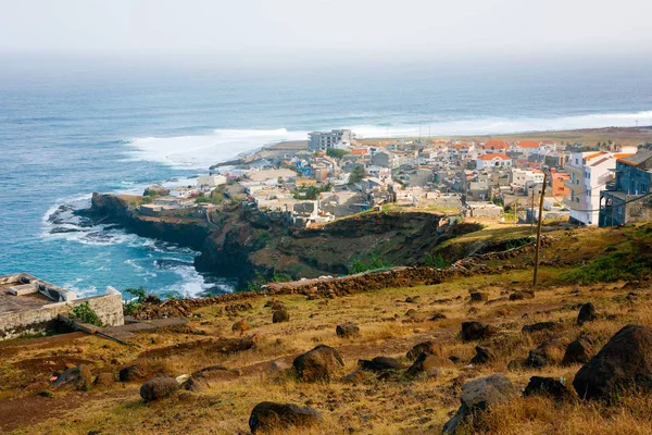
Ponta Do Sol, View Of The Fishing Village At The Atlantic Ocean, Santo Antao Island
Image, 7.34MB, 3600 × 2400 jpg

Santo Antao Island In The North Atlantic Ocean On A Topographic, OSM Humanitarian Style Map
Image, 0.97MB, 2880 × 1620 jpg
Page 3