photo free
Home Images Vectors Videos

Stock image Southern Route page 3

stock image Hot Desert Road

Hot Desert Road

Image, 6.56MB, 4200 × 2803 jpg
stock image Empty road in the southern hilly-mountainous area on a hot summe

Empty Road In The Southern Hilly-mountainous Area On A Hot Summe

Image, 3.01MB, 2592 × 1944 jpg
stock image A Welcome to North Carolina sign on the highway marking the state border with Tennessee.

A Welcome To North Carolina Sign On The Highway Marking The State Border With Tennessee.

Image, 24.25MB, 6240 × 4160 jpg
stock image Linn Cove Viaduct

Linn Cove Viaduct

Image, 7.25MB, 2848 × 4049 jpg
stock image Kelbaker Road Approaches Needles Freeway US 40 California Desert

Kelbaker Road Approaches Needles Freeway US 40 California Desert

Image, 10.77MB, 6047 × 3372 jpg
stock image Interstate 10 sign.

Interstate 10 Sign.

Image, 10.59MB, 4096 × 4096 jpg
stock image Tour in the mountains

Tour In The Mountains

Image, 4.11MB, 3780 × 2362 jpg
stock vector Final dash circuit wallpaper

Final Dash Circuit Wallpaper

Vector, 6.45MB, 4134 × 4134 eps
stock image asphalt road with text welcome to colombia near yellow line.

Asphalt Road With Text Welcome To Colombia Near Yellow Line.

Image, 23.13MB, 6300 × 4204 jpg
stock image Steenbras, near Gordons Bay, Western cape, South Africa. December 2019. Clarence Drive a picturesque drive over Steenbras Bridge on the R44 highway towards Hermanus, South Africa

Steenbras, Near Gordons Bay, Western Cape, South Africa. December 2019. Clarence Drive A Picturesque Drive Over Steenbras Bridge On The R44 Highway Towards Hermanus, South Africa

Image, 15.98MB, 6053 × 3891 jpg
stock image Slope Point, the southern place in New Zealand

Slope Point, The Southern Place In New Zealand

Image, 9.67MB, 5472 × 3648 jpg
stock image Florida, USA: Welcome to Florida sign next to highway with palm trees around

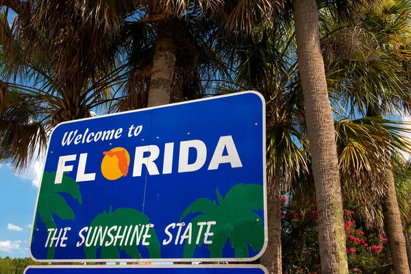
Florida, USA: Welcome To Florida Sign Next To Highway With Palm Trees Around

Image, 0MB, 6300 × 4200 jpg
stock image Sceninc road along Lake Pukaki goes all the way under the Southern Alps of New Zealand with the highest mountain Mt Cook, Aoraki

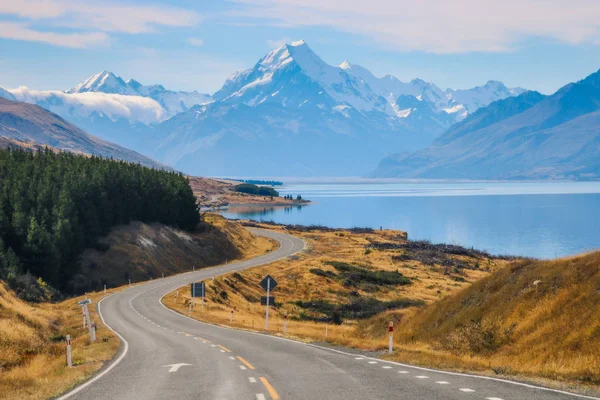
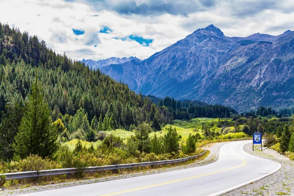
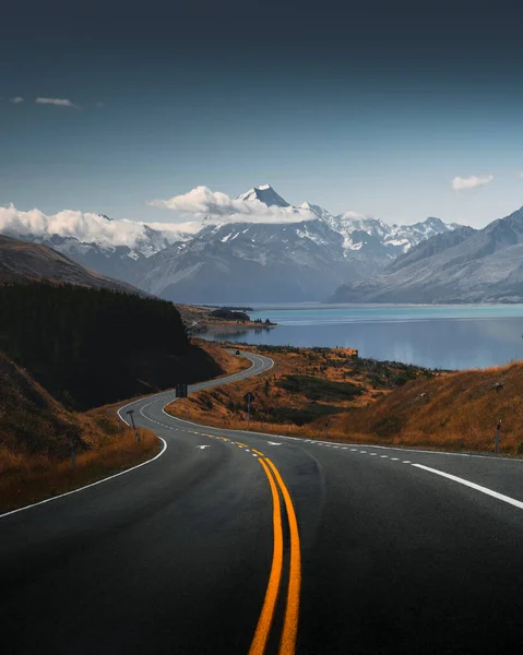
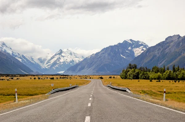
Sceninc Road Along Lake Pukaki Goes All The Way Under The Southern Alps Of New Zealand With The Highest Mountain Mt Cook, Aoraki

Image, 5.19MB, 3854 × 2570 jpg
stock image North Downs Way signpost

North Downs Way Signpost

Image, 11.01MB, 4408 × 2939 jpg
stock vector Final dash circuit wallpaper

Final Dash Circuit Wallpaper

Vector, 1.44MB, 4134 × 4134 eps
stock image Romania mountain road

Romania Mountain Road

Image, 2.27MB, 3012 × 2008 jpg
stock image Road along Lake Wakatipu

Road Along Lake Wakatipu

Image, 16.2MB, 5759 × 3839 jpg
stock vector Highway motosport circuit wallpaper

Highway Motosport Circuit Wallpaper

Vector, 1.44MB, 4134 × 4134 eps
stock image Traffic in a freeway on a cloudy day in California, USA

Traffic In A Freeway On A Cloudy Day In California, USA

Image, 3.29MB, 3105 × 2000 jpg
stock image Ruta 40. The road passes through picturesque landscapes. Argentina. Forests and mountains surround the famous highway 40. Travel to South America.

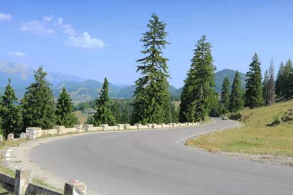
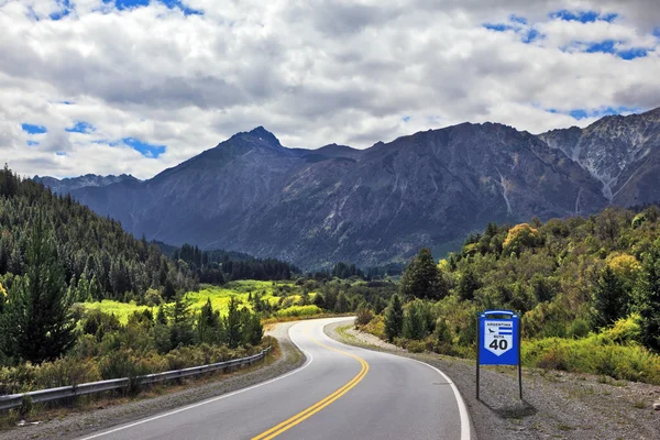
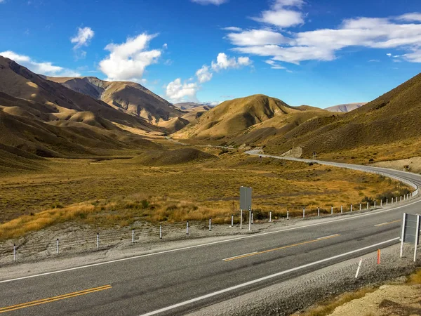
Ruta 40. The Road Passes Through Picturesque Landscapes. Argentina. Forests And Mountains Surround The Famous Highway 40. Travel To South America.

Image, 16.65MB, 5184 × 3456 jpg
stock vector Speed track background

Speed Track Background

Vector, 1.41MB, 4134 × 4134 eps
stock image Beautiful view of a road leading to Mount Cook, New Zealand

Beautiful View Of A Road Leading To Mount Cook, New Zealand

Image, 20.91MB, 5200 × 6500 jpg
stock vector Vector - Compass signs and symbols logo

Vector - Compass Signs And Symbols Logo

Vector, 0.57MB, 5000 × 5000 eps
stock image Famous Route 40 paved road

Famous Route 40 Paved Road

Image, 12.49MB, 5616 × 3744 jpg
stock image The  Route 40, southern Argentina

The Route 40, Southern Argentina

Image, 12.49MB, 5616 × 3744 jpg
stock image Scenic road in Canterbury area, New Zealand

Scenic Road In Canterbury Area, New Zealand

Image, 1.1MB, 5184 × 3456 jpg
stock image South African road through the savannas and deserts with marking

South African Road Through The Savannas And Deserts With Marking

Image, 9.32MB, 5616 × 3744 jpg
stock image Highway 41 sign on the asphalt

Highway 41 Sign On The Asphalt

Image, 16.34MB, 7136 × 4763 jpg
stock image South Africa: the breathtaking african landscape seen from R319, the scenic Regional Route which lead to Cape Agulhas

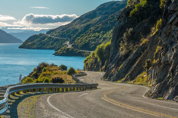
South Africa: The Breathtaking African Landscape Seen From R319, The Scenic Regional Route Which Lead To Cape Agulhas

Image, 7.77MB, 4288 × 2848 jpg
stock vector Race track circuit

Race Track Circuit

Vector, 1.35MB, 4134 × 4134 eps
stock image Group of cyclists descending from the Mount Teide

Group Of Cyclists Descending From The Mount Teide

Image, 14.74MB, 5739 × 3737 jpg
stock image Barstow Sign Route 66

Barstow Sign Route 66

Image, 11.88MB, 5530 × 3687 jpg
stock image View with a road near Lindis valley, New Zealand

View With A Road Near Lindis Valley, New Zealand

Image, 17.44MB, 5184 × 3456 jpg
stock image Cyclists riding along a scenic South African highway

Cyclists Riding Along A Scenic South African Highway

Image, 12.8MB, 6000 × 3903 jpg
stock image One of the most beautiful mountain roads in the world located in

One Of The Most Beautiful Mountain Roads In The World Located In

Image, 8.92MB, 4928 × 3264 jpg
stock image Global signpost world distances measured from the world's southernmost signpost in Bluff, New Zealand.

Global Signpost World Distances Measured From The World's Southernmost Signpost In Bluff, New Zealand.

Image, 6.08MB, 3872 × 2592 jpg
stock image Road perspective and Mt Cook

Road Perspective And Mt Cook

Image, 5.8MB, 4256 × 2830 jpg
stock image The Nullarbor Plain  is part of the area of flat, almost treeless, arid or semi-arid country of southern Australia. The only way from Western Australia to Cedun

The Nullarbor Plain Is Part Of The Area Of Flat, Almost Treeless, Arid Or Semi-arid Country Of Southern Australia. The Only Way From Western Australia To Cedun

Image, 7.12MB, 4458 × 2604 jpg
stock image Hand Holding Compass

Hand Holding Compass

Image, 7.92MB, 5184 × 3456 jpg
stock image Encinitas CA

Encinitas CA

Image, 2.58MB, 2800 × 1867 jpg
stock image Traffic on 405 freeway in Los Angeles

Traffic On 405 Freeway In Los Angeles

Image, 7.98MB, 4000 × 2667 jpg
stock image North Downs Way path

North Downs Way Path

Image, 16.93MB, 5211 × 3744 jpg
stock vector Bloodstone thunder circuit wallpaper

Bloodstone Thunder Circuit Wallpaper

Vector, 1.45MB, 4134 × 4124 eps
stock image Road and Reykjanes lighthouse on Reykjanes Peninsula in Iceland

Road And Reykjanes Lighthouse On Reykjanes Peninsula In Iceland

Image, 11.78MB, 4600 × 3070 jpg
stock image The stunning brown landscape of the rolling hills and mountains

The Stunning Brown Landscape Of The Rolling Hills And Mountains

Image, 5.9MB, 3264 × 2448 jpg
stock image California Beach Crossing

California Beach Crossing

Image, 5.67MB, 3648 × 2736 jpg
stock vector Compass signs and symbols logo  vector app icons -

Compass Signs And Symbols Logo Vector App Icons -

Vector, 0.69MB, 5000 × 4000 eps
stock vector Three yellow race circuit background

Three Yellow Race Circuit Background

Vector, 6.15MB, 4134 × 4134 eps
stock image Transfagarasan Road, Romania

Transfagarasan Road, Romania

Image, 4.71MB, 3012 × 2008 jpg
stock image Mount Cook, New Zealand

Mount Cook, New Zealand

Image, 9.29MB, 5000 × 3332 jpg
Previous << Page 3 >> Next