
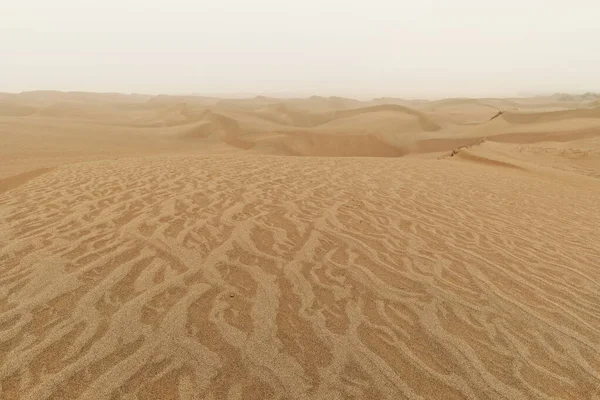
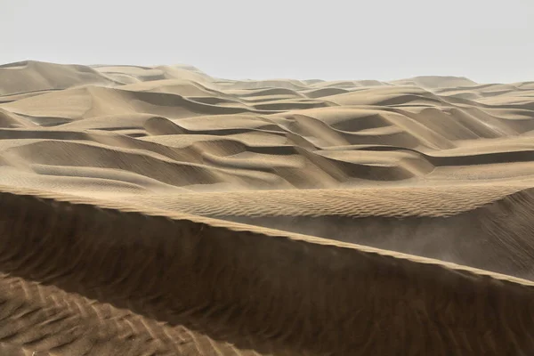
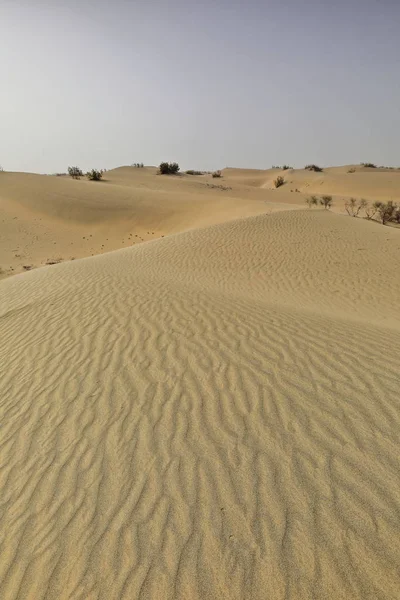
Stock image Taklamakan Desert


Lonely Desert Poplar-Populus Euphratica Deciduous Tree With Bent-forked Double Stem Growing On The Slope Of A Sand Dune In The Taklamakan Desert. Keriya County-Xinjiang Uyghur Autonomous Region-China.
Image, 13.32MB, 5100 × 3400 jpg
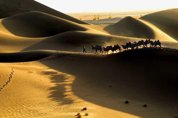
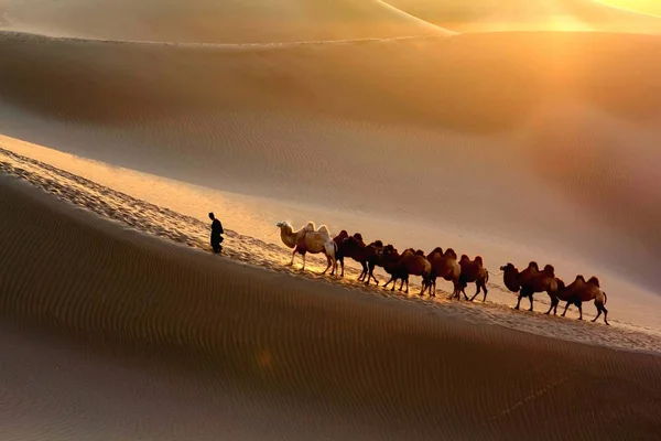
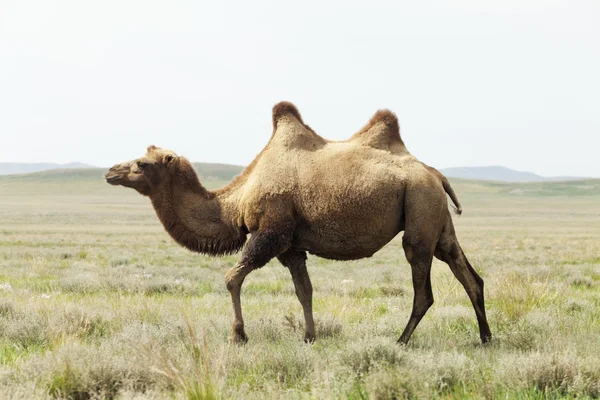
Camels Walk In The Taklamakan Desert, Also Known As Taklimakan And Teklimakan, In The Tarim Basin In Southwest China's Xinjiang Uyghur Autonomous Region, 29 October 2013
Image, 0.93MB, 5760 × 3840 jpg
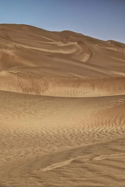
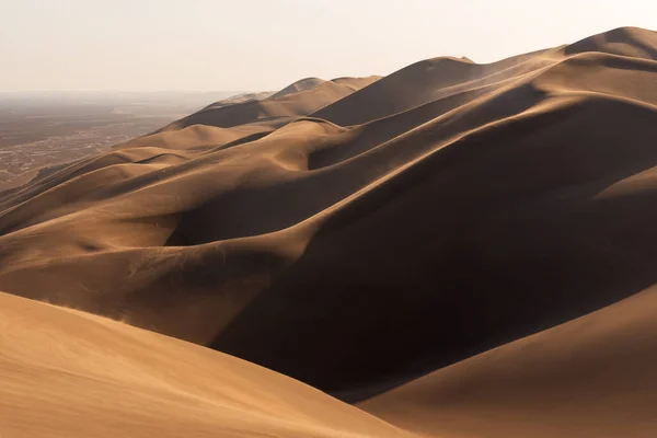
Diffused Light Of Morning Over Chains Of Moving Sand Dunes Covering The Surface Of The Taklamakan Desert Some Of Them Reaching Up To 300 Ms.high. Qiemo Cherchen County-Xinjiang Uyghur Region-China.
Image, 16.87MB, 5100 × 3400 jpg
Early Morning Light Over Chains Of Barchans-moving Sand Dunes Covering The Surface Of The Taklamakan Desert Some Of Them Reaching Up To 300 Ms.high. Qiemo Cherchen County-Xinjiang Uyghur Region-China.
Image, 8.09MB, 5100 × 3400 jpg
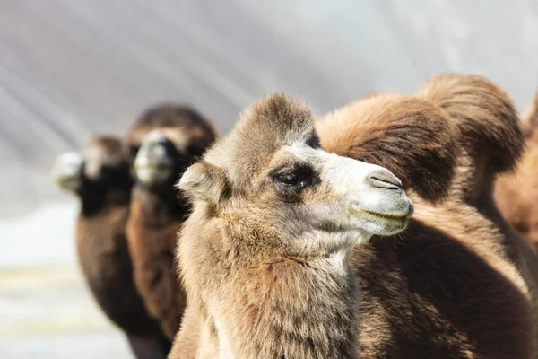
Camels Walk In The Taklamakan Desert, Also Known As Taklimakan And Teklimakan, In The Tarim Basin In Southwest China's Xinjiang Uyghur Autonomous Region, 29 October 2013
Image, 0.92MB, 5184 × 3456 jpg

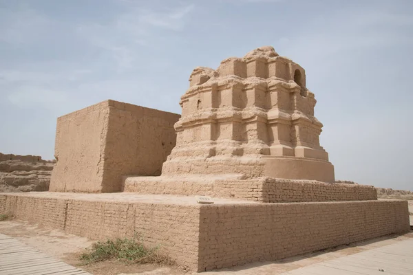
Ruins Of The Large Rectangular Tibetan Fort From The Tang Dinasty Active In The VIII-IX Centurys. Ancient Town Of Miran-old Caravan Track To Dunhuang-Southern Silk Road. Ruoqiang County-Xinjiang-China
Image, 13.5MB, 3600 × 5400 jpg
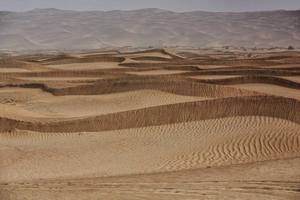
Moving Sand Dunes Cover The Surface Of The Taklamakan Desert Forming Chains Of These Eolian Topographic Forms-some Of Them Reaching Up To 300 Ms.high. Yutian Keriya County-Xinjiang Uyghur Region-China
Image, 13.63MB, 3400 × 5100 jpg
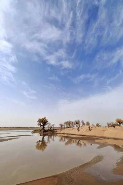
Keriya River Supplies Several Oases-flows N.into The TaklaMakan Desert To An Endorheic Delta Where It Gets Lost In The Sand. Keriya Yutian County-Hotan Pref.-Xinjiang Uyghur Autonomous Region-China.
Image, 9.53MB, 3400 × 5100 jpg
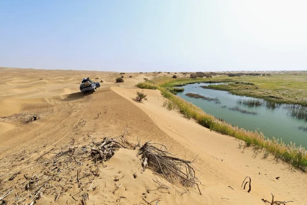
Keriya River Supplies Several Oases-flows N.into The TaklaMakan Desert To An Endorheic Delta Where It Gets Lost In The Sand-off Road Vehicles Running Along. Yutian County-Xinjiang Uyghur Region-China.
Image, 12.73MB, 5100 × 3400 jpg

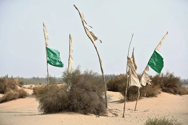
Votive Flags On Burial Mounds Mark The Sufi Mystic Imam Asim's Mazar-masoleum Area Among Windswept Sand Dunes At The Edge Of The Taklamakan Desert. Hotan City-Xinjiang Uyghur Autonomous Region-China.
Image, 8.06MB, 4500 × 3000 jpg
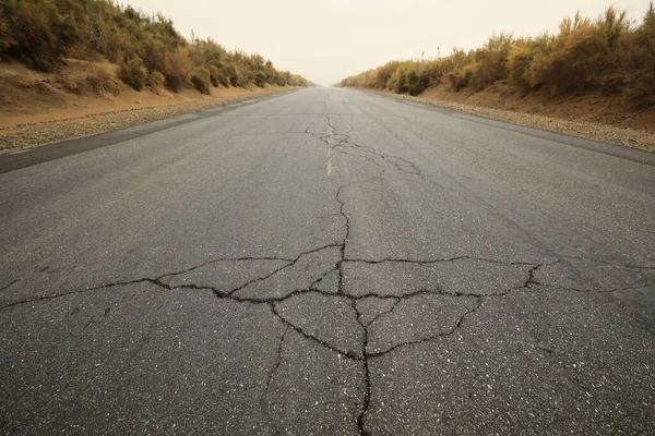
Taqie Highway-branch Of Lunmin Hwy.-tract Of Tarim Desert Hwy.crosses The Taklamakan Desert For 552 Km.from N.to S.linking Luntai And Minfeng Cities-serving The Tazhong Oilfield. Xinjiang Region-China
Image, 18.78MB, 5100 × 3400 jpg

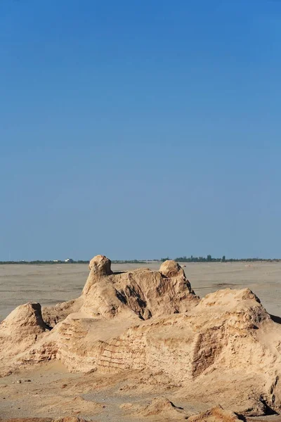
Ruins Of The Large Rectangular Tibetan Fort From The Tang Dinasty Active In The VIII-IX Centurys. Ancient Town Of Miran-old Caravan Track To Dunhuang-Southern Silk Road. Ruoqiang County-Xinjiang-China
Image, 13.4MB, 3600 × 5400 jpg
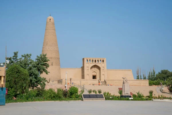
Emin Tower Standing In Uyghur Mosque Located In Grape Yard In Ancient Turpan, Xinjiang, China.
Image, 16.4MB, 6016 × 4016 jpg

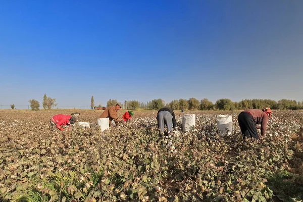
Qiemo, China-October 10, 2017: Uyghur Farmers Pick Cotton By Hand In A Field On The Outskirts Of Town To Put It Into Large Plastic Sacks-then To Load Them On Trailer Trucks-carry To The Cotton Gin.
Image, 17.4MB, 5400 × 3600 jpg

Cotton Field On The Qiemo-Cherchen-Qarqan Town Outskirts About To Be Harvested Showing White Cotton Fibers In Bolls Closed And Open Lined By Populus Alba Pyramidalis-white Poplar Trees. Xinjiang-China
Image, 18.1MB, 5400 × 3600 jpg
Qiemo, China-October 10, 2017: Uyghur Farmers Pick Cotton By Hand In A Field On The Outskirts Of Town To Put It Into Large Plastic Sacks-then To Load Them On Trailer Trucks-carry To The Cotton Gin.
Image, 16.82MB, 5400 × 3600 jpg

View From Nature And Landscapes Of Dasht E Lut Or Sahara Desert At Sunset. Middle East Desert
Image, 8.95MB, 6016 × 4016 jpg
Shifting Sand Dunes-nitre Bushes-Takla Makan Desert. Hotan Prefecture-Xinjiang Uyghur Region-China-0009
Image, 18.08MB, 3400 × 5100 jpg

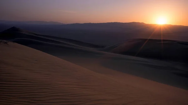
Diffused Sunrise Light-Taklamakan Shifting Dunes Along 233 Prov.Road Between Shamo Expwy.and 315 Nnal.Road Running N.and E.across The Desert. Qiemo Cherchen-Bayingolin Pref.-Xinjiang Uyghur Reg.-China
Image, 10.71MB, 3000 × 4500 jpg
Moving Sand Dunes Cover The Surface Of The Taklamakan Desert Forming Chains Of These Eolian Topographic Forms-some Of Them Reaching Up To 300 Ms.high. Yutian Keriya County-Xinjiang Uyghur Region-China
Image, 10.84MB, 3400 × 5100 jpg

Landscape Of Dunes In The Takla Makan (Taklamakan Or Taklimakan) Desert, Xinjiang Uygur Autonomous Region, October 25, 2007
Image, 2.35MB, 3888 × 2592 jpg
View From Nature And Landscapes Of Dasht E Lut Or Sahara Desert. Middle East Desert
Image, 6.23MB, 5746 × 3836 jpg
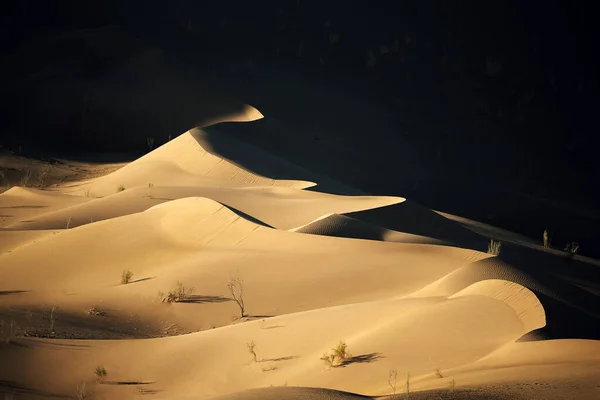
Moving Sand Dunes Cover The Surface Of The Taklamakan Desert Forming Chains Of These Eolian Topographic Forms-some Of Them Reaching Up To 300 Ms.high. Yutian Keriya County-Xinjiang Uyghur Region-China
Image, 11.68MB, 5100 × 3400 jpg
View From Nature And Landscapes Of Dasht E Lut Or Sahara Desert At Sunset. Middle East Desert
Image, 7.02MB, 6016 × 3384 jpg

Ruins Of Ancient Gaochang City, Turpan, China. Dating More Than 2000 Years, Gaochang And Jiaohe Are The Oldest And Largest Ruins In Xinjiang. The Flaming Mountains Are Visible In The Background
Image, 16.4MB, 6016 × 4016 jpg
View From Nature And Landscapes Of Dasht E Lut Or Sahara Desert. Middle East Desert
Image, 15.91MB, 6016 × 4016 jpg


Nature And Landscapes Of Dasht E Lut Or Sahara Desert With Sand Dunes In Foreground And Hazy Sky
Image, 9.23MB, 5421 × 3049 jpg
Kuche Subash Buddhist Ruins Landscape Breathtaking Picturesque View Point
Image, 4.67MB, 3000 × 2002 jpg
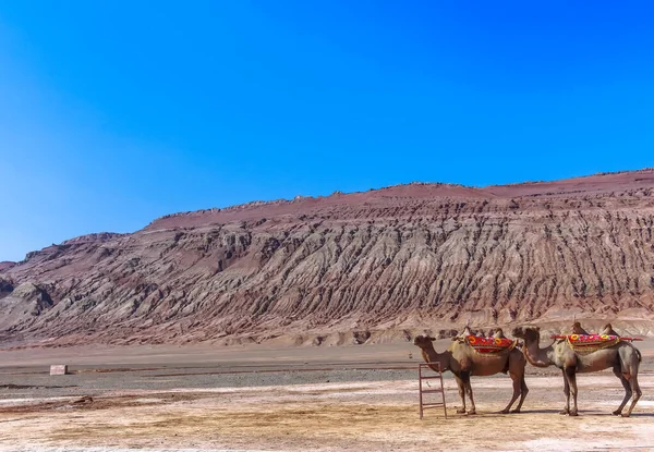
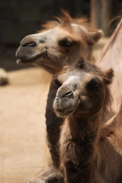
Bactrian Camels Were The Principal Means Of Transportation For The Historic Silk Road, Now Serving Transportation For Tourist
Image, 7.49MB, 4994 × 3456 jpg


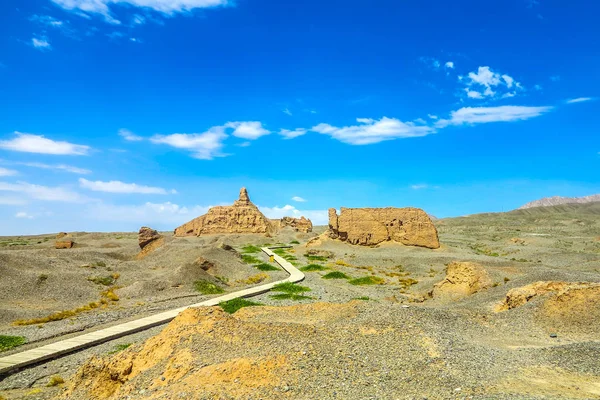
Ruins Of Rawak Stupa And Vihara-Taklamakan Desert. Xinjiang Uyghur Region-China-0030
Image, 10.4MB, 4500 × 3000 jpg
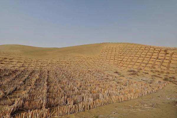
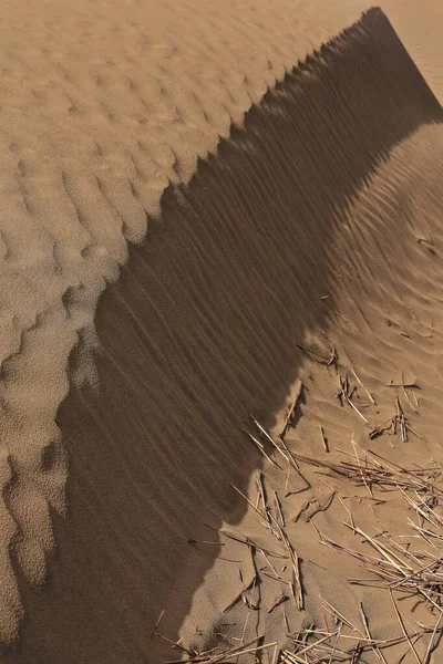
Straw Checkerboard Sand Control Barriers. Hotan Prefecture-Xinjiang Uyghur Region-China-0002
Image, 16.86MB, 5100 × 3400 jpg
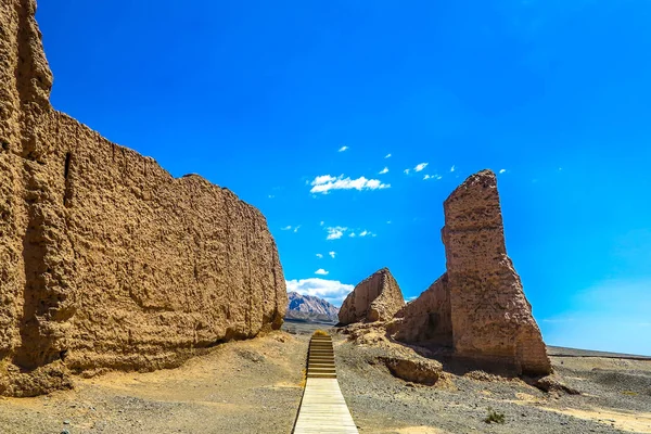
Kuche Subash Buddhist Ruins Landscape Breathtaking Picturesque View Point
Image, 4.86MB, 3000 × 2002 jpg

A Car Or Suv Is Drifting An Sands And Splashing Sands On Air And Around In Dasht E Lut Or Sahara Desert.
Image, 3.63MB, 4060 × 2645 jpg

Kuche Subash Buddhist Ruins Landscape Breathtaking Picturesque View Point
Image, 4.34MB, 3000 × 2002 jpg


Ruins Of Ancient Gaochang City, Turpan, China. Dating More Than 2000 Years, Gaochang And Jiaohe Are The Oldest And Largest Ruins In Xinjiang. The Flaming Mountains Are Visible In The Background
Image, 14.43MB, 6016 × 4016 jpg

Keriya County, China-October 5, 2017: Car-pushing Drivers Unstuck A Green Off-road Car For Touristic Service Stuck In Sand While Driving Through The Treacherous Loose Dunes Of The Taklamakan Desert.
Image, 11.75MB, 5100 × 3400 jpg


Ruins Of Ancient Gaochang City, Turpan, China. Dating More Than 2000 Years, Gaochang And Jiaohe Are The Oldest And Largest Ruins In Xinjiang. The Flaming Mountains Are Visible In The Background
Image, 15.79MB, 6016 × 4016 jpg
Page 1 >> Next