
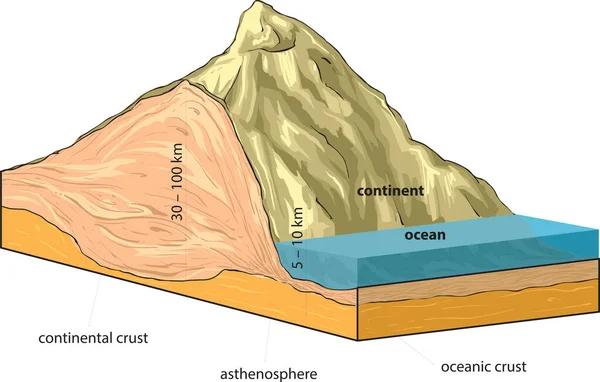
Stock image Tectonic Formation page 2
Types Of Plate Boundaries. Transform Boundaries (Conservative) Occur Where Two Lithospheric Plates Slide, Grind Past Each Other Along Transform Faults, Where Plates Are Neither Created Nor Destroyed. 3d Rendering
Image, 4.87MB, 5511 × 3100 jpg

Different Types Of Plate Boundaries: Convergent Boundaries, Terrain Section, 3d Render. Tectonic Plates, Side Sliding Margin, Earthquake
Image, 11.27MB, 5511 × 3324 jpg


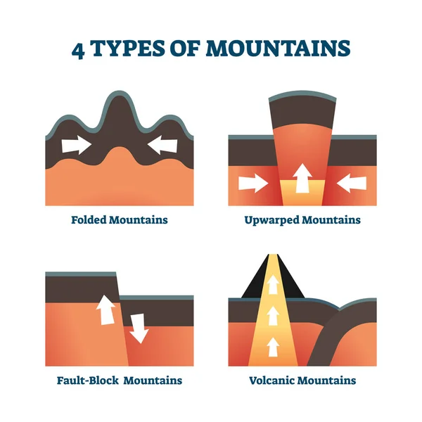
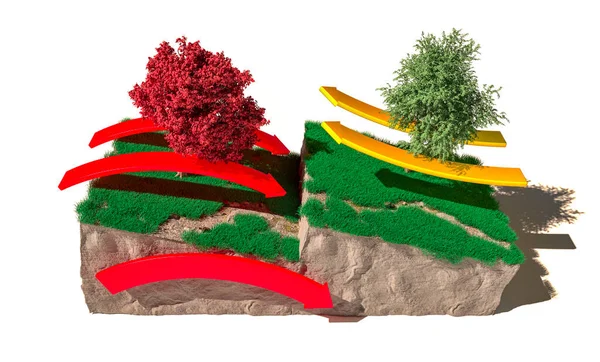
Four Types Of Mountains Vector Illustration. Labeled Formation Explanation.
Vector, 5.53MB, 4000 × 4000 eps

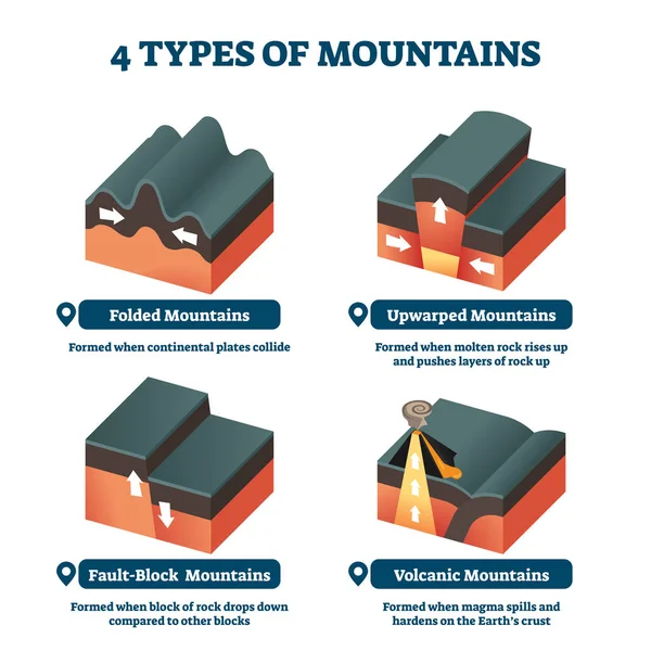
Four Types Of Mountains Vector Illustration. Labeled Formation Explanation.
Vector, 5.96MB, 4000 × 4000 eps
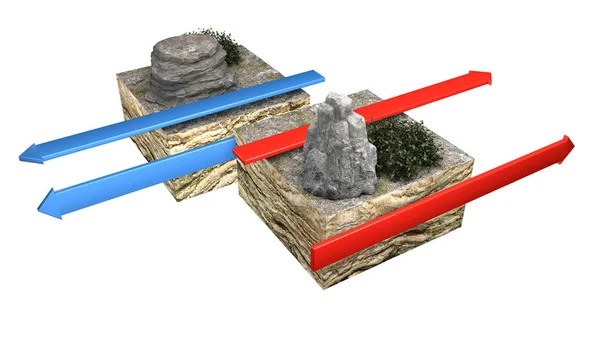
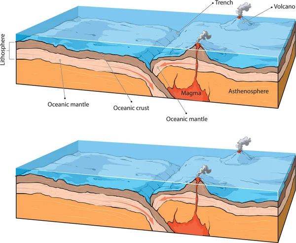
Types Of Plate Boundaries. Convergent Boundaries (Destructive) (or Active Margins) Occur Where Two Plates Slide Toward Each Other To Form Either A Subduction Zone (one Plate Moving Underneath The Other) Or A Continental Collision. 3d Rendering
Image, 6.07MB, 4675 × 3100 jpg
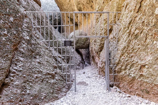
South Entrance Of Balconies Cave. Pinnacles National Park, California, USA.
Image, 23.63MB, 6497 × 4331 jpg

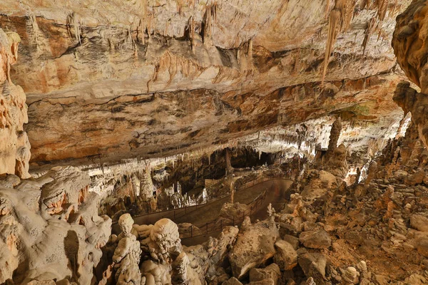
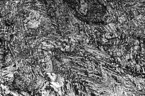
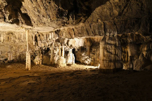
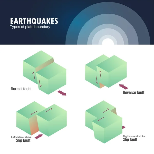


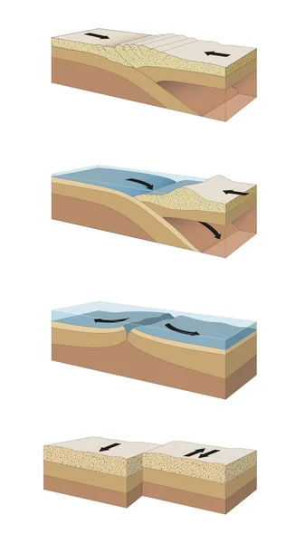

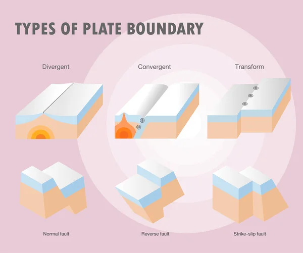
Plate Boundaries Vector Illustration. Labeled Tectonic Movement Comparison.
Vector, 5.64MB, 4000 × 4000 eps


Saint Beatus, Canton Bern, Switzerland, February 12, 2023 Incredible Beautiful Rock Formations Inside The Popular Saint Beatus Caves Near Interlaken At The Lake Of Thun
Image, 5.73MB, 5568 × 3712 jpg

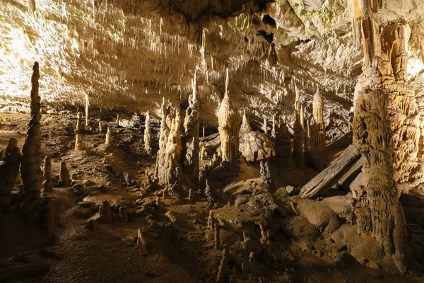
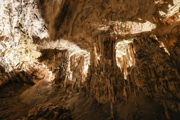
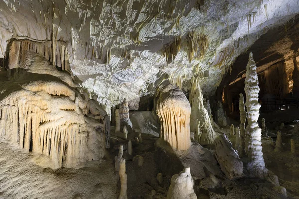
World Famous Cave Postojna In Slovenia With Stalactites And Stalagmites
Image, 17.91MB, 6661 × 4441 jpg
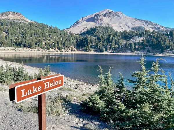
Lassen Volcanic National Park, California. Lake Helen With Sign. Lassen Peak Is A Cinder Cone Volcano. The Vulcans Eye Is The Rock Formation At The Beginning Of The Lassen Trail.
Image, 5.87MB, 4032 × 3024 jpg
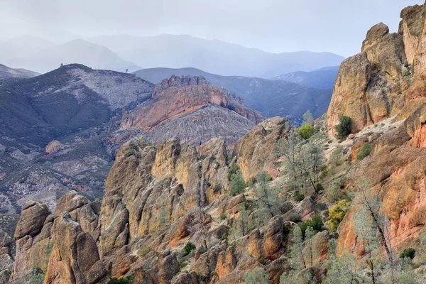
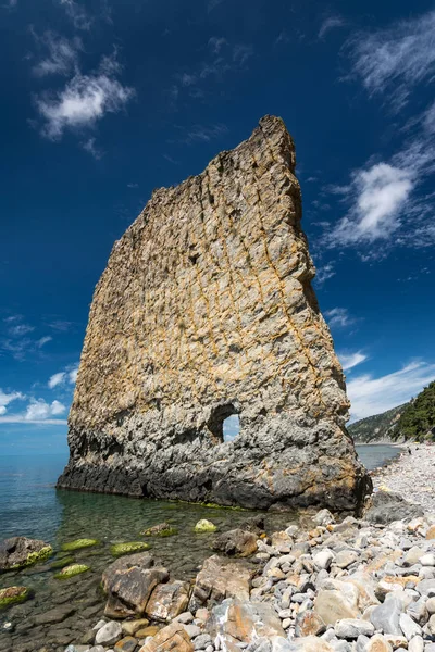
Volcanic Rocks At High Peaks On A Winter Sunset. Pinnacles National Park, San Benito County, California, USA.
Image, 18.69MB, 6720 × 4480 jpg


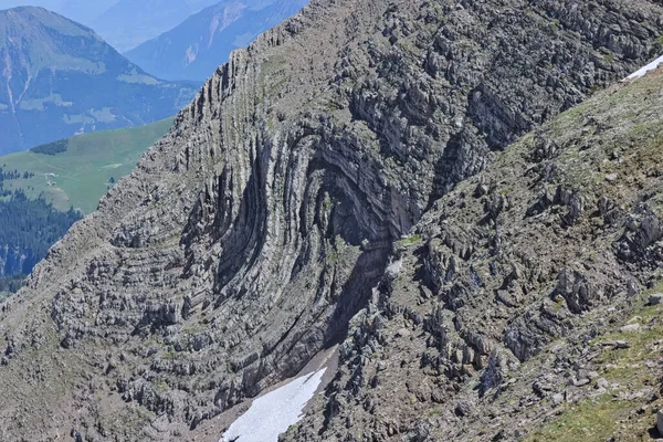
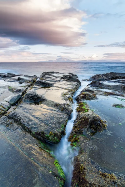
Rock Folded Into Syncline In Alpine Swiss Mountains. S-Fold Found At Steep Mountain Side.
Image, 27.5MB, 6016 × 4012 jpg

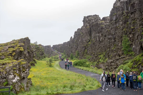
Thingvellir, Iceland - July 19, 2017: Tourists Walk Through The Almannagja Fault Line In The Mid-atlantic Ridge North American Plate In Thingvellir National Park. Iceland
Image, 13.83MB, 5644 × 3740 jpg

Geological Layers Of Earth - Layered Rock Background. Rock Layer Sediment. Layer Of Yellow Sand. Crust Of The Earth. Strata, Slate Or Shale Rock Layers.
Image, 21.19MB, 5184 × 3456 jpg


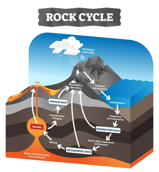
Rock Cycle Vector Illustration. Educational Labeled Geology Process Scheme.
Vector, 5.98MB, 4000 × 4320 eps
World Famous Cave Postojna In Slovenia With Stalactites And Stalagmites
Image, 16.64MB, 6720 × 4480 jpg

Previous << Page 2 >> Next