photo free
Home Images Vectors Videos

Stock image Tectonics

stock image Pangea, Laurasia, Gondwana, continental drift, diagram-illustration, isolated image on a white background

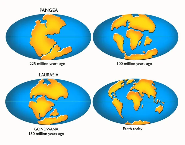
Pangea, Laurasia, Gondwana, Continental Drift, Diagram-illustration, Isolated Image On A White Background

Image, 4.49MB, 5750 × 4500 jpg
stock image World map in the Raisz-Armadillo projection centered on 170 West longitude. Satellite imagery A - composite of raster with graticule and tectonic plates borders. 3D illustration

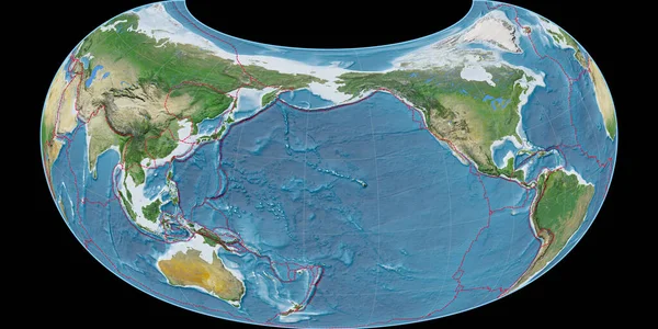
World Map In The Raisz-Armadillo Projection Centered On 170 West Longitude. Satellite Imagery A - Composite Of Raster With Graticule And Tectonic Plates Borders. 3D Illustration

Image, 8.78MB, 4000 × 2000 jpg
stock vector Plate Tectonics World

Plate Tectonics World

Vector, 3.99MB, 9000 × 5495 eps
stock vector Plate Tectonics German

Plate Tectonics German

Vector, 4.17MB, 9000 × 5495 eps
stock image Cliffs of Color

Cliffs Of Color

Image, 7.41MB, 3424 × 2568 jpg
stock image Outburst of boiling metal

Outburst Of Boiling Metal

Image, 4.78MB, 2784 × 1848 jpg
stock image Volcanic Landscape Bolivia

Volcanic Landscape Bolivia

Image, 14.81MB, 3744 × 5616 jpg
stock image Volcanic lava

Volcanic Lava

Image, 7.4MB, 3000 × 3000 jpg
stock image World map in the Van Der Grinten projection centered on 11 East longitude. Bilevel topographic map - raw composite of raster with graticule. 3D illustration

World Map In The Van Der Grinten Projection Centered On 11 East Longitude. Bilevel Topographic Map - Raw Composite Of Raster With Graticule. 3D Illustration

Image, 2.1MB, 4000 × 2000 jpg
stock image World map in the Winkel Tripel projection centered on 11 East longitude. Satellite imagery B - raw composite of raster with graticule. 3D illustration

World Map In The Winkel Tripel Projection Centered On 11 East Longitude. Satellite Imagery B - Raw Composite Of Raster With Graticule. 3D Illustration

Image, 9.18MB, 4000 × 2000 jpg
stock image World map in the Braun Stereographic projection centered on 11 East longitude. Mean annual temperature map - raw composite of raster with graticule. 3D illustration

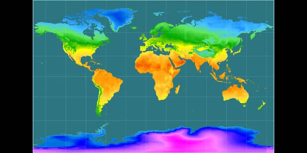
World Map In The Braun Stereographic Projection Centered On 11 East Longitude. Mean Annual Temperature Map - Raw Composite Of Raster With Graticule. 3D Illustration

Image, 3.4MB, 4000 × 2000 jpg
stock image Eruption of the volcano. Shot from space. Elements of this image

Eruption Of The Volcano. Shot From Space. Elements Of This Image

Image, 1.48MB, 2254 × 2248 jpg
stock vector Seismic activity infographics vector illustration with sound waves, graphs and topological relief on white background

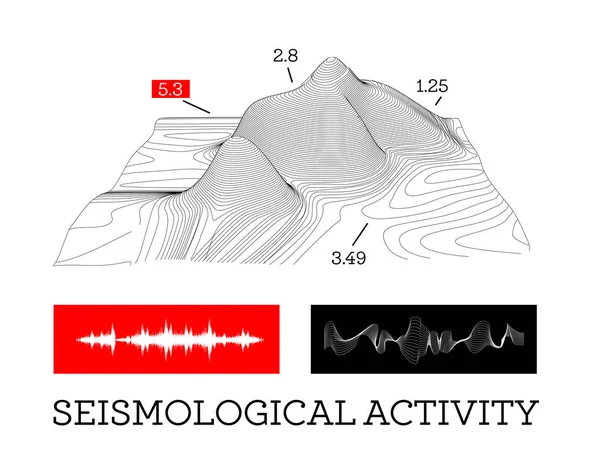
Seismic Activity Infographics Vector Illustration With Sound Waves, Graphs And Topological Relief On White Background

Vector, 0.99MB, 5000 × 3900 eps
stock image lava seamless texture

Lava Seamless Texture

Image, 21.51MB, 6000 × 6000 jpg
stock image Seamless lava texture

Seamless Lava Texture

Image, 6.65MB, 5000 × 5000 jpg
stock image Seismological activity lines human hand

Seismological Activity Lines Human Hand

Image, 2.19MB, 5006 × 3337 jpg
stock image red volcanic rock

Red Volcanic Rock

Image, 3.37MB, 2000 × 2000 jpg
stock image Beautiful landscape of Menengai Crater, Nakuru, Kenya

Beautiful Landscape Of Menengai Crater, Nakuru, Kenya

Image, 17.61MB, 5760 × 3840 jpg
stock image Aerial View to the Blue Salty Lake, Djibouti

Aerial View To The Blue Salty Lake, Djibouti

Image, 6.75MB, 4000 × 2250 jpg
stock image Tectonic plates move constantly, making new areas of ocean floor, building mountains, causing earthquakes, and creating volcanoes. 3d rendering. Map. Element of this image are furnished by Nasa

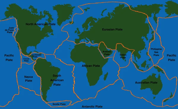
Tectonic Plates Move Constantly, Making New Areas Of Ocean Floor, Building Mountains, Causing Earthquakes, And Creating Volcanoes. 3d Rendering. Map. Element Of This Image Are Furnished By Nasa

Image, 9.22MB, 5014 × 5010 jpg
stock image Red-hot molten lava flow - seamless texture perfect for 3D modeling and rendering

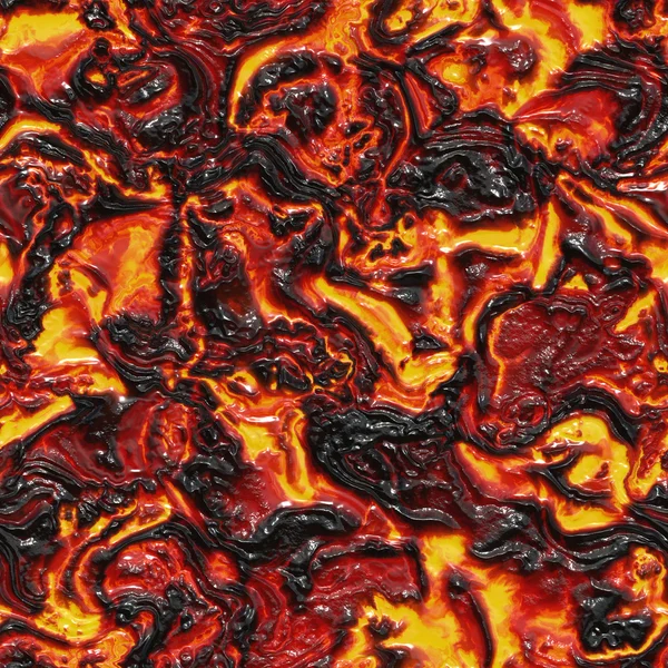
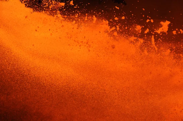
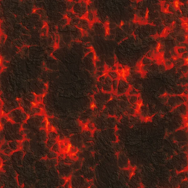
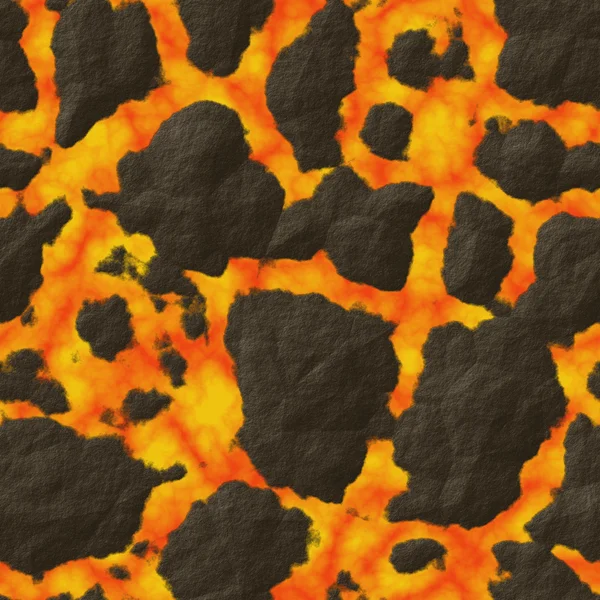
Red-hot Molten Lava Flow - Seamless Texture Perfect For 3D Modeling And Rendering

Image, 11.13MB, 4000 × 4000 jpg
stock image World map in the Gall Stereographic projection centered on 11 East longitude. Colored shader, elevation map - raw composite of raster with graticule. 3D illustration

World Map In The Gall Stereographic Projection Centered On 11 East Longitude. Colored Shader, Elevation Map - Raw Composite Of Raster With Graticule. 3D Illustration

Image, 7.47MB, 4000 × 2000 jpg
stock image Earth structure, division into layers, the earth's crust and core. 3d rendering

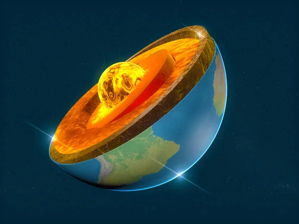
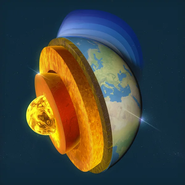
Earth Structure, Division Into Layers, The Earth's Crust And Core. 3d Rendering

Image, 15.61MB, 6299 × 4724 jpg
stock image Linn cove viaduct during winter near blowing rock nc

Linn Cove Viaduct During Winter Near Blowing Rock Nc

Image, 11.13MB, 4928 × 3264 jpg
stock image Seismological device sheet - Seismometer

Seismological Device Sheet - Seismometer

Image, 3.01MB, 5760 × 3840 jpg
stock image World map in the Gall Stereographic projection centered on 11 East longitude. Main physiographic landscape features - raw composite of raster with graticule. 3D illustration

World Map In The Gall Stereographic Projection Centered On 11 East Longitude. Main Physiographic Landscape Features - Raw Composite Of Raster With Graticule. 3D Illustration

Image, 7.6MB, 4000 × 2000 jpg
stock image Structure of the Earth

Structure Of The Earth

Image, 11.66MB, 4724 × 4724 jpg
stock vector Plate Tectonics World Map Faultlines

Plate Tectonics World Map Faultlines

Vector, 10.43MB, 9000 × 5495 eps
stock image The outcrop of rocks in the river.

The Outcrop Of Rocks In The River.

Image, 8.8MB, 4368 × 2912 jpg
stock image A geological fold in sedimentary rock. The fold is in a cliff above a river. Many layers of sedimentary rock visible. Plants grow from the rock.

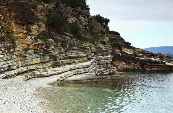
A Geological Fold In Sedimentary Rock. The Fold Is In A Cliff Above A River. Many Layers Of Sedimentary Rock Visible. Plants Grow From The Rock.

Image, 8.39MB, 3600 × 2400 jpg
stock vector illustration of how himalayan mountains were formed

Illustration Of How Himalayan Mountains Were Formed

Vector, 6.53MB, 5312 × 6919 eps
stock image Crane on work site

Crane On Work Site

Image, 9.48MB, 3744 × 5616 jpg
stock image Thingvellir National Park

Thingvellir National Park

Image, 8.21MB, 3982 × 2730 jpg
stock image Sedimentary geology

Sedimentary Geology

Image, 13.14MB, 4500 × 2941 jpg
stock image Thingvellir rocks in Golden Circle of Iceland

Thingvellir Rocks In Golden Circle Of Iceland

Image, 13.22MB, 5184 × 3456 jpg
stock image World map in the Miller Cylindrical projection centered on 11 East longitude. Mean annual temperature map - raw composite of raster with graticule. 3D illustration

World Map In The Miller Cylindrical Projection Centered On 11 East Longitude. Mean Annual Temperature Map - Raw Composite Of Raster With Graticule. 3D Illustration

Image, 3.05MB, 4000 × 2000 jpg
stock image an image of construction zone and building

An Image Of Construction Zone And Building

Image, 0MB, 4992 × 3328 jpg
stock image Galapagos Islands area enlarged and glowed on a darkened background of its surroundings. Relief map

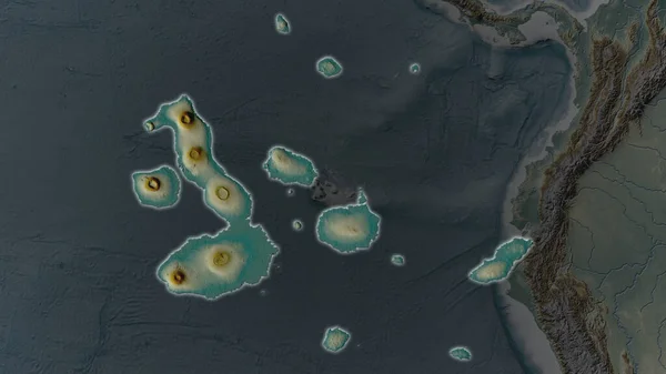
Galapagos Islands Area Enlarged And Glowed On A Darkened Background Of Its Surroundings. Relief Map

Image, 1.77MB, 3840 × 2160 jpg
stock image Linn cove viaduct during winter near blowing rock nc

Linn Cove Viaduct During Winter Near Blowing Rock Nc

Image, 8.77MB, 3264 × 4928 jpg
stock image plane, avia, sky, gold, industry, fly

Plane, Avia, Sky, Gold, Industry, Fly

Image, 2.34MB, 5092 × 2500 jpg
stock image Magnificent earth in outer space. The elements of this image fur

Magnificent Earth In Outer Space. The Elements Of This Image Fur

Image, 2.37MB, 3000 × 2228 jpg
stock image Seismological device sheet - Seismometer

Seismological Device Sheet - Seismometer

Image, 3.04MB, 5760 × 3840 jpg
stock image Seismological device sheet - Seismometer

Seismological Device Sheet - Seismometer

Image, 4.67MB, 3422 × 4045 jpg
stock image World map in the Ortelius Oval projection centered on 90 West longitude. Bilevel topographic map - composite of raster with graticule and tectonic plates borders. 3D illustration

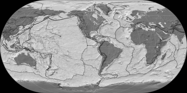
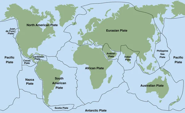
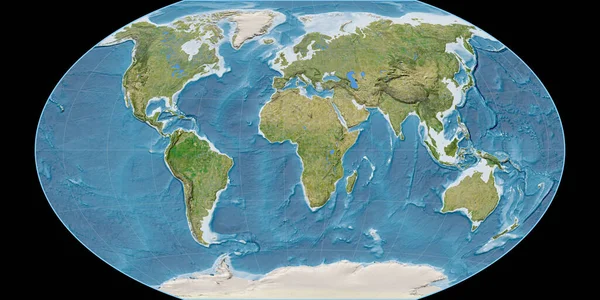
World Map In The Ortelius Oval Projection Centered On 90 West Longitude. Bilevel Topographic Map - Composite Of Raster With Graticule And Tectonic Plates Borders. 3D Illustration

Image, 4.7MB, 4000 × 2000 jpg
stock image Lava texture

Lava Texture

Image, 12.58MB, 4500 × 3000 jpg
stock image Volcano section

Volcano Section

Image, 5.81MB, 3448 × 4724 jpg
stock image Fire hot alien planet with volcanic activity, 3d render

Fire Hot Alien Planet With Volcanic Activity, 3d Render

Image, 9.76MB, 6796 × 5000 jpg
stock image Eruption of the Fagradalsfjall volcano seen from Reykjavik at dusk

Eruption Of The Fagradalsfjall Volcano Seen From Reykjavik At Dusk

Image, 4.95MB, 2835 × 4252 jpg
stock vector Seismogram of the earthquake. Seismic activity record. Vector illustration.

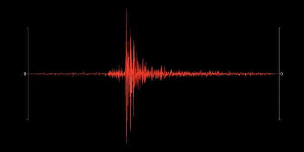
Seismogram Of The Earthquake. Seismic Activity Record. Vector Illustration.

Vector, 0.43MB, 6000 × 3000 eps
stock image Perishes planet earth, Armageddon. 3D render of hot liquid lava planet on black background

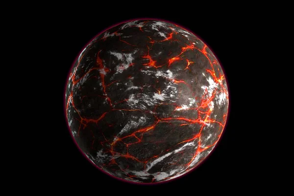
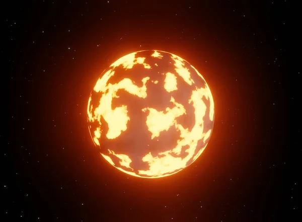
Perishes Planet Earth, Armageddon. 3D Render Of Hot Liquid Lava Planet On Black Background

Image, 1.93MB, 3240 × 2160 jpg
Page 1 >> Next