photo free
Home Images Vectors Videos

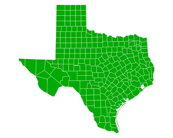
Stock image Texas Counties page 2

stock image Texas, USA hi res aerial view

Texas, USA Hi Res Aerial View

Image, 8.96MB, 3300 × 2550 jpg
stock vector Texas accurate vector exact detailed State Map with Community Assistance and Activates Icons Original pastel Illustration. United States of Americ

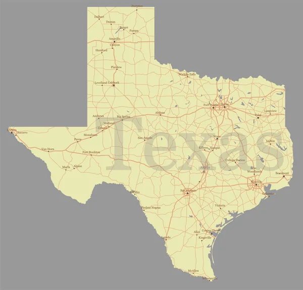
Texas Accurate Vector Exact Detailed State Map With Community Assistance And Activates Icons Original Pastel Illustration. United States Of Americ

Vector, 0.98MB, 5501 × 5272 eps
stock image California, USA  hi res aerial view

California, USA Hi Res Aerial View

Image, 8.47MB, 3300 × 2550 jpg
stock image Montana, USA hi res aerial view

Montana, USA Hi Res Aerial View

Image, 9.04MB, 3300 × 2550 jpg
stock image Iowa, USA hi res aerial view

Iowa, USA Hi Res Aerial View

Image, 13.41MB, 3300 × 3300 jpg
stock image Connecticut, USA hi res aerial view

Connecticut, USA Hi Res Aerial View

Image, 8.01MB, 3300 × 2550 jpg
stock image Maryland, USA hi res aerial view

Maryland, USA Hi Res Aerial View

Image, 7.4MB, 3300 × 2550 jpg
stock image Texas Map

Texas Map

Image, 2.85MB, 6000 × 6000 jpg
stock image Minnesota, USA hi res aerial view

Minnesota, USA Hi Res Aerial View

Image, 8.91MB, 3300 × 2550 jpg
stock image Alabama, USA hi res aerial view

Alabama, USA Hi Res Aerial View

Image, 8.71MB, 3300 × 2550 jpg
stock image Florida, USA hi res aerial view

Florida, USA Hi Res Aerial View

Image, 7.06MB, 3300 × 2550 jpg
stock image Virginia, USA hi res aerial view

Virginia, USA Hi Res Aerial View

Image, 8.16MB, 3300 × 2550 jpg
stock image USA counties.

USA Counties.

Image, 2.96MB, 2853 × 2015 jpg
stock image Illinois, USA hi res aerial view

Illinois, USA Hi Res Aerial View

Image, 8.72MB, 3300 × 2550 jpg
stock image Louisiana, USA hi res aerial view

Louisiana, USA Hi Res Aerial View

Image, 9.16MB, 3300 × 2550 jpg
stock image New Mexico, USA hi res aerial view

New Mexico, USA Hi Res Aerial View

Image, 9.11MB, 3300 × 2550 jpg
stock image Pennsylvania, USA hi res aerial view

Pennsylvania, USA Hi Res Aerial View

Image, 11.19MB, 3300 × 2550 jpg
stock image Maine, USA hi res aerial view

Maine, USA Hi Res Aerial View

Image, 8.32MB, 3300 × 2550 jpg
stock vector Accurate map of Texas

Accurate Map Of Texas

Vector, 0.78MB, 5000 × 4000 eps
stock image State of Wyoming, USA, hi res aerial view

State Of Wyoming, USA, Hi Res Aerial View

Image, 9.42MB, 3300 × 2550 jpg
stock vector Set 3 of 5 Division United States into counties, political and geographic subdivisions of a states, Highly detailed vector maps with names and territory nicknames

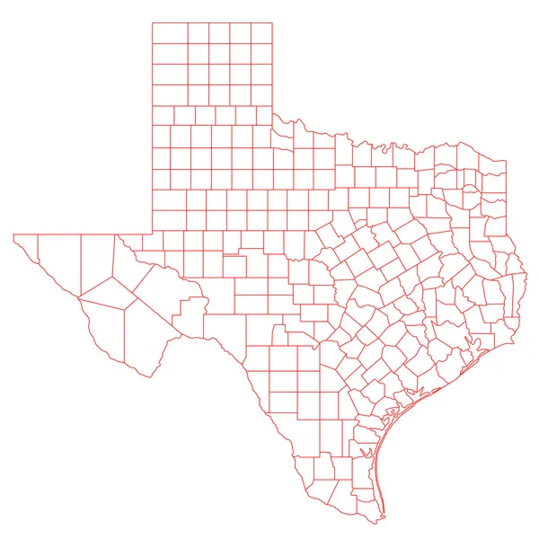
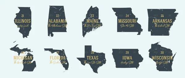
Set 3 Of 5 Division United States Into Counties, Political And Geographic Subdivisions Of A States, Highly Detailed Vector Maps With Names And Territory Nicknames

Vector, 10.09MB, 9585 × 4010 eps
stock image Mississippi, USA hi res aerial view

Mississippi, USA Hi Res Aerial View

Image, 9.36MB, 3300 × 2550 jpg
stock vector Modern City Map - Dallas Texas city of the USA with boroughs and

Modern City Map - Dallas Texas City Of The USA With Boroughs And

Vector, 7.78MB, 5000 × 5435 eps
stock vector Modern City Map - Fort Worth Texas city of the USA neighborhoods

Modern City Map - Fort Worth Texas City Of The USA Neighborhoods

Vector, 8.15MB, 5000 × 5768 eps
stock image New Hampshire, USA hi res aerial view

New Hampshire, USA Hi Res Aerial View

Image, 8.01MB, 3300 × 2550 jpg
stock image Tennessee, USA hi res aerial view

Tennessee, USA Hi Res Aerial View

Image, 8.21MB, 3300 × 2550 jpg
stock image New York state, USA hi res aerial view

New York State, USA Hi Res Aerial View

Image, 8.14MB, 3300 × 2550 jpg
stock vector Vector set 6 of 10 Highly detailed silhouettes of US state maps, divided into counties with names and territory nicknames

Vector Set 6 Of 10 Highly Detailed Silhouettes Of US State Maps, Divided Into Counties With Names And Territory Nicknames

Vector, 8.22MB, 9585 × 3348 eps
stock image Georgia, USA hi res aerial view

Georgia, USA Hi Res Aerial View

Image, 9.01MB, 3300 × 2550 jpg
stock image North Carolina, USA hi res aerial view

North Carolina, USA Hi Res Aerial View

Image, 7.8MB, 3300 × 2550 jpg
stock vector Colorful united staes administrative and political vector map.

Colorful United Staes Administrative And Political Vector Map.

Vector, 0.6MB, 5104 × 3262 eps
stock image Michigan, USA hi res aerial view

Michigan, USA Hi Res Aerial View

Image, 7.34MB, 3300 × 2550 jpg
stock image Kentucky, USA hi res aerial view

Kentucky, USA Hi Res Aerial View

Image, 9.29MB, 3300 × 2550 jpg
stock image South Carolina, USA hi res aerial view

South Carolina, USA Hi Res Aerial View

Image, 7.67MB, 3300 × 2550 jpg
stock image US State Maps Set II

US State Maps Set II

Image, 22MB, 7500 × 7500 jpg
stock vector Texas State isolated map. Black outlines on white background.

Texas State Isolated Map. Black Outlines On White Background.

Vector, 8.09MB, 5000 × 4810 eps
stock vector Set 3 of 5 Highly detailed vector silhouettes of USA state maps

Set 3 Of 5 Highly Detailed Vector Silhouettes Of USA State Maps

Vector, 9.07MB, 8858 × 3738 eps
stock vector Map of the United States of America

Map Of The United States Of America

Vector, 2.33MB, 5000 × 3123 ai
stock vector Arkansas

Arkansas

Vector, 0.92MB, 3644 × 3598 eps
stock vector road map of the US American State of New Mexico

Road Map Of The US American State Of New Mexico

Vector, 1.91MB, 3100 × 3516 eps
stock image Top view row of single family houses in residential area with fa

Top View Row Of Single Family Houses In Residential Area With Fa

Image, 8.55MB, 4056 × 3040 jpg
stock vector Modern City Map - Dallas Texas city of the USA with boroughs and

Modern City Map - Dallas Texas City Of The USA With Boroughs And

Vector, 7.77MB, 5000 × 5379 eps
stock image Aerial view well lined and branched of single-family detached homes in Cedar Hill, a city in Dallas and Ellis counties, 16 miles southwest of downtown Dallas. Color autumn leaves

Aerial View Well Lined And Branched Of Single-family Detached Homes In Cedar Hill, A City In Dallas And Ellis Counties, 16 Miles Southwest Of Downtown Dallas. Color Autumn Leaves

Image, 11.35MB, 4056 × 3040 jpg
stock vector Lubbock texas on blue background

Lubbock Texas On Blue Background

Vector, 0.07MB, 8400 × 5101 eps
stock vector Typography composition of city names, silhouettes maps of the states of America, vector detailed posters, Division Mountain and West South Central - Colorado, New Mexico, Texas - set 13 of 17

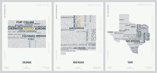
Typography Composition Of City Names, Silhouettes Maps Of The States Of America, Vector Detailed Posters, Division Mountain And West South Central - Colorado, New Mexico, Texas - Set 13 Of 17

Vector, 3.58MB, 8896 × 4168 eps
stock image Map of Kaufman County in Texas state on white background. single County map highlighted by black colour on Texas map. UNITED STATES, US

Map Of Kaufman County In Texas State On White Background. Single County Map Highlighted By Black Colour On Texas Map. UNITED STATES, US

Image, 6.5MB, 8000 × 8000 jpg
stock image Map of hood County in Texas state on white background. single County map highlighted by black colour on Texas map. UNITED STATES, US

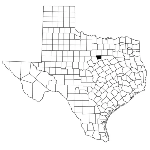
Map Of Hood County In Texas State On White Background. Single County Map Highlighted By Black Colour On Texas Map. UNITED STATES, US

Image, 6.5MB, 8000 × 8000 jpg
stock image Map of Jones County in Texas state on white background. single County map highlighted by black colour on Texas map. UNITED STATES, US

Map Of Jones County In Texas State On White Background. Single County Map Highlighted By Black Colour On Texas Map. UNITED STATES, US

Image, 6.5MB, 8000 × 8000 jpg
stock image Map of hudspeth County in Texas state on white background. single County map highlighted by black colour on Texas map. UNITED STATES, US

Map Of Hudspeth County In Texas State On White Background. Single County Map Highlighted By Black Colour On Texas Map. UNITED STATES, US

Image, 6.5MB, 8000 × 8000 jpg
stock image Map of clay County in Texas state on white background. single County map highlighted by black colour on Texas map. UNITED STATES, US

Map Of Clay County In Texas State On White Background. Single County Map Highlighted By Black Colour On Texas Map. UNITED STATES, US

Image, 6.5MB, 8000 × 8000 jpg
Previous << Page 2 >> Next