
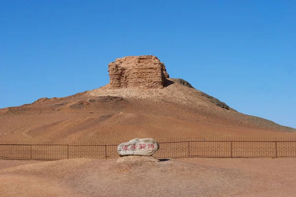
Stock image The Silk Road Landform

Zhangye Danxia National Geological Park In China - Colorful Hills And Amazing Landscape
Image, 3.38MB, 3000 × 2000 jpg
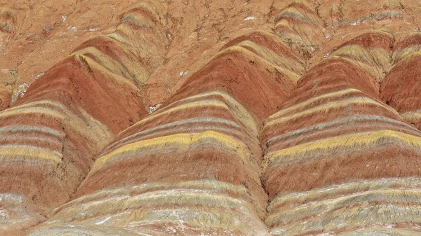
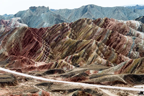
Spectacular Colorful Rusty Sandstone And Siltstone Landforms Of Zhangye Danxia-Red Cloud Nnal.Geological Park So Called Rainbow Mountains-E.foothills Of The Qilian Range. Zhangye-Gansu Province-China.
Image, 18.56MB, 5760 × 3240 jpg


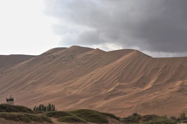
Tire Tracks In The Megadune Overlooking The East Shore Of Sumu Jaran Lake Illuminated By The Warm Light Of Sunset Under A Menacing Leaden Sky. Badain Jaran Desert-Alxa Plateau-Inner Mongolia-China.
Image, 11.71MB, 5400 × 3600 jpg

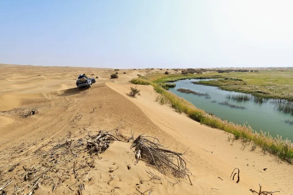
Keriya River Supplies Several Oases-flows N.into The TaklaMakan Desert To An Endorheic Delta Where It Gets Lost In The Sand-off Road Vehicles Running Along. Yutian County-Xinjiang Uyghur Region-China.
Image, 12.73MB, 5100 × 3400 jpg
Undulating Sands Of The Megadune Overlooking The W.shore Of Sumu Jaran Lake Illuminated By The Warm Light Of Sunset Under A Menacing Leaden Sky. Badain Jaran Desert-Alxa Plateau-Inner Mongolia-China.
Image, 10.16MB, 5400 × 3600 jpg
GANSU, CHINA - Apr 10 2015: Colourful Hills Scenic Area Of Zhangye National Geopark (Zhangye Danxia). The Danxia Landform Is Famous Landscape In Zhangye, Gansu, China.
Image, 16.33MB, 7360 × 4912 jpg

GANSU, CHINA - Apr 10 2015: Colourful Hills Scenic Area Of Zhangye National Geopark (Zhangye Danxia). The Danxia Landform Is Famous Landscape In Zhangye, Gansu, China.
Image, 13.28MB, 7360 × 4912 jpg
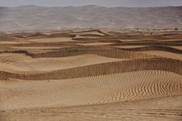
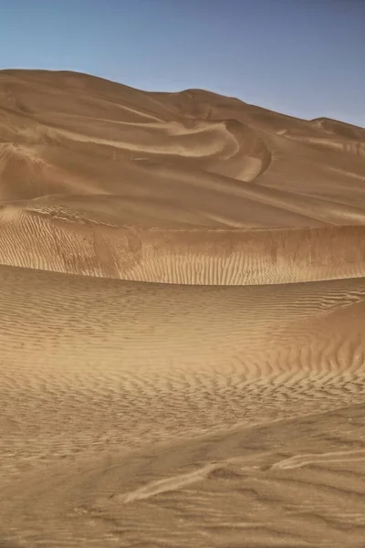
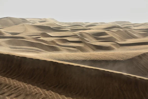
Moving Sand Dunes Cover The Surface Of The Taklamakan Desert Forming Chains Of These Eolian Topographic Forms-some Of Them Reaching Up To 300 Ms.high. Yutian Keriya County-Xinjiang Uyghur Region-China
Image, 11.68MB, 5100 × 3400 jpg
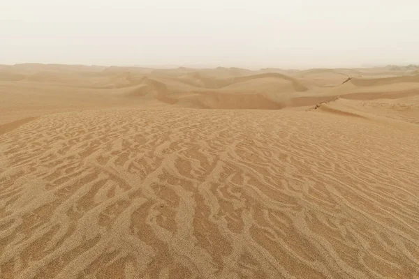
Diffused Light Of Morning Over Chains Of Moving Sand Dunes Covering The Surface Of The Taklamakan Desert Some Of Them Reaching Up To 300 Ms.high. Qiemo Cherchen County-Xinjiang Uyghur Region-China.
Image, 16.87MB, 5100 × 3400 jpg
GANSU, CHINA - Apr 10 2015: Colourful Hills Scenic Area Of Zhangye National Geopark (Zhangye Danxia). The Danxia Landform Is Famous Landscape In Zhangye, Gansu, China.
Image, 14.74MB, 7360 × 4912 jpg
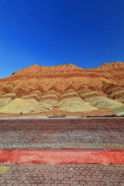
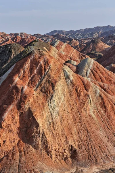
Spectacular Colorful Rusty Sandstone And Siltstone Landforms Of Zhangye Danxia-Red Cloud Nnal.Geological Park So Called Rainbow Mountains-E.foothills Of The Qilian Range. Zhangye-Gansu Province-China.
Image, 16.42MB, 3600 × 5400 jpg

GANSU, CHINA - Apr 10 2015: Colourful Hills Scenic Area Of Zhangye National Geopark (Zhangye Danxia). The Danxia Landform Is Famous Landscape In Zhangye, Gansu, China.
Image, 15.09MB, 7360 × 4912 jpg
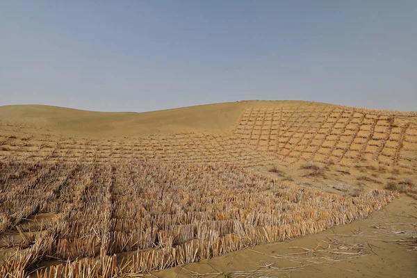
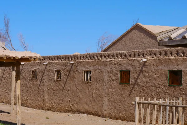
Straw Checkerboard Sand Control Barriers. Hotan Prefecture-Xinjiang Uyghur Region-China-0002
Image, 16.86MB, 5100 × 3400 jpg
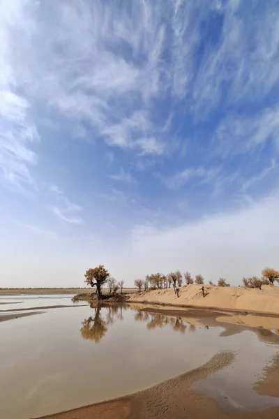
Keriya River Supplies Several Oases-flows N.into The TaklaMakan Desert To An Endorheic Delta Where It Gets Lost In The Sand. Keriya Yutian County-Hotan Pref.-Xinjiang Uyghur Autonomous Region-China.
Image, 9.53MB, 3400 × 5100 jpg
Moving Sand Dunes Cover The Surface Of The Taklamakan Desert Forming Chains Of These Eolian Topographic Forms-some Of Them Reaching Up To 300 Ms.high. Yutian Keriya County-Xinjiang Uyghur Region-China
Image, 10.84MB, 3400 × 5100 jpg

Lonely Desert Poplar-Populus Euphratica Deciduous Tree With Bent-forked Double Stem Growing On The Slope Of A Sand Dune In The Taklamakan Desert. Keriya County-Xinjiang Uyghur Autonomous Region-China.
Image, 13.32MB, 5100 × 3400 jpg
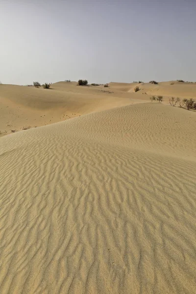
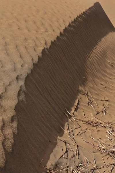
Shifting Sand Dunes-nitre Bushes-Takla Makan Desert. Hotan Prefecture-Xinjiang Uyghur Region-China-0009
Image, 18.08MB, 3400 × 5100 jpg

Early Morning Light Over Chains Of Barchans-moving Sand Dunes Covering The Surface Of The Taklamakan Desert Some Of Them Reaching Up To 300 Ms.high. Qiemo Cherchen County-Xinjiang Uyghur Region-China.
Image, 8.09MB, 5100 × 3400 jpg

Keriya County, China-October 5, 2017: Car-pushing Drivers Unstuck A Green Off-road Car For Touristic Service Stuck In Sand While Driving Through The Treacherous Loose Dunes Of The Taklamakan Desert.
Image, 11.75MB, 5100 × 3400 jpg
Moving Sand Dunes Cover The Surface Of The Taklamakan Desert Forming Chains Of These Eolian Topographic Forms-some Of Them Reaching Up To 300 Ms.high. Yutian Keriya County-Xinjiang Uyghur Region-China
Image, 13.63MB, 3400 × 5100 jpg

Diffused Sunrise Light-Taklamakan Shifting Dunes Along 233 Prov.Road Between Shamo Expwy.and 315 Nnal.Road Running N.and E.across The Desert. Qiemo Cherchen-Bayingolin Pref.-Xinjiang Uyghur Reg.-China
Image, 10.71MB, 3000 × 4500 jpg
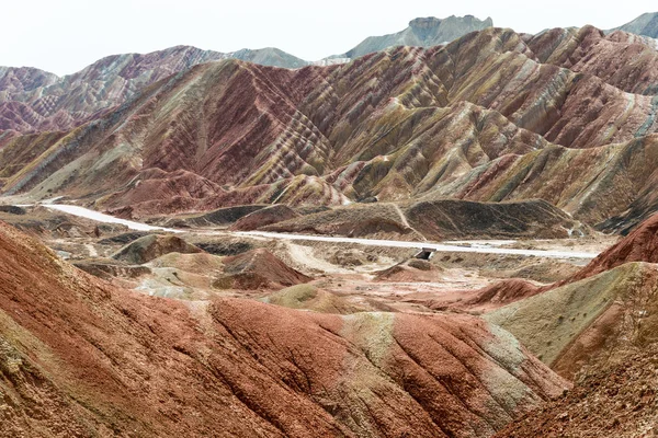
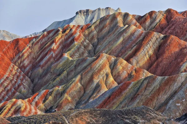
Spectacular Colorful Rusty Sandstone And Siltstone Landforms Of Zhangye Danxia-Red Cloud Nnal.Geological Park So Called Rainbow Mountains-E.foothills Of The Qilian Range. Zhangye-Gansu Province-China.
Image, 19.72MB, 3600 × 5400 jpg
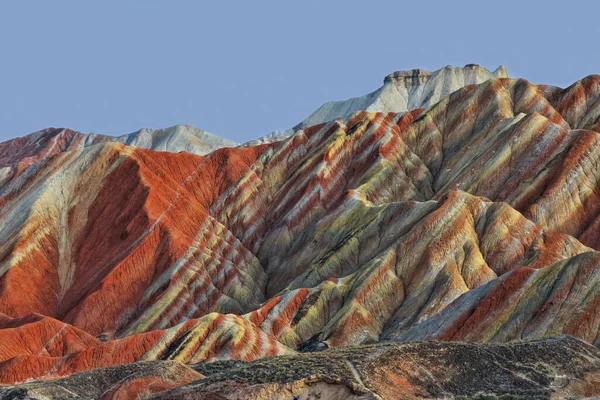
Spectacular Colorful Rusty Sandstone And Siltstone Landforms Of Zhangye Danxia-Red Cloud Nnal.Geological Park So Called Rainbow Mountains-E.foothills Of The Qilian Range. Zhangye-Gansu Province-China.
Image, 15.75MB, 5400 × 3600 jpg
Spectacular Colorful Rusty Sandstone And Siltstone Landforms Of Zhangye Danxia-Red Cloud Nnal.Geological Park So Called Rainbow Mountains-E.foothills Of The Qilian Range. Zhangye-Gansu Province-China.
Image, 14.41MB, 5400 × 3600 jpg

Spectacular Colorful Rusty Sandstone And Siltstone Landforms Of Zhangye Danxia-Red Cloud Nnal.Geological Park So Called Rainbow Mountains-E.foothills Of The Qilian Range. Zhangye-Gansu Province-China.
Image, 16.03MB, 5400 × 3600 jpg
Page 1 >> Next