photo free
Home Images Vectors Videos

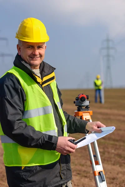
Stock image To Measure Land

stock image Digital level on tripod with sand mounds on background

Digital Level On Tripod With Sand Mounds On Background

Image, 6.39MB, 7360 × 4912 jpg
stock image Land surveyors

Land Surveyors

Image, 7.84MB, 4959 × 3306 jpg
stock image Digital level for geodesy measuring on dirt road

Digital Level For Geodesy Measuring On Dirt Road

Image, 5.12MB, 7219 × 4818 jpg
stock image Geodesist measure land speak transmitter

Geodesist Measure Land Speak Transmitter

Image, 8.67MB, 6048 × 4032 jpg
stock image Digital level for geodesic measuring on dirt road with blue sky at background

Digital Level For Geodesic Measuring On Dirt Road With Blue Sky At Background

Image, 4.56MB, 4275 × 6407 jpg
stock image Geodesist measure land look construction plan

Geodesist Measure Land Look Construction Plan

Image, 11.68MB, 3865 × 5797 jpg
stock image Digital level for geodesy measuring on tripod

Digital Level For Geodesy Measuring On Tripod

Image, 7.11MB, 7360 × 4912 jpg
stock image Geodesist measure land hold construction plans

Geodesist Measure Land Hold Construction Plans

Image, 10.02MB, 4032 × 6048 jpg
stock image Digital level for geodesy measuring on dirt road with buildings at background

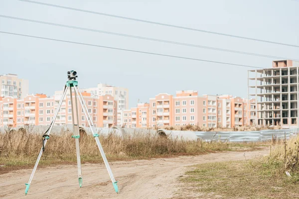
Digital Level For Geodesy Measuring On Dirt Road With Buildings At Background

Image, 7.35MB, 7027 × 4690 jpg
stock image equipment, surveyor, technology, to measure land

Equipment, Surveyor, Technology, To Measure Land

Image, 7.19MB, 3056 × 4592 jpg
stock image Surveyor engineer making measure on the field

Surveyor Engineer Making Measure On The Field

Image, 10.71MB, 5616 × 3744 jpg
stock vector Tape Measure Icon. Vector Isolated. Measuring Equipment Used to Measure Length or Distance

Tape Measure Icon. Vector Isolated. Measuring Equipment Used To Measure Length Or Distance

Vector, 0.22MB, 7500 × 5000 eps
stock image Geodesist measure land speak transmitter

Geodesist Measure Land Speak Transmitter

Image, 6.05MB, 4032 × 4032 jpg
stock image Total station set in the field

Total Station Set In The Field

Image, 9.63MB, 5184 × 3456 jpg
stock image Total station set in the field

Total Station Set In The Field

Image, 12.2MB, 3456 × 5184 jpg
stock image Surveyor engineer making measure on the field with tablet pc

Surveyor Engineer Making Measure On The Field With Tablet Pc

Image, 10.54MB, 5616 × 3744 jpg
stock image Special device (level) for surveyor builders, geodesy equipment close up. Outdoors, copy space.

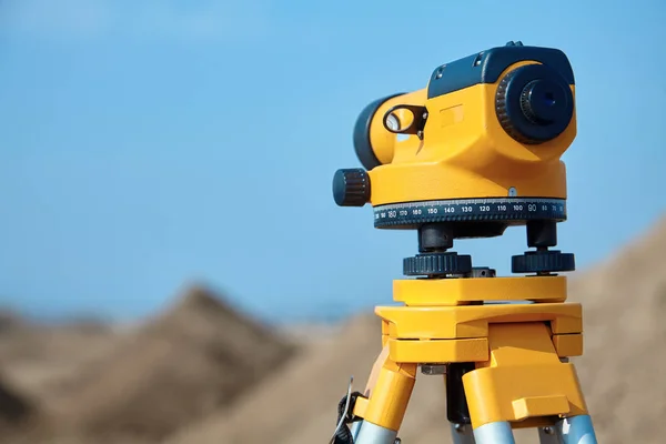
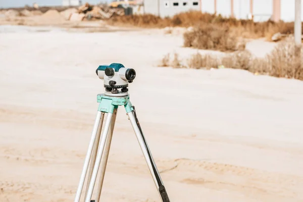
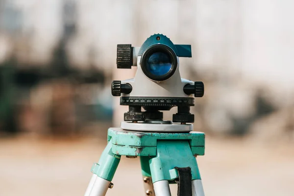
Special Device (level) For Surveyor Builders, Geodesy Equipment Close Up. Outdoors, Copy Space.

Image, 3.7MB, 4000 × 2667 jpg
stock image When road construction is underway, the contractor uses leveling rotary laser measuring equipment on the construction site

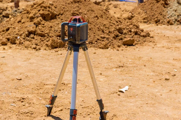
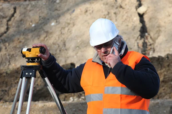
When Road Construction Is Underway, The Contractor Uses Leveling Rotary Laser Measuring Equipment On The Construction Site

Image, 11.28MB, 5211 × 3475 jpg
stock image Surveyor equipment tacheometer or theodolite outdoors at construction site for civil engineer checking the construction area

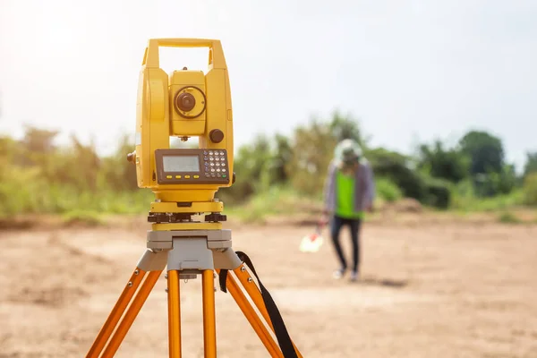
Surveyor Equipment Tacheometer Or Theodolite Outdoors At Construction Site For Civil Engineer Checking The Construction Area

Image, 13.6MB, 6016 × 4016 jpg
stock image Surveyor equipment level at construction site

Surveyor Equipment Level At Construction Site

Image, 5.67MB, 5000 × 3337 jpg
stock image Surveyor engineer making measure on the field with tablet pc

Surveyor Engineer Making Measure On The Field With Tablet Pc

Image, 10.03MB, 5616 × 3744 jpg
stock image Special device (level) for surveyor builders, geodesy equipment close up in front of a ground work with people on blurred background. Outdoors, copy space.

Special Device (level) For Surveyor Builders, Geodesy Equipment Close Up In Front Of A Ground Work With People On Blurred Background. Outdoors, Copy Space.

Image, 3.81MB, 4000 × 2667 jpg
stock image Total station prism with survey worker hands

Total Station Prism With Survey Worker Hands

Image, 7.75MB, 4548 × 3032 jpg
stock image surveyor worker with theodolite

Surveyor Worker With Theodolite

Image, 6.08MB, 4288 × 2848 jpg
stock image Geodesist device on a building site. Civil engineer with theodol

Geodesist Device On A Building Site. Civil Engineer With Theodol

Image, 11.54MB, 5185 × 3456 jpg
stock image Engineer with a theodolite for measuring topographic

Engineer With A Theodolite For Measuring Topographic

Image, 0MB, 4745 × 3163 jpg
stock image surveyor worker with theodolite

Surveyor Worker With Theodolite

Image, 6.38MB, 4288 × 2848 jpg
stock image Surveyor instrument is for measuring level on construction site. Surveyors ensure precise measurements before undertaking large construction projects.

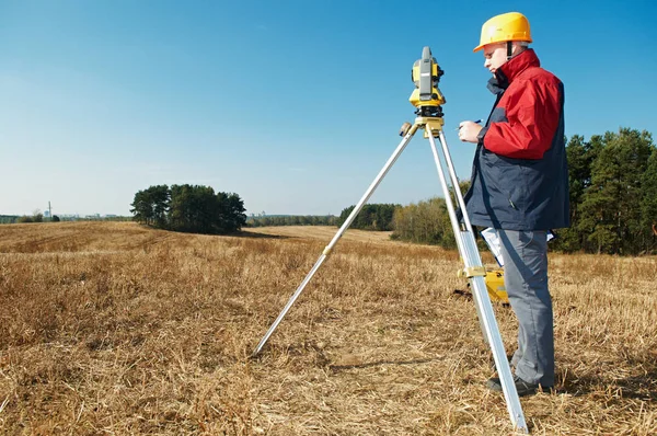
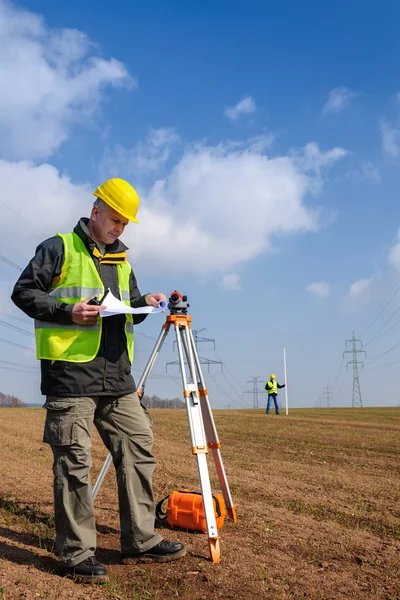
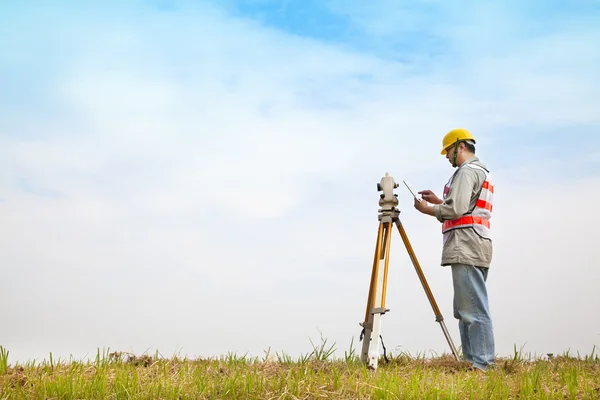
Surveyor Instrument Is For Measuring Level On Construction Site. Surveyors Ensure Precise Measurements Before Undertaking Large Construction Projects.

Image, 8.17MB, 5184 × 3456 jpg
stock image engineer with theodolite

Engineer With Theodolite

Image, 9.92MB, 4745 × 3163 jpg
stock image construction surveyor worker with theodolite outdoors over blue sky

Construction Surveyor Worker With Theodolite Outdoors Over Blue Sky

Image, 2.42MB, 4000 × 2657 jpg
stock image Geodesy. surveyor worker with theodolite

Geodesy. Surveyor Worker With Theodolite

Image, 6.02MB, 4288 × 2848 jpg
stock image Surveyor or Engineer making measure by Theodolite on the street.

Surveyor Or Engineer Making Measure By Theodolite On The Street.

Image, 8.18MB, 5320 × 3540 jpg
stock image Surveyor or Engineer making measure on the field.

Surveyor Or Engineer Making Measure On The Field.

Image, 7.53MB, 5320 × 3540 jpg
stock image surveyor works with theodolite

Surveyor Works With Theodolite

Image, 12.68MB, 6050 × 4038 jpg
stock image Land checking : Surveyor engineer making measure at the land

Land Checking : Surveyor Engineer Making Measure At The Land

Image, 5.58MB, 5358 × 3572 jpg
stock image Geodetic total station on the construction site against blurred background

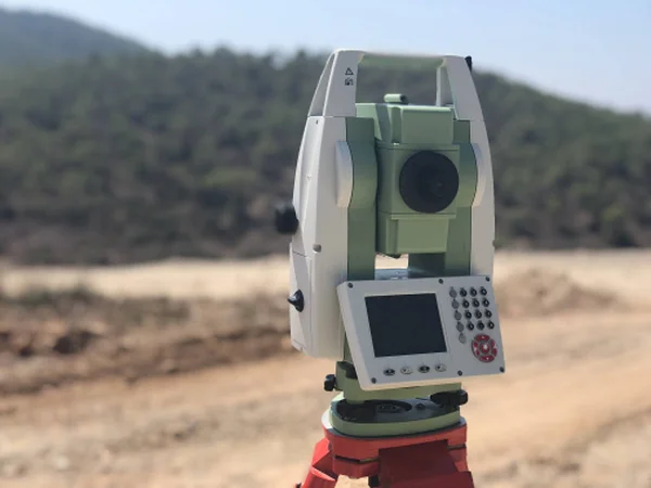
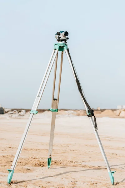
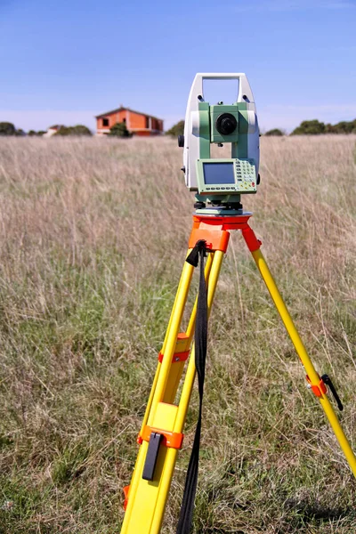
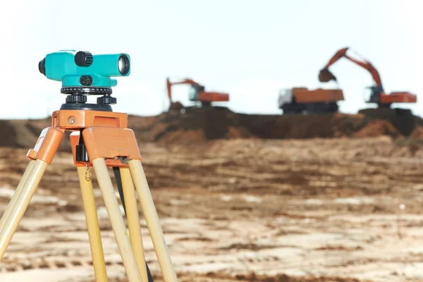
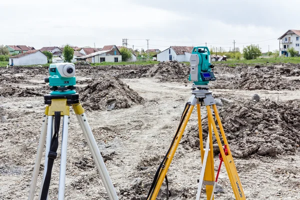
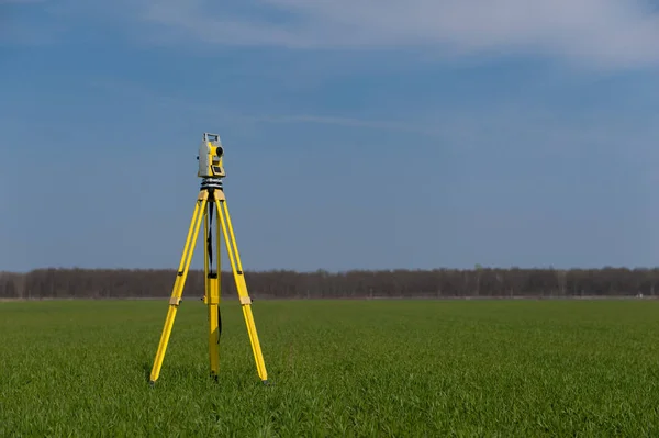
Geodetic Total Station On The Construction Site Against Blurred Background

Image, 0.36MB, 4032 × 3024 jpg
stock image Land checking : Surveyor engineer making measure at the land

Land Checking : Surveyor Engineer Making Measure At The Land

Image, 7.99MB, 5472 × 3648 jpg
stock image Surveyor on the phone

Surveyor On The Phone

Image, 8.73MB, 5616 × 3744 jpg
stock image surveyor worker with theodolite

Surveyor Worker With Theodolite

Image, 5.81MB, 4288 × 2848 jpg
stock image Land surveyors

Land Surveyors

Image, 7.02MB, 4893 × 3262 jpg
stock image A land surveyor writing in his notebook while talking on the phone

A Land Surveyor Writing In His Notebook While Talking On The Phone

Image, 10.67MB, 3744 × 5616 jpg
stock image Surveyor engineer making measure with partner on the field

Surveyor Engineer Making Measure With Partner On The Field

Image, 11.73MB, 5616 × 3744 jpg
stock image Surveyor Civil Engineer using equipment theodolite or total positioning station on the construction site.

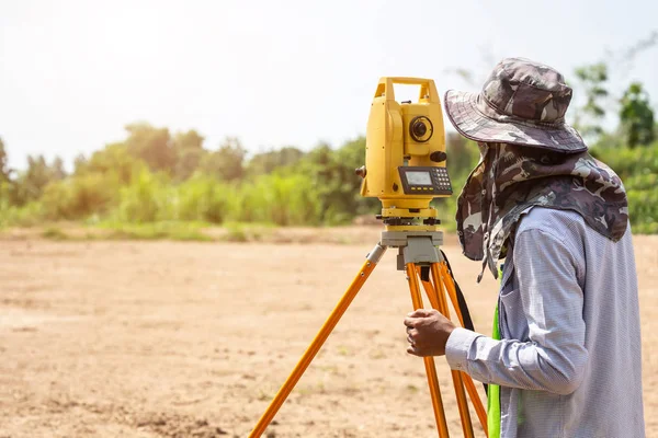
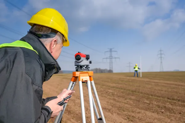
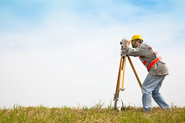
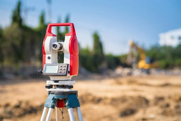
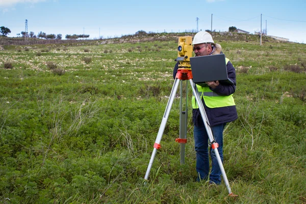
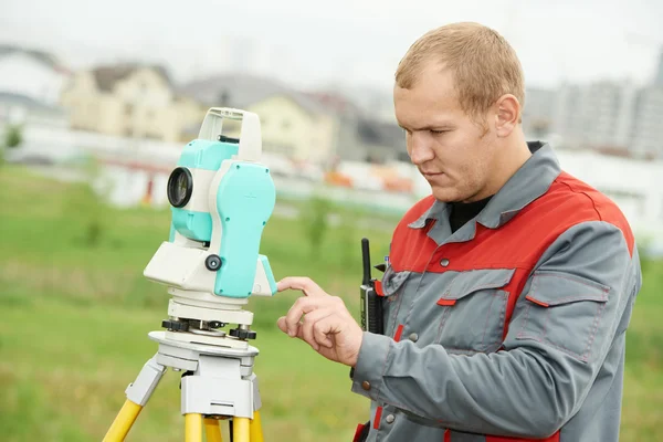
Surveyor Civil Engineer Using Equipment Theodolite Or Total Positioning Station On The Construction Site.

Image, 15.44MB, 7952 × 5304 jpg
stock image Surveyor engineer making measure in outdoor

Surveyor Engineer Making Measure In Outdoor

Image, 7.8MB, 5616 × 3744 jpg
stock image Measuring Tape on green grass

Measuring Tape On Green Grass

Image, 15.88MB, 5320 × 3547 jpg
stock image Surveyor works with theodolite

Surveyor Works With Theodolite

Image, 9.88MB, 6000 × 4004 jpg
stock image Front of Surveyors equipment (theodolite or total positioning station) on the construction site of the road or building with construction machinery background

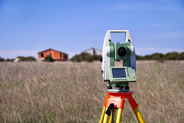
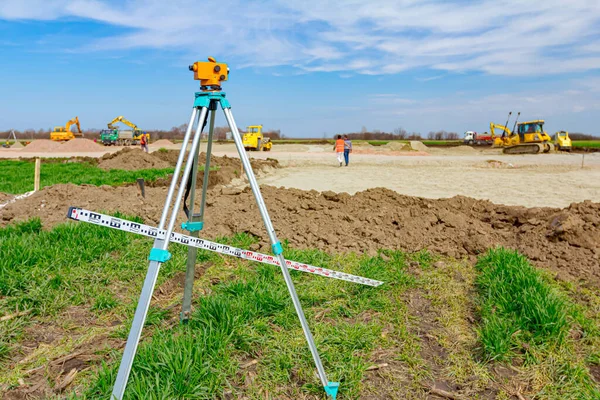
Front Of Surveyors Equipment (theodolite Or Total Positioning Station) On The Construction Site Of The Road Or Building With Construction Machinery Background

Image, 13.76MB, 7952 × 5304 jpg
stock image Surveyor instrument and leveling lath are used for measuring level on construction site. Surveyors ensure precise measurements before undertaking large construction projects.

Surveyor Instrument And Leveling Lath Are Used For Measuring Level On Construction Site. Surveyors Ensure Precise Measurements Before Undertaking Large Construction Projects.

Image, 14.09MB, 5184 × 3456 jpg
stock image Surveyor equipment outdoors theodolite on tripod

Surveyor Equipment Outdoors Theodolite On Tripod

Image, 5.67MB, 4256 × 2832 jpg
stock image Land plot in aerial view. Gps registration survey of property, real estate for map with location, area. Concept for residential construction and development. Also home, house for sale, buy, investment

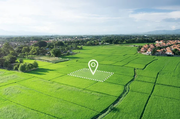
Land Plot In Aerial View. Gps Registration Survey Of Property, Real Estate For Map With Location, Area. Concept For Residential Construction And Development. Also Home, House For Sale, Buy, Investment

Image, 13.17MB, 5464 × 3640 jpg
Page 1 >> Next