photo free
Home Images Vectors Videos

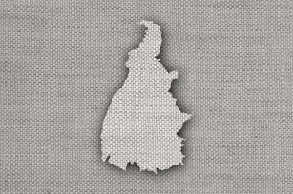
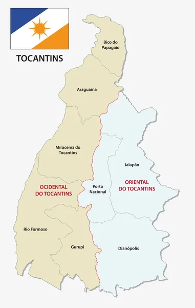
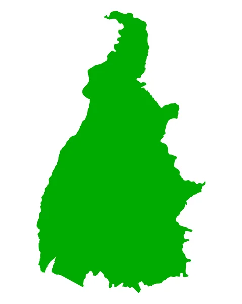
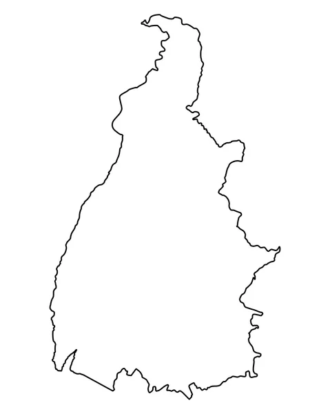
Stock image Tocantins State

stock image Red dunes at Jalapao, one of wildest areas in Brazil

Red Dunes At Jalapao, One Of Wildest Areas In Brazil

Image, 11.41MB, 5113 × 3402 jpg
stock image Waving Flag of Tocantins State, Brazil

Waving Flag Of Tocantins State, Brazil

Image, 10.38MB, 5184 × 3456 jpg
stock vector Tocantins blank outline map set

Tocantins Blank Outline Map Set

Vector, 0.38MB, 3829 × 5878 eps
stock image Red dunes at Jalapao, one of wildest areas in Brazil

Red Dunes At Jalapao, One Of Wildest Areas In Brazil

Image, 12.66MB, 3402 × 5113 jpg
stock image Tocantins state, Brazil

Tocantins State, Brazil

Image, 8.19MB, 4724 × 4724 jpg
stock image Sandy tracks at Jalapao, one of wildest areas in Brazil

Sandy Tracks At Jalapao, One Of Wildest Areas In Brazil

Image, 13.66MB, 5113 × 3402 jpg
stock image Red dunes at Jalapao, one of wildest areas in Brazil

Red Dunes At Jalapao, One Of Wildest Areas In Brazil

Image, 10.64MB, 5113 × 3402 jpg
stock image Remote Sono River, Tocantins Estate, Brazil

Remote Sono River, Tocantins Estate, Brazil

Image, 11.39MB, 5113 × 3402 jpg
stock image Tocantins, state of Brazil. Elevation map colored in wiki style with lakes and rivers. Locations of major cities of the region. Corner auxiliary location maps

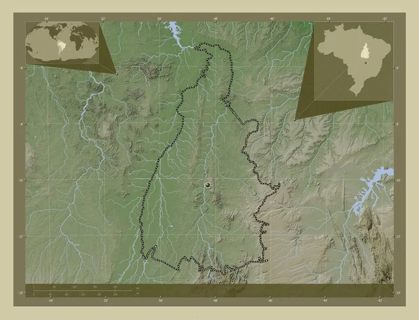
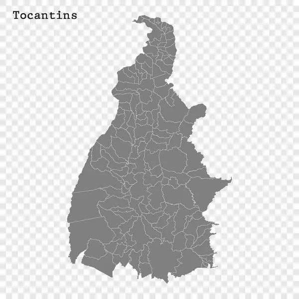
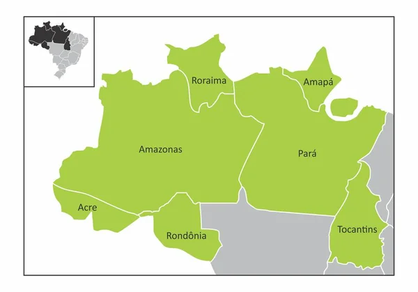
Tocantins, State Of Brazil. Elevation Map Colored In Wiki Style With Lakes And Rivers. Locations Of Major Cities Of The Region. Corner Auxiliary Location Maps

Image, 10.37MB, 4930 × 3770 jpg
stock image Tocantins, state of Brazil. Elevation map colored in wiki style with lakes and rivers. Corner auxiliary location maps

Tocantins, State Of Brazil. Elevation Map Colored In Wiki Style With Lakes And Rivers. Corner Auxiliary Location Maps

Image, 10.37MB, 4930 × 3770 jpg
stock image Flag of Tocantins State, Brazil, painted on leather texture

Flag Of Tocantins State, Brazil, Painted On Leather Texture

Image, 20.55MB, 5184 × 3456 jpg
stock image Tocantins, state of Brazil. Grayscale elevation map with lakes and rivers. Locations of major cities of the region. Corner auxiliary location maps

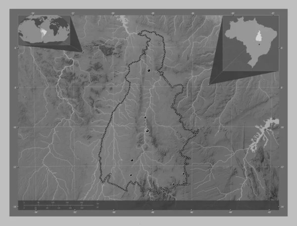
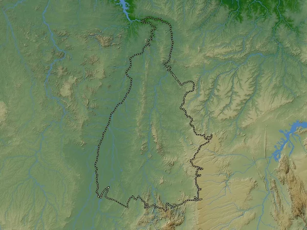
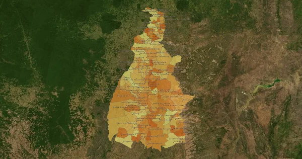
Tocantins, State Of Brazil. Grayscale Elevation Map With Lakes And Rivers. Locations Of Major Cities Of The Region. Corner Auxiliary Location Maps

Image, 7.74MB, 4930 × 3770 jpg
stock image Tocantins, state of Brazil. Bilevel elevation map with lakes and rivers

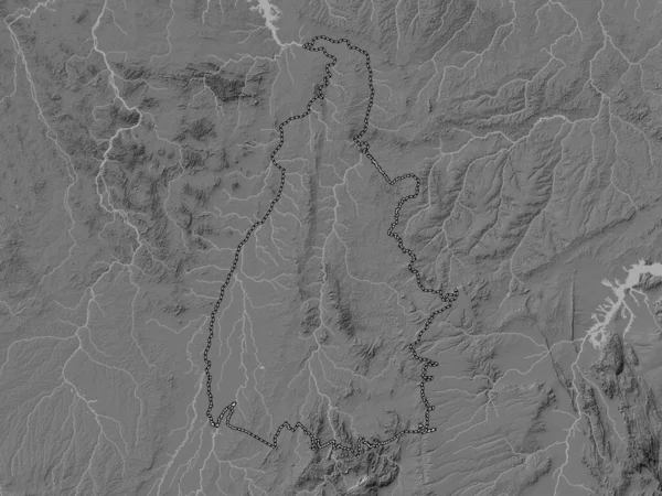
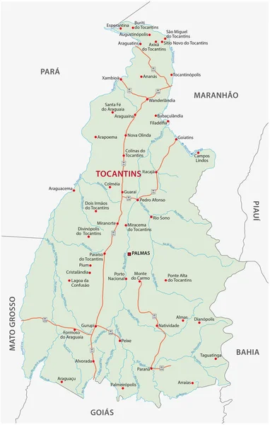
Tocantins, State Of Brazil. Bilevel Elevation Map With Lakes And Rivers

Image, 7.57MB, 3840 × 2880 jpg
stock image Tocantins, state of Brazil. Colored elevation map with lakes and rivers

Tocantins, State Of Brazil. Colored Elevation Map With Lakes And Rivers

Image, 8.61MB, 3840 × 2880 jpg
stock image Waving Flag of Tocantins State, Brazil

Waving Flag Of Tocantins State, Brazil

Image, 11.94MB, 5184 × 3456 jpg
stock vector Tocantins state blank outline map

Tocantins State Blank Outline Map

Vector, 0.28MB, 4000 × 4800 eps
stock vector Map of Brazil where Tocantins is pulled out

Map Of Brazil Where Tocantins Is Pulled Out

Vector, 1.76MB, 4959 × 5105 eps
stock image Jalapao State Park in Tocantins Brazil - Cachoeira da Formiga.

Jalapao State Park In Tocantins Brazil - Cachoeira Da Formiga.

Image, 6.79MB, 4000 × 6000 jpg
stock image Jalapao State Park in Tocantins Brazil - Cachoeira da Formiga.

Jalapao State Park In Tocantins Brazil - Cachoeira Da Formiga.

Image, 21.7MB, 6000 × 4000 jpg
stock image Jalapao State Park - Holed stone in Tocantins Brazil, near Ponte Alta do Tocantins.

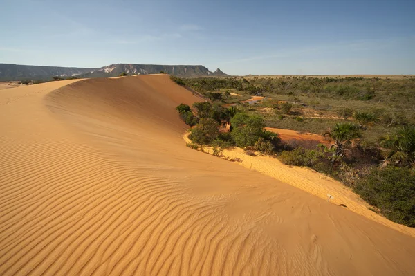
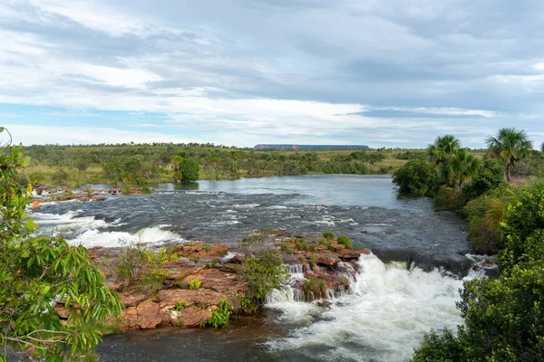
Jalapao State Park - Holed Stone In Tocantins Brazil, Near Ponte Alta Do Tocantins.

Image, 16.28MB, 5760 × 3840 jpg
stock image Tocantins state of Brazil flag waving sky background 3D illustration

Tocantins State Of Brazil Flag Waving Sky Background 3D Illustration

Image, 4.17MB, 3500 × 2450 jpg
stock image Tocantins state of Brazil flag textile cloth fabric waving on the top sunrise mist fog

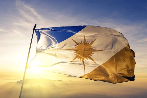
Tocantins State Of Brazil Flag Textile Cloth Fabric Waving On The Top Sunrise Mist Fog

Image, 2.55MB, 3660 × 2440 jpg
stock vector Waving ribbon or banner with flag

Waving Ribbon Or Banner With Flag

Vector, 9.93MB, 6000 × 4000 eps
stock vector Waving flag of Tocantins - state of Brazil on flagpole. Template for independence day poster

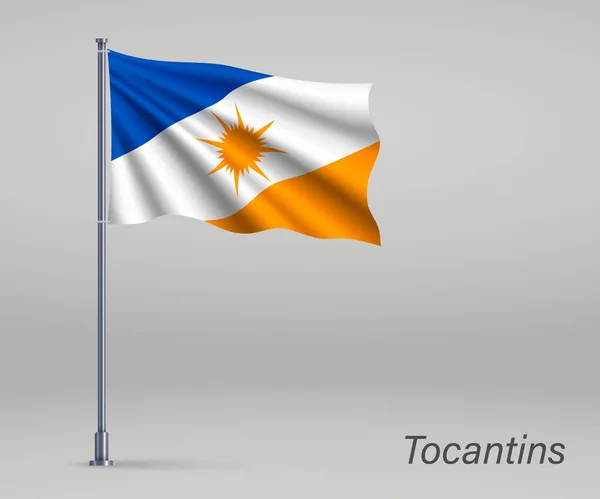
Waving Flag Of Tocantins - State Of Brazil On Flagpole. Template For Independence Day Poster

Vector, 3.7MB, 4800 × 4000 eps
stock image Map of Tocantins on old linen

Map Of Tocantins On Old Linen

Image, 3.91MB, 4288 × 2848 jpg
stock vector High Quality mapstate of Brazil

High Quality Mapstate Of Brazil

Vector, 3.5MB, 4000 × 4000 eps
stock image Porto Nacional, Tocantins, Brazil, June 21, 2011. Colonial houses on street in Center of Porto Nacional. National Harbor is a municipality in the Brazilian state of Tocantins.

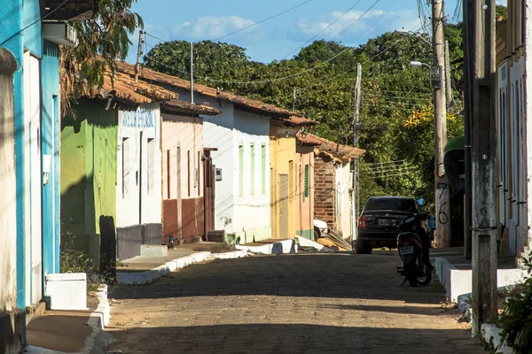
Porto Nacional, Tocantins, Brazil, June 21, 2011. Colonial Houses On Street In Center Of Porto Nacional. National Harbor Is A Municipality In The Brazilian State Of Tocantins.

Image, 7.73MB, 3888 × 2592 jpg
stock image Jalapao State Park in Tocantins Brazil - Cachoeira da Formiga.

Jalapao State Park In Tocantins Brazil - Cachoeira Da Formiga.

Image, 14.84MB, 5796 × 3864 jpg
stock image Tocantins Coat of Arms, Brazil. Close Up.

Tocantins Coat Of Arms, Brazil. Close Up.

Image, 0MB, 5980 × 4078 jpg
stock image Flag of Tocantins, Brazil

Flag Of Tocantins, Brazil

Image, 2.47MB, 3072 × 1920 jpg
stock image tocantins on map of brazil

Tocantins On Map Of Brazil

Image, 27.4MB, 4456 × 4056 jpg
stock vector tocantins administrative and political map with flag

Tocantins Administrative And Political Map With Flag

Vector, 0.67MB, 3100 × 4870 eps
stock vector Map of Tocantins

Map Of Tocantins

Vector, 0.68MB, 4000 × 5000 eps
stock vector Coat of arms of the states of Brazil, All Brazilian regions emblem collection

Coat Of Arms Of The States Of Brazil, All Brazilian Regions Emblem Collection

Vector, 18.44MB, 5167 × 4000 eps
stock vector Accurate map of Tocantins

Accurate Map Of Tocantins

Vector, 0.73MB, 4000 × 5000 eps
stock vector Illustration of a map of Brazil with the north region highlighted

Illustration Of A Map Of Brazil With The North Region Highlighted

Vector, 8.14MB, 5000 × 5000 eps
stock vector all Flags of states of Brazil. Vector illustraion

All Flags Of States Of Brazil. Vector Illustraion

Vector, 8.14MB, 6381 × 4000 eps
stock vector Brazil States Flag Collection Vector Illustration in Official Colors And Proportion

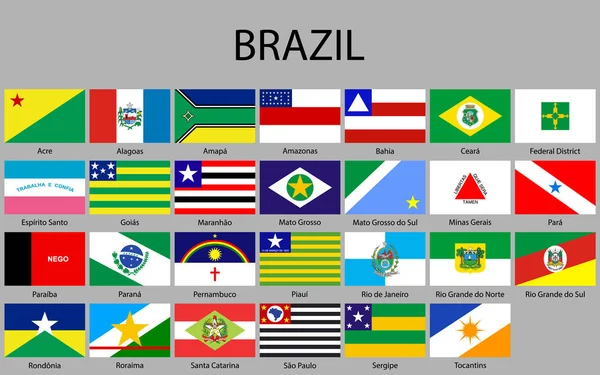
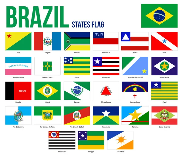
Brazil States Flag Collection Vector Illustration In Official Colors And Proportion

Vector, 2.86MB, 8301 × 7126 eps
stock vector Map of the north region of Brazil with the identified states

Map Of The North Region Of Brazil With The Identified States

Vector, 8.3MB, 5000 × 3500 eps
stock vector Flags of the states of Brazil

Flags Of The States Of Brazil

Vector, 9.1MB, 4000 × 4320 eps
stock image Shape of Tocantins, state of Brazil, with its capital isolated on white background. Topographic relief map. 3D rendering

Shape Of Tocantins, State Of Brazil, With Its Capital Isolated On White Background. Topographic Relief Map. 3D Rendering

Image, 5.49MB, 2390 × 3836 jpg
stock vector Brazil higt detailed map with subdivisions. Administrative map of Brazil with districts and cities name, colored by states and administrative districts. Vector illustration.

Brazil Higt Detailed Map With Subdivisions. Administrative Map Of Brazil With Districts And Cities Name, Colored By States And Administrative Districts. Vector Illustration.

Vector, 11.46MB, 4000 × 4000 eps
stock vector Green Brazil map flag vector silhouette illustration isolated on black background. South America country. Brazil flag.

Green Brazil Map Flag Vector Silhouette Illustration Isolated On Black Background. South America Country. Brazil Flag.

Vector, 0.35MB, 5001 × 5001 eps
stock image Goias state, Brazil

Goias State, Brazil

Image, 7.11MB, 4724 × 4724 jpg
stock image Tocantins State - Brazil

Tocantins State - Brazil

Image, 13.73MB, 8533 × 4500 jpg
stock image Map of Tocantins on green felt

Map Of Tocantins On Green Felt

Image, 2.55MB, 4288 × 2848 jpg
stock vector Green Brazil map flag vector silhouette illustration isolated on white background. South America country. Brazil flag.

Green Brazil Map Flag Vector Silhouette Illustration Isolated On White Background. South America Country. Brazil Flag.

Vector, 0.35MB, 5001 × 5001 eps
stock vector Green Brazil map flag vector silhouette illustration isolated on white background. South America country. Brazil flag.

Green Brazil Map Flag Vector Silhouette Illustration Isolated On White Background. South America Country. Brazil Flag.

Vector, 0.35MB, 5001 × 5001 eps
stock vector Grunge Tocantins flag

Grunge Tocantins Flag

Vector, 3.64MB, 7031 × 4972 eps
stock vector road vector map of the brazilian state tocantins

Road Vector Map Of The Brazilian State Tocantins

Vector, 1.45MB, 3100 × 4861 eps
Page 1 >> Next