photo free
Home Images Vectors Videos

Stock image Tolland

stock vector Connecticut County map

Connecticut County Map

Vector, 0.45MB, 5000 × 3500 ai
stock vector Connecticut, U.S. state, subdivided into 8 counties, gray political map with borders and county names. State in the New England region of Northeastern United States nicknamed The Constitution State.

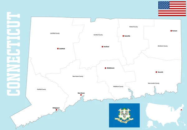
Connecticut, U.S. State, Subdivided Into 8 Counties, Gray Political Map With Borders And County Names. State In The New England Region Of Northeastern United States Nicknamed The Constitution State.

Vector, 1.81MB, 8015 × 6000 eps
stock vector Connecticut County Map

Connecticut County Map

Vector, 0.41MB, 5000 × 3500 ai
stock vector Connecticut, U.S. state, subdivided into 8 counties, multi colored political map with capital Hartford, borders and county names. State in the New England region of the USA. The Constitution State.

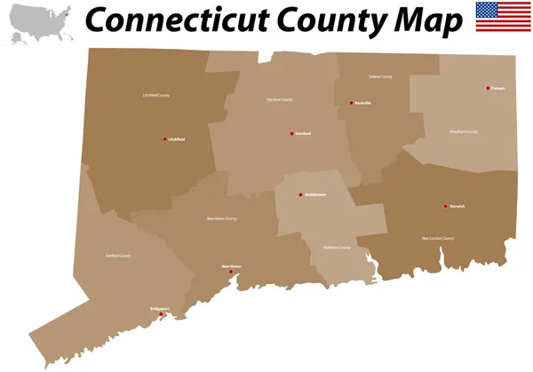
Connecticut, U.S. State, Subdivided Into 8 Counties, Multi Colored Political Map With Capital Hartford, Borders And County Names. State In The New England Region Of The USA. The Constitution State.

Vector, 1.82MB, 8015 × 6000 eps
stock vector Connecticut, U.S. state, subdivided into 8 counties, political map with borders and county names. State in the New England region of Northeastern United States nicknamed The Constitution State.

Connecticut, U.S. State, Subdivided Into 8 Counties, Political Map With Borders And County Names. State In The New England Region Of Northeastern United States Nicknamed The Constitution State.

Vector, 2.73MB, 7581 × 6000 eps
Page 1 >> Next