
Stock image Transit Brazil
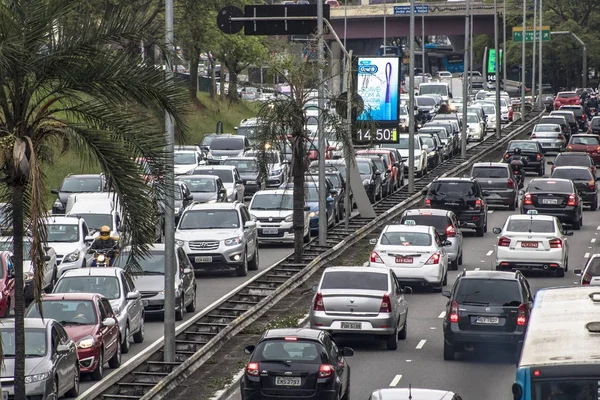
Sao Paulo, Brazil, October 23, 2017. Heavy Traffic In The North South Corridor, At The Rubem Berta Avenue, South Zone Of Sao Paulo. This Avenue Connects The Northern And Southern Areas Of The City.
Image, 16.23MB, 6000 × 4000 jpg
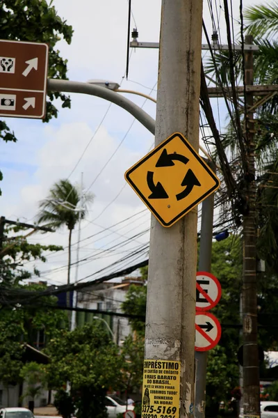
Salvador, Bahia, Brazil - December 21, 2020: Traffic Sign Indicating Rotatory Is Seen Attached To A Pole In The Neighborhood Of Itapua, In The City Of Salvador. *** Local Caption ***
Image, 4.57MB, 3840 × 5760 jpg

Salvador, Bahia, Brazil - December 30, 2020: Traffic Sign Indicates Speed Limit Of 40 Kilometers Per Hour On The Street In The City Of Salvador. *** Local Caption ***
Image, 5.37MB, 5760 × 3840 jpg
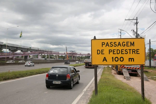
Salvador, Bahia, Brazil - April 11, 2022: Traffic Sign On Highway BR 324 Indicates Pedestrian Crossing 100 Meters Away.
Image, 0.92MB, 3840 × 2560 jpg

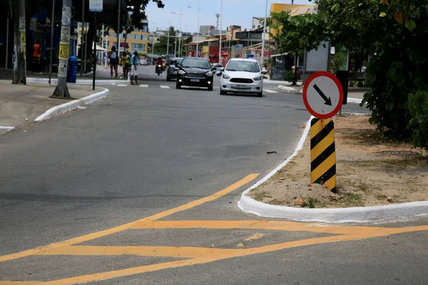
Salvador, Bahia, Brazil - July 19, 2022: Traffic Signs Indicative Of Give The Preference On A Street In The City Of Salvador
Image, 7.53MB, 3840 × 5760 jpg
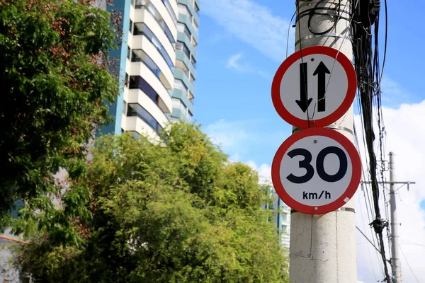
Salvador, Bahia, Brazil - January 25, 2021: Traffic Sign Speed Limit At 30 Kilometers Per Hour And Also A Two-way Street In The City Of Salvador. *** Local Caption ***
Image, 5.02MB, 5760 × 3840 jpg
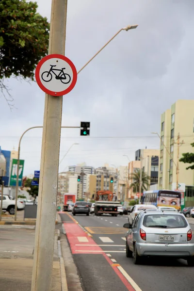
Salvador, Bahia, Brazil - January 11, 2021: Traffic Sign Indicating The Beginning Of A Cycle Path In The Pituba Neighborhood On The Edge Of The City Of Salvador. *** Local Caption ***
Image, 4.29MB, 3840 × 5760 jpg

Salvador, Bahia, Brazil - December 30, 2020: Traffic Sign Indicates Prohibited To And Park On The Street In The City Of Salvador. *** Local Caption ***
Image, 5.58MB, 3840 × 5760 jpg

Salvador, Bahia, Brazil - April 11, 2022: Traffic Sign Indicates Heavy Vehicles Will Use The Right Lane On Highway BR 324 In The City Of Salvador.
Image, 0.87MB, 3840 × 2560 jpg
Salvador, Bahia, Brazil - December 21, 2020: Traffic Sign Indicating Mandatory Crossing Along With Zebra-plated Marks Painted On The Floor In The Itapua Neighborhood, In The City Of Salvador. *** Local Caption ***
Image, 5.9MB, 5760 × 3840 jpg
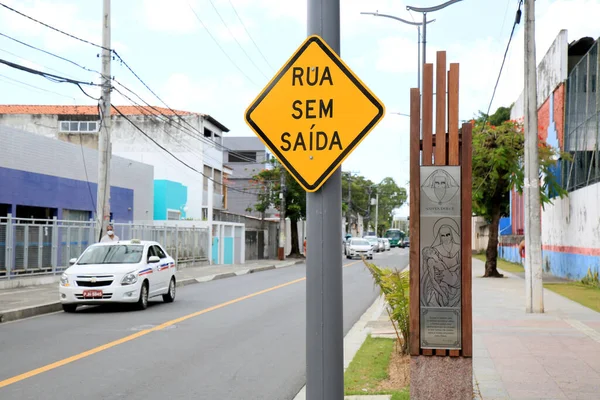
Salvador, Bahia, Brazil January 4, 2021: Traffic Sign Indicates Dead End Street In The City Of Salvador. *** Local Caption ***
Image, 4.21MB, 5760 × 3840 jpg

Salvador, Bahia, Brazil - April 11, 2022: Traffic Sign Indicates Electronic Inspection For Speed Of 80 Kilometers Per Hour On Highway BR 324
Image, 0.83MB, 3840 × 2560 jpg
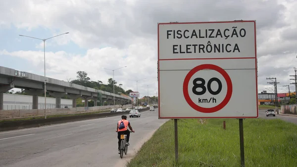
Salvador, Bahia, Brazil - April 11, 2022: Traffic Sign Indicates Electronic Inspection For Speed Of 80 Kilometers Per Hour On Highway BR 324
Image, 0.75MB, 3840 × 2160 jpg

Salvador, Bahia, Brazil - September 23, 2023: Traffic Signpost Indicative Of Luiz Viana Avenue - Parallel - In The City Of Salvador.
Image, 7.28MB, 5760 × 3840 jpg
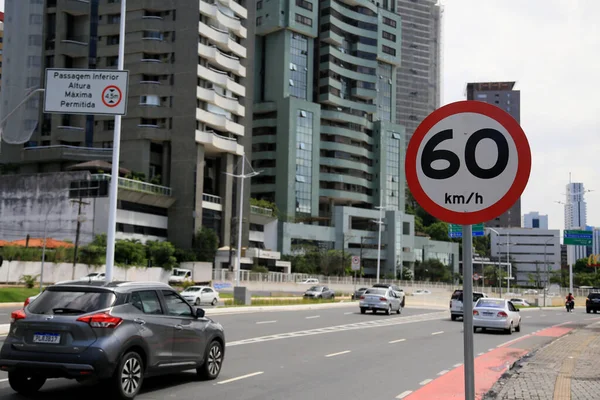
Salvador, Bahia, Brazil - May 16, 2023: Traffic Sign Indicates Speed Limit Of 60 Kilometers Per Hour On Street In The City Of Salvador.
Image, 8.11MB, 5760 × 3840 jpg


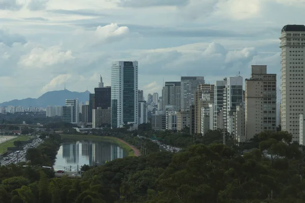
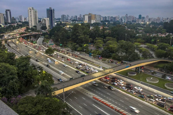
Sao Paulo, Brazil, April 24, 2018 Aerial View Of Traffic On The Famous 23 De Maio Avenue In Sao Paulo, Brazil. This Avenue Run Past Ibirapuera Park.
Image, 15.82MB, 5715 × 3810 jpg

Campo Grande - MS, Brazil - November 12, 2020: Aerial View Of The Highs Of The Afonso Pena Avenue And The Parque Dos Poderes Park On The Background.
Image, 8.62MB, 3020 × 2013 jpg

Marilia, Sao Paulo, Brazil, March 24, 2019. Facade Of The Marlia Bus Terminal, In The Center West Region Of The State Of Sao Paulo.
Image, 11.62MB, 5944 × 3963 jpg

Sao Paulo, Brazil, April 24, 2018 Aerial View Of Traffic On The Famous 23 De Maio Avenue In Sao Paulo, Brazil. This Avenue Run Past Ibirapuera Park.
Image, 18.5MB, 6000 × 4000 jpg

Journalist Roberto Marinho Avenue, Sao Paulo, Brazil, South America America
Image, 9.05MB, 3992 × 2992 jpg
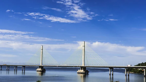
Anita Garibaldi Bridge Located In The City Of Laguna In The Southern State Of Santa Catarina Brazil, Structure With 2815 Meters In Length
Image, 9.01MB, 5946 × 3345 jpg
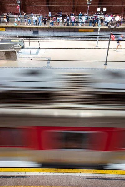
Sao Paulo, Brazil - Feb 28, 2022 - Moving Inside The Luz Station, Trains And Passengers At The Boarding And Landing Platforms, In The Downtown Of Sao Paulo, Brazil. Inaugurated In 1867.
Image, 14.17MB, 3648 × 5472 jpg

Sao Paulo, Brazil, Mai 26, 2018: Aerial View Of The New Modern Eucalipto Subway Station In Sao Paulo
Image, 7.82MB, 6016 × 4016 jpg
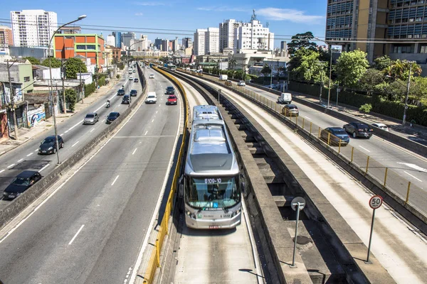
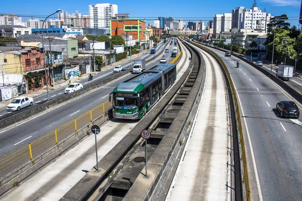
Sao Paulo, SP, Brazil, February 23, 2017. Vehicle In Tiradentes Express Bus Corridor, Which Runs Over The Tamanduatei River, On Estado Avenue, Central Region Of Sao Paulo, SP.
Image, 14.34MB, 5755 × 3837 jpg
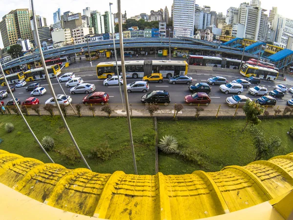
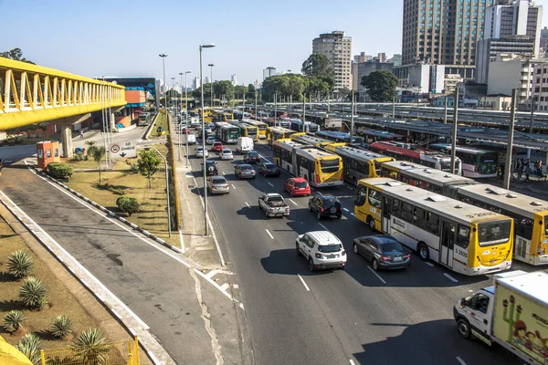
Sao Paulo, SP, Brazil, April 17, 2017. Transit Of Vehicles In The Avenue Of The State Next To The Entrance Of The Bus Terminal Of The Park Dom Pedro II, In The Center Of Sao Paulo
Image, 10.14MB, 3958 × 2969 jpg

Salvador, Bahia, Brazil - September 24, 2022: View From The Top Of Cars Traveling On Open Lanes In The Neighborhood Of Pernambues In Salvador, Bahia.
Image, 6.53MB, 3936 × 2624 jpg


Sao Paulo, SP, Brazil, April 17, 2017. Transit Of Vehicles In The Avenue Of The State Next To The Entrance Of The Bus Terminal Of The Park Dom Pedro II, In The Center Of Sao Paulo
Image, 6.79MB, 3739 × 2493 jpg
Sao Paulo, SP, Brazil, December 14, 2017. Transit Of Vehicles In The Avenue Of The State Next To The Entrance Of The Bus Terminal Of The Park Dom Pedro II, In The Center Of Sao Paulo
Image, 13.85MB, 5847 × 3898 jpg

RIO DE JANEIRO, BRAZIL - JAN 27, 2015: Train In A Metro Station Botafogo In Rio De Janeiro, Brazil
Image, 6.24MB, 4752 × 3168 jpg
Curitiba, Brazil, January 03, 2018. Traffic Of Vehicles On Visconde De Guarapuava Avenue, In The Central Region Of Curitiba In Parana State
Image, 14.33MB, 4000 × 6000 jpg
Sao Paulo, SP, Brazil, February 23, 2017. Vehicle In Tiradentes Express Bus Corridor, Which Runs Over The Tamanduatei River, On Estado Avenue, Central Region Of Sao Paulo, SP.
Image, 14.02MB, 5665 × 3777 jpg

Sao Paulo, Brazil, November 24, 2006. Facade Of The Clinicas Subway Station On Line 2 Green At Doctor Arnaldo Avenue, West Zone Of Sao Paulo City
Image, 4.35MB, 2410 × 3213 jpg


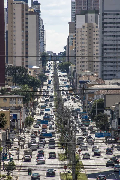
Curitiba, Brazil, January 03, 2018. Traffic Of Vehicles On 7 De Setembro Avenue, In The Central Region Of Curitiba In Parana State
Image, 14.66MB, 6000 × 4000 jpg
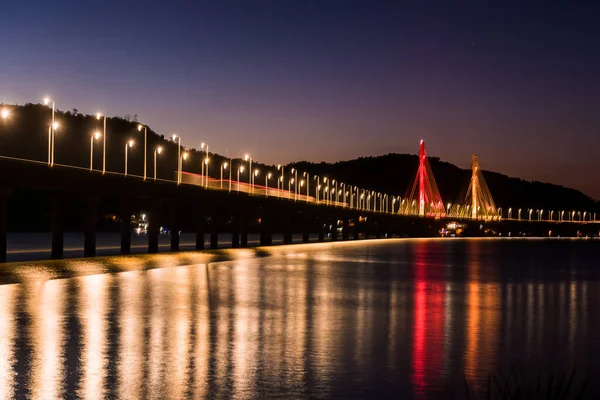
Anita Garibaldi Bridge At Dusk And Illuminated, Structure With 2815 Meters, Is Sutuada In The City Of Laguna State D Santa Catarina Brazil,
Image, 9.4MB, 5797 × 3870 jpg
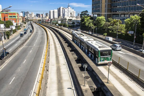
Sao Paulo, SP, Brazil, February 23, 2017. Vehicle In Tiradentes Express Bus Corridor, Which Runs Over The Tamanduatei River, On Estado Avenue, Central Region Of Sao Paulo, SP.
Image, 14.15MB, 5938 × 3959 jpg
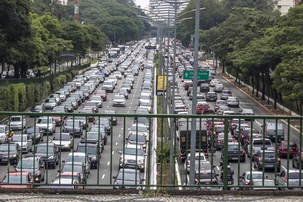
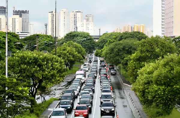
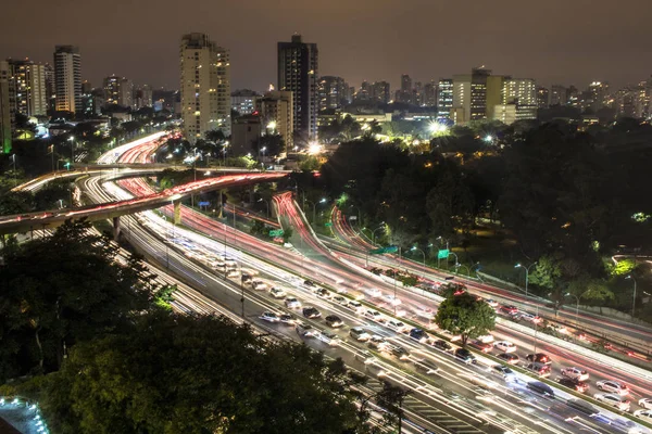
Sao Paulo, Brazil, December 08, 2017. Heavy Traffic In The North South Corridor, At The 23 De Maio Avenue, South Zone Of Sao Paulo. This Avenue Connects The Northern And Southern Areas Of The City.
Image, 14.01MB, 5749 × 3833 jpg


Sao Paulo, Brazil, December 08, 2017. Heavy Traffic In The North South Corridor, At The 23 De Maio Avenue, South Zone Of Sao Paulo. This Avenue Connects The Northern And Southern Areas Of The City.
Image, 18.72MB, 4000 × 6000 jpg
Page 1 >> Next