photo free
Home Images Vectors Videos

Stock image Utah Administrative

stock vector Utah black map on white background

Utah Black Map On White Background

Vector, 5.26MB, 4000 × 4000 eps
stock vector Utah map

Utah Map

Vector, 4.41MB, 4660 × 5000 eps
stock vector Utah map

Utah Map

Vector, 7.47MB, 7002 × 7002 eps
stock vector USA maps collection large navigation set and World map

USA Maps Collection Large Navigation Set And World Map

Vector, 18.12MB, 5029 × 8192 eps
stock vector Map of the United States of America, with borders and state name

Map Of The United States Of America, With Borders And State Name

Vector, 25.9MB, 7296 × 4104 eps
stock vector Vector set 9 of 10 Highly detailed silhouettes of US state maps, divided into counties with names and territory nicknames

Vector Set 9 Of 10 Highly Detailed Silhouettes Of US State Maps, Divided Into Counties With Names And Territory Nicknames

Vector, 3.98MB, 9585 × 3348 eps
stock vector Detailed vintage map of the United States of America split into

Detailed Vintage Map Of The United States Of America Split Into

Vector, 24.72MB, 7296 × 4104 eps
stock vector Montana - Idaho - Wyoming - Utah - Arizona Map labelled black

Montana - Idaho - Wyoming - Utah - Arizona Map Labelled Black

Vector, 3MB, 5000 × 7814 eps
stock vector USA blind map navigation set

USA Blind Map Navigation Set

Vector, 8.68MB, 8192 × 7638 eps
stock vector California - Nevada - Utah - Arizona Map labelled black

California - Nevada - Utah - Arizona Map Labelled Black

Vector, 3.22MB, 5856 × 5000 eps
stock vector Nevada state detailed editable map

Nevada State Detailed Editable Map

Vector, 0.82MB, 5050 × 6500 eps
stock vector Nevada road and administrative map with interstate US highways and main roads

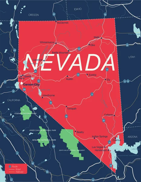
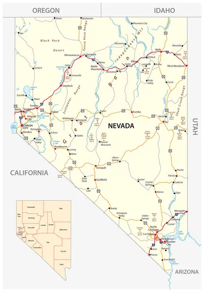
Nevada Road And Administrative Map With Interstate US Highways And Main Roads

Vector, 1.8MB, 3100 × 4432 eps
stock image Administrative Offices of the President, University of Utah

Administrative Offices Of The President, University Of Utah

Image, 4.81MB, 2495 × 4107 jpg
stock vector Typography composition of city names, silhouettes maps of the states of America, vector detailed posters, Division Mountain - Nevada, Utah, Arizona - set 14 of 17

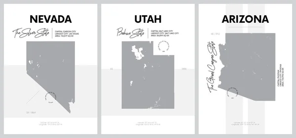
Typography Composition Of City Names, Silhouettes Maps Of The States Of America, Vector Detailed Posters, Division Mountain - Nevada, Utah, Arizona - Set 14 Of 17

Vector, 2.4MB, 8896 × 4168 eps
stock image Map of Utah state, USA

Map Of Utah State, USA

Image, 1.58MB, 3500 × 2258 jpg
stock vector Set 5 of 5 Highly detailed vector silhouettes of USA state maps

Set 5 Of 5 Highly Detailed Vector Silhouettes Of USA State Maps

Vector, 7.62MB, 8858 × 3738 eps
stock vector Colorado state detailed editable map

Colorado State Detailed Editable Map

Vector, 1.07MB, 7000 × 5291 eps
stock image Flag of American state. Word cloud illustration.

Flag Of American State. Word Cloud Illustration.

Image, 6.69MB, 5276 × 2743 jpg
stock vector Vector posters states of the United States with a name, nickname, date admitted to the Union, Division Mountain and West South Central - Colorado, New Mexico, Texas - set 13 of 17

Vector Posters States Of The United States With A Name, Nickname, Date Admitted To The Union, Division Mountain And West South Central - Colorado, New Mexico, Texas - Set 13 Of 17

Vector, 2.59MB, 8896 × 4168 eps
stock vector 45 of 50 states of the United States with a name, nickname, and

45 Of 50 States Of The United States With A Name, Nickname, And

Vector, 0.88MB, 7311 × 4112 eps
stock vector Highly detailed vector silhouettes of US state maps, Division United States into counties, political and geographic subdivisions of a states, Mountain - Nevada, Utah, Arizona - set 14 of 17

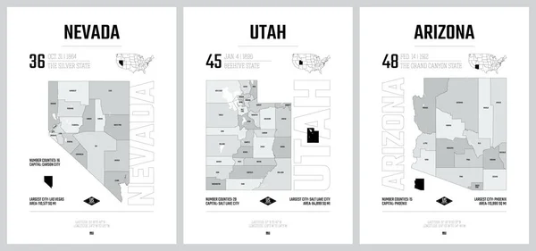
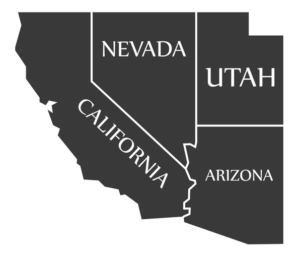
Highly Detailed Vector Silhouettes Of US State Maps, Division United States Into Counties, Political And Geographic Subdivisions Of A States, Mountain - Nevada, Utah, Arizona - Set 14 Of 17

Vector, 5.36MB, 9608 × 4501 eps
stock vector Vector posters with highly detailed silhouettes of maps of the s

Vector Posters With Highly Detailed Silhouettes Of Maps Of The S

Vector, 1.4MB, 7292 × 3416 eps
stock vector West, census region of the United States of America, gray political map of census region 4, consisting of 13 single states. Map with geographical borders and capitals. Isolated illustration.

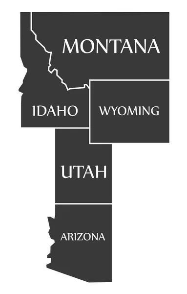
West, Census Region Of The United States Of America, Gray Political Map Of Census Region 4, Consisting Of 13 Single States. Map With Geographical Borders And Capitals. Isolated Illustration.

Vector, 2.69MB, 9000 × 5805 eps
stock image Symbol Map of the State Utah (United States of America) showing the territory of the state as a lawn football field

Symbol Map Of The State Utah (United States Of America) Showing The Territory Of The State As A Lawn Football Field

Image, 24.08MB, 4735 × 6000 jpg
stock vector Set 5 of 5 Division United States into counties, political and geographic subdivisions of a states, Highly detailed vector maps with names and territory nicknames

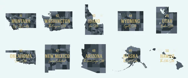
Set 5 Of 5 Division United States Into Counties, Political And Geographic Subdivisions Of A States, Highly Detailed Vector Maps With Names And Territory Nicknames

Vector, 5.97MB, 9585 × 4010 eps
stock image Map of the State Utah (United States of America) showing the isolated territory with relief representation, water bodies like seas, rivers, lakes and with borders. No labels at all.

Map Of The State Utah (United States Of America) Showing The Isolated Territory With Relief Representation, Water Bodies Like Seas, Rivers, Lakes And With Borders. No Labels At All.

Image, 3MB, 4914 × 6000 jpg
stock vector Utah, U.S. state subdivided into 29 counties, political map with borders and county names. State in the Mountain West region of Western USA. Nicknamed Beehive State, The Mormon State, and Deseret.

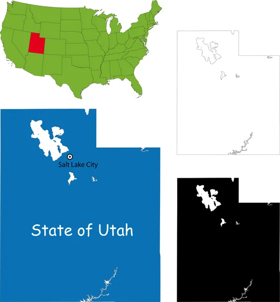
Utah, U.S. State Subdivided Into 29 Counties, Political Map With Borders And County Names. State In The Mountain West Region Of Western USA. Nicknamed Beehive State, The Mormon State, And Deseret.

Vector, 2.66MB, 6000 × 7304 eps
stock image Flag of Utah state. Utah flag illustration on stick isolated on white

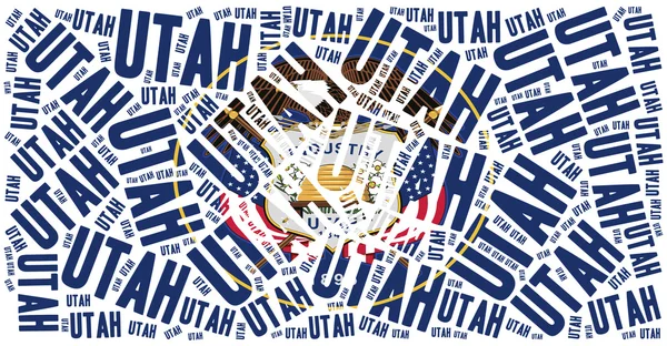
Flag Of Utah State. Utah Flag Illustration On Stick Isolated On White

Image, 7.01MB, 3840 × 2160 jpg
stock image Symbol Map of the State Utah (United States of America) showing the outline of the state as an asphalt surface

Symbol Map Of The State Utah (United States Of America) Showing The Outline Of The State As An Asphalt Surface

Image, 26.63MB, 4735 × 6000 jpg
stock image Area of Utah, state of Mainland United States, isolated on a solid background in a georeferenced bounding box. Labels. Satellite imagery. 3D rendering

Area Of Utah, State Of Mainland United States, Isolated On A Solid Background In A Georeferenced Bounding Box. Labels. Satellite Imagery. 3D Rendering

Image, 2.06MB, 2880 × 1620 jpg
stock vector Utah, U.S. state subdivided into 29 counties, gray political map with borders and county names. State in the Mountain West region of Western USA. Nicknamed Beehive State, Mormon State, and Deseret.

Utah, U.S. State Subdivided Into 29 Counties, Gray Political Map With Borders And County Names. State In The Mountain West Region Of Western USA. Nicknamed Beehive State, Mormon State, And Deseret.

Vector, 2.42MB, 6000 × 7308 eps
stock vector Utah, U.S. state, subdivided into 29 counties, multi colored political map with capital Salt Lake City, borders and county names. State in the Mountain West region of Western USA. The Beehive State.

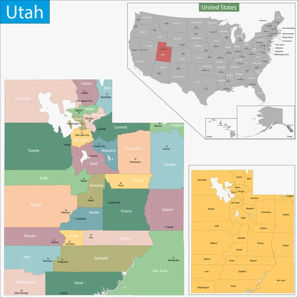
Utah, U.S. State, Subdivided Into 29 Counties, Multi Colored Political Map With Capital Salt Lake City, Borders And County Names. State In The Mountain West Region Of Western USA. The Beehive State.

Vector, 2.43MB, 6000 × 7308 eps
stock vector Utah state blank outline map

Utah State Blank Outline Map

Vector, 0.22MB, 4000 × 4800 eps
Page 1 >> Next