
Stock image Uyghur Autonomous Region page 2
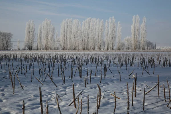
A View Of Rime-covered Trees And Snow-covered Road In Altay Prefecture, Northwest China's Xinjiang Uyghur Autonomous Region, 18 December 2018.
Image, 7.76MB, 5760 × 3840 jpg

Transport Collage Xinjiang Uyghur Region Map With Scratched Fast Delivery Watermark
Vector, 5.86MB, 6766 × 3000 eps

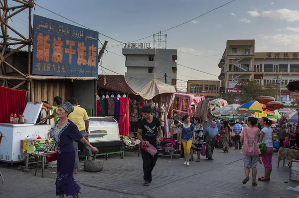
Kashgar, Xinjiang, China - August 14, 2012: Uyghur Man With A Donkey At A Street Market In The City Of Kashgar, Xinjiang, China
Image, 6.7MB, 4288 × 2848 jpg

Young Chinese Uighur Women Dry Jujube Fruits, Also Called Chinese Dates, At A Jujube Processing Factory In Zepu County, Kashgar, Northwest Chinas Xinjiang Uygur Autonomous Region, 21 October 2010
Image, 4.15MB, 3711 × 2592 jpg

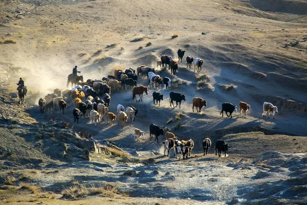
Kazakh Shepherds Riding Horses Direct A Large Herd Of Cattle, Sheep And Goats As They Migrate To The Summer Pasturing Areas At A Mountainous Region In Fuhai County, Altay Prefecture, Northwest China Xinjiang Uyghur Autonomous Region
Image, 2.98MB, 5172 × 3288 jpg
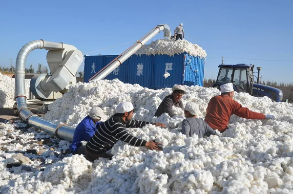
Chinese Workers Load Cotton Onto A Truck At A Sunning Ground In Alar (Alaer), Northwest China's Xinjiang Uygur Autonomous Region, 29 September 2015
Image, 1.06MB, 2464 × 1632 jpg

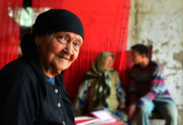
Chinese Uighur Woman Ali Mihan, Right, 127 Years Old, Is Pictured With Her Daughter At Home In Shule County, Kashgar Prefecture, Northwest Chinas Xinjiang Uygur Autonomous Region, 16 August 2013
Image, 1.08MB, 2800 × 1863 jpg

Qiemo, China-October 10, 2017: Uyghur Farmers Pick Cotton By Hand In A Field On The Outskirts Of Town To Put It Into Large Plastic Sacks-then To Load Them On Trailer Trucks-carry To The Cotton Gin.
Image, 17.4MB, 5400 × 3600 jpg
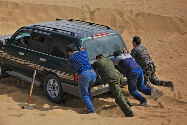
Keriya County, China-October 5, 2017: Car-pushing Drivers Unstuck A Green Off-road Car For Touristic Service Stuck In Sand While Driving Through The Treacherous Loose Dunes Of The Taklamakan Desert.
Image, 11.75MB, 5100 × 3400 jpg

Kashgar, Xinjiang, China - August 14, 2012: Portrait Of A Uyghur Man At A Street In The City Of Kashgar, Xinjiang, China
Image, 7.2MB, 4288 × 2848 jpg
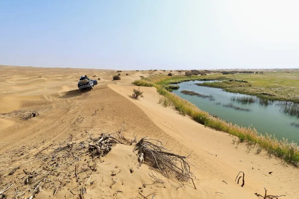
Keriya River Supplies Several Oases-flows N.into The TaklaMakan Desert To An Endorheic Delta Where It Gets Lost In The Sand-off Road Vehicles Running Along. Yutian County-Xinjiang Uyghur Region-China.
Image, 12.73MB, 5100 × 3400 jpg
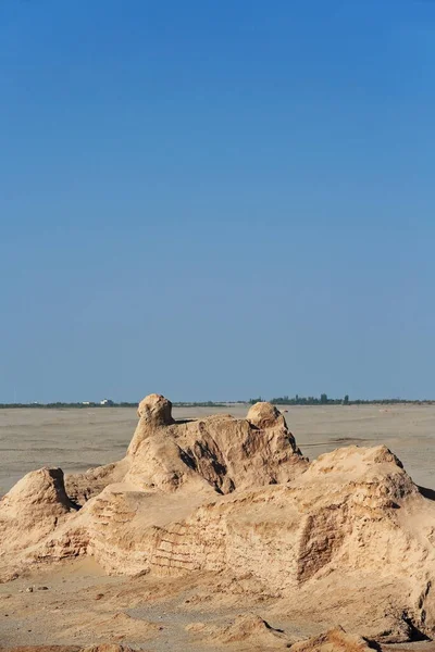
Ruins Of The Large Rectangular Tibetan Fort From The Tang Dinasty Active In The VIII-IX Centurys. Ancient Town Of Miran-old Caravan Track To Dunhuang-Southern Silk Road. Ruoqiang County-Xinjiang-China
Image, 13.4MB, 3600 × 5400 jpg

Street In Old City Of Kashgar, Xinjiang, China, Uyghur Autonomous Region
Image, 3.01MB, 4608 × 3072 jpg
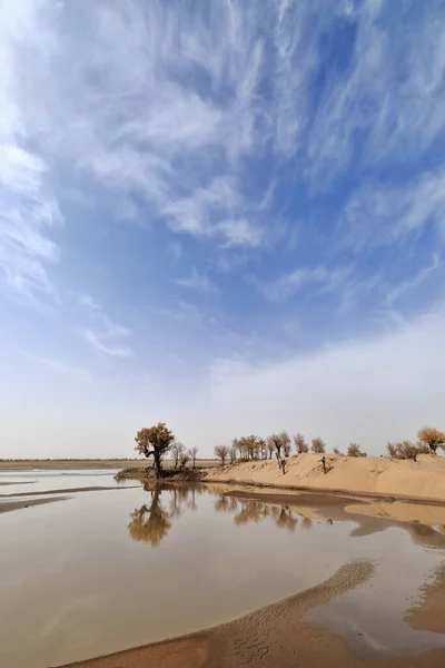
Keriya River Supplies Several Oases-flows N.into The TaklaMakan Desert To An Endorheic Delta Where It Gets Lost In The Sand. Keriya Yutian County-Hotan Pref.-Xinjiang Uyghur Autonomous Region-China.
Image, 9.53MB, 3400 × 5100 jpg

Brussels, Belgium. 5th July 2020. Protesters Take Part In A Rally Against Belgium's Constitutional Court Rule To Prohibit The Use Of Head Scarfs In Universities.
Image, 10.84MB, 5527 × 3685 jpg
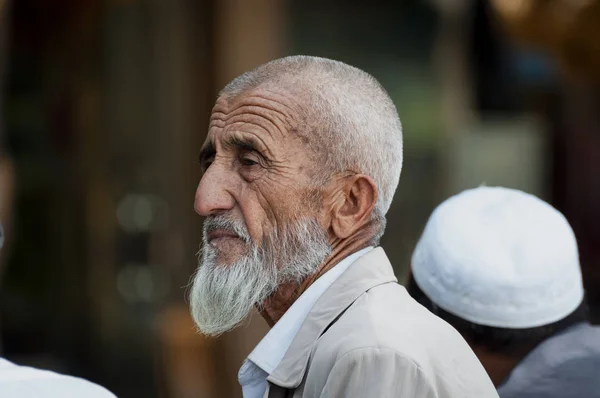
Kashgar, Xinjiang, China - August 14, 2012: Portrait Of A Uyghur Man At A Street Market In The City Of Kashgar, Xinjiang, China
Image, 6.61MB, 4288 × 2848 jpg

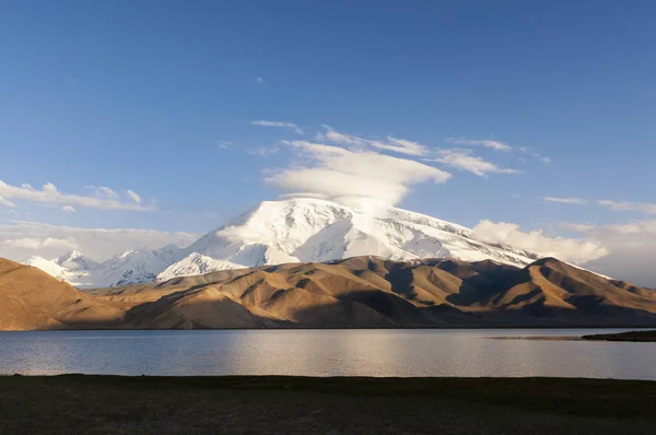
Aerial View Of The Ailik Lake During Sunset With Beautiful Orange Sun. The Ailik Or Aylik Lake Is A Lake In Xinjiang Uighur Autonomous Region Of China.
Image, 10.21MB, 5472 × 3078 jpg
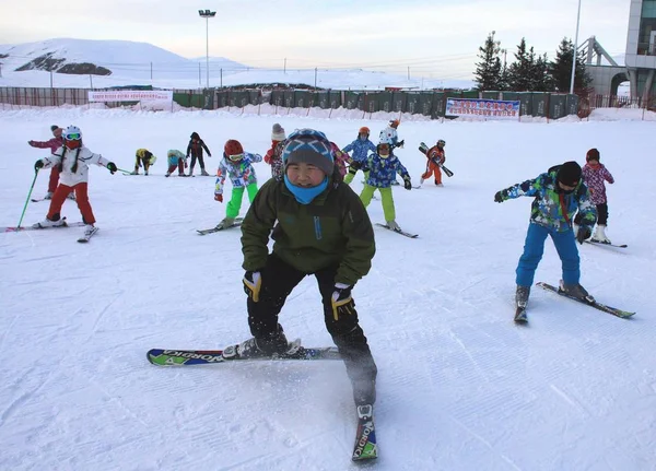
Students From A Primary School Are Learning To Ski At A Ski Resort In Altay Prefecture, Northwest China's Xinjiang Uyghur Autonomous Region, 22 December 2016
Image, 1.37MB, 4146 × 2982 jpg
Turpan, China - August 10, 2012: People At A Street Market In The City Of Turpan, Xinjiang Region.
Image, 6.86MB, 4288 × 2848 jpg

Kashgar, Xinjiang, China - August 14, 2012: A Uyghur Man At A Bus In The City Of Kashgar, Xinjiang, China
Image, 8.09MB, 4288 × 2848 jpg
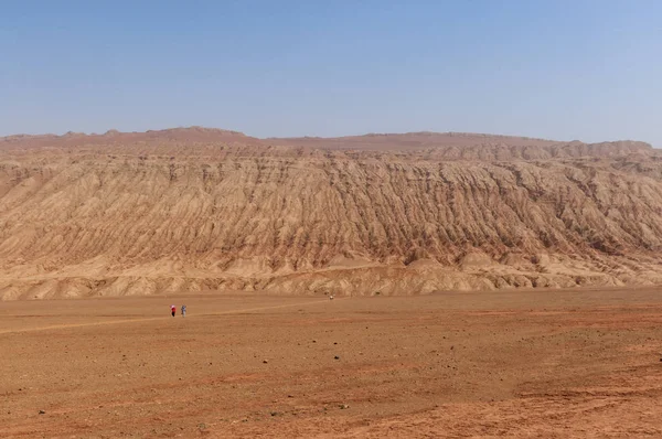
The Arid Landscape At The Flaming Mountains Near The City Of Turpan, Xinjiang, China
Image, 8.71MB, 4288 × 2848 jpg
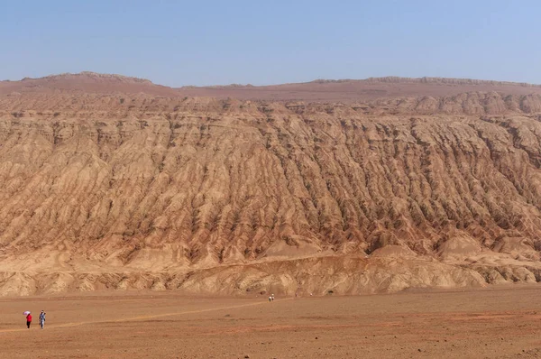
The Arid Landscape At The Flaming Mountains Near The City Of Turpan, Xinjiang, China
Image, 9.14MB, 4288 × 2848 jpg
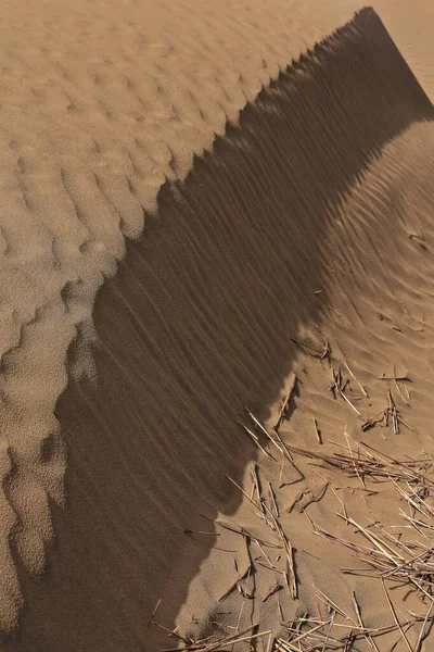
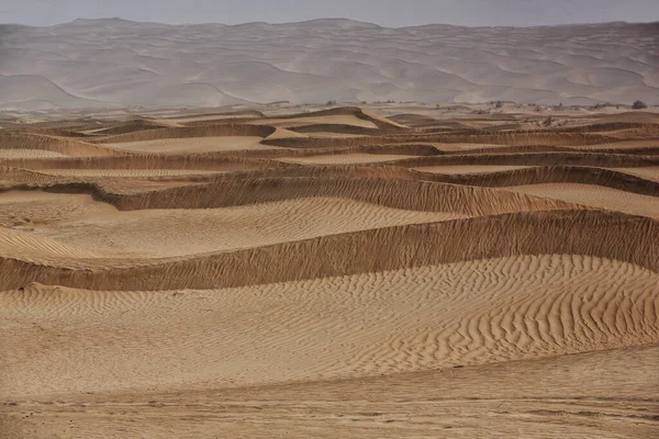
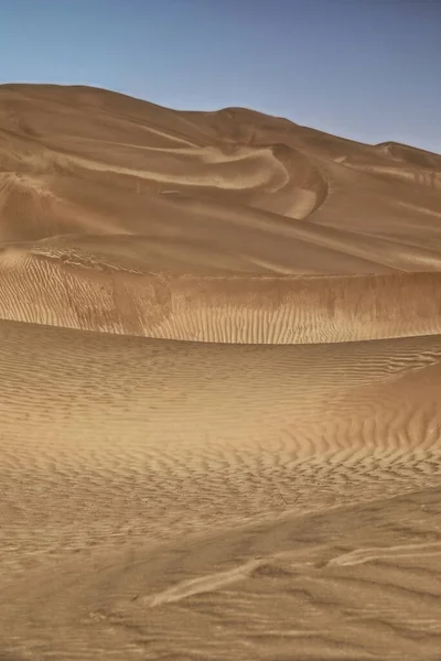
Moving Sand Dunes Cover The Surface Of The Taklamakan Desert Forming Chains Of These Eolian Topographic Forms-some Of Them Reaching Up To 300 Ms.high. Yutian Keriya County-Xinjiang Uyghur Region-China
Image, 13.63MB, 3400 × 5100 jpg

Ruins Of Rawak Stupa And Vihara-Taklamakan Desert. Xinjiang Uyghur Region-China-0030
Image, 10.4MB, 4500 × 3000 jpg

100 Year Old Uyghur Tea House In Old City Of Kashgar, Xinjiang, China, Uyghur Autonomous Region
Image, 2.28MB, 4491 × 2995 jpg
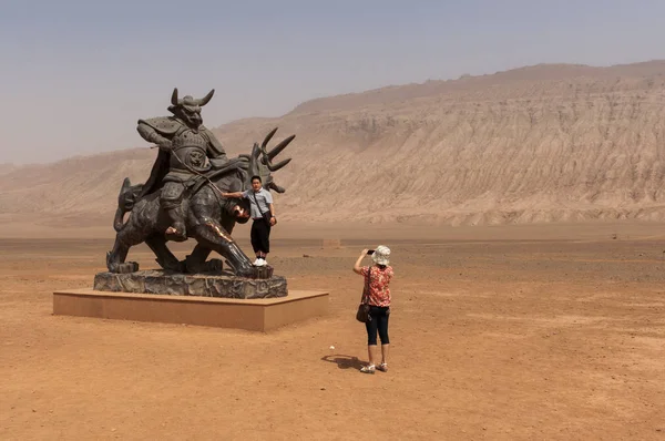
Flaming Mountains, Xinjiang, China - August 12, 2012: Chinese Tourists Taking Pictures In Front Of A Statue Near The Flaming Mountains, Xinjiang, China
Image, 6.74MB, 4288 × 2848 jpg
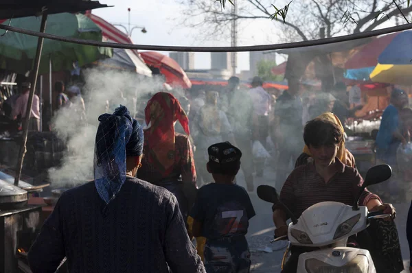
Kashgar, Xinjiang, China - August 16, 2012: People In A Street Market In The City Of Kashgar, Xinjiang, China
Image, 6.06MB, 4288 × 2848 jpg
Chinese Uighur Woman Ali Mihan, Front, 127 Years Old, Is Pictured At Home In Shule County, Kashgar Prefecture, Northwest Chinas Xinjiang Uygur Autonomous Region, 16 August 2013
Image, 1.27MB, 5814 × 3991 jpg
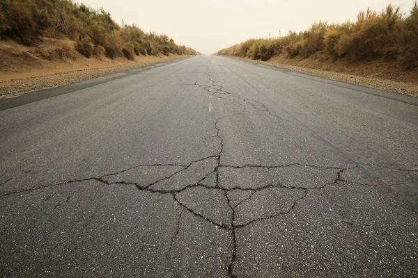
Taqie Highway-branch Of Lunmin Hwy.-tract Of Tarim Desert Hwy.crosses The Taklamakan Desert For 552 Km.from N.to S.linking Luntai And Minfeng Cities-serving The Tazhong Oilfield. Xinjiang Region-China
Image, 18.78MB, 5100 × 3400 jpg
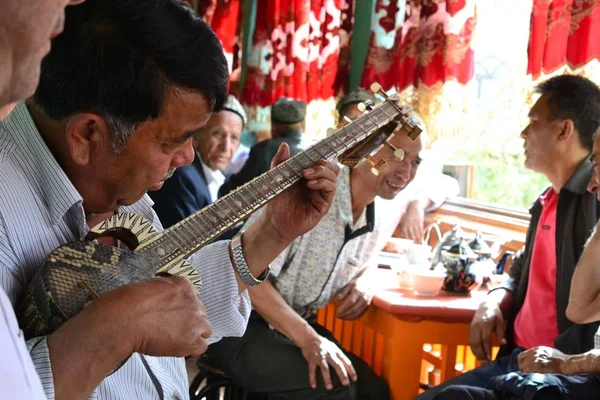
Music Player In 100 Year Old Uyghur Tea House In Old City Of Kashgar, Xinjiang, China, Uyghur Autonomous Region
Image, 2.21MB, 4608 × 3072 jpg

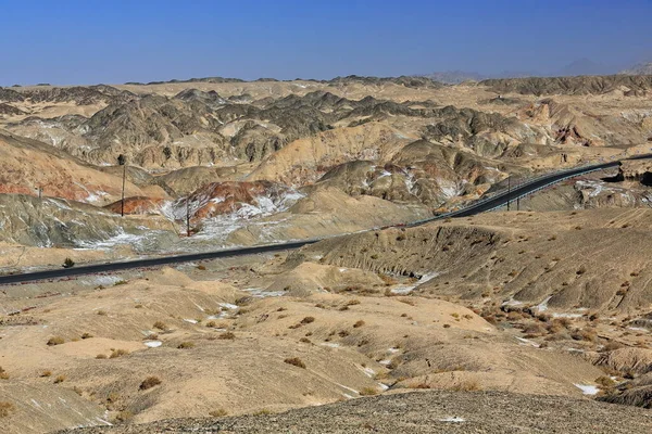
Nnal.Highway G315 Crossing The Altyn-Tagh Ranges Of The Kunlun Mountains Through A 3600 Ms.high Mountain Pass Going From The Taklamakan Desert Into The Qaidam Basin. Xingjiang-Qinghai Provinces-China.
Image, 18.55MB, 5100 × 3400 jpg
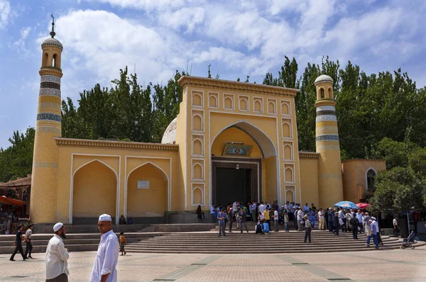
Kashgar, Xinjiang, China - August 14, 2012: The Id Kah Mosque In The City Of Kashgar, Xinjiang, China
Image, 8.53MB, 4258 × 2830 jpg
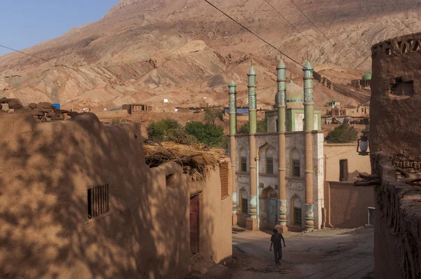
Tuyog, Turpan, China - August 12, 2012: A Man Passing In Front Of The Mosque At The Uyghur Village Of Tuyog, With Mountains On The Background, Xinjiang Region, China.
Image, 7.68MB, 4265 × 2833 jpg
Moving Sand Dunes Cover The Surface Of The Taklamakan Desert Forming Chains Of These Eolian Topographic Forms-some Of Them Reaching Up To 300 Ms.high. Yutian Keriya County-Xinjiang Uyghur Region-China
Image, 11.68MB, 5100 × 3400 jpg

Ruins Of The Large Rectangular Tibetan Fort From The Tang Dinasty Active In The VIII-IX Centurys. Ancient Town Of Miran-old Caravan Track To Dunhuang-Southern Silk Road. Ruoqiang County-Xinjiang-China
Image, 13.5MB, 3600 × 5400 jpg


Brussels, Belgium. 5th July 2020. Protesters Take Part In A Rally Against Belgium's Constitutional Court Rule To Prohibit The Use Of Head Scarfs In Universities.
Image, 13.2MB, 6240 × 4160 jpg


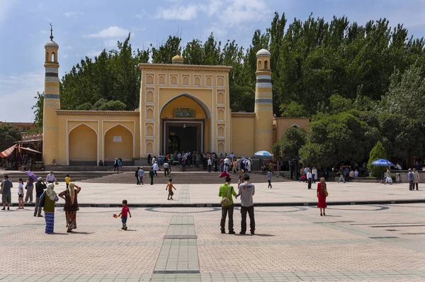
Kashgar, Xinjiang, China - August 14, 2012: The Id Kah Mosque In The City Of Kashgar, Xinjiang, China
Image, 8.55MB, 4208 × 2797 jpg
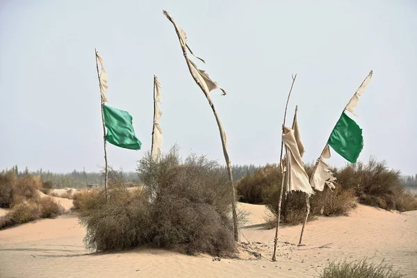
Votive Flags On Burial Mounds Mark The Sufi Mystic Imam Asim's Mazar-masoleum Area Among Windswept Sand Dunes At The Edge Of The Taklamakan Desert. Hotan City-Xinjiang Uyghur Autonomous Region-China.
Image, 8.06MB, 4500 × 3000 jpg
A Large Herd Of Sheep And Cattle Move To A Winter Pasture During A Seasonal Livestock Migration In Fuyun County, Altay, Northwest China's Xinjiang Uyghur Autonomous Region, 22 September 2018
Image, 0.85MB, 2972 × 1981 jpg
Moving Sand Dunes Cover The Surface Of The Taklamakan Desert Forming Chains Of These Eolian Topographic Forms-some Of Them Reaching Up To 300 Ms.high. Yutian Keriya County-Xinjiang Uyghur Region-China
Image, 10.84MB, 3400 × 5100 jpg

Lonely Desert Poplar-Populus Euphratica Deciduous Tree With Bent-forked Double Stem Growing On The Slope Of A Sand Dune In The Taklamakan Desert. Keriya County-Xinjiang Uyghur Autonomous Region-China.
Image, 13.32MB, 5100 × 3400 jpg

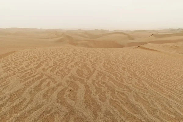
Diffused Sunrise Light-Taklamakan Shifting Dunes Along 233 Prov.Road Between Shamo Expwy.and 315 Nnal.Road Running N.and E.across The Desert. Qiemo Cherchen-Bayingolin Pref.-Xinjiang Uyghur Reg.-China
Image, 10.71MB, 3000 × 4500 jpg
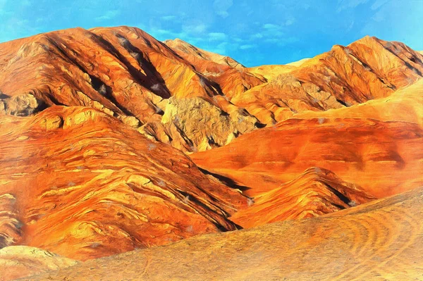
Scenery Mountain Landscape Looks Like Drawing, Flaming Mountains, Silk Road, China.
Image, 28.56MB, 5600 × 3724 jpg
Diffused Light Of Morning Over Chains Of Moving Sand Dunes Covering The Surface Of The Taklamakan Desert Some Of Them Reaching Up To 300 Ms.high. Qiemo Cherchen County-Xinjiang Uyghur Region-China.
Image, 16.87MB, 5100 × 3400 jpg

Previous << Page 2 >> Next