photo free
Home Images Vectors Videos

Stock image Vanikoro

stock image Louis XVI giving Laperouse his instructions on 29 June 1785. Engraving from Nicolas-Andre Monsiau painting

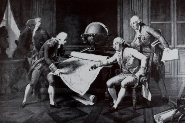
Louis XVI Giving Laperouse His Instructions On 29 June 1785. Engraving From Nicolas-Andre Monsiau Painting

Image, 4.08MB, 4080 × 2720 jpg
stock image Banie Island in the Coral Sea on a satellite image taken in November 8, 2019

Banie Island In The Coral Sea On A Satellite Image Taken In November 8, 2019

Image, 6.99MB, 2880 × 1620 jpg
stock image Banie Island in the Coral Sea, belonging to Solomon Islands, isolated on a bilevel elevation map, with distance scale

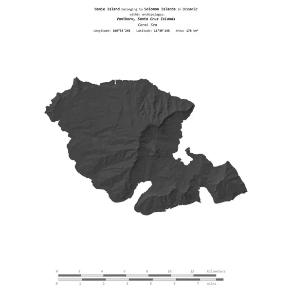
Banie Island In The Coral Sea, Belonging To Solomon Islands, Isolated On A Bilevel Elevation Map, With Distance Scale

Image, 0.45MB, 2160 × 2160 jpg
stock image Banie Island in the Coral Sea, belonging to Solomon Islands, isolated on a topographic, OSM Humanitarian style map, with distance scale

Banie Island In The Coral Sea, Belonging To Solomon Islands, Isolated On A Topographic, OSM Humanitarian Style Map, With Distance Scale

Image, 0.5MB, 2160 × 2160 jpg
stock image Banie Island in the Coral Sea on a topographic, OSM Humanitarian style map

Banie Island In The Coral Sea On A Topographic, OSM Humanitarian Style Map

Image, 0.34MB, 2880 × 1620 jpg
stock image Banie Island in the Coral Sea - belonging to Solomon Islands. Described location diagram with yellow shape of the island and sample maps of its surroundings

Banie Island In The Coral Sea - Belonging To Solomon Islands. Described Location Diagram With Yellow Shape Of The Island And Sample Maps Of Its Surroundings

Image, 2MB, 3840 × 2160 jpg
stock image Female Vanikoro Broadbill (Myiagra vanikorensis) sitting by the

Female Vanikoro Broadbill (Myiagra Vanikorensis) Sitting By The

Image, 7.14MB, 5184 × 3456 jpg
stock image Banie Island in the Coral Sea, belonging to Solomon Islands, isolated on a satellite image taken in September 29, 2017, with distance scale

Banie Island In The Coral Sea, Belonging To Solomon Islands, Isolated On A Satellite Image Taken In September 29, 2017, With Distance Scale

Image, 1.38MB, 2160 × 2160 jpg
stock image Vanikoro island bis

Vanikoro Island Bis

Image, 12.29MB, 4468 × 3008 jpg
stock image Banie Island in the Coral Sea on a colored elevation map

Banie Island In The Coral Sea On A Colored Elevation Map

Image, 1.08MB, 2880 × 1620 jpg
Page 1 >> Next