
Stock image Westward View
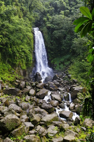
Trafalgar Falls, Morne Trois Pitons National Park (UNESCO Heritage Site), Dominica. Lesser Antilles
Image, 36.88MB, 4000 × 6016 jpg
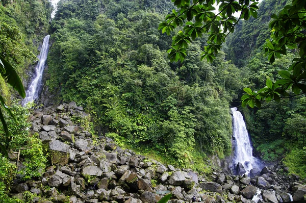
Trafalgar Falls, Morne Trois Pitons National Park (UNESCO Heritage Site), Dominica. Lesser Antilles
Image, 39.82MB, 6016 × 4000 jpg
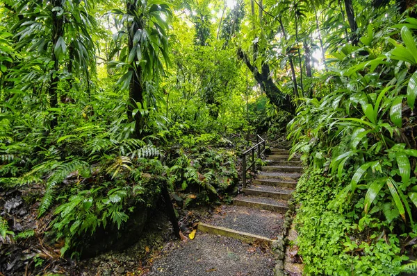
Falling Lianas On Trail To The Trafalgar Waterfalls. Morne Trois Pitons National Park (UNESCO Heritage Site), Dominica
Image, 33.3MB, 6016 × 4000 jpg
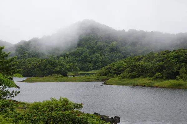
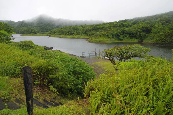
The Freshwater Lake, Morne Trois Pitons National Park (UNESCO Heritage Site), Dominica. Lesser Antilles
Image, 23.41MB, 6016 × 4000 jpg

The Freshwater Lake, Morne Trois Pitons National Park (UNESCO Heritage Site), Dominica. Lesser Antilles
Image, 24.49MB, 6016 × 4000 jpg
The Freshwater Lake, Morne Trois Pitons National Park (UNESCO Heritage Site), Dominica. Lesser Antilles
Image, 24.25MB, 6016 × 4000 jpg

Aerial View Of The Westerly Side Of Funchal With Many Hotels, Madeira Island
Image, 12.22MB, 4800 × 3200 jpg

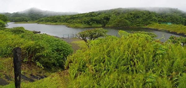
The Freshwater Lake, Morne Trois Pitons National Park (UNESCO Heritage Site), Dominica. Lesser Antilles
Image, 22.26MB, 9556 × 3733 jpg

The Freshwater Lake, Morne Trois Pitons National Park (UNESCO Heritage Site), Dominica. Lesser Antilles
Image, 25.75MB, 6016 × 4000 jpg


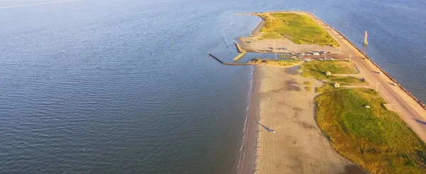
Panorama Aerial View Famous Texas City Dike, A Levee That Projects Nearly 5miles South-east Into Mouth Of Galveston Bay. It Was Designed To Reduce The Impact Of Sediment Accumulation Along Lower Bay
Image, 3.67MB, 3999 × 1637 jpg
Panorama Aerial View Famous Texas City Dike, A Levee That Projects Nearly 5miles South-east Into Mouth Of Galveston Bay. It Was Designed To Reduce The Impact Of Sediment Accumulation Along Lower Bay
Image, 4.33MB, 3999 × 1637 jpg

The Freshwater Lake, Morne Trois Pitons National Park (UNESCO Heritage Site), Dominica. Lesser Antilles
Image, 23.51MB, 6016 × 4000 jpg
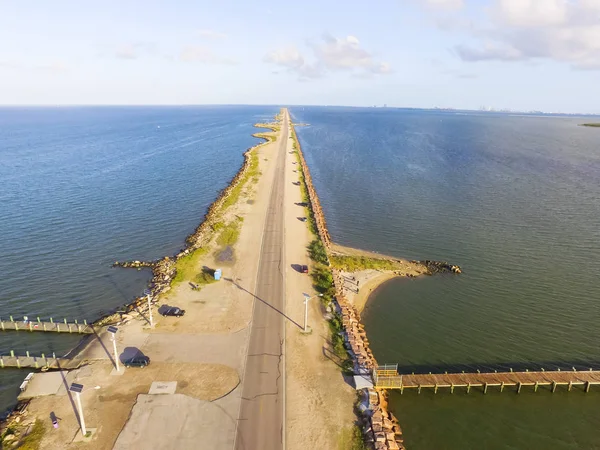
Aerial View Famous Texas City Dike With Wooden Piers, A Levee That Project Nearly 5miles South-east Into Mouth Of Galveston Bay. It Was Designed To Reduce The Impact Of Sediment Accumulation Along Bay
Image, 6.32MB, 4000 × 3000 jpg
The Freshwater Lake, Morne Trois Pitons National Park (UNESCO Heritage Site), Dominica. Lesser Antilles
Image, 33.04MB, 8204 × 3921 jpg

Panorama Aerial View Famous Texas City Dike, A Levee That Projects Nearly 5miles South-east Into Mouth Of Galveston Bay. It Was Designed To Reduce The Impact Of Sediment Accumulation Along Lower Bay
Image, 3.64MB, 3999 × 1637 jpg
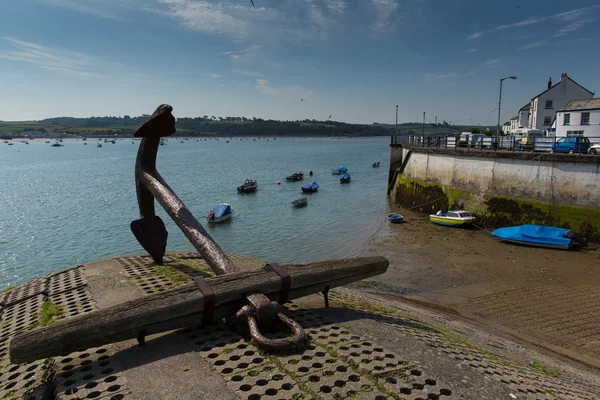
Ships Anchor Appledore Devon England And River Torridge Near Bideford
Image, 13.23MB, 5583 × 3722 jpg


Baracoa, Cuba-October 21, 2019: Panoramic View To The West Over Calle Mariana Grajales Street, Main Thoroughfare Of The La Playa Area, At Early Sunset Seen From The Former El Castillo-The Castle Fort.
Image, 21.17MB, 5690 × 3680 jpg

Havana, Cuba-October 26, 2019: Westward View Along Calle Brasil -Teniente Rey- Street, House With Artistic Arrowhead-finished Iron Fence-railings On Right Side, Edificio Gomez Vila Building On Left.
Image, 11.48MB, 3778 × 5666 jpg

View After Rain Of The Seawall Parapet And The Buildings In Row Along The Malecon Esplanade From Number 65 Until The United States Embassy In The Far Background. Centro Habana And Vedado-Havana-Cuba.
Image, 26.77MB, 6780 × 4520 jpg

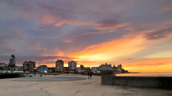
Spectacular Sunset Over The Malecon Esplanade, Parque Maceo Park Area, With Local People Sitting On The Seawall Parapet While Chatting, Relaxing And Fishing, Habana Centro Neighbourhood. Havana-Cuba.
Image, 7.53MB, 5604 × 3736 jpg

Havana, Cuba-October 26, 2019: Sunset Over The AD 1916 Antonio Maceo Equestrian Monument In The Parque Maceo Park Of The Malecon Promenade, Buildings On Calle Marina Street In Background. Havana-Cuba.
Image, 7.62MB, 3600 × 5400 jpg

Havana, Cuba-October 26, 2019: View At Sunset Of The Seawall Parapet And The Buildings In Row Along The Malecon Esplanade From The Parque Maceo Park Area To The Edificio Focsa Building. Havana-Cuba.
Image, 10.59MB, 5760 × 3840 jpg
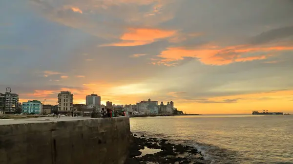
Havana, Cuba-October 26, 2019: Sunset View Of The Seawall Parapet And The Buildings In Row Along The Malecon Esplanade From The Parque Maceo Park Area To The Edificio Someillan Building. Havana-Cuba.
Image, 11.48MB, 6735 × 3788 jpg

Santiago, Cuba-October 20, 2019: Westward View Along Calle Bartolome Maso Street And The South Edge Of The Balcon De Velazquez Balcony To The Innermost Part Of The Bay, Sierra Maestra In Background,
Image, 22.5MB, 4452 × 6678 jpg
Havana, Cuba-October 26, 2019: Sunset View Of The Seawall Parapet And The Buildings In Row Along The Malecon Esplanade From The Parque Maceo Park Area To The Edificio Someillan Building. Havana-Cuba.
Image, 9.44MB, 6500 × 3656 jpg

Baracoa, Cuba-October 21, 2019: Panoramic View To The West Over Calle Mariana Grajales Street, Main Thoroughfare Of La Playa Area, El Yunque Table Mountain In Back Seen From El Castillo-The Castle.
Image, 10.1MB, 5805 × 3845 jpg
Page 1 >> Next