Home
Images
Vectors
Videos
Stock image Eastern Macedonia and Thrace, decentralized administration of Greece. Colored shader data with lakes and rivers. Shape outlined against its country area. 3D rendering
Published:
Aug.21, 2020 08:26:08
Author:
Yarr65
Views:
1
Downloads:
0
File type:
image
/
jpg
File size:
4.76 MB
Orginal size:
2880
x
1620
px
Available sizes:
S
(500 x 281)
M
(1000 x 563)
L
(2000 x 1125)
XL
(2880 x 1620)
EL0
(2880 x 1620)
Level:
bronze
Download Image
Image topics:
View
Shape
Travel
Nature
Border
Landscape
Physical
Glow
Contour
Scale
Earth
Planet
World
Ocean
Science
Capital
Europe
Profile
Outline
Country
Map
Cartography
Geography
Continent
Land
Zoom
Athens
Greece
Region
Territory
Outlined
Atlas
Legend
Overlay
GRC
3d Rendering
Komotini
Subregion
Eastern Macedonia And Thrace
Administrative Division
Decentralized Administration
Similar stock images
Close-up Of Aphysical Map Centered On Uzbekistan
3840 × 2160
Close-up Of The Georgia Border Area Highlighting With A Dark Overlay On A Physical Map. Capital Point. Outline Around The Country Shape.
3840 × 2160
Maga Buryatdan, Region Of Russia. Colored Shader Data With Lakes And Rivers. Shape Outlined Against Its Country Area. 3D Rendering
2880 × 1620
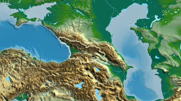
Close-up Of The Georgia Border Area On A Physical Map. Capital Point. Glow Around The Country Shape.
3840 × 2160
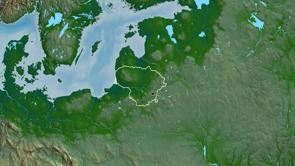
Close-up Of The Lithuania Border Area On A Physical Map. Capital Point. Outline Around The Country Shape.
3840 × 2160
Close-up Of Aphysical Map Centered On Lithuania
3840 × 2160
Close-up Of The Lithuania Border Area On A Physical Map. Capital Point. Glow Around The Country Shape.
3840 × 2160
Close-up Of The Georgia Border Area And Its Regional Borders On A Physical Map. Capital Point. Outline Around The Country Shape.
3840 × 2160