photo free
Home Images Vectors Videos

Stock image Kent Island in the North Atlantic Ocean, belonging to United States, isolated on a bilevel elevation map, with distance scale
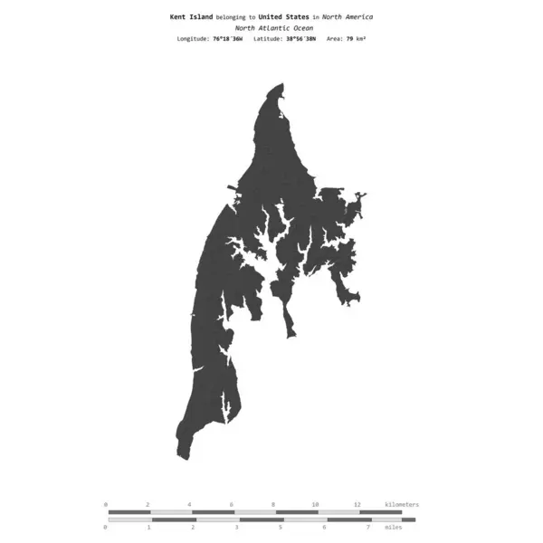
Stock image Kent Island in the North Atlantic Ocean, belonging to United States, isolated on a bilevel elevation map, with distance scale
Published: Sep.11, 2024 14:07:23
Author: zelwanka
Views: 0
Downloads: 0
File type: image / jpg
File size: 0.32 MB
Orginal size: 2160 x 2160 px
Available sizes:
S
(500 x 500)
M
(1000 x 1000)
L
(2000 x 2000)
XL
(2160 x 2160)
EL0
(2160 x 2160)
Level: beginner
Download Image
Image topics:

Similar stock images

stock image Shape of Newfoundland and Labrador, province of Canada, with its capital isolated on white background. Bilevel elevation map. 3D rendering

Shape Of Newfoundland And Labrador, Province Of Canada, With Its Capital Isolated On White Background. Bilevel Elevation Map. 3D Rendering

3836 × 2846
stock image Shape of Tulcea, county of Romania, with its capital isolated on white background. Bilevel elevation map. 3D rendering

Shape Of Tulcea, County Of Romania, With Its Capital Isolated On White Background. Bilevel Elevation Map. 3D Rendering

3836 × 2773
stock image Area of Mwanza, region of Tanzania, isolated on a solid background in a georeferenced bounding box. Labels. Colored elevation map. 3D rendering

Area Of Mwanza, Region Of Tanzania, Isolated On A Solid Background In A Georeferenced Bounding Box. Labels. Colored Elevation Map. 3D Rendering

2880 × 1620
stock image Shape of a Pale colored elevation map with lakes and rivers of the Turks and Caicos Islands, with distance scale and map border coordinates, isolated on white

Shape Of A Pale Colored Elevation Map With Lakes And Rivers Of The Turks And Caicos Islands, With Distance Scale And Map Border Coordinates, Isolated On White

2666 × 1687
stock image Area of Massachusetts, state of Mainland United States, isolated on a solid background in a georeferenced bounding box. Labels. Bilevel elevation map. 3D rendering

Area Of Massachusetts, State Of Mainland United States, Isolated On A Solid Background In A Georeferenced Bounding Box. Labels. Bilevel Elevation Map. 3D Rendering

2880 × 1620
stock image Shape of a topographic, OSM standard style map of the Belize, with distance scale and map border coordinates, isolated on white

Shape Of A Topographic, OSM Standard Style Map Of The Belize, With Distance Scale And Map Border Coordinates, Isolated On White

1761 × 2554
stock image Shape of a topographic, OSM standard style map of the Falkland Islands, with distance scale and map border coordinates, isolated on white

Shape Of A Topographic, OSM Standard Style Map Of The Falkland Islands, With Distance Scale And Map Border Coordinates, Isolated On White

2593 × 1735
stock image Shape of Quebec, province of Canada, with its capital isolated on a solid color background. Bilevel elevation map. 3D rendering

Shape Of Quebec, Province Of Canada, With Its Capital Isolated On A Solid Color Background. Bilevel Elevation Map. 3D Rendering

3537 × 3836