photo free
Home Images Vectors Videos

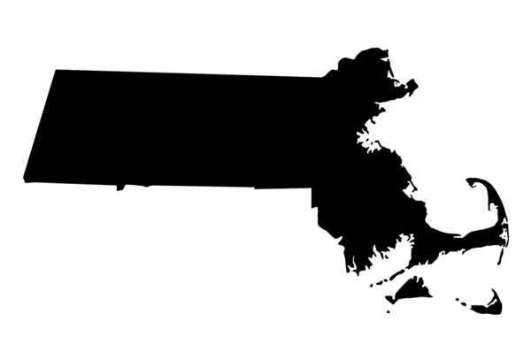
Stock image Map of Barnstable County in Massachusetts state on white background. single County map highlighted by black colour on Massachusetts map. UNITED STATES, US

Stock image Map of Barnstable County in Massachusetts state on white background. single County map highlighted by black colour on Massachusetts map. UNITED STATES, US
Published: Jul.18, 2024 13:59:11
Author: akhtaransari
Views: 0
Downloads: 0
File type: image / jpg
File size: 4.38 MB
Orginal size: 8000 x 6667 px
Available sizes:
S
(500 x 417)
M
(1000 x 833)
L
(2000 x 1667)
XL
(8000 x 6667)
EL0
(8000 x 6667)
Level: beginner
Download Image
Image topics:

Similar stock images

stock image Commonwealth of Massachusetts map

Commonwealth Of Massachusetts Map

4300 × 2800
stock image Shape of Massachusetts, state of Mainland United States, with its capital isolated on white background. Bilevel elevation map. 3D rendering

Shape Of Massachusetts, State Of Mainland United States, With Its Capital Isolated On White Background. Bilevel Elevation Map. 3D Rendering

3836 × 2225
stock image Map of Massachusetts - USA

Map Of Massachusetts - USA

8000 × 5000
stock image Commonwealth of Massachusetts

Commonwealth Of Massachusetts

4300 × 2800
stock image Shape of Massachusetts, state of Mainland United States, with its capital isolated on white background. Composition of patterned textures. 3D rendering

Shape Of Massachusetts, State Of Mainland United States, With Its Capital Isolated On White Background. Composition Of Patterned Textures. 3D Rendering

3836 × 2225
stock image Shape of Massachusetts, state of Mainland United States, with its capital isolated on white background. Colored elevation map. 3D rendering

Shape Of Massachusetts, State Of Mainland United States, With Its Capital Isolated On White Background. Colored Elevation Map. 3D Rendering

3836 × 2225
stock image Shape of Rhode Island, state of Mainland United States, with its capital isolated on white background. Bilevel elevation map. 3D rendering

Shape Of Rhode Island, State Of Mainland United States, With Its Capital Isolated On White Background. Bilevel Elevation Map. 3D Rendering

2805 × 3836
stock image Massachusetts, state of United States of America. Open Street Map. Corner auxiliary location maps

Massachusetts, State Of United States Of America. Open Street Map. Corner Auxiliary Location Maps

4930 × 3770