Home
Images
Vectors
Videos
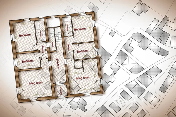
Stock image Residential building plan over an imaginary cadastral map of ter
Published:
May.11, 2019 09:59:07
Author:
Francescoscatena
Views:
92
Downloads:
8
File type:
image
/
jpg
File size:
8.23 MB
Orginal size:
4752
x
3168
px
Available sizes:
S
(500 x 333)
M
(1000 x 667)
L
(2000 x 1333)
XL
(4752 x 3168)
EL0
(4752 x 3168)
Level:
bronze
Download Image
Image topics:
Graphic
Illustration
Design
Road
Traffic
Building
City
House
Urban
Interior
Home
Measurement
Writing
Planning
Drawing
Street
Pencil
Ownership
Property
Town
Outline
Map
Cartography
Geography
Plan
Land
Architect
Residential
Engineer
Chart
Topography
Imaginary
Crossroad
Survey
Register
Surveyor
Cadastre
Human Hand
Copy Space
Row House
Residential District
Residential Building
Terraced House
Home Ownership
Semi Detached House
Cadastral
Cartographic Survey
Similar stock images
Render Model Landscape Architect Design House
1200 × 3500
Computer Generated Visualization Of Apartment Building. Top View.
4000 × 3000
Project Plan Of The Shopping Center In The City
6001 × 6001
Plan Office Building
3465 × 1900
Modern Beautiful House. Cottage For A Large Family. 3D Illustration.
6817 × 3000
Multistorey Building
3081 × 2052
3d Floor Plan For Real Estate. House Floor Plan Elevation. 3D Design Of Home Space.
3840 × 2715