photo free
Home Images Vectors Videos

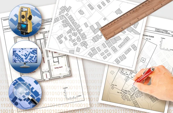
Stock image Cadastral

stock image Close-up Of Human Hand Holding Pencil Over Paper Cadastre Map

Close-up Of Human Hand Holding Pencil Over Paper Cadastre Map

Image, 12.96MB, 8688 × 5792 jpg
stock image engineer with theodolite

Engineer With Theodolite

Image, 11.94MB, 5170 × 3447 jpg
stock image cadastral map of a garden flat

Cadastral Map Of A Garden Flat

Image, 12.89MB, 6000 × 4000 jpg
stock image Close-up Of Human Hand Holding Pencil Over Paper Cadastre Map

Close-up Of Human Hand Holding Pencil Over Paper Cadastre Map

Image, 20.1MB, 9504 × 6336 jpg
stock image Close-up Of Human Hand Holding Pencil Over Paper Cadastre Map

Close-up Of Human Hand Holding Pencil Over Paper Cadastre Map

Image, 13.67MB, 9244 × 6163 jpg
stock image Close-up Of Human Hand Holding Pencil Over Paper Cadastre Map

Close-up Of Human Hand Holding Pencil Over Paper Cadastre Map

Image, 13.33MB, 9504 × 6336 jpg
stock image building project and tool works

Building Project And Tool Works

Image, 14.03MB, 6000 × 4000 jpg
stock image work table of an engeneer

Work Table Of An Engeneer

Image, 13.45MB, 6000 × 4000 jpg
stock vector Cadastre (imaginary seamless image)

Cadastre (imaginary Seamless Image)

Vector, 6.01MB, 5700 × 3800 eps
stock image cadastral map and tool works of an engeneer

Cadastral Map And Tool Works Of An Engeneer

Image, 10.36MB, 6000 × 4000 jpg
stock image angry and upset captain for delays flight by snowstorm

Angry And Upset Captain For Delays Flight By Snowstorm

Image, 8.7MB, 5760 × 3840 jpg
stock image Hands Holding Pencils Over Cadastre Map Stock Photo

Hands Holding Pencils Over Cadastre Map Stock Photo

Image, 14.08MB, 8688 × 5792 jpg
stock image Man conducting a survey

Man Conducting A Survey

Image, 8.82MB, 5616 × 3744 jpg
stock image Marked territory on cadastral map, top view. Illustration

Marked Territory On Cadastral Map, Top View. Illustration

Image, 4.73MB, 7510 × 5075 jpg
stock image Office stationery and magnifying glass on cadastral maps of territory with buildings

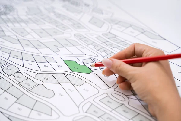
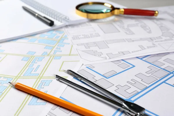
Office Stationery And Magnifying Glass On Cadastral Maps Of Territory With Buildings

Image, 7.16MB, 5760 × 3840 jpg
stock image Close-up Of A Businessperson Analyzing Cadastre Map On Computer In The Office

Close-up Of A Businessperson Analyzing Cadastre Map On Computer In The Office

Image, 15.45MB, 7564 × 5044 jpg
stock image Worker, architect and engineer work on real estate construction project oratory planning with cartography and cadastral map of urban town area to guide to construction developer business plan of city

Worker, Architect And Engineer Work On Real Estate Construction Project Oratory Planning With Cartography And Cadastral Map Of Urban Town Area To Guide To Construction Developer Business Plan Of City

Image, 11.3MB, 9504 × 3595 jpg
stock image Imaginary cadastral map with buildings, land parcel, vacant plot and Volumetric Format Plan

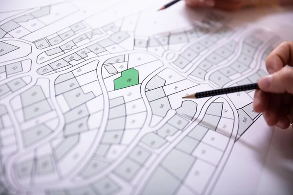
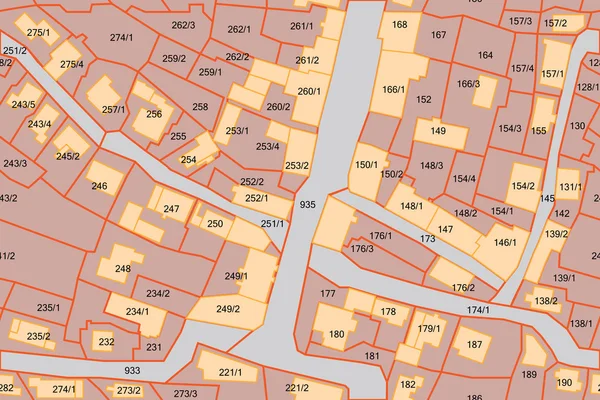
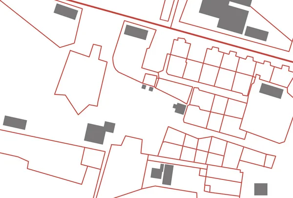
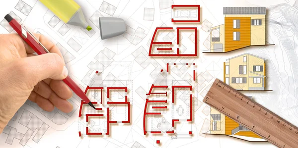
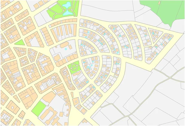
Imaginary Cadastral Map With Buildings, Land Parcel, Vacant Plot And Volumetric Format Plan

Image, 15.15MB, 5760 × 3840 jpg
stock image Imaginary cadastral map with buildings, land parcel and vacant plot - icon concept

Imaginary Cadastral Map With Buildings, Land Parcel And Vacant Plot - Icon Concept

Image, 4.6MB, 3880 × 4574 jpg
stock image A land surveyor writing in his notebook while talking on the phone

A Land Surveyor Writing In His Notebook While Talking On The Phone

Image, 10.67MB, 3744 × 5616 jpg
stock image Architect designs a new residential building with floor plans and elevations over an imaginary city map - concept image.

Architect Designs A New Residential Building With Floor Plans And Elevations Over An Imaginary City Map - Concept Image.

Image, 10.3MB, 6341 × 3168 jpg
stock image Office stationery and cadastral maps of territory with buildings on table

Office Stationery And Cadastral Maps Of Territory With Buildings On Table

Image, 7.46MB, 5760 × 3840 jpg
stock image Cadastral map with a tree on a green area - Concept image seen through a magnifying glass.

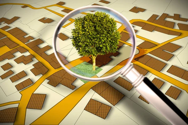
Cadastral Map With A Tree On A Green Area - Concept Image Seen Through A Magnifying Glass.

Image, 9.38MB, 4752 × 3168 jpg
stock image Imaginary cadastral map with buildings, land parcel and vacant plot - land records and property registry concept

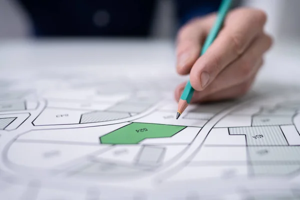
Imaginary Cadastral Map With Buildings, Land Parcel And Vacant Plot - Land Records And Property Registry Concept

Image, 11.3MB, 5745 × 4114 jpg
stock image Road works with excavation for the installation of a methane gas distribution system in a construction site - concept with an imaginary city map

Road Works With Excavation For The Installation Of A Methane Gas Distribution System In A Construction Site - Concept With An Imaginary City Map

Image, 21.96MB, 7872 × 3168 jpg
stock image Imaginary Zoning Ordinance, General Urban Plan with indications of urban destinations with buildings, buildable areas, land plot and real estate land property

Imaginary Zoning Ordinance, General Urban Plan With Indications Of Urban Destinations With Buildings, Buildable Areas, Land Plot And Real Estate Land Property

Image, 7.76MB, 4752 × 3168 jpg
stock image Planning a new city with BIM, Building Information Modeling system, a new way of architecture designing - concept with an engineer or architect drawing a sketch of a new modern imaginary town and digital tablet

Planning A New City With BIM, Building Information Modeling System, A New Way Of Architecture Designing - Concept With An Engineer Or Architect Drawing A Sketch Of A New Modern Imaginary Town And Digital Tablet

Image, 13.77MB, 8458 × 3168 jpg
stock image Cadastral reform concept image with an imaginary cadastral map o

Cadastral Reform Concept Image With An Imaginary Cadastral Map O

Image, 8.18MB, 5476 × 3570 jpg
stock image Advertising billboard immersed in a rural scene with a cadastral

Advertising Billboard Immersed In A Rural Scene With A Cadastral

Image, 12.53MB, 4752 × 3168 jpg
stock image Census of singol, group or row trees in cities -  green management and tree mapping concept with imaginary city map with highlighted trees

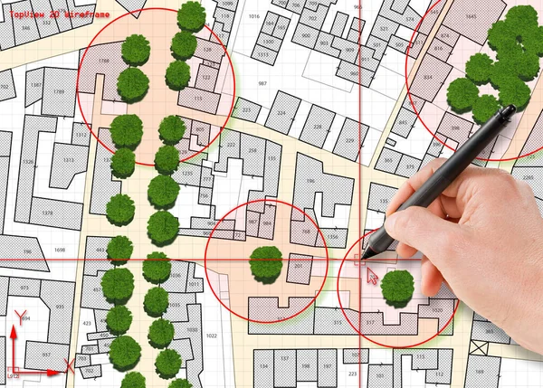
Census Of Singol, Group Or Row Trees In Cities - Green Management And Tree Mapping Concept With Imaginary City Map With Highlighted Trees

Image, 14.27MB, 5738 × 4110 jpg
stock image Doubts and questions about buildings - concept with home model against question marks and imaginary city cadastral map

Doubts And Questions About Buildings - Concept With Home Model Against Question Marks And Imaginary City Cadastral Map

Image, 10.61MB, 7872 × 3168 jpg
stock image Nature and city - concept image with a green grass area of a public park, city map and urban skyline.

Nature And City - Concept Image With A Green Grass Area Of A Public Park, City Map And Urban Skyline.

Image, 19.61MB, 10643 × 3168 jpg
stock image Imaginary topographic cadastral map and land parcels of territory with trees on background and buildable vacant land for sale - concept image.

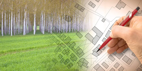
Imaginary Topographic Cadastral Map And Land Parcels Of Territory With Trees On Background And Buildable Vacant Land For Sale - Concept Image.

Image, 18.53MB, 6349 × 3168 jpg
stock image Close-up Of Human Hand Holding Pencil Over Paper Cadastre Map

Close-up Of Human Hand Holding Pencil Over Paper Cadastre Map

Image, 15.91MB, 9504 × 6336 jpg
stock image Old aged dangerous asbestos roof in our cities - one of the most

Old Aged Dangerous Asbestos Roof In Our Cities - One Of The Most

Image, 14.84MB, 4686 × 4686 jpg
stock image Female Executive Looking At Cadastre Map On Screen

Female Executive Looking At Cadastre Map On Screen

Image, 15.21MB, 9109 × 6073 jpg
stock image Buildings Permit concept with imaginary cadastral on digital tablet - building activity and construction industry with General Urban Plan

Buildings Permit Concept With Imaginary Cadastral On Digital Tablet - Building Activity And Construction Industry With General Urban Plan

Image, 17.49MB, 5760 × 3840 jpg
stock image Imaginary General Urban Plan - Zoning regulations with zoning districts, urban destinations, land use, buildable areas and land plot - web design banner concept with copy space and space for text

Imaginary General Urban Plan - Zoning Regulations With Zoning Districts, Urban Destinations, Land Use, Buildable Areas And Land Plot - Web Design Banner Concept With Copy Space And Space For Text

Image, 7MB, 7872 × 3168 jpg
stock image Imaginary General Urban Plan with urban destinations, buildings, buildable areas, land plot and cityscape on foreground

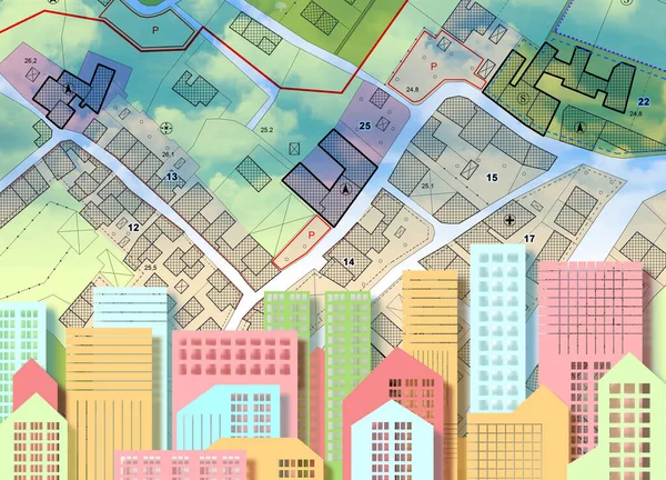
Imaginary General Urban Plan With Urban Destinations, Buildings, Buildable Areas, Land Plot And Cityscape On Foreground

Image, 10.18MB, 5751 × 4147 jpg
stock image Building Activity with red location pin point against an imaginary General Urban Plan and cadastral map with zoning regulations, urban districts, urban destinations and land use - Real Estate concept

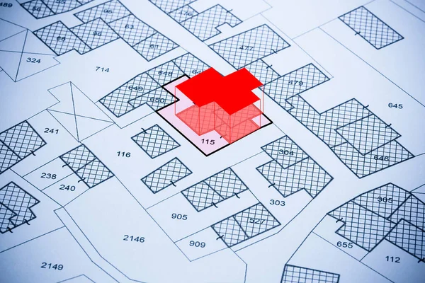
Building Activity With Red Location Pin Point Against An Imaginary General Urban Plan And Cadastral Map With Zoning Regulations, Urban Districts, Urban Destinations And Land Use - Real Estate Concept

Image, 9.24MB, 4752 × 3163 jpg
stock image Updating public cadastral digital databases and information about land registry - concept image with an imaginary cadastral map of territory with buildings, roads and land parcel - Note: The map background is totally invented and does not represent a

Updating Public Cadastral Digital Databases And Information About Land Registry - Concept Image With An Imaginary Cadastral Map Of Territory With Buildings, Roads And Land Parcel - Note: The Map Background Is Totally Invented And Does Not Represent A

Image, 30.91MB, 11261 × 7372 jpg
stock image Doubts and questions about buildings - concept with home model against question marks and imaginary city cadastral map

Doubts And Questions About Buildings - Concept With Home Model Against Question Marks And Imaginary City Cadastral Map

Image, 8.91MB, 6336 × 3168 jpg
stock vector Imaginary cadastral map of an area with buildings and streets.

Imaginary Cadastral Map Of An Area With Buildings And Streets.

Vector, 0MB, 4000 × 3832 zip
stock image Professional cartographers working with cadastral map at table, closeup

Professional Cartographers Working With Cadastral Map At Table, Closeup

Image, 6.56MB, 5760 × 3840 jpg
stock vector Location pin is marking a specific point on a digital cadastral map, indicating property boundaries and land ownership

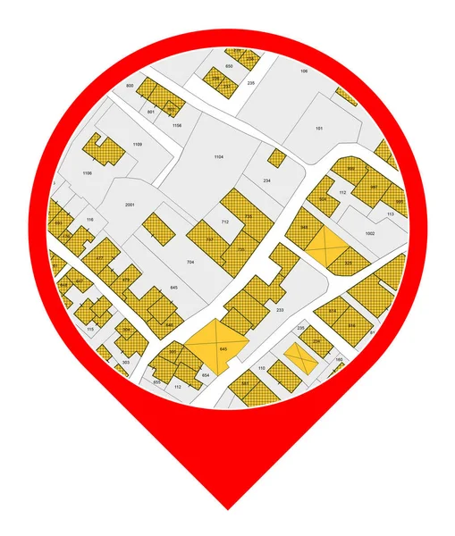
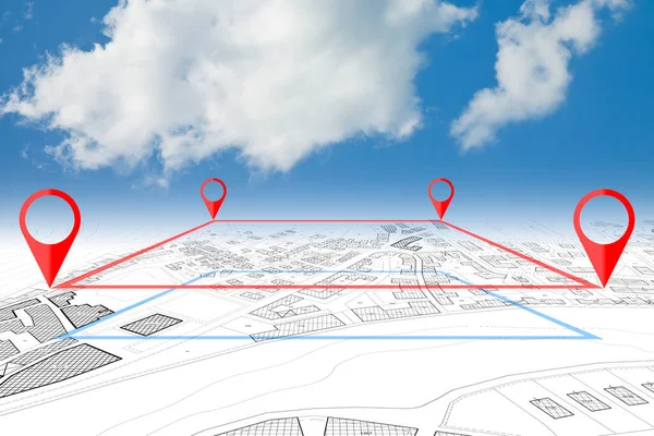
Location Pin Is Marking A Specific Point On A Digital Cadastral Map, Indicating Property Boundaries And Land Ownership

Vector, 0.93MB, 5000 × 5000 eps
stock image Register old buildings at buildings cadastre for taxation - Land registry concept with an imaginary cadastral map of territory and old italian historic buildings

Register Old Buildings At Buildings Cadastre For Taxation - Land Registry Concept With An Imaginary Cadastral Map Of Territory And Old Italian Historic Buildings

Image, 7.78MB, 4666 × 2333 jpg
stock image Land plot management - real estate concept with a vacant land and cadastral parcel available for building activity with cloudy sk

Land Plot Management - Real Estate Concept With A Vacant Land And Cadastral Parcel Available For Building Activity With Cloudy Sk

Image, 4.71MB, 4752 × 3168 jpg
stock image New home and free vacant land for building activity - Construction industry and building permit concept with a residential area, cadastral map, General Urban Planning and zoning regulations

New Home And Free Vacant Land For Building Activity - Construction Industry And Building Permit Concept With A Residential Area, Cadastral Map, General Urban Planning And Zoning Regulations

Image, 17.41MB, 7872 × 3168 jpg
stock image Closeup image of professional cooperative engineer team discuss about building location at modern office. Male engineer put the map on table while beautiful architect taking a note. Immaculate.

Closeup Image Of Professional Cooperative Engineer Team Discuss About Building Location At Modern Office. Male Engineer Put The Map On Table While Beautiful Architect Taking A Note. Immaculate.

Image, 7.14MB, 7008 × 3195 jpg
stock image Imaginary city map with buildings, roads and central parking zone in a residential district - concept image.

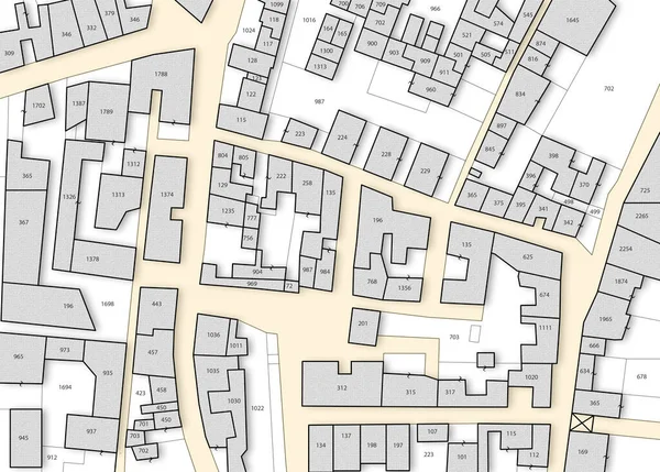
Imaginary City Map With Buildings, Roads And Central Parking Zone In A Residential District - Concept Image.

Image, 26.47MB, 7872 × 3168 jpg
Page 1 >> Next