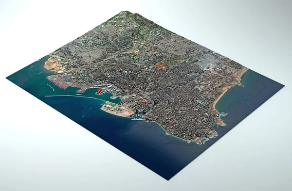
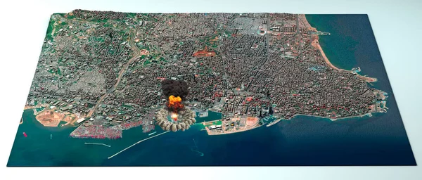
Stock image Satellite view of the city of Beirut in Lebanon. Streets and buildings. Place of the explosion in the port area. Element of this image are furnished by NASA. 3d render
Published: Aug.06, 2020 14:30:22
Author: vampy1
Views: 67
Downloads: 3
File type: image / jpg
File size: 10.34 MB
Orginal size: 5511 x 2356 px
Available sizes:
Level: silver