Home
Images
Vectors
Videos
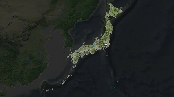
Stock image Shape of Japan separated by the desaturation of neighboring areas. Borders. Satellite imagery. 3D rendering
Published:
Sep.16, 2020 08:56:35
Author:
Yarr65
Views:
0
Downloads:
0
File type:
image
/
jpg
File size:
4.04 MB
Orginal size:
3000
x
2000
px
Available sizes:
S
(500 x 333)
M
(1000 x 667)
L
(2000 x 1333)
XL
(3000 x 2000)
EL0
(3000 x 2000)
Level:
bronze
Download Image
Image topics:
View
Travel
Nature
Sea
Landscape
Earth
Planet
World
Ocean
Science
Capital
Globe
Profile
Country
Map
Cartography
Geography
Continent
Land
Zoom
Asia
Japan
Satellite
Tokyo
Region
Territory
Atlas
Overlay
3d Rendering
Subregion
Jpn
Administrative Division
Similar stock images
Shape Of Japan Separated By The Desaturation Of Neighboring Areas. Satellite Imagery. 3D Rendering
3000 × 2000
The Highlighted Area Of Japan With Capital Point On The Desaturated Map Of Its Neighbourhood. Satellite Imagery
2880 × 1620
Shape Of Japan Separated By The Desaturation Of Neighboring Areas. Borders. Topographic Relief Map. 3D Rendering
3000 × 2000
The Highlighted Area Of Japan With Capital Point On The Desaturated Map Of Its Neighbourhood. Topographic Map
2880 × 1620
The Highlighted Area Of Japan With Capital Point On The Desaturated Map Of Its Neighbourhood. Color Physical Map
2880 × 1620
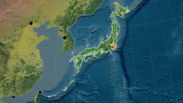
Japan Outlined On The Topographic Orthographic Map. Capital, Administrative Borders And Graticule
3840 × 2160
Enlarged Area Of Japan Surrounded By A Circle On The Background Of Its Neighborhood. Color Physical Map
2880 × 1620
Enlarged Area Of Japan Surrounded By A Circle On The Background Of Its Neighborhood. Satellite Imagery
2880 × 1620