Home
Images
Vectors
Videos
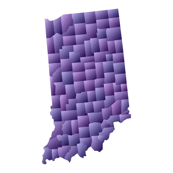
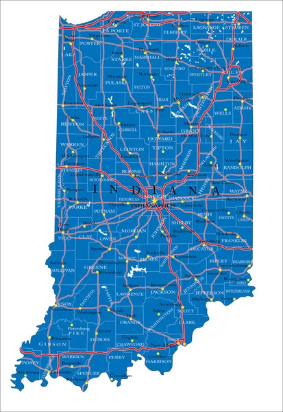
Stock image The state of Indiana is seen as a pastel patchwork of individual counties with a star for the capital Indianpolis. This is a 3-d illustration.
Published:
Apr.21, 2022 09:58:46
Author:
robgoebel1@gmail.com
Views:
2
Downloads:
0
File type:
image
/
jpg
File size:
0.84 MB
Orginal size:
2417
x
2814
px
Available sizes:
S
(429 x 500)
M
(859 x 1000)
L
(1718 x 2000)
XL
(2417 x 2814)
EL0
(2417 x 2814)
Level:
bronze
Download Image
Image topics:
Colors
Yellow
Background
Design
Copy
Space
Isolated
Shape
Travel
Texture
Brown
Modern
Symbol
Pastel
Star
Icon
City
Text
Usa
Highway
Outline
Country
Map
Geography
Area
Tourist
State
Location
America
Welcome
Federal
Embossed
Indiana
County
Patchwork
Greenwood
Carmel
Indianapolis
Counties
Copy Space
Travel Destinations
Global Positioning System
Road Trip
Great Lakes
Text Area
South Bend
Fort Wayne
3 D Illustration
Hoosier State
Midwestern Us
Similar stock images
Indiana Road And Highway Map. Vector Illustration.
3379 × 4667
Indiana - Highly Detailed Editable Political Map With Labeling.
3392 × 4765
U.S. States - Map Of Indiana With Paper Cut Effect. Hand Made. Rivers And Lakes Are Shown. Please Look At My Other Images Of Cartographic Series - They Are All Very Detailed And Carefully Drawn By Hand WITH RIVERS AND LAKES.
6891 × 6891
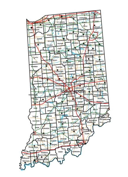
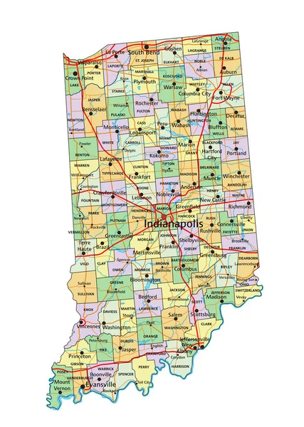
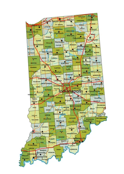
Detailed Map Of Indiana State,in Vector Format,with County Borders,roads And Major Cities
3444 × 5000
Highly Detailed Editable Political Map With Separated Layers. Indiana.
3392 × 4765
Indiana Map Geometric Style Us State Outline With Counties Beautiful Violet Vector Illustration
5480 × 5480
Ohio Road And Highway Map. Vector Illustration.
3121 × 3535
Accurate Map Of Indiana
4000 × 5000