Home
Images
Vectors
Videos
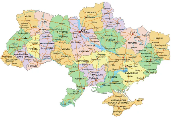
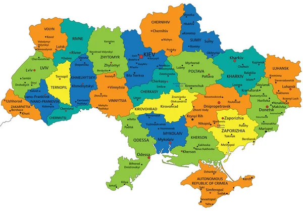
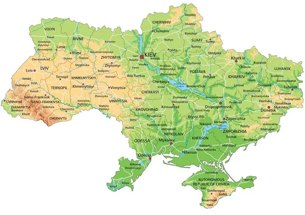
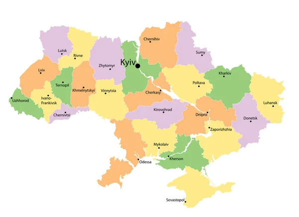
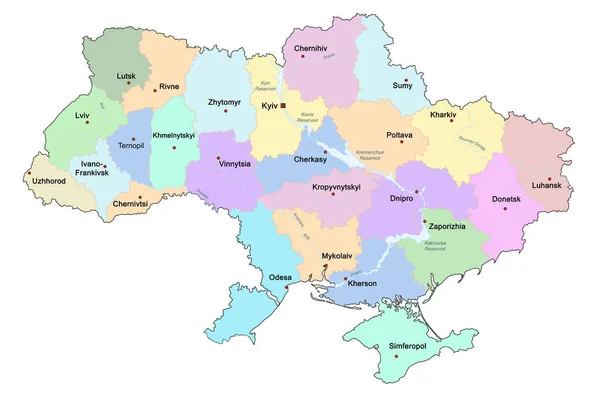
Stock vector administrative map of Ukraine with colored ukrainian areas. Vector illustration on white
Published:
Oct.25, 2022 15:59:02
Author:
olena-design
Views:
44
Downloads:
3
File type:
vector
/
eps
File size:
1.47 MB
Orginal size:
5567
x
4038
px
Available sizes:
S
(500 x 363)
M
(1000 x 725)
L
(2000 x 1451)
XL
(5567 x 4038)
VECT
(5567 x 4038)
EL0
(5567 x 4038)
Level:
beginner
Download Vector
Vector topics:
Green
Color
Yellow
Vector
Graphic
Colored
Illustration
Isolated
Travel
Orange
Silhouette
Multicolor
Multicolored
Crimea
Ukraine
Europe
East
Eastern
Country
Map
Cartography
Political
Administrative
Region
Cities
Territory
Ukrainian
Eps
Areas
Similar stock vectors
Political Map Of Ukraine On White Background, Illustration
13776 × 9247
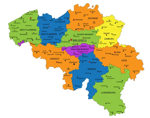
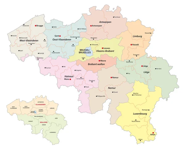
Colorful Belgium Political Map With Clearly Labeled, Separated Layers. Vector Illustration.
5404 × 4252
Administrative And Political Vector Map Of The Republic Of Serbia.
3100 × 4042
Ukraine - Highly Detailed Editable Political Map With Labeling.
5671 × 4005
Map Of Belgium
5000 × 4250
Colorful Ukraine Political Map With Clearly Labeled, Separated Layers. Vector Illustration.
5672 × 4005
High Detailed Ukraine Physical Map With Labeling.
5671 × 4005
Administrative Vector Map Of Belgium Regions, Provinces And Districts
4000 × 3256