Home
Images
Vectors
Videos
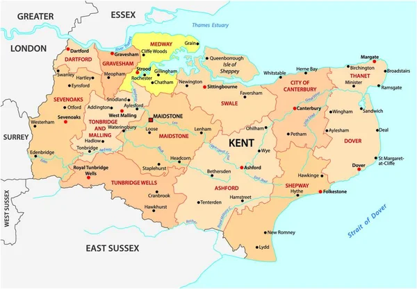
Stock vector administrative vector map of the english county kent with flag
Published:
Jun.05, 2020 07:22:28
Author:
Lesniewski
Views:
2
Downloads:
0
File type:
vector
/
eps
File size:
1.12 MB
Orginal size:
4552
x
3100
px
Available sizes:
S
(500 x 341)
M
(1000 x 681)
L
(2000 x 1362)
XL
(4552 x 3100)
VECT
(4552 x 3100)
EL0
(4552 x 3100)
Level:
bronze
Download Vector
Vector topics:
Vector
Background
Graphic
Illustration
Design
Isolated
Shape
Travel
Abstract
Border
Flag
Modern
Symbol
Icon
City
Simple
Europe
Outline
Country
District
Map
Cartography
Geography
Uk
State
Channel
Political
Administrative
Department
Britain
Region
Division
English
British
Insignia
Territory
England
Province
County
Borough
Mapping
Regional
Dover
Kent
Great Britain
United Kingdom
Similar stock vectors
Kent County Map Divided In Districts With Labels, England
5000 × 3434
Kent County Map Divided In Districts With Labels, England
5000 × 3434
Vector Administrative Map Of The County Kent, England
5376 × 3744
High Quality Map Is A County Of England
4000 × 4000
Georgia Highly Detailed Political Map With National Flag Isolated On White Background.
3600 × 1944
Vector Administrative Map Of The County East Essex, England
5680 × 3464
Vector Macedonia Map
5600 × 4378
Map Of Austria
5400 × 3200