Home
Images
Vectors
Videos
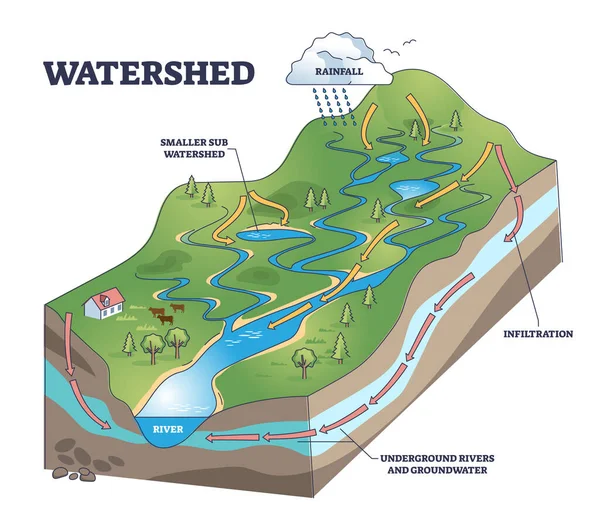
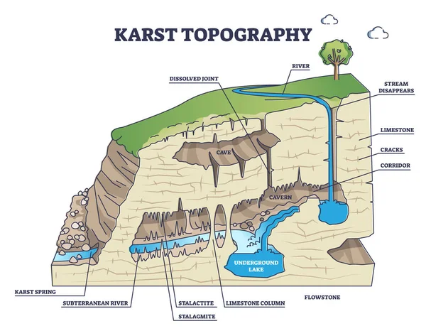
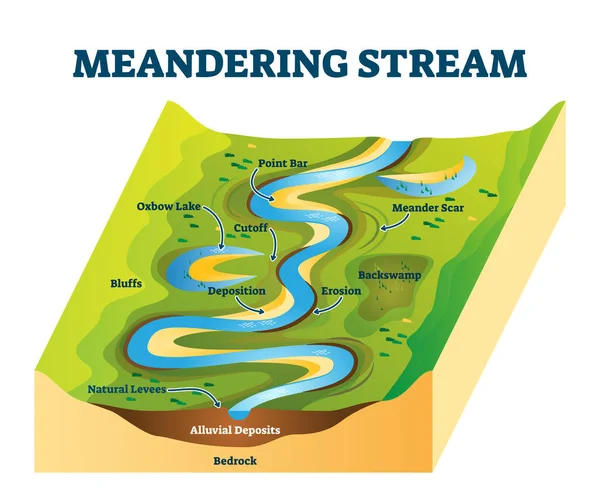
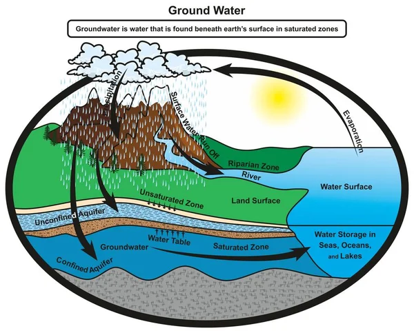
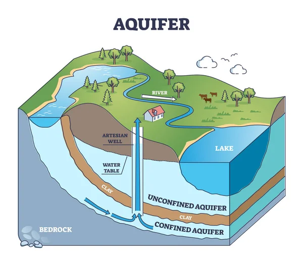
Stock vector Aquifer as confined underground water layers in geological outline diagram
Published:
Nov.15, 2021 12:43:01
Author:
VectorMine
Views:
87
Downloads:
2
File type:
vector
/
eps
File size:
5.84 MB
Orginal size:
4500
x
3886
px
Available sizes:
S
(500 x 432)
M
(1000 x 864)
L
(2000 x 1727)
XL
(4500 x 3886)
VECT
(4500 x 3886)
EL0
(4500 x 3886)
Level:
silver
Download Vector
Vector topics:
Vector
Graphic
Illustration
Model
Nature
Environment
Water
Saturated
River
Concept
Aqua
Ecology
Earth
Environmental
Rock
Sand
Soil
System
Under
Outline
Geography
Ground
Geology
Lake
Climate
Chart
Layer
Process
Well
Clay
Underground
Scheme
Limestone
Educational
Depth
Diagram
Fossil
Confined
Explanation
Groundwater
Sediment
Bedrock
Aquifer
Artesian
Labeled
Hydrogeology
Unconfined
Aquiclude
Similar stock vectors
Watershed As Water Basin System With Mountain River Streams Outline Diagram
4400 × 3800
Karst Topography And Geological Underground Cave Formation Outline Diagram
5000 × 3889
Meandering Stream Vector Illustration. River Curves Cause Explanation Scheme
4500 × 3750
Groundwater Infographic Diagram Showing Cycle Of Water And How It Gets Stored In Saturated Zones Of Earth Layer At Confined Aquifer Also Showing Water Table For Geology Science Education
2264 × 1825
Artesian Water And Groundwater. Aquifer And Artesian Well. Cross Section Of Soil With Sand Layer, Gravel, Loam, Clay, And Rock. Vector Illustration.
4444 × 4444
Scheme Of The Water Cycle, Flats Design Stock Vector Illustration
6256 × 6255
Cave Formation In Limestone Educational Process Explanation Outline Diagram
4000 × 4000
Water Cycle
5000 × 5000