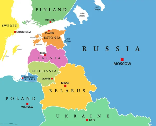
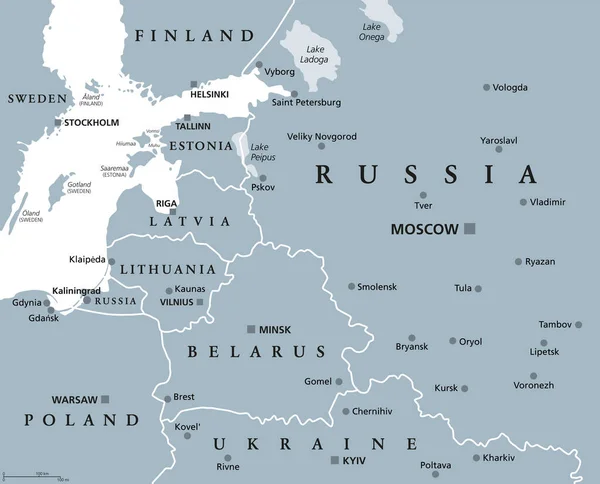
Stock vector Baltic States and Kaliningrad Oblast, gray political map. From Finland to Estonia, Latvia and Lithuania to Poland, and from the Russian exclave Kaliningrad, to Belarus and the European Part of Russia.
Published: Jul.08, 2022 15:43:07
Author: Furian
Views: 23
Downloads: 2
File type: vector / eps
File size: 2.43 MB
Orginal size: 7432 x 6000 px
Available sizes:
Level: silver