Home
Images
Vectors
Videos
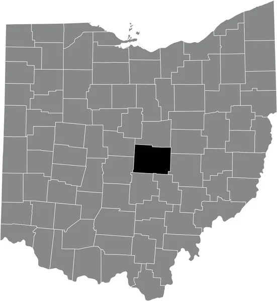
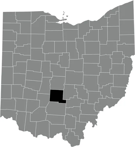
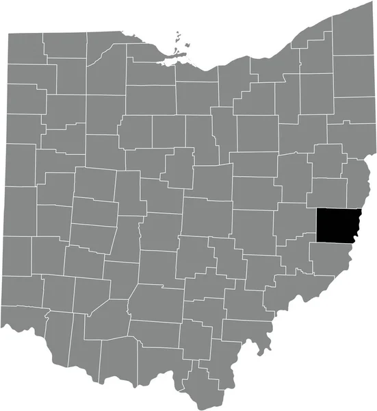
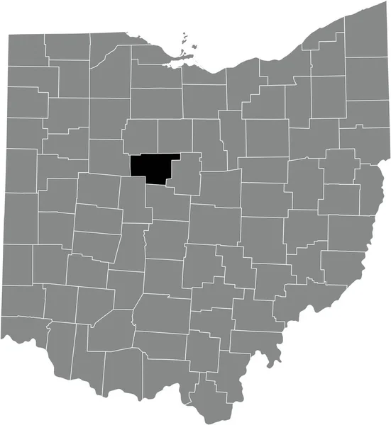
Stock vector Black highlighted location map of the Marion County inside gray administrative map of the Federal State of Ohio, USA
Published:
Oct.29, 2021 07:12:43
Author:
momcilo.jovanov
Views:
2
Downloads:
1
File type:
vector
/
eps
File size:
0.65 MB
Orginal size:
4699
x
5107
px
Available sizes:
S
(460 x 500)
M
(920 x 1000)
L
(1840 x 2000)
XL
(4699 x 5107)
VECT
(4699 x 5107)
EL0
(4699 x 5107)
Level:
bronze
Download Vector
Vector topics:
Vector
Illustration
Design
Sign
Travel
Mountain
Flag
Road
Position
Symbol
Icon
City
Usa
Journey
Outline
District
Direction
Map
Cartography
Land
Topography
Unity
Division
Voting
Insignia
Election
Ohio
Coat Of Arms
Cut Out
Travel Destinations
National Flag
No People
Physical Geography
Line Art
Washington Dc
Eastern USA
Western USA
Contour Line
Relief Carving
Relief Map
Topographic Map
Flat Design
Cleveland Ohio
In Silhouette
Columbus Ohio
Similar stock vectors
Black Highlighted Location Map Of The Fayette County Inside Gray Administrative Map Of The Federal State Of Ohio, USA
4699 × 5107
Black Highlighted Location Map Of The Clinton County Inside Gray Administrative Map Of The Federal State Of Ohio, USA
4699 × 5107
Black Highlighted Location Map Of The Allen County Inside Gray Administrative Map Of The Federal State Of Ohio, USA
4699 × 5107
Black Highlighted Location Map Of The Van Wert County Inside Gray Administrative Map Of The Federal State Of Ohio, USA
4699 × 5107
Black Highlighted Location Map Of The Licking County Inside Gray Administrative Map Of The Federal State Of Ohio, USA
4699 × 5107
Black Highlighted Location Map Of The Pickaway County Inside Gray Administrative Map Of The Federal State Of Ohio, USA
4699 × 5107
Black Highlighted Location Map Of The Belmont County Inside Gray Administrative Map Of The Federal State Of Ohio, USA
4699 × 5107
Black Highlighted Location Map Of The Tuscarawas County Inside Gray Administrative Map Of The Federal State Of Ohio, USA
4699 × 5107