photo free
Home Images Vectors Videos

Stock image Relief Map

stock image El Salvador area on the topographic relief map in the stereographic projection - raw composition of raster layers with dark glowing outline

El Salvador Area On The Topographic Relief Map In The Stereographic Projection - Raw Composition Of Raster Layers With Dark Glowing Outline

Image, 5.98MB, 2880 × 1620 jpg
stock vector Abstract topographic map

Abstract Topographic Map

Vector, 0.62MB, 5935 × 4200 eps
stock vector World Map Physical Topographic - Vector Detailed Illustration

World Map Physical Topographic - Vector Detailed Illustration

Vector, 39.43MB, 6001 × 3669 eps
stock vector World Map Vintage Political - Vector Illustration

World Map Vintage Political - Vector Illustration

Vector, 39.88MB, 6001 × 3669 eps
stock vector World map embossed

World Map Embossed

Vector, 20.1MB, 5625 × 3750 eps
stock vector Topographic map background concept with space for your copy.

Topographic Map Background Concept With Space For Your Copy.

Vector, 3.89MB, 5000 × 5000 eps
stock vector World map with labeling.

World Map With Labeling.

Vector, 12.26MB, 5513 × 3506 eps
stock image Desaturated shape of Russia with its capital, main regional division and the separated Kursk area. Labels. Topographic relief map. 3D rendering

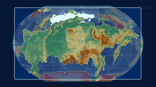
Desaturated Shape Of Russia With Its Capital, Main Regional Division And The Separated Kursk Area. Labels. Topographic Relief Map. 3D Rendering

Image, 1.79MB, 2880 × 1620 jpg
stock image Desaturated shape of Russia with its capital, main regional division and the separated Saint Petersburg area. Labels. Topographic relief map. 3D rendering

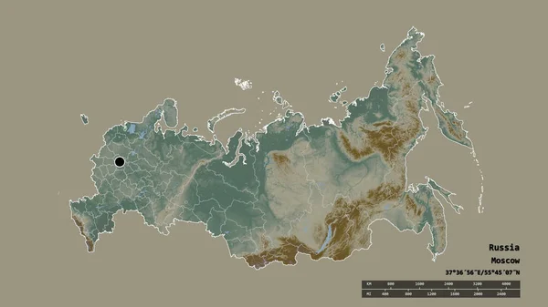
Desaturated Shape Of Russia With Its Capital, Main Regional Division And The Separated Saint Petersburg Area. Labels. Topographic Relief Map. 3D Rendering

Image, 1.79MB, 2880 × 1620 jpg
stock vector World Map and Flags - Physical Topographic - Vector Detailed Illustration

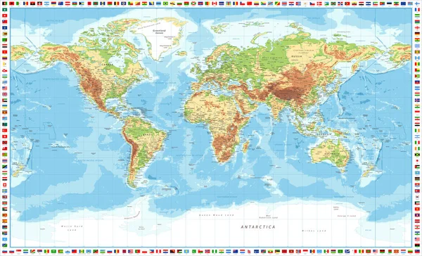
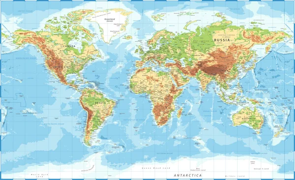
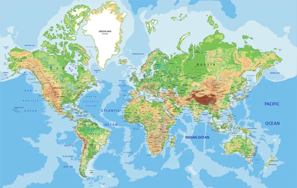
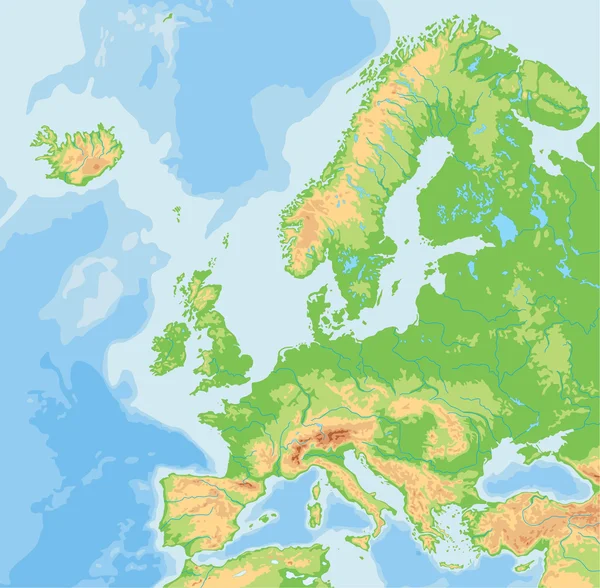
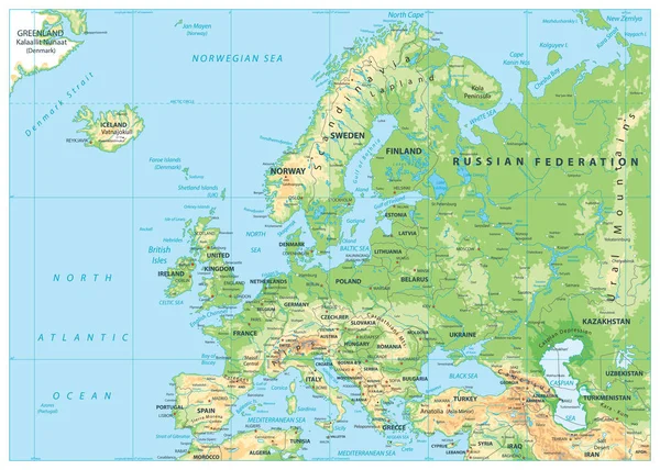
World Map And Flags - Physical Topographic - Vector Detailed Illustration

Vector, 69.74MB, 6277 × 3810 eps
stock image Area of Brazil isolated on a solid background in a georeferenced bounding box. Main regional division, distance scale, labels. Topographic relief map. 3D rendering

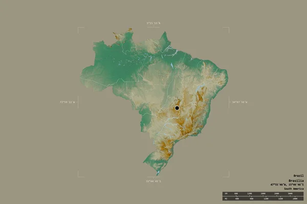
Area Of Brazil Isolated On A Solid Background In A Georeferenced Bounding Box. Main Regional Division, Distance Scale, Labels. Topographic Relief Map. 3D Rendering

Image, 1.6MB, 3000 × 2000 jpg
stock vector Gray vector map of the Federal State of Florida, USA with white borders of its counties

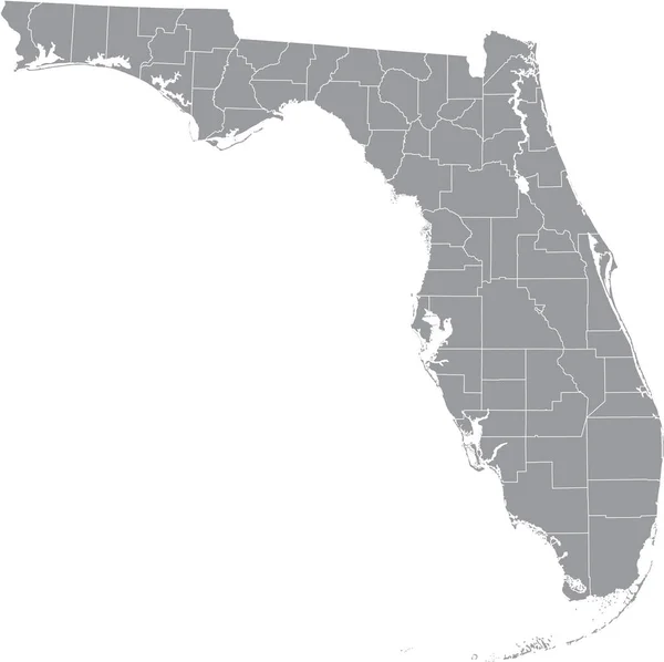
Gray Vector Map Of The Federal State Of Florida, USA With White Borders Of Its Counties

Vector, 1.96MB, 5005 × 4988 eps
stock image High resolution topographic map of Montana

High Resolution Topographic Map Of Montana

Image, 7.16MB, 11811 × 7015 jpg
stock vector Old map

Old Map

Vector, 3.65MB, 3304 × 4204 eps
stock vector Black highlighted location administrative map of the US Federal State of Vermont inside gray map of the United States of America

Black Highlighted Location Administrative Map Of The US Federal State Of Vermont Inside Gray Map Of The United States Of America

Vector, 0.64MB, 6202 × 3933 eps
stock image World map on old parchment with country names

World Map On Old Parchment With Country Names

Image, 8.83MB, 6016 × 4000 jpg
stock vector Vector abstract blue earth relief map. Generated conceptual elevation map. Isolines of landscape surface elevation. Geographic map conceptual design. Elegant background for presentations.

Vector Abstract Blue Earth Relief Map. Generated Conceptual Elevation Map. Isolines Of Landscape Surface Elevation. Geographic Map Conceptual Design. Elegant Background For Presentations.

Vector, 4.94MB, 5000 × 5000 eps
stock image High resolution topographic map of California

High Resolution Topographic Map Of California

Image, 8.58MB, 11102 × 12992 jpg
stock image High resolution world map with country names.

High Resolution World Map With Country Names.

Image, 18.04MB, 10000 × 6000 jpg
stock vector Four Seamless Vector Topographic Map Patterns

Four Seamless Vector Topographic Map Patterns

Vector, 6.72MB, 4500 × 4500 eps
stock vector Black highlighted location map of the US Volusia county inside gray map of the Federal State of Florida, USA

Black Highlighted Location Map Of The US Volusia County Inside Gray Map Of The Federal State Of Florida, USA

Vector, 1.97MB, 5005 × 4988 eps
stock vector Black highlighted location administrative map of the US Federal State of Tennessee inside gray map of the United States of America

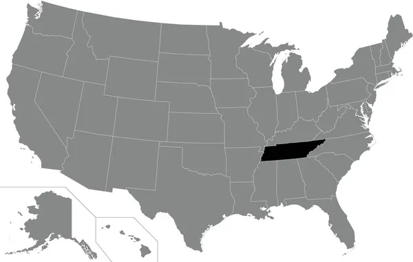
Black Highlighted Location Administrative Map Of The US Federal State Of Tennessee Inside Gray Map Of The United States Of America

Vector, 0.64MB, 6202 × 3933 eps
stock vector Black highlighted location map of the US Federal State of Arizona inside gray map of the United States of America

Black Highlighted Location Map Of The US Federal State Of Arizona Inside Gray Map Of The United States Of America

Vector, 2.44MB, 6102 × 3808 eps
stock vector Blank Relief Map of Oceania

Blank Relief Map Of Oceania

Vector, 6.41MB, 8192 × 5842 eps
stock vector Black highlighted location map of the Cleveland County inside gray administrative map of the Federal State of North Carolina, USA

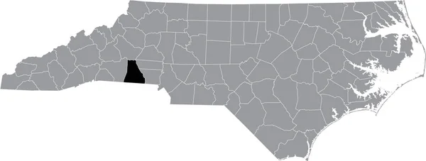
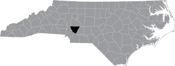
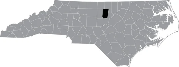
Black Highlighted Location Map Of The Cleveland County Inside Gray Administrative Map Of The Federal State Of North Carolina, USA

Vector, 1.42MB, 8003 × 3035 eps
stock vector Germany - detailed topographic map - illustration.

Germany - Detailed Topographic Map - Illustration.

Vector, 13.05MB, 5400 × 7212 eps
stock vector Black highlighted location map of the Carroll County inside gray map of the Federal State of Maryland, USA

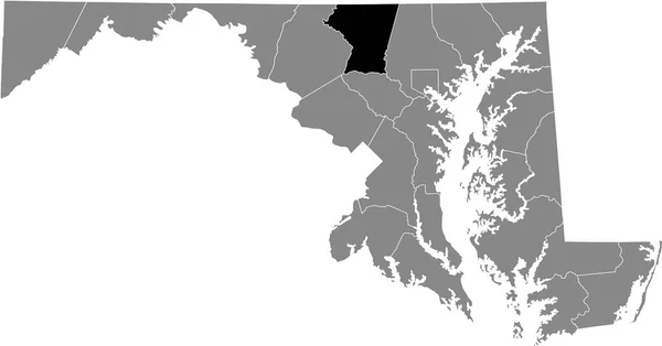
Black Highlighted Location Map Of The Carroll County Inside Gray Map Of The Federal State Of Maryland, USA

Vector, 0.94MB, 6903 × 3614 eps
stock vector Vector illustration of some basic lake types

Vector Illustration Of Some Basic Lake Types

Vector, 1.1MB, 3743 × 3200 eps
stock image Shape of Indonesia with its capital isolated on white background. Topographic relief map. 3D rendering

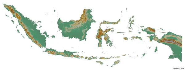
Shape Of Indonesia With Its Capital Isolated On White Background. Topographic Relief Map. 3D Rendering

Image, 1.64MB, 3434 × 1316 jpg
stock image Shape of Sao Paulo, state of Brazil, with its capital isolated on white background. Topographic relief map. 3D rendering

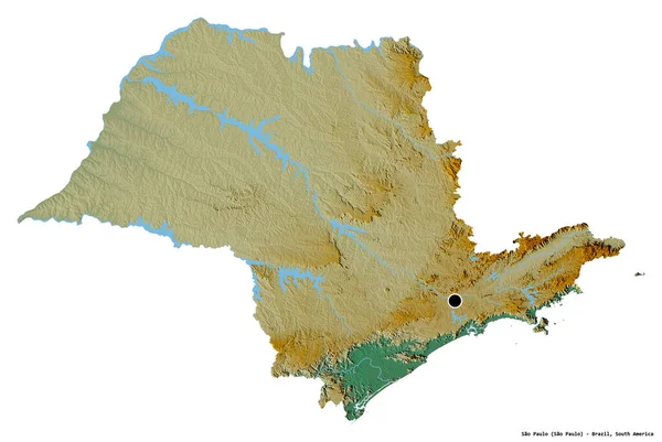
Shape Of Sao Paulo, State Of Brazil, With Its Capital Isolated On White Background. Topographic Relief Map. 3D Rendering

Image, 5.61MB, 3836 × 2570 jpg
stock vector Topographic Map Texture

Topographic Map Texture

Vector, 1.86MB, 7087 × 7087 eps
stock image Imaginary cadastral map of territory with relief map - concept i

Imaginary Cadastral Map Of Territory With Relief Map - Concept I

Image, 12.34MB, 4742 × 3161 jpg
stock vector Black highlighted location map of the Cabarrus County inside gray administrative map of the Federal State of North Carolina, USA

Black Highlighted Location Map Of The Cabarrus County Inside Gray Administrative Map Of The Federal State Of North Carolina, USA

Vector, 1.42MB, 8003 × 3035 eps
stock image Zoomed-in view of Russia outline with perspective lines against a global map in the Kavrayskiy projection. Shape centered. topographic relief map

Zoomed-in View Of Russia Outline With Perspective Lines Against A Global Map In The Kavrayskiy Projection. Shape Centered. Topographic Relief Map

Image, 3.25MB, 2880 × 1620 jpg
stock vector United States of America road map

United States Of America Road Map

Vector, 7.55MB, 5671 × 3844 eps
stock vector Europe physical map.

Europe Physical Map.

Vector, 6.02MB, 4908 × 4816 eps
stock image High resolution topographic map of Michigan

High Resolution Topographic Map Of Michigan

Image, 3.6MB, 7677 × 9933 jpg
stock image North America from space

North America From Space

Image, 12.98MB, 3000 × 3000 jpg
stock vector Topographic map background. Vector illustration

Topographic Map Background. Vector Illustration

Vector, 1.86MB, 5120 × 5120 eps
stock vector Gray vector map of the Federal State of Massachusetts, USA with white borders of its counties

Gray Vector Map Of The Federal State Of Massachusetts, USA With White Borders Of Its Counties

Vector, 0.56MB, 6307 × 3855 eps
stock vector Europe Physical Map. No bathymetry

Europe Physical Map. No Bathymetry

Vector, 10.25MB, 8192 × 5853 eps
stock vector Gray vector map of the Federal State of Arkansas, USA with white borders of its counties

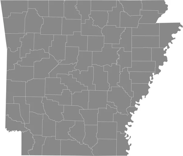
Gray Vector Map Of The Federal State Of Arkansas, USA With White Borders Of Its Counties

Vector, 0.53MB, 5304 × 4544 eps
stock image Relief map with the heights of the USA

Relief Map With The Heights Of The USA

Image, 0MB, 5000 × 3000 jpg
stock image Cote d'Azur

Cote D'Azur

Image, 3.82MB, 3264 × 2448 jpg
stock image Shape of Texas, state of Mainland United States, with its capital isolated on white background. Topographic relief map. 3D rendering

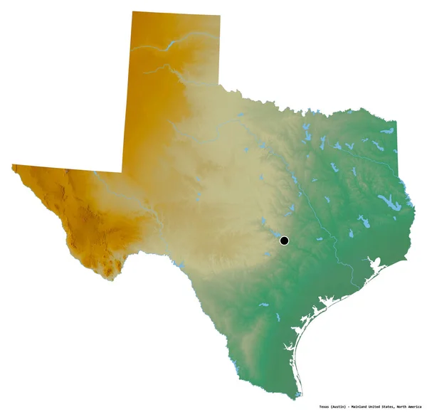
Shape Of Texas, State Of Mainland United States, With Its Capital Isolated On White Background. Topographic Relief Map. 3D Rendering

Image, 5.86MB, 3836 × 3705 jpg
stock vector Spain - detailed map - illustration

Spain - Detailed Map - Illustration

Vector, 4.37MB, 5798 × 4134 eps
stock vector Black highlighted location map of the Orange County inside gray administrative map of the Federal State of North Carolina, USA

Black Highlighted Location Map Of The Orange County Inside Gray Administrative Map Of The Federal State Of North Carolina, USA

Vector, 1.42MB, 8003 × 3035 eps
stock image Shape of Los Rios, region of Chile, with its capital isolated on a solid color background. Topographic relief map. 3D rendering

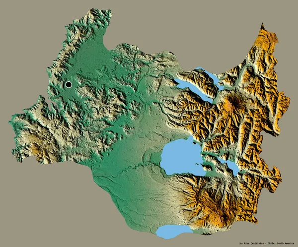
Shape Of Los Rios, Region Of Chile, With Its Capital Isolated On A Solid Color Background. Topographic Relief Map. 3D Rendering

Image, 10.79MB, 3836 × 3185 jpg
stock image Detailed Earth. Central Europe

Detailed Earth. Central Europe

Image, 12.63MB, 5000 × 5000 jpg
stock vector Topographic contour map with marker. Map pattern with mountain texture and grid. Route map. Travel in the mountains

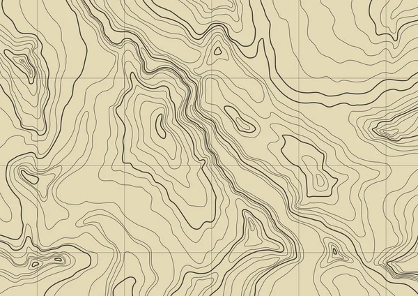
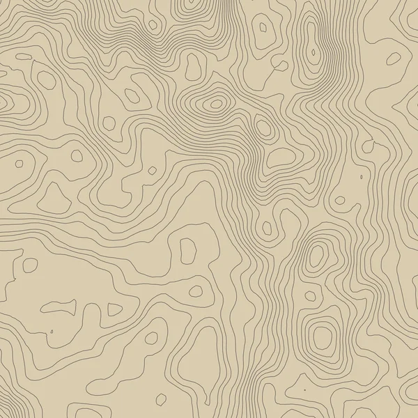
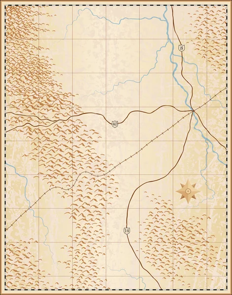
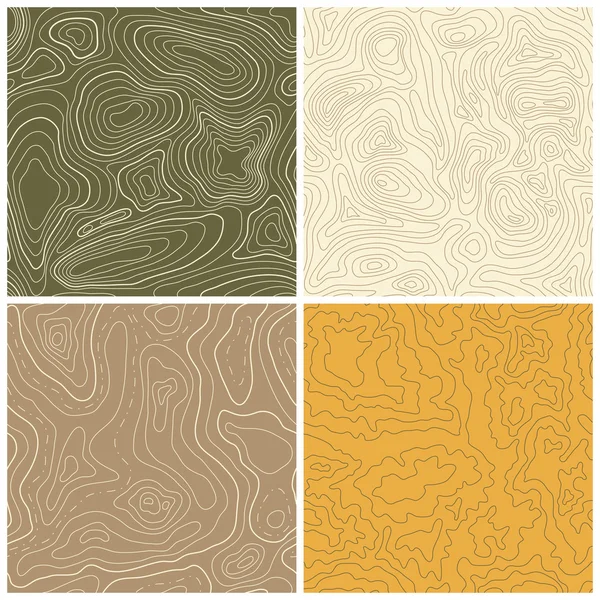
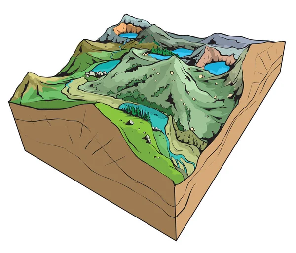
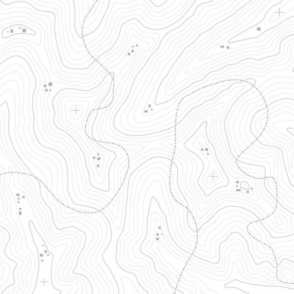
Topographic Contour Map With Marker. Map Pattern With Mountain Texture And Grid. Route Map. Travel In The Mountains

Vector, 3.98MB, 6750 × 4500 eps
Page 1 >> Next