Home
Images
Vectors
Videos
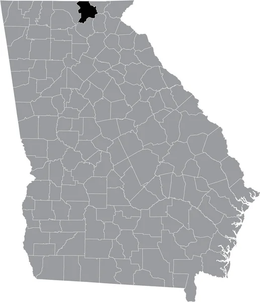
Stock vector Black highlighted location map of the US Union county inside gray map of the Federal State of Georgia, USA
Published:
Jun.25, 2021 17:57:43
Author:
momcilo.jovanov
Views:
0
Downloads:
0
File type:
vector
/
eps
File size:
3.52 MB
Orginal size:
4578
x
5304
px
Available sizes:
S
(432 x 500)
M
(863 x 1000)
L
(1726 x 2000)
XL
(4578 x 5304)
VECT
(4578 x 5304)
EL0
(4578 x 5304)
Level:
bronze
Download Vector
Vector topics:
Vector
Illustration
Design
Sign
Travel
Mountain
Flag
Road
Position
Symbol
Icon
City
Usa
Journey
Outline
District
Direction
Map
Cartography
National
Land
State
Topography
Unity
Georgia
Region
Division
Voting
Insignia
Election
Province
Atlanta
Coat Of Arms
Cut Out
Travel Destinations
National Flag
No People
Physical Geography
Line Art
Washington Dc
Eastern USA
Western USA
Contour Line
Relief Carving
Relief Map
Topographic Map
Flat Design
In Silhouette
Similar stock vectors
Black Highlighted Location Map Of The US Rabun County Inside Gray Map Of The Federal State Of Georgia, USA
4578 × 5304
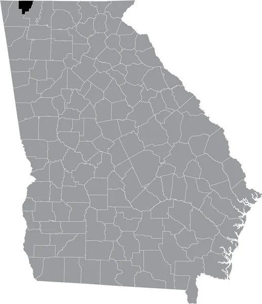
Black Highlighted Location Map Of The US Catoosa County Inside Gray Map Of The Federal State Of Georgia, USA
4578 × 5304
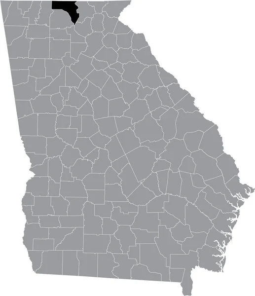
Black Highlighted Location Map Of The US Towns County Inside Gray Map Of The Federal State Of Georgia, USA
4578 × 5304
Black Highlighted Location Map Of The US Fannin County Inside Gray Map Of The Federal State Of Georgia, USA
4578 × 5304
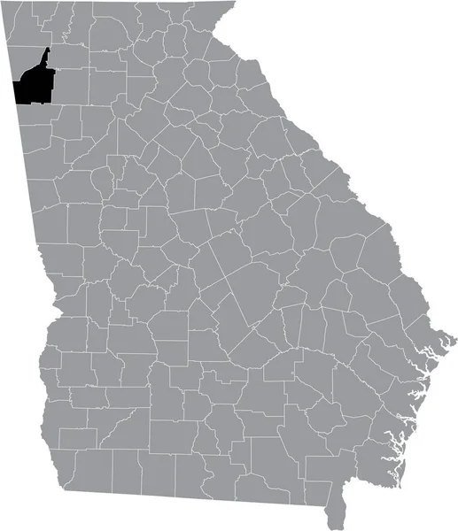
Black Highlighted Location Map Of The US Floyd County Inside Gray Map Of The Federal State Of Georgia, USA
4578 × 5304
Black Highlighted Location Map Of The US Habersham County Inside Gray Map Of The Federal State Of Georgia, USA
4578 × 5304
Black Highlighted Location Map Of The US Polk County Inside Gray Map Of The Federal State Of Georgia, USA
4578 × 5304
Black Highlighted Location Map Of The US White County Inside Gray Map Of The Federal State Of Georgia, USA
4578 × 5304