photo free
Home Images Vectors Videos

Stock vector Blue-gray detailed map of Papua New Guinea administrative divisions and location on the globe. Vector illustration
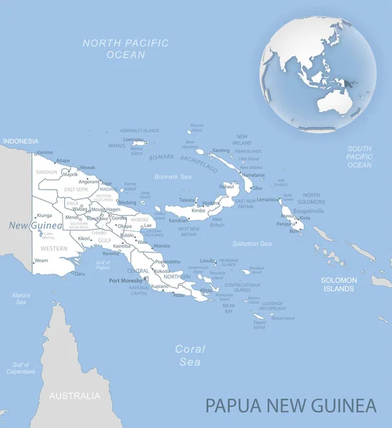
Stock vector Blue-gray detailed map of Papua New Guinea administrative divisions and location on the globe. Vector illustration
Published: Oct.23, 2020 06:48:27
Author: gt29
Views: 11
Downloads: 0
File type: vector / eps
File size: 14.9 MB
Orginal size: 5226 x 5693 px
Available sizes:
S
(459 x 500)
M
(918 x 1000)
L
(1836 x 2000)
XL
(5226 x 5693)
VECT
(5226 x 5693)
EL0
(5226 x 5693)
Level: bronze
Download Vector
Vector topics:

Similar stock vectors

stock vector Papua New Guinea political map

Papua New Guinea Political Map

9777 × 6518
stock vector Papua New Guinea Political Map

Papua New Guinea Political Map

9000 × 5403
stock vector Illustrated Country Shape of Papua New Guinea

Illustrated Country Shape Of Papua New Guinea

4167 × 2778
stock vector Vector Flat Map of Papua New Guinea with Caption

Vector Flat Map Of Papua New Guinea With Caption

5692 × 4050
stock vector Illustrated Country Shape of Papua New Guinea

Illustrated Country Shape Of Papua New Guinea

4167 × 2778
stock vector Illustrated Country Shape of Papua New Guinea

Illustrated Country Shape Of Papua New Guinea

2501 × 1667
stock vector Western New Guinea, gray political map. Also Papua, is a Western portion of the Melanesian island of New Guinea, administered by Indonesia, with the provinces Papua and West Papua. English labeling.

Western New Guinea, Gray Political Map. Also Papua, Is A Western Portion Of The Melanesian Island Of New Guinea, Administered By Indonesia, With The Provinces Papua And West Papua. English Labeling.

8254 × 6000
stock vector High detailed vector map - Papua New Guinea.

High Detailed Vector Map - Papua New Guinea.

8334 × 6251