Home
Images
Vectors
Videos
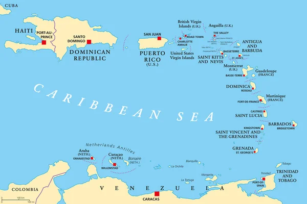
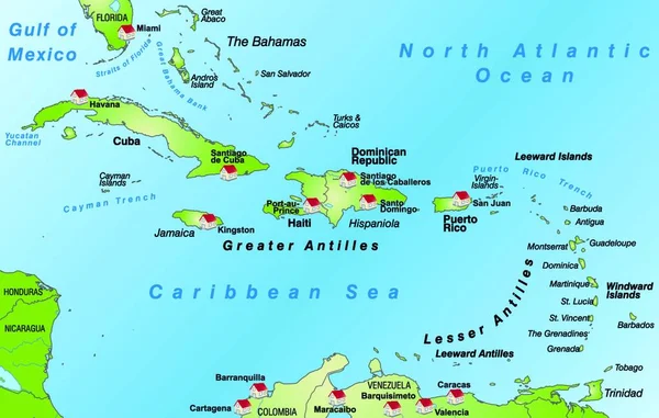
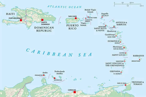
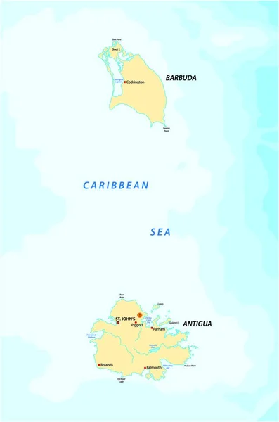
Stock vector Caribbean Map with Flags and Location
Published:
Jul.28, 2015 13:29:12
Author:
pablofdezr1984
Views:
228
Downloads:
5
File type:
vector
/
eps
File size:
8.34 MB
Orginal size:
6350
x
4245
px
Available sizes:
S
(500 x 334)
M
(1000 x 669)
L
(2000 x 1337)
XL
(6350 x 4245)
VECT
(6350 x 4245)
EL0
(6350 x 4245)
Level:
bronze
Download Vector
Vector topics:
Vector
Illustration
Sea
Country
Map
Geography
Area
State
Location
America
Administrative
Islands
Region
Caribbean
Flags
Jamaica
Cuba
Dominican
Barbuda
Trinidad
Bahamas
Antigua
Dominica
Barbados
Grenada
Haiti
Tobago
Caribe
Similar stock vectors
Lesser Antilles Political Map
8985 × 6000
The Card Is Modern And Pictorially Illustrates ... The Card Can Be Used Immediately And Is Optimized For Printing And Application In Digital Medien..der Color Mode Is Rgb.
6808 × 4328
Lesser Antilles, Haiti, Dominican Republic
10000 × 6682
Map Of The Caribbean Islands Antigua And Barbuda
2183 × 3296
Caribbean Islands Map With Names Vector
5731 × 3800
Vector Illustration On Map On Atlas
6808 × 4328
The Bahamas Map
7000 × 7000