Home
Images
Vectors
Videos
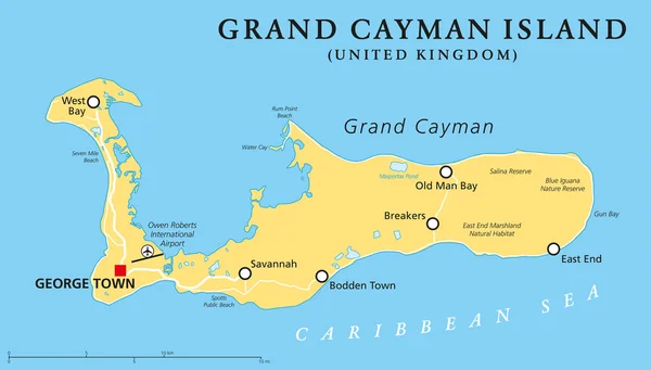
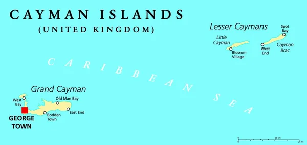
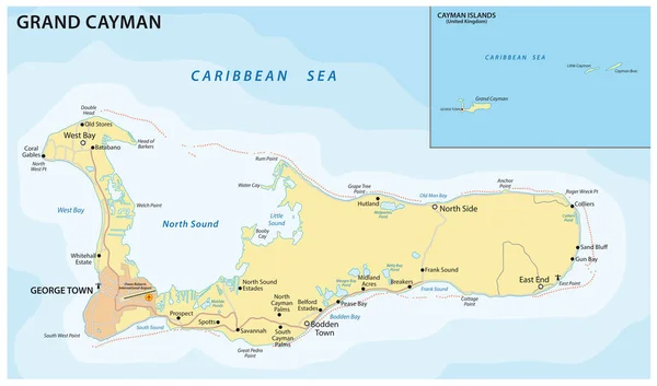
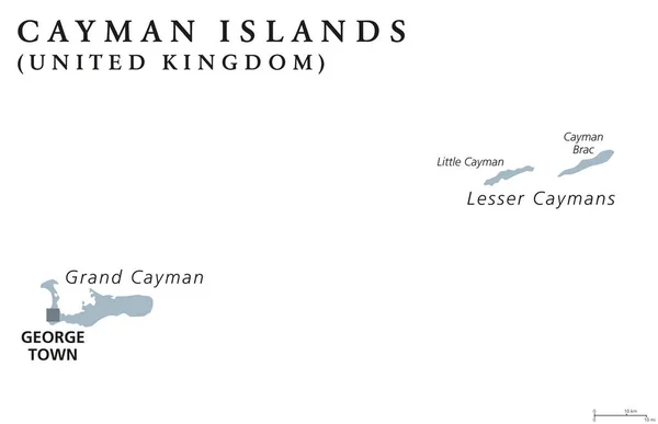
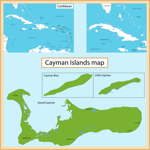
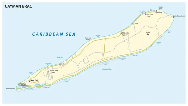
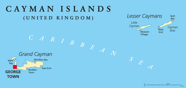
Stock vector Cayman Islands Political Map
Published:
Apr.14, 2015 05:21:24
Author:
Furian
Views:
223
Downloads:
9
File type:
vector
/
eps
File size:
0.43 MB
Orginal size:
9000
x
4261
px
Available sizes:
S
(500 x 237)
M
(1000 x 473)
L
(2000 x 947)
XL
(9000 x 4261)
VECT
(9000 x 4261)
EL0
(9000 x 4261)
Level:
silver
Download Vector
Vector topics:
Illustration
Travel
Abstract
Coastline
Capital
Cruise
Map
Cartography
Geography
Uk
Island
Destination
Caribbean
British
Atlas
Americas
Cayman
Georgetown
Antilles
Tropical Climate
Great Britain
United Kingdom
Greater Antilles
George Town
East End
Grand Cayman
Little Cayman
Cayman Islands
West Bay
Overseas Territory
Political Map
Cruise Destination
Cayman Brac
Lesser Caymans
Bodden Town
Old Man Bay
Similar stock vectors
Grand Cayman Island Political Map
9000 × 5125
Cayman Islands Political Map With Capital George Town And Important Places. A British Overseas Territory In The Western Caribbean Sea. English Labeling And Scaling. Illustration.
4536 × 2148
Vector Road Map Of The Caribbean Island Of Grand Cayman
5266 × 3100
Vector Road Map Of The Caribbean Island Of Grand Cayman
4000 × 3747
Cayman Islands Political Map
9888 × 6379
Cayman Islands Map
7000 × 7000
Map Of Cayman Brac, An Island In The Cayman Islands, UK
5478 × 3100
Cayman Islands Blue Square Grunge Vintage Isolated Stamp
9250 × 4005